


Hummastinvaara mountain biking routes 25 km, Raahe
Poziom trudności: S2
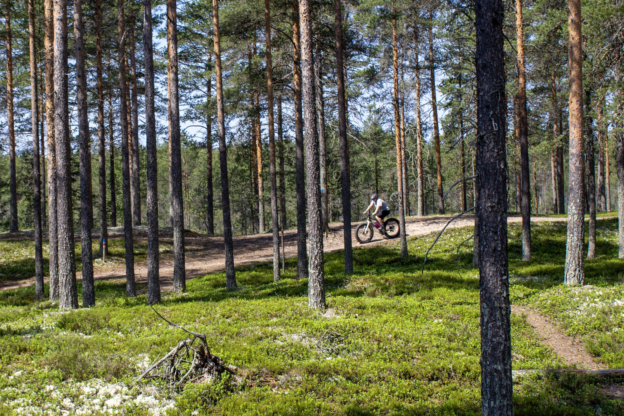
On the 25 km route of Hummastinvaara, you can admire the beautiful outdoor route network in its entirety. Forest landscapes change along the way into fields and mire landscapes, and the route allows detours...
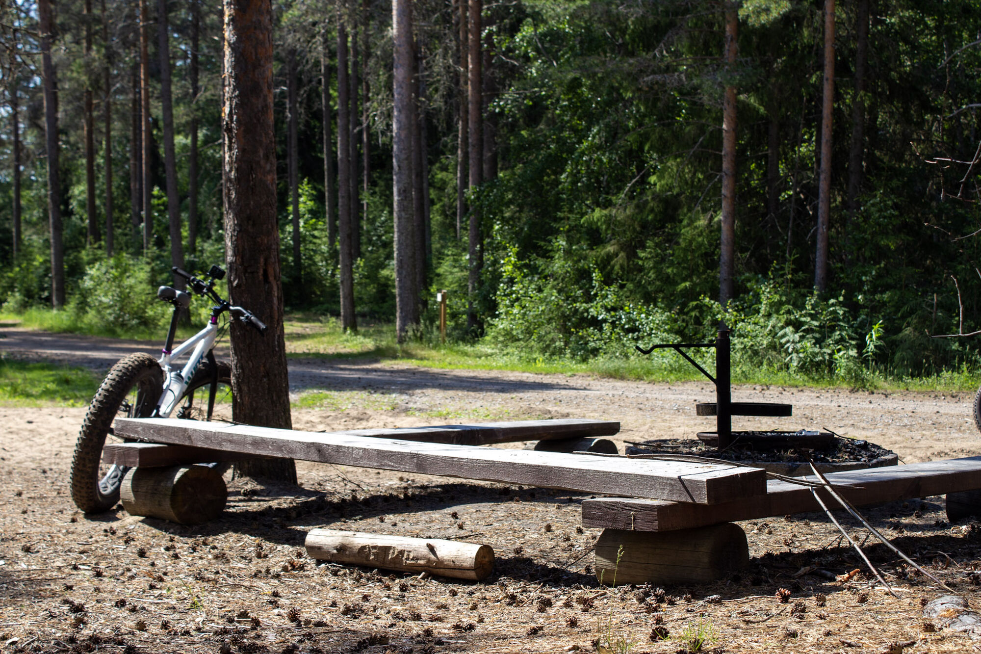
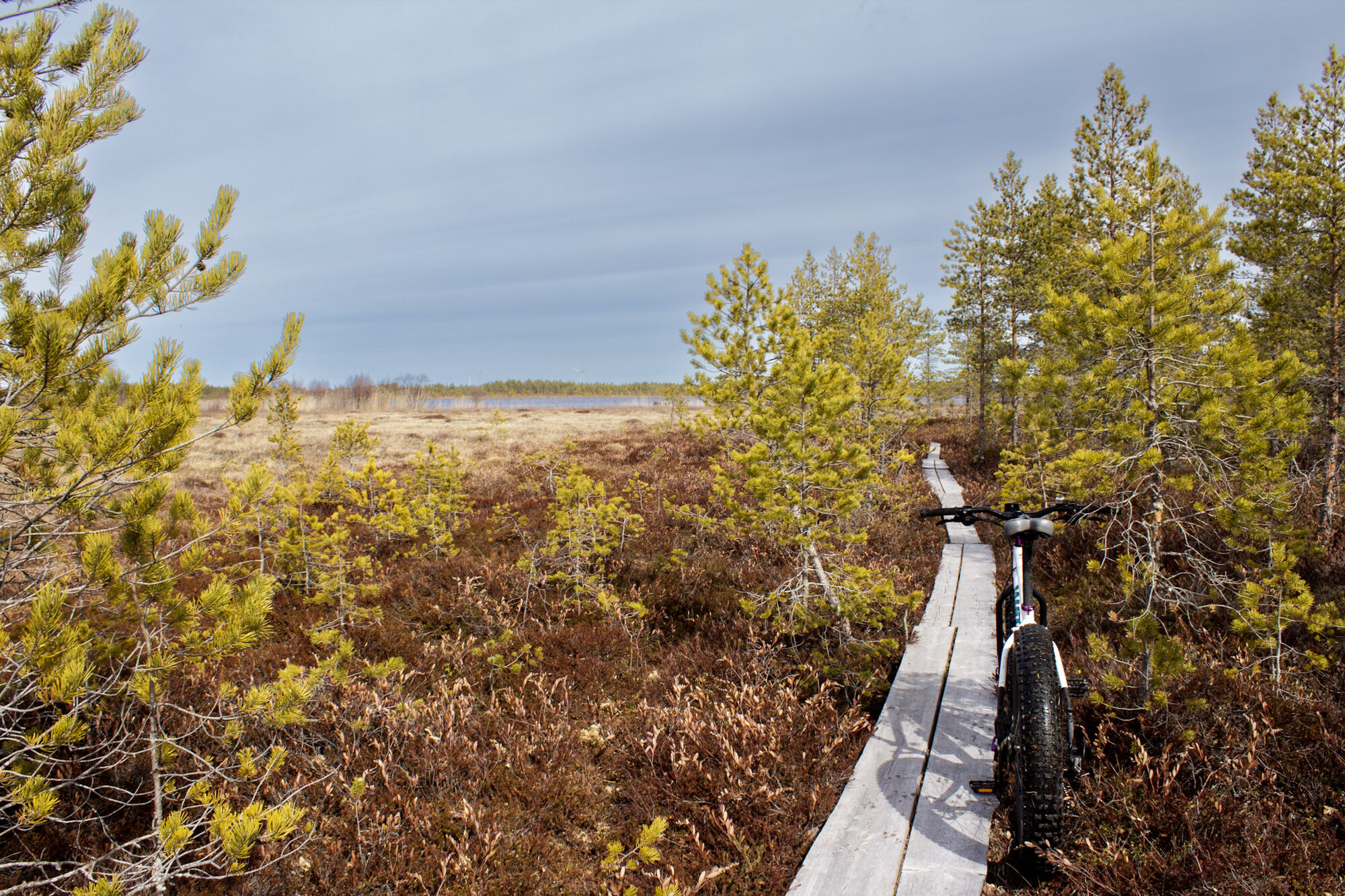
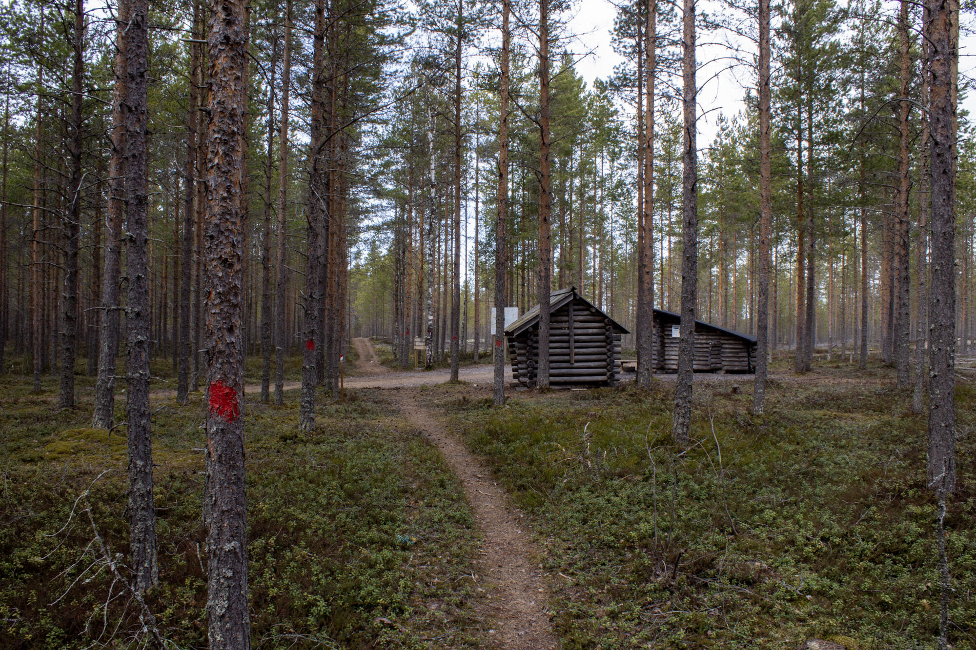
On the 25 km route of Hummastinvaara, you can admire the beautiful outdoor route network in its entirety. Forest landscapes change along the way into fields and mire landscapes, and the route allows detours along boardwalks to Hummastinjärvi lakes, where you can even take a swim during your bike ride or just enjoy the views. There are two lean-tos along the route, and you can also take breaks on resting benches.
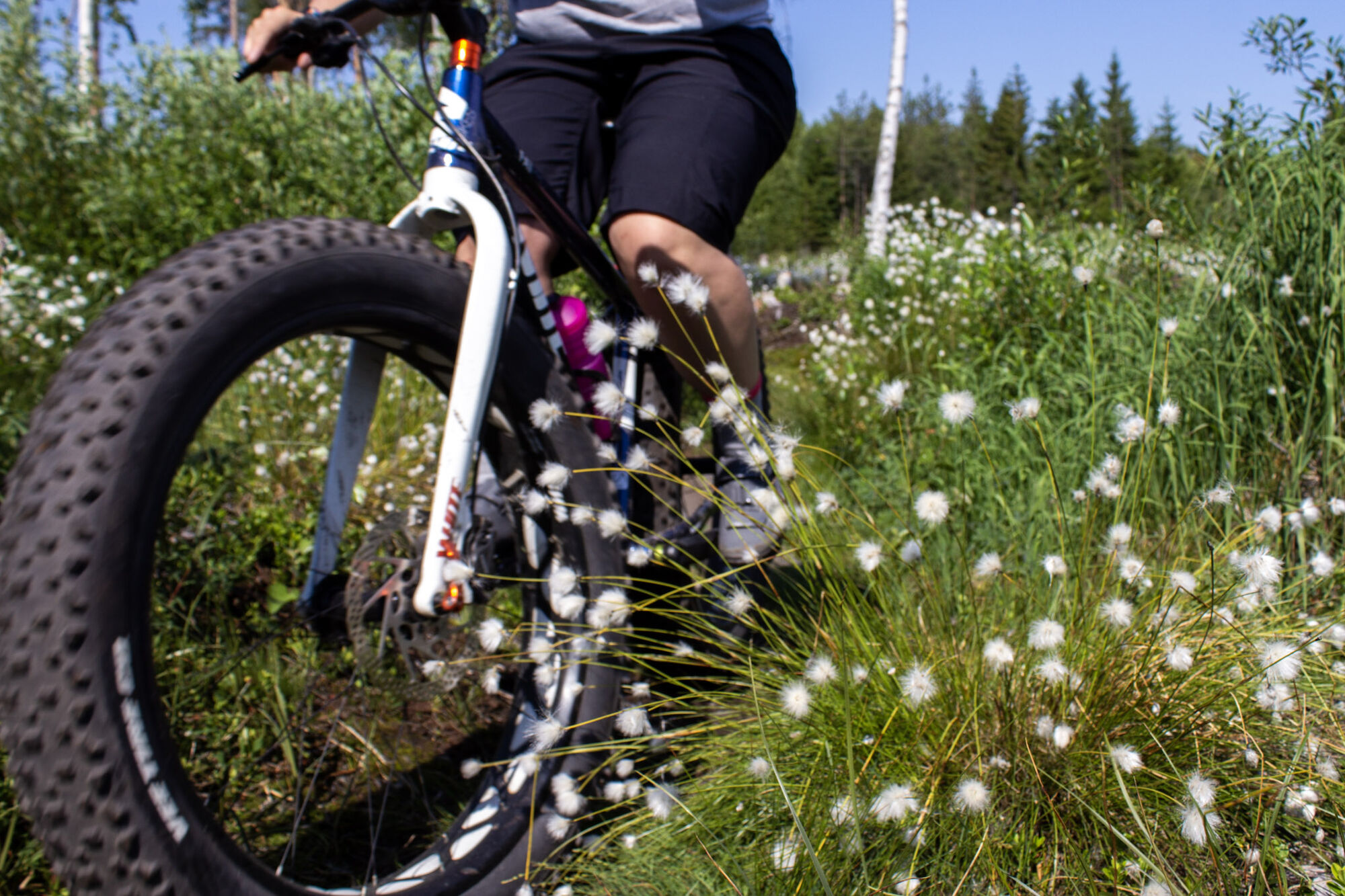
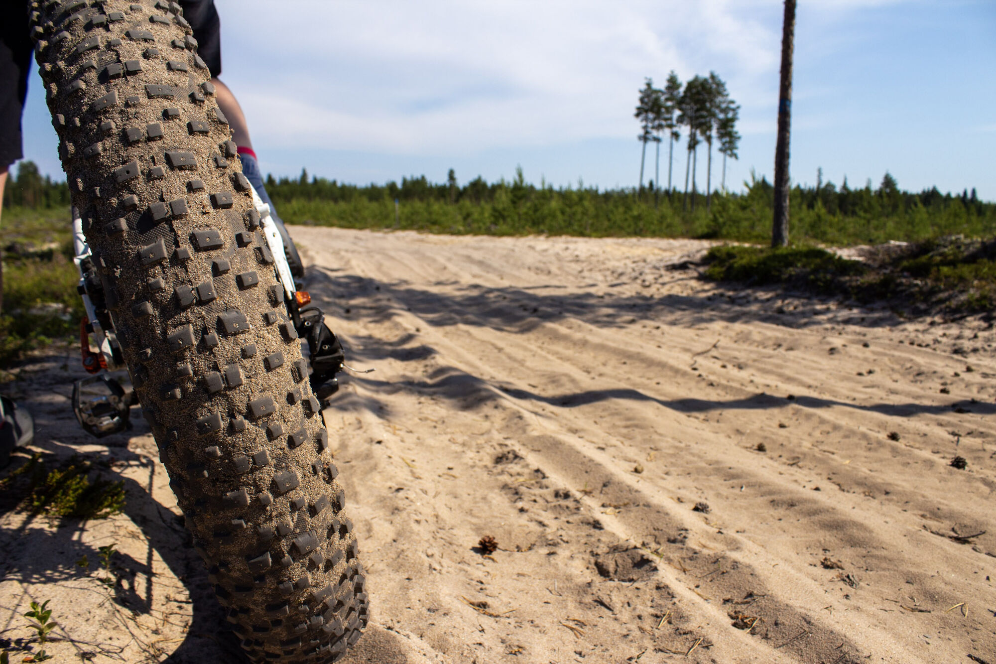
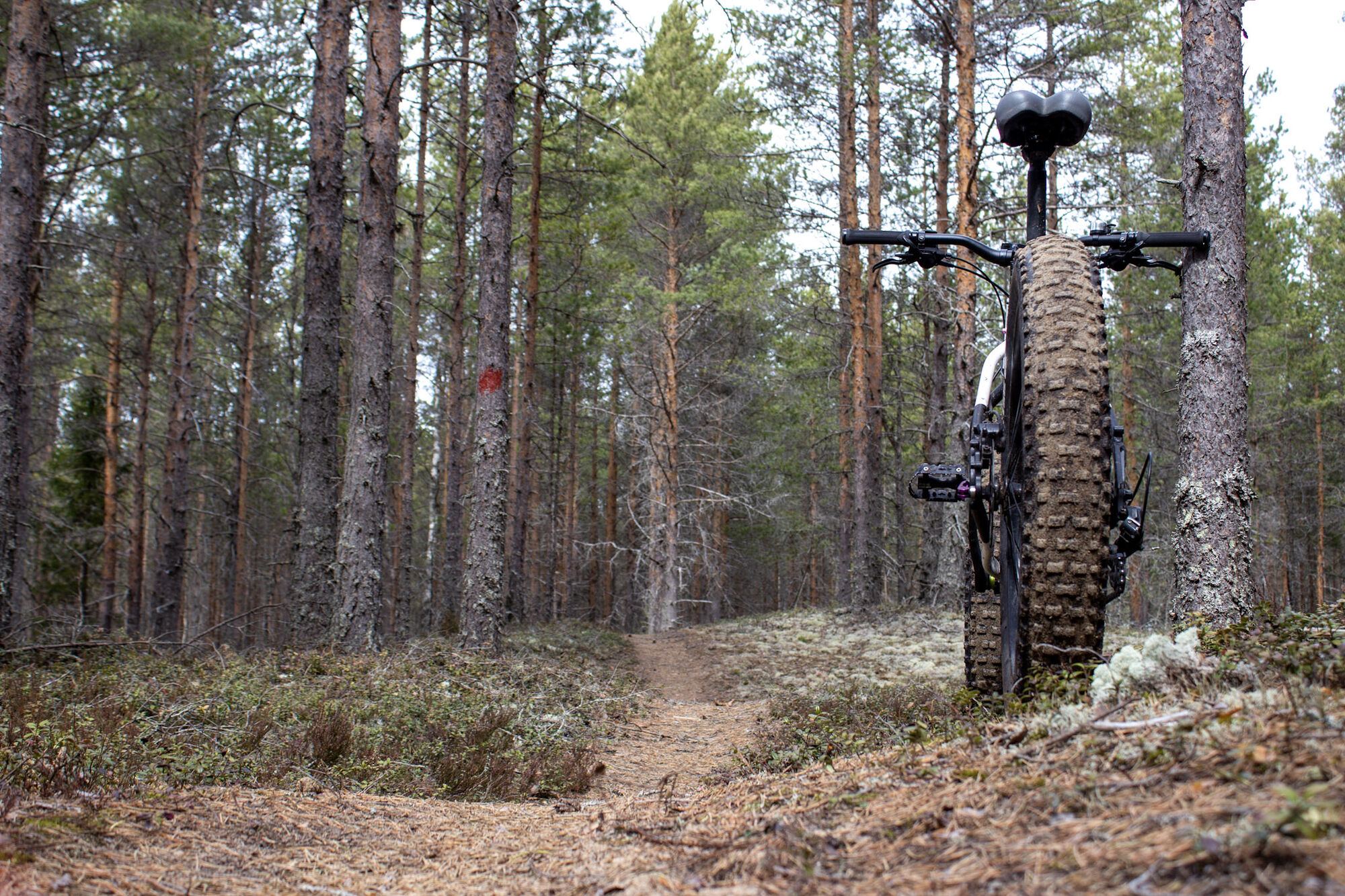
The route is mostly easy to traverse and suitable for those who have some experience in mountain biking. Please note that the route is very challenging to traverse due to rocky sections for about 4 km around Hummastinvaara, the birdwatching tower, and quarry area, and you may have to push your bike at times. Along the route, you will experience various terrains – rolling paths, forest roads, root sections, boardwalks, and sandy ground. The route offers varied and enjoyable cycling, and despite its flatness, you can also experience the thrill of speed on the well-rolling paths. The route can be cycled in both directions. The difficulty comes from the length of the route and the rocky sections.
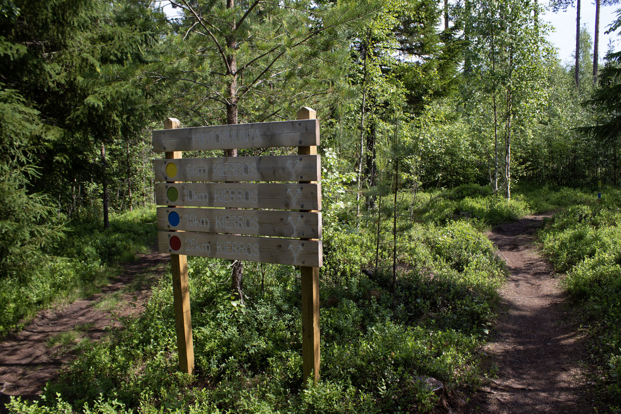
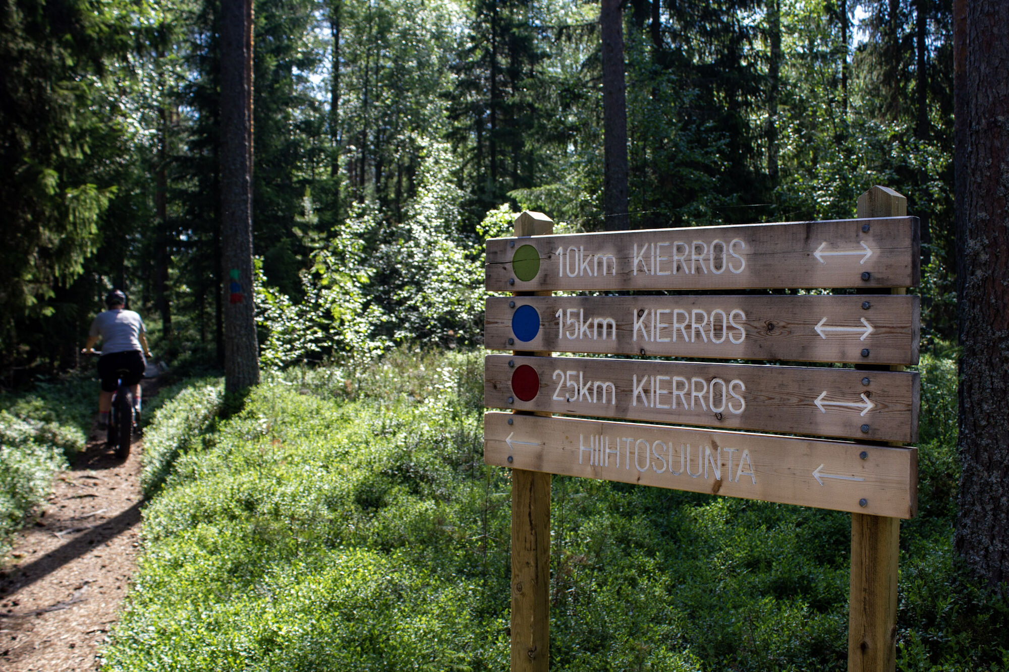
The route is well marked in the terrain. The routes of Hummastinvaara are maintained by the city of Raahe.

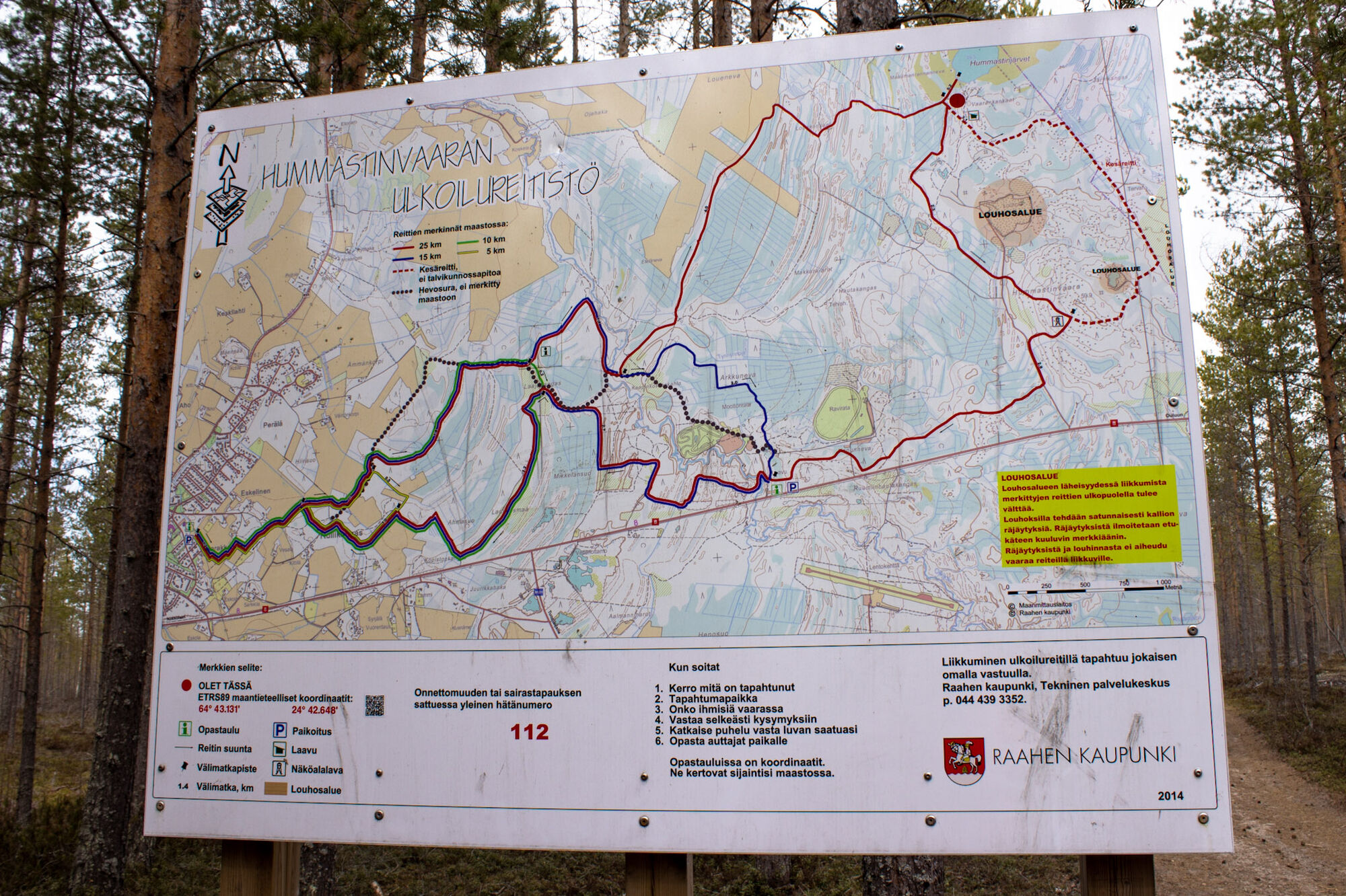
There are two starting points for the route, both accessible by car from E8 road.
To reach the Harakkamäentie starting point, turn from E8 first onto Pattijoentie and about 500 m later onto Harakkamäentie.
Along E8, you will find signs to Hummastinvaara when approaching from both directions.
The routes begin near the parking areas at both starting points.
The route partly follows a soft sandy horse track, which is why cycling with wider tires, for example a fatbike, is recommended.
Please note that there are no water points on the route, so bring snacks and drinks with you.
Near the 25 km route, there are two mineral quarry areas, where occasional rock blasting is done. Blasting is announced in advance by audible signals. The blasting and quarrying do not pose danger to those on the routes, but movement outside the routes near the quarry areas should be avoided.
Please note that the route from Hummastinvaara birdwatching tower to the quarry area is rocky and challenging to traverse, and the bike must sometimes be pushed. The rocks may be slippery after rain.
The summer route starting from the lean-to may be tempting, but it is very rocky and unsuitable for mountain biking due to its difficulty.
Please bring enough water with you, as there is no water refill point on the route.
There are two starting points for the route.
There is a sign to Hummastinvaara from both directions on Kasitie (E8).
You can reach the Harakkamäki starting point from Raahe via bike paths or by car. When arriving by car, turn from E8 onto Pattijoentie and then to Harakkamäentie.
The E8 road starting point is about 100 m from the rest area, where you will find signs for the area's routes. Parking is available at both starting points. From the Harakkamäentie starting point, you can access all marked routes of Hummastinvaara. When departing from Harakkamäentie, the route branches after a couple of kilometers, and you can cycle the route in the direction you prefer.
Both starting points, at Harakkamäentie and along E8 road, have parking areas.
S2
If desired, the route can be modified to follow 5 km, 10 km, or 15 km variants.
You will also find two campfire sites along the route. Near Kasitie, at the starting point of Moottoriradantie, there is a campfire place, and near the Hummastinjärvi lakes, there is a lean-to maintained by the city of Raahe, approximately 100 meters from the route. A sign guides you from the route to the lean-to.
Popularne wycieczki w okolicy
-
Flatland Route touring cycle route
światłoKolarstwo długodystansowe 319,6 km -
The path of Fantti
światłoWędrówka 0,64 km -
Hummastinvaara mountain biking routes 15 km, Raahe
średniMountainbike 14,3 km -
Iso-Kraaseli nature trail
światłoWędrówka 1,95 km -
Tour of Mikonkari
światłoWędrówka 1,75 km -
Raahe city tour
światłoJazda na rowerze 14,3 km -
Varvi nature trail, Raahe
światłoTrasa tematyczna 5,68 km -
Mountain biking trails in Hummastinvaara, Raahe, 5 km
światłoMountainbike 4,92 km -
Rivi's trail, Mikonkari
światłoWędrówka 2,17 km -
Pitkänkari paths, Takaranta and Hakotauri
światłoWędrówka 3,66 km

Wędrówki i tropienie


Nie przegap ofert i inspiracji na następne wakacje
Twój adres e-mail została dodana do listy mailingowej.