







Tour dell'Uja: Stage 2 Borgata Bracchiello - Alpe dAttia
Departing from the village of Bracchiello, go along path no. 241, through a wooded area. The path goes up the Rio Crosiasse valley, with stretches on both banks until reaching the Crosiasse alpine pasture...
Departing from the village of Bracchiello, go along path no. 241, through a wooded area. The path goes up the Rio Crosiasse valley, with stretches on both banks until reaching the Crosiasse alpine pasture (1795 m). Continuing on path no. 241 you turn in a south-westerly direction to continue climbing until you reach the panoramic Colle d'Attia (2101 m). From this point a descent begins on trail no. 238, which leads to Alpe d'Attia where the stage ends and from where you can depart once again the following day. To reach the accommodation facilities where you can spend the night, you must descend for a further stretch along the south-facing waterway on trail no. 238 to reach Pian d'Attia where you will find the connection to the road. Alternatively you can take another stretch of the route on trail no. 236A from Alpe d'Attia, making a wide semi-circle to the west crossing the Rio Chianale valley to Alpe Serpeis (1603 m) where there is a carriage road. If contacted beforehand, one of the operators from the Municipality of Ala can meet the hikers at one of the meeting points to accompany them to the main town with their own means of transport and to the departure point the next day.

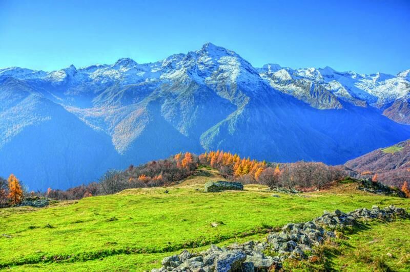

Starting from Borgata Bracchiello, along path no. 241, you go through a wooded area. The route goes up the valley of the Rio Crosiasse, resting for stretches on both banks, until reaching the Crosiasse mountain pasture (1795 m). Always continuing on track no. 241 turn south-west to continue climbing until you reach the panoramic Colle d'Attia (2101 m). From this point a descent begins, on track no. 238, which leads to Alpe d'Attia where the stage ends and from where you can start again the following day. To reach the accommodation facilities where you can stay overnight it is necessary to descend for a further stretch along the south-facing watershed on track no. 238 to reach Pian d'Attia where you find the connection to the driveway. Alternatively, from Alpe d'Attia, follow another section of the itinerary on route no. 236A to cross, with a wide arc towards the west, the valley of the Rio Chianale up to Alpe Serpeis (1603 m) where a driveway arrives. From the meeting points it is possible to be reached by one of the tourist operators of the Municipality of Ala who, contacted in advance, will be able to accompany the hikers to the capital via their own means of transport and the following day to the starting point.
The use of trekking boots, fleece, trousers and windbreaker in technical fabric is recommended.
Nothing to report in this regard
At Ala di Stura: Casa della Dogana (dating back to 1400, where the "coat of arms" and "friezes" of the Savoy family have been restored). In the hamlets surrounding the capital many houses preserve Sundials and Frescoes, some of 1577 and 1588 attributed to Perini and invaluable heritage, object of historical/cultural routes inserted into the project of the Municipality to requalify the works in the artistic and tourist panorama of Piedmont.
Popularne wycieczki w okolicy
-
5,0
CERESOLE REALE Bellagarda ponds
średniWędrówka 7,60 km -
5,0
BALME Green Lakes and Lago Paschiet
średniWędrówka 7,51 km -
CERES Santa Cristina Loop
średniWędrówka 7,84 km -
5,0
BALME Arnas Ring - Pian della Mussa
ciężkiWędrówka 13,6 km -
5,0
LEMIE Ovarda Lakes loop
ciężkiWędrówka 15,9 km -
GPR - Giroparco Gran Paradiso
ciężkiWędrówka 100,4 km -
NOASCA Loop to the Noaschetta refuge
średniWędrówka 7,44 km -
5,0
PONT CANAVESE Valle Orco and Colle del Nivolet
ciężkiJazda na rowerze 56,3 km -
Lake Dres - Ceresole Reale
średniWędrówka 7,24 km -
Grande Traversata delle Alpi - GTA: Central Piedmont Section
średniWędrówka 318,3 km
Wędrówki i tropienie


Nie przegap ofert i inspiracji na następne wakacje
Twój adres e-mail została dodana do listy mailingowej.





