


NOASCA Loop to the Noaschetta refuge
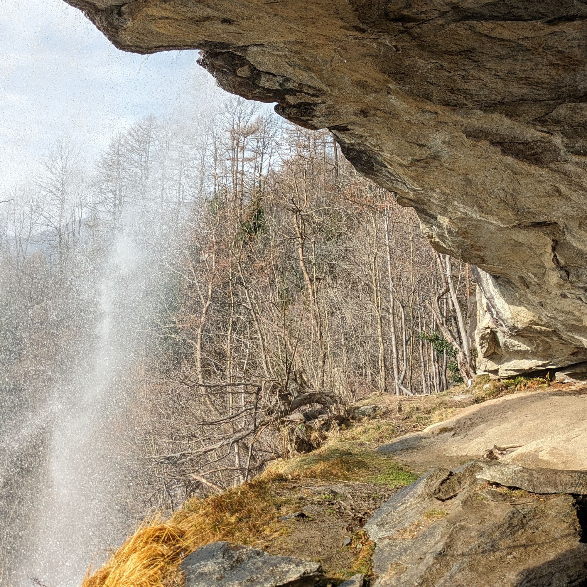
This route proposal includes a short detour immediately to observe up close (and from behind) the charming waterfall just above the town of Noasca.
The Noaschetta side valley is rich in water and seems...
This route proposal includes a short detour immediately to observe up close (and from behind) the charming waterfall just above the town of Noasca.
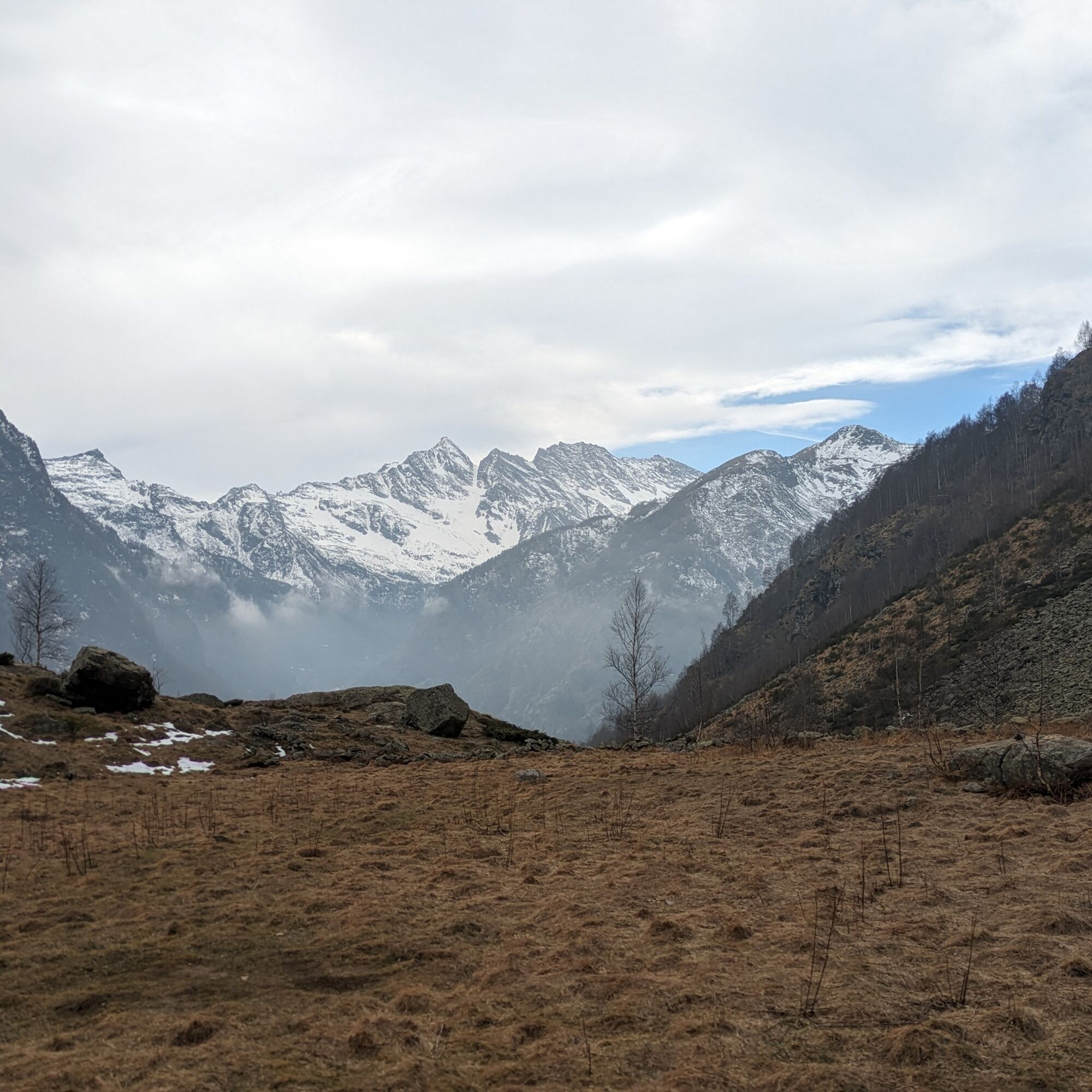
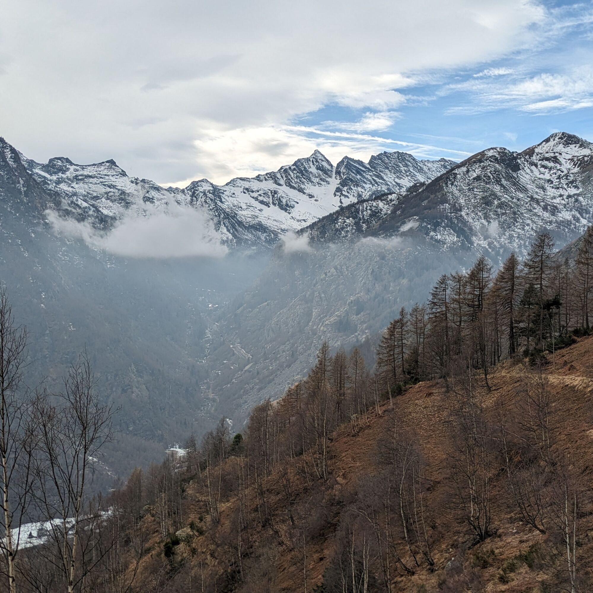
The Noaschetta side valley is rich in water and seems suspended above the main valley. The Noaschetta stream flows loudly within a rocky gorge. In the upper part, pastures and meadows open up, offering wide views.
The descent is along a beautiful and historic hunting mule track that enters an elegant larch forest, reaching the characteristic Sassa hamlet before reaching the state road.
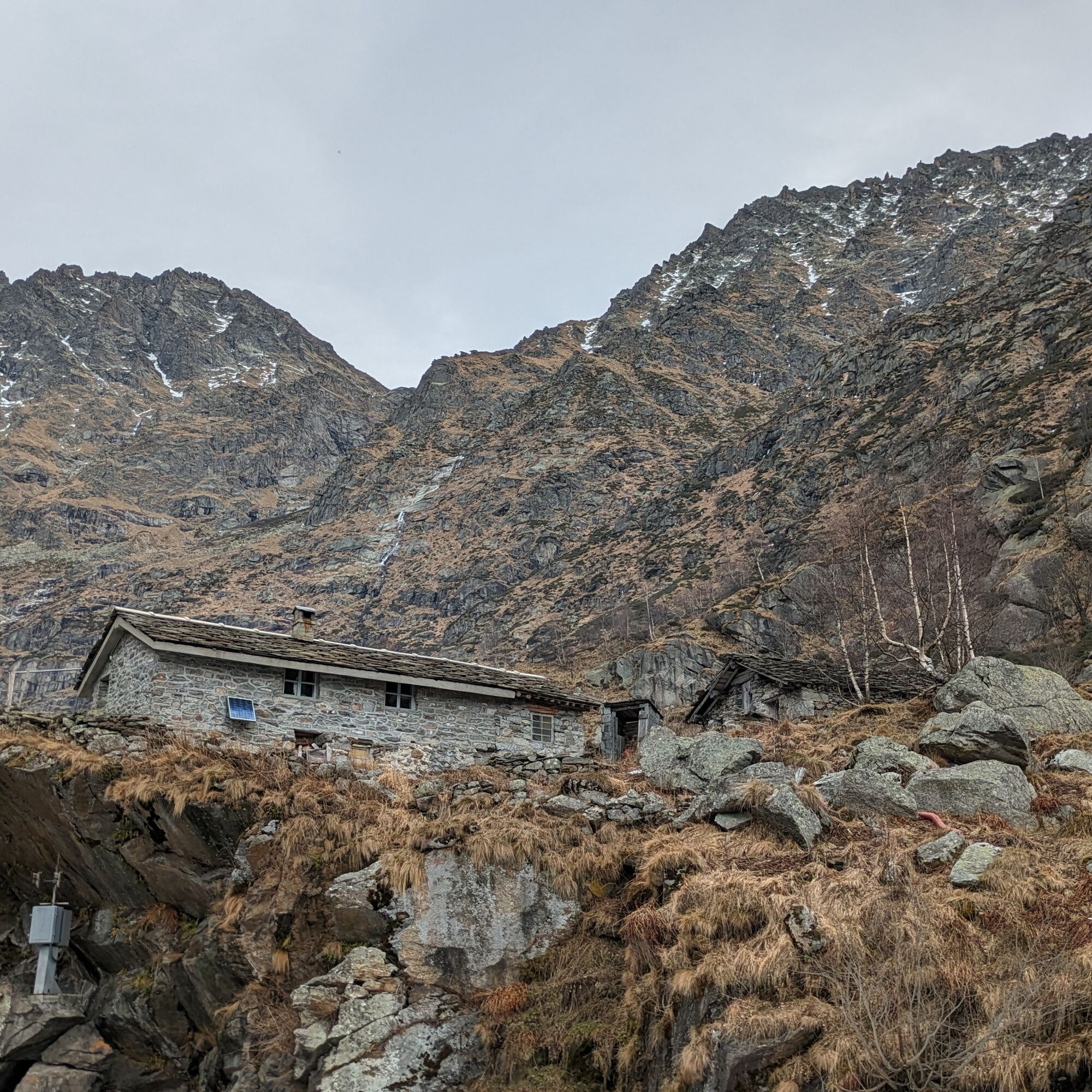
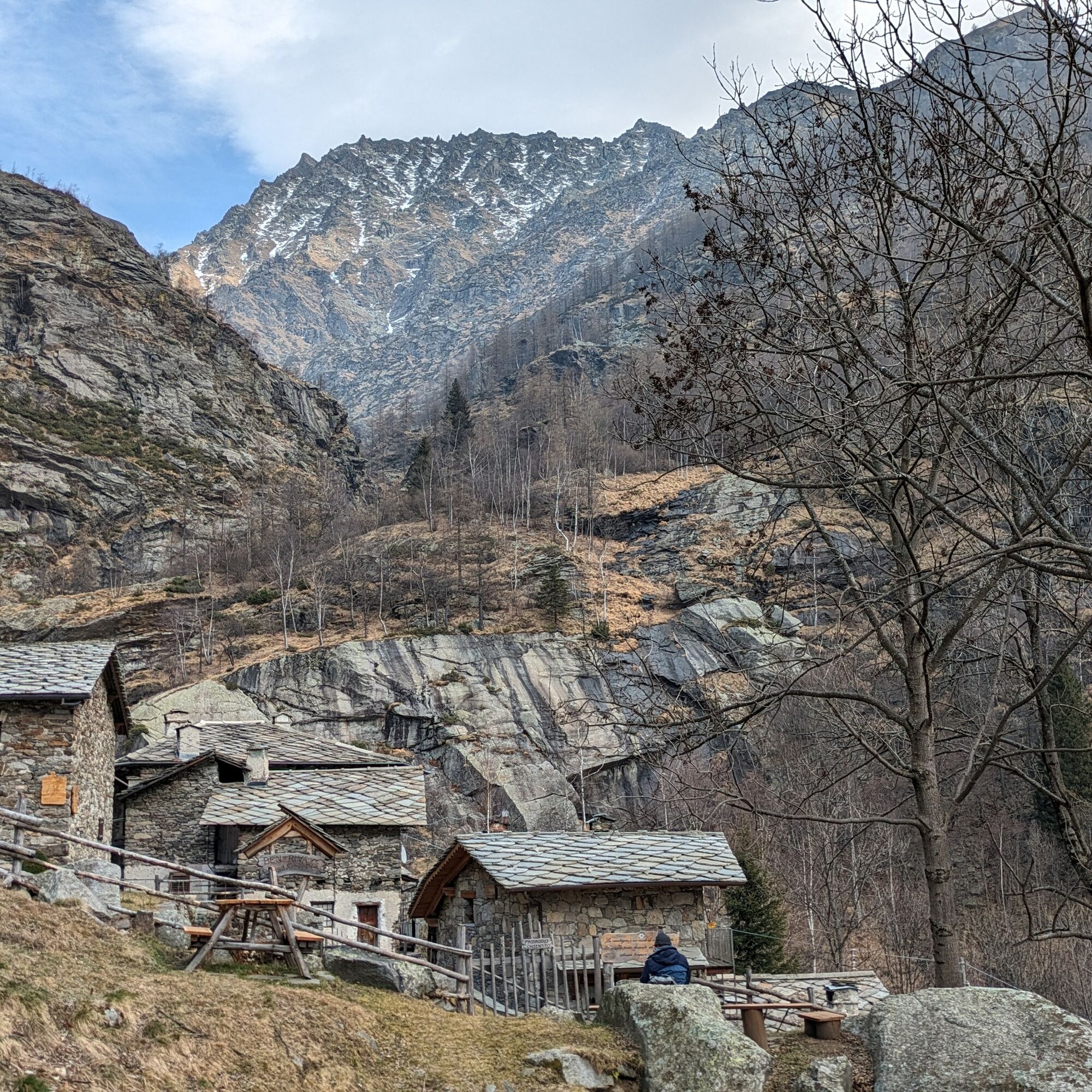
The refuge (unmanaged, 12 beds with mattresses, pillows, and blankets) was created from a portion of the building constructed for the caretakers who controlled the underground channel that carries water from the Ceresole dam to the Rosone hydroelectric plant.
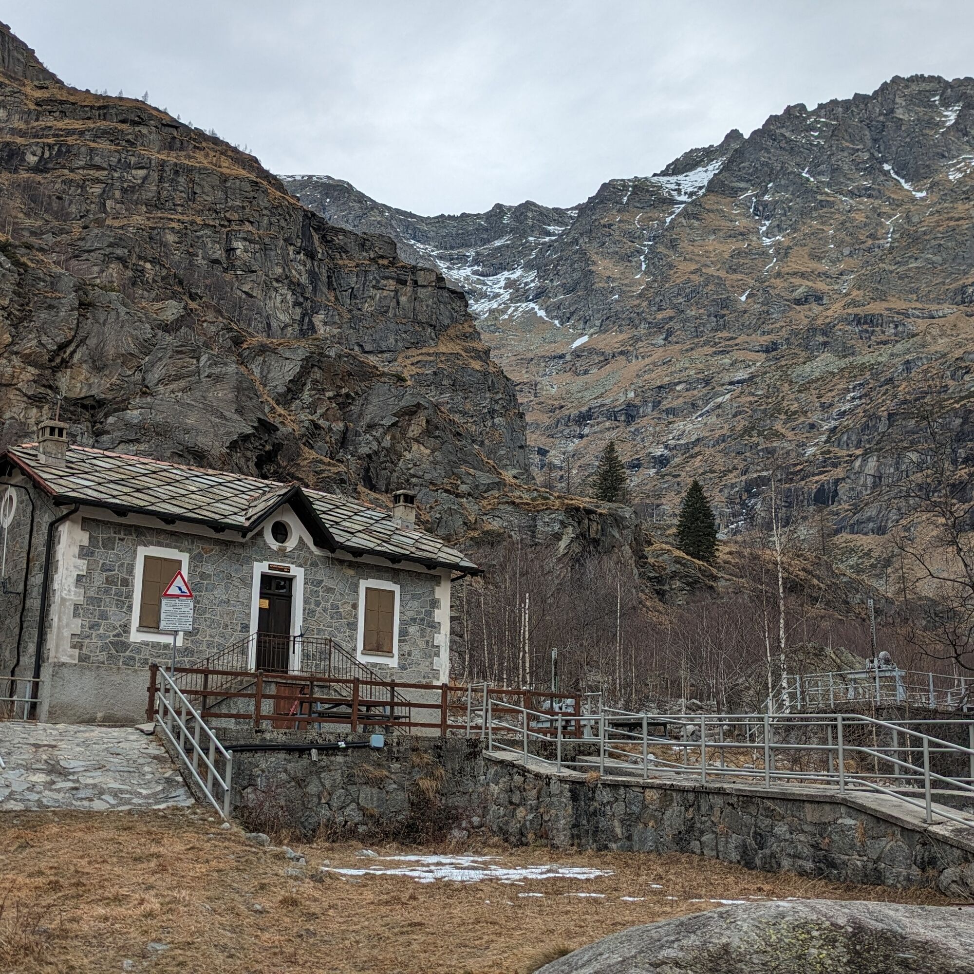
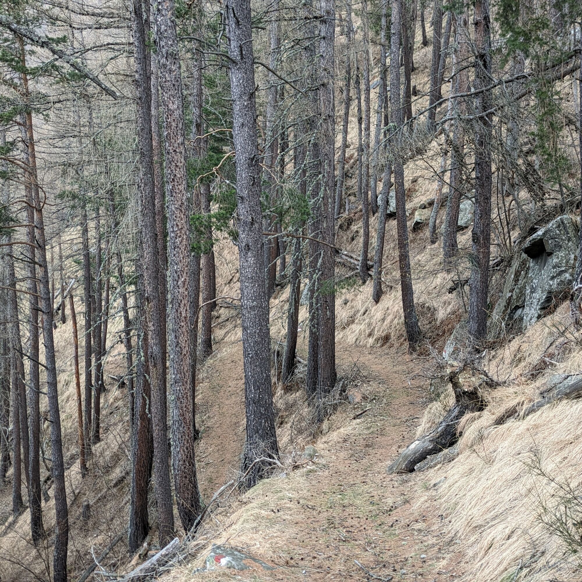
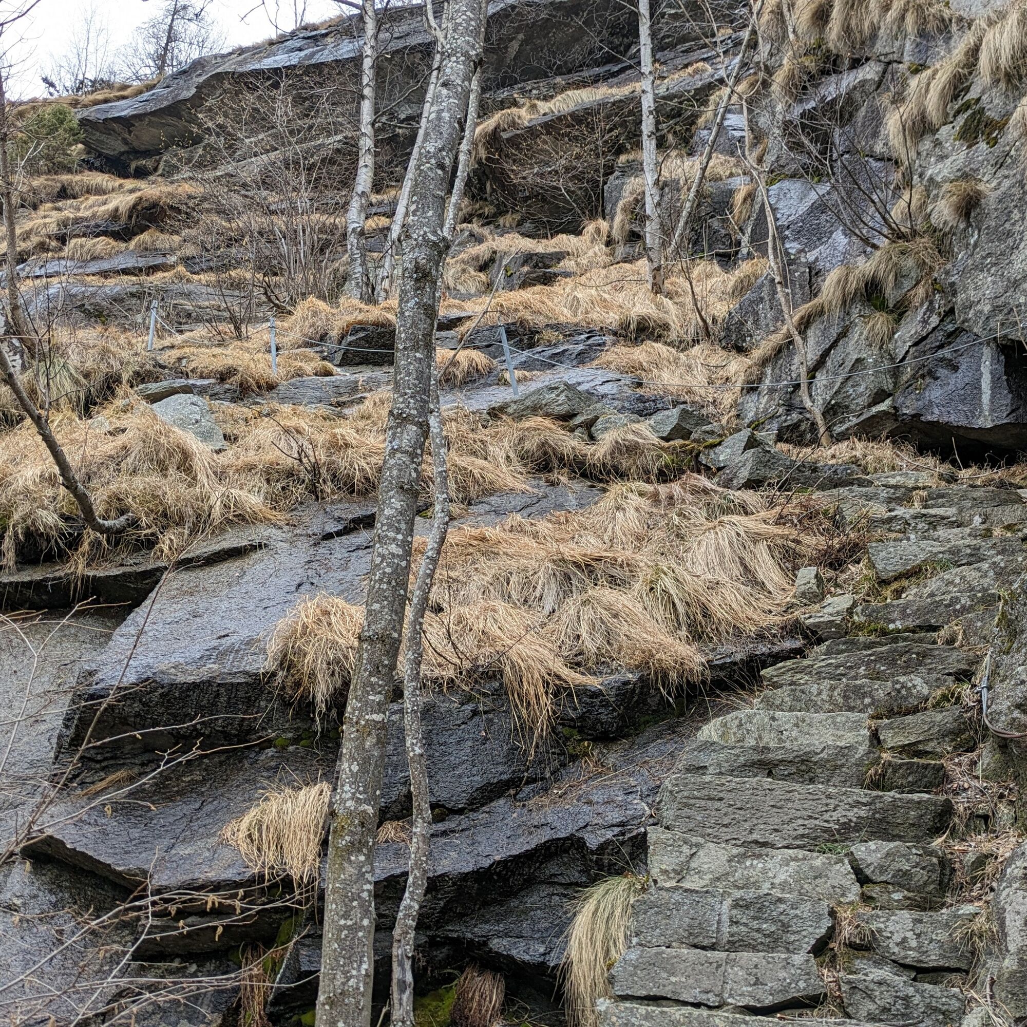
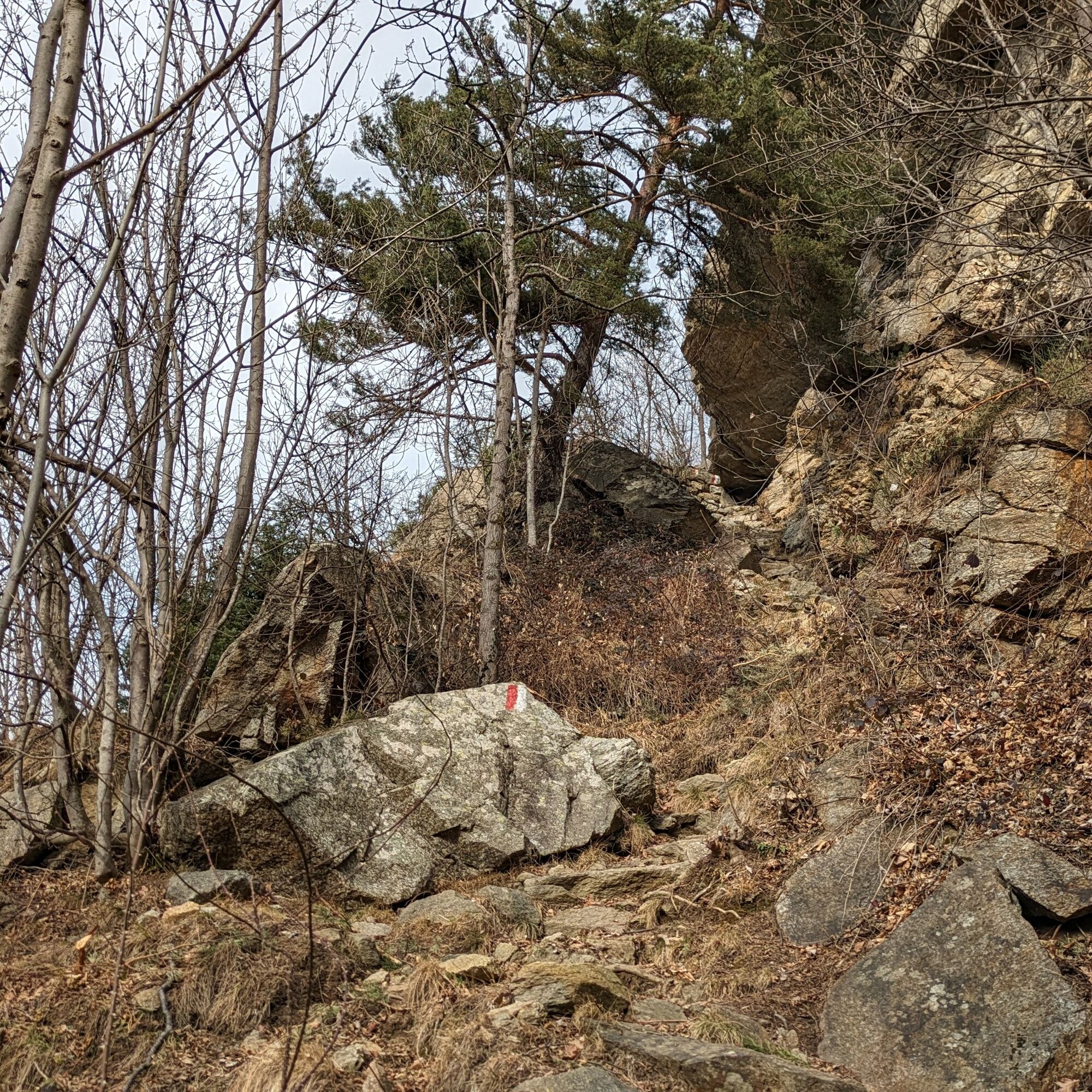
From the main square, following the signs for the "Sentiero Ada e Renato Minetti" (548 B) you reach the church and, skirting it, you take the path. Shortly after, you encounter the fork for the Noasca waterfall, which is reached with a slight uphill walk (5-10 minutes). From the waterfall, return on the same path to the fork where you resume the original itinerary. Avoid the branch to the Torre Jamonin climbing gym by turning left and going under the rock face where a long, steep rocky staircase begins that leads into the Noaschetta valley (1250 m). The path then continues more gently, touching Alpe Sengie. Then you arrive at a rocky staircase that can be climbed with the help of a fixed metal cable. Beyond this, continue to ascend gently, first passing near Alpe Scialer and then reaching Alpe Lavassai. Then cross the stream and reach the refuge (1520 m) by turning right.
From the refuge, go back a few meters, without crossing the stream, and climb the small wood that then opens into a plateau where the path to the Ivrea bivouac (path 548) intersects: turn left making a long traverse until you leave the path to the Gran Piano hunting lodge to descend on the mule track to the left. Then you reach the Sassa hamlet (1353 m) and continuing downhill you reach the Ceresole state road. Then walk along the road back to the starting point.
Non-slip sole footwear, wind/rain protection, a warm layer, hat, and sunglasses are recommended.
The first part of the path is very steep and requires attention. It is not recommended to undertake the route in winter or rainy periods because there are sections that may be icy or slippery.
There are no refreshment points along the route, so you need to carry water and food supplies.
From Cuorgnè, ascend the Orco Valley following signs for Ceresole Reale until you reach the town of Noasca.
The starting point is near the stop of bus no. 5137 on the Rivarolo - Pont - Ceresole Reale line.
Check the GTT website (Gruppo Trasporti Torinesi) for schedule information.
Upon arriving at Noasca square, turn left and cross the Orco stream, reaching the nearby parking lot of the Gera hamlet.
For information about the Noaschetta refuge, access to the refuge, and how to get the keys, consult the dedicated CAI Rivarolo section website
Take time to wander among the ancient houses of the Sassa hamlet.
Popularne wycieczki w okolicy
-
5,0
Gran Paradiso über Rifugio Vittorio Emanuele II.
średniWycieczka wysokogórska 10,1 km -
3,3
Pont Le Breuil - Rifugio Vittorio Emanuele
średniWędrówka 10,5 km -
Gran Paradiso
Wycieczka narciarska 11,8 km -
5,0
CERESOLE REALE Bellagarda ponds
średniWędrówka 7,60 km -
NIVOLET PASS Lakes Rosset, Leità and Chanavey
średniWędrówka 4,45 km -
GPR - Giroparco Gran Paradiso
ciężkiWędrówka 100,4 km -
5,0
Vie Storiche di Montagna | Colle del Nivolet
ciężkiDroga rowerowa 18,5 km -
Lake Dres - Ceresole Reale
średniWędrówka 7,24 km -
CHIALAMBERTO Sanctuary Madonna del Ciavanis and roc d'le Masche from Vonzo
średniWędrówka 6 km -
PIALPETTA Val Grande Balcony Trail loop
średniWędrówka 13,1 km

Wędrówki i tropienie


Nie przegap ofert i inspiracji na następne wakacje
Twój adres e-mail została dodana do listy mailingowej.