


NIVOLET PASS Lakes Rosset, Leità and Chanavey
Hike that allows approaching several glacial origin lakes through a route without any technical difficulty. The panorama perfectly allows admiring the Gran Paradiso massif with its glacial face (where...
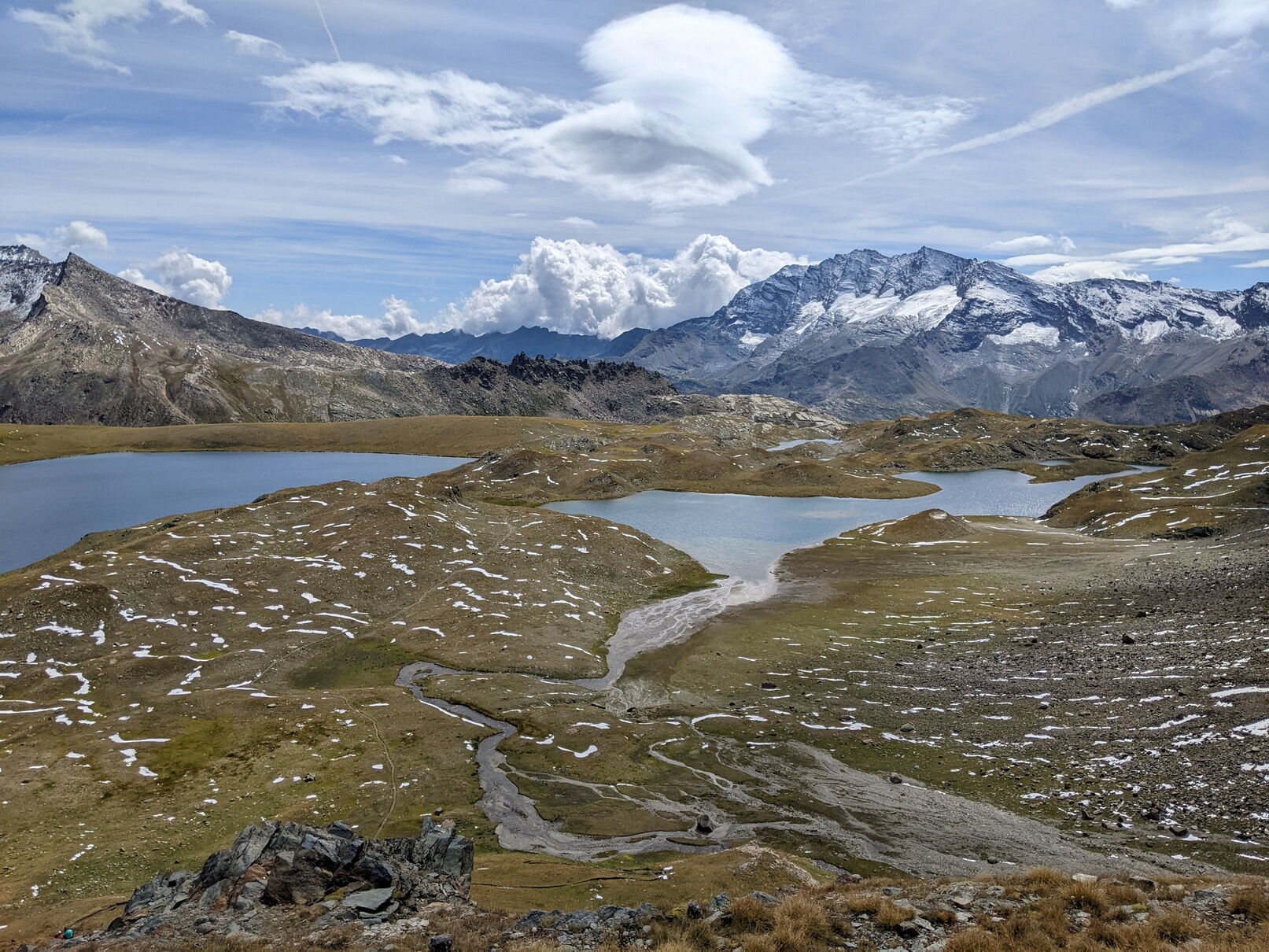
Hike that allows approaching several glacial origin lakes through a route without any technical difficulty. The panorama perfectly allows admiring the Gran Paradiso massif with its glacial face (where the normal ascent route passes) and nearby other striking peaks like Ciarforon, Tresenta and Becca di Monciair. In addition: Punta Basei, Taou Blanc and, to the south, the Levanne.
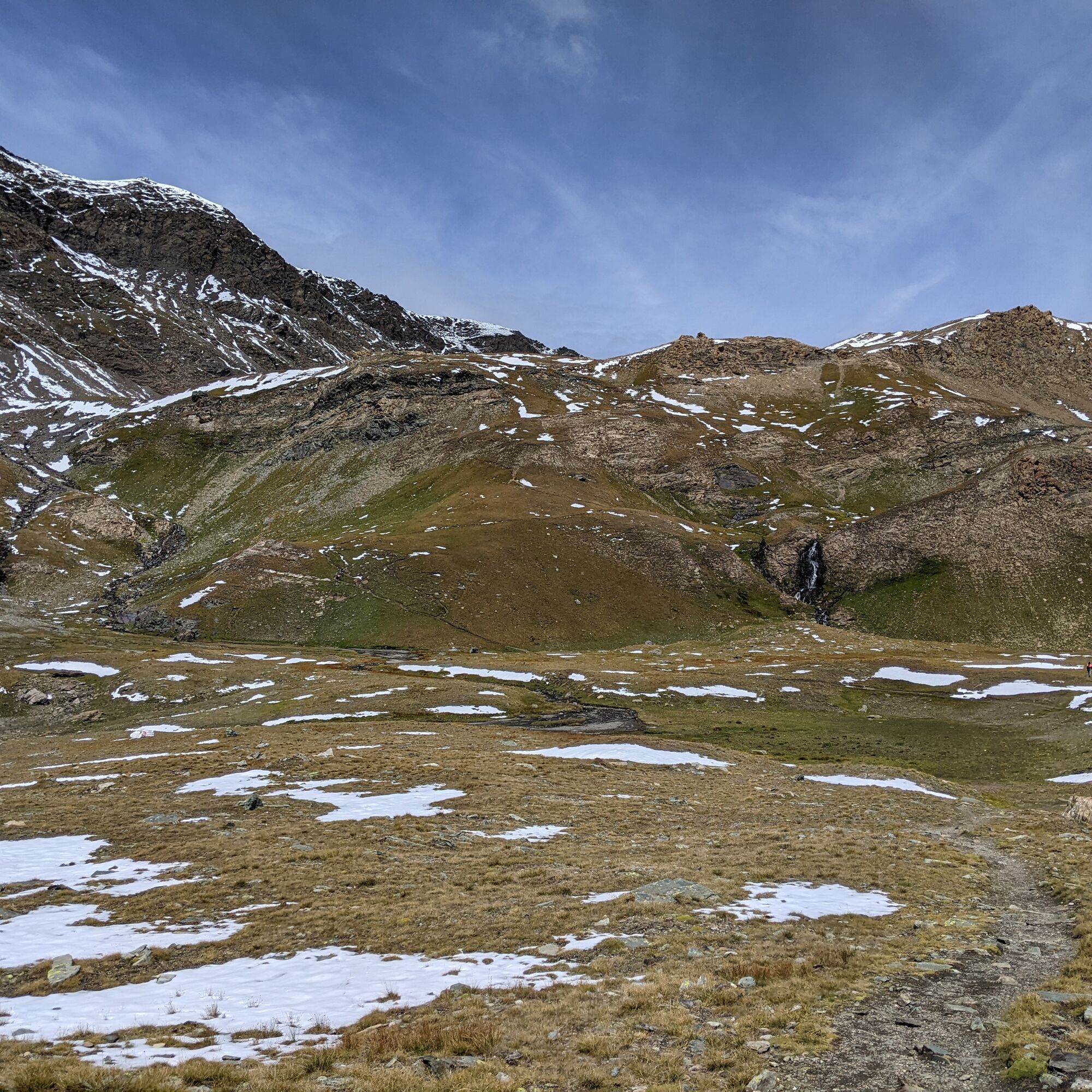
The environment is that of high-altitude meadows and poor grasslands, while in the highest part the amount of debris increases. Early summer presents numerous and colorful blooms, while in the latter part of the season the cottony white plumes further embellish the shores of the lakes. During the walk, with a bit of luck and peace, you can meet marmots, curious foxes or ibex.

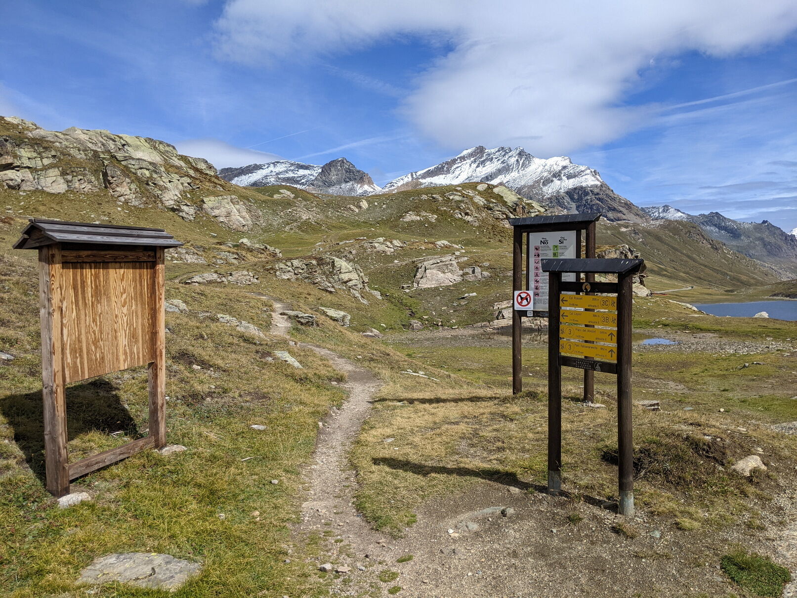
Just before reaching the Nivolet lakes, on the left side of the road, the start of the trail (3C) can be seen by the presence of signs and notice boards.
After about ten minutes keep to the left avoiding taking the path that leads to the Savoia hut. Shortly after, the route turns sharply left crossing the Rosset stream.
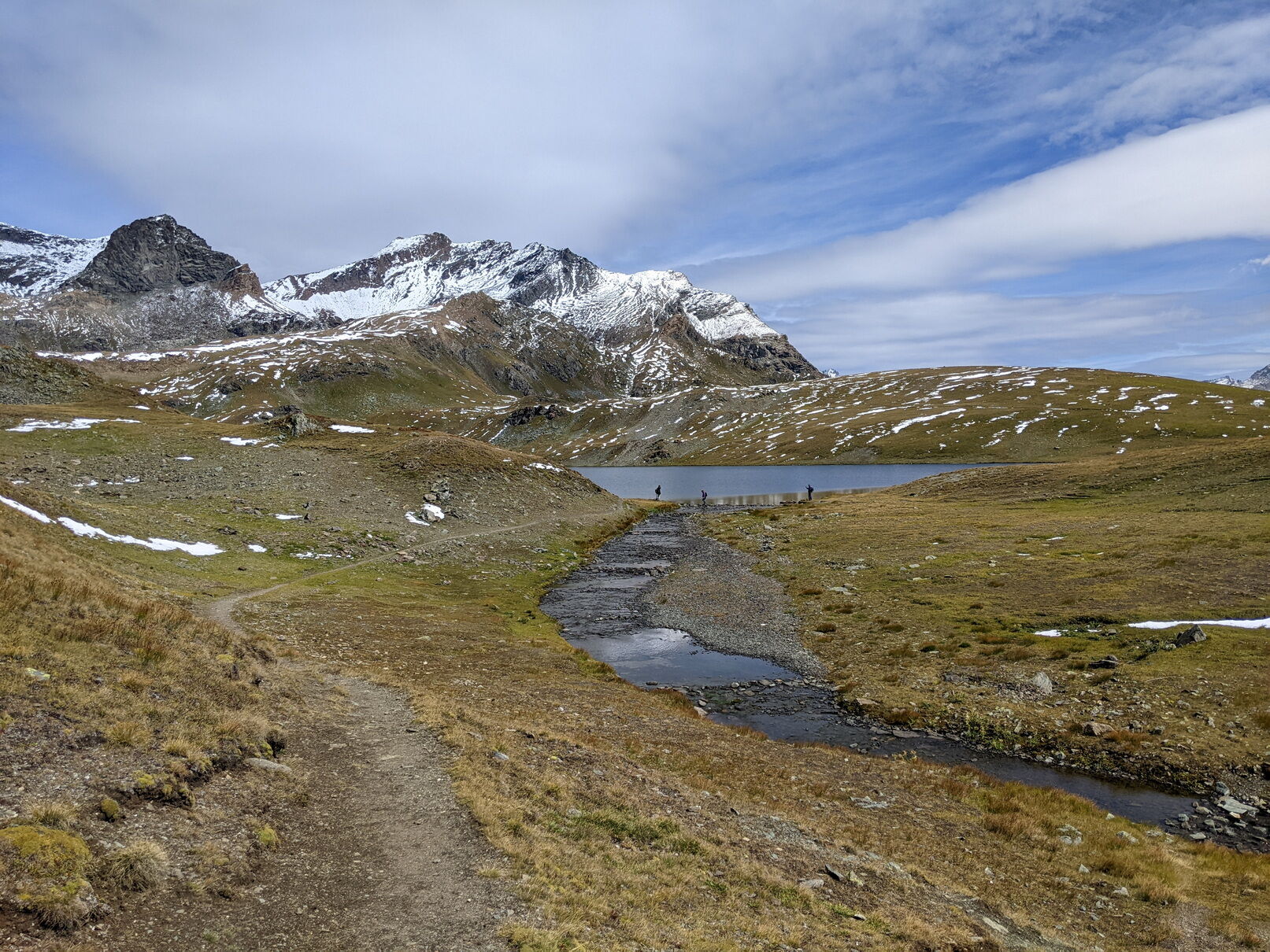
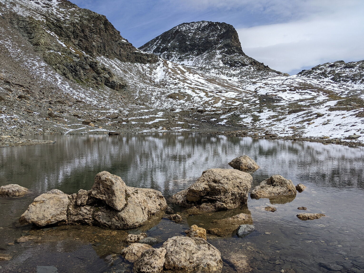
After a small ramp, the trail gradually ascends until it reaches the shore of Lake Rosset.
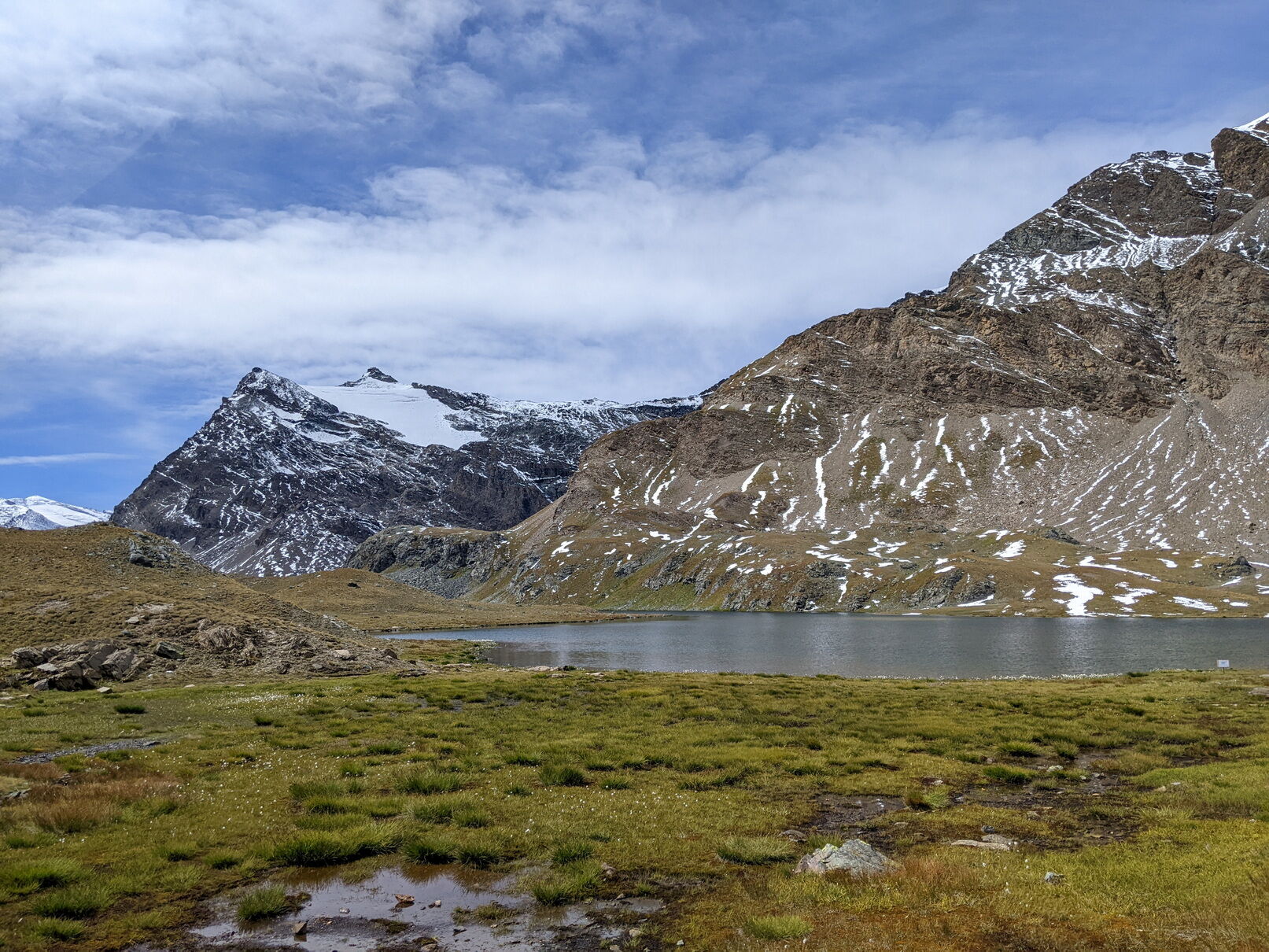
Next, there remains a steep ramp that leads to the highest part where, a little further on, are the Chanavey ponds. I recommend continuing to the last pond, located at the beginning of the final ascent to the Rosset pass.
Return via the ascent route.
Tak
Non-slip sole footwear, wind/rain protection, a warm layer, hat and sunglasses, water reserve, food are recommended.
Although the road makes it relatively easy to reach these places, remember you are in high mountain where weather conditions can change quickly.
From Cuorgnè reach Ceresole Reale on state road 460. Pass through the town of Ceresole Reale and continue on provincial road 50 to the Nivolet pass. The road is closed to traffic on holidays in July and August from 9:30 to 18:00 from Serrù locality to Nivolet Pass. From there, a shuttle service to the Nivolet pass is available.
Start descending towards the Nivolet lakes: the trailhead is a few hundred meters after the Città di Chivasso hut.
On holidays there is a shuttle service to the Nivolet pass and back. One run per day from Ivrea and some locations in Canavese; several runs from Ceresole Reale.
Spaces for parking just before the trailhead and shortly after near the Nivolet lakes.
For information on Gran Paradiso National Park and shuttle service to the pass visit the official website: pngp.it
Popularne wycieczki w okolicy
-
5,0
Gran Paradiso über Rifugio Vittorio Emanuele II.
średniWycieczka wysokogórska 10,1 km -
3,3
Pont Le Breuil - Rifugio Vittorio Emanuele
średniWędrówka 10,5 km -
5,0
CERESOLE REALE Bellagarda ponds
średniWędrówka 7,60 km -
Gran Paradiso
Wycieczka narciarska 11,8 km -
5,0
The Grand Méan lake via the Evettes circus
ciężkiWędrówka 13,6 km -
NOASCA Loop to the Noaschetta refuge
średniWędrówka 7,44 km -
Thumel - Rifugio Benevolo
średniWędrówka 12,5 km -
5,0
Vie Storiche di Montagna | Colle del Nivolet
ciężkiDroga rowerowa 18,5 km -
Lake Dres - Ceresole Reale
średniWędrówka 7,24 km -
NOASCA The high hamlets route
średniWędrówka 6,57 km
Wędrówki i tropienie


Nie przegap ofert i inspiracji na następne wakacje
Twój adres e-mail została dodana do listy mailingowej.