


BALME Arnas Ring - Pian della Mussa
The itinerary starts from the bottom of Pian della Mussa quickly gaining altitude, walking among meadows and heaths from which the view dominates much of the Val d'Ala below. At the Gastaldi refuge (open...
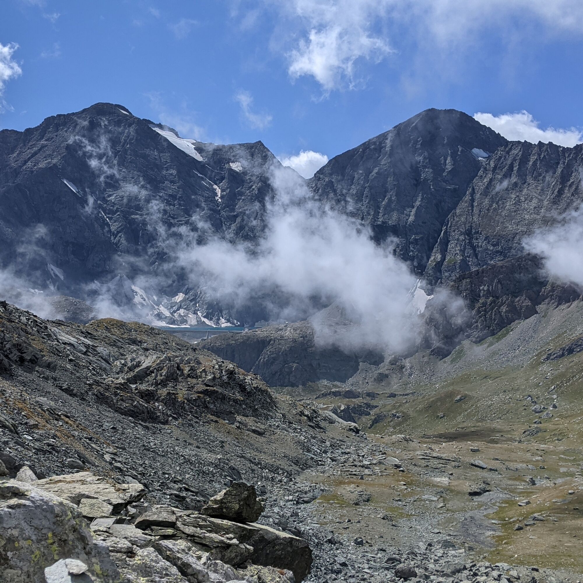
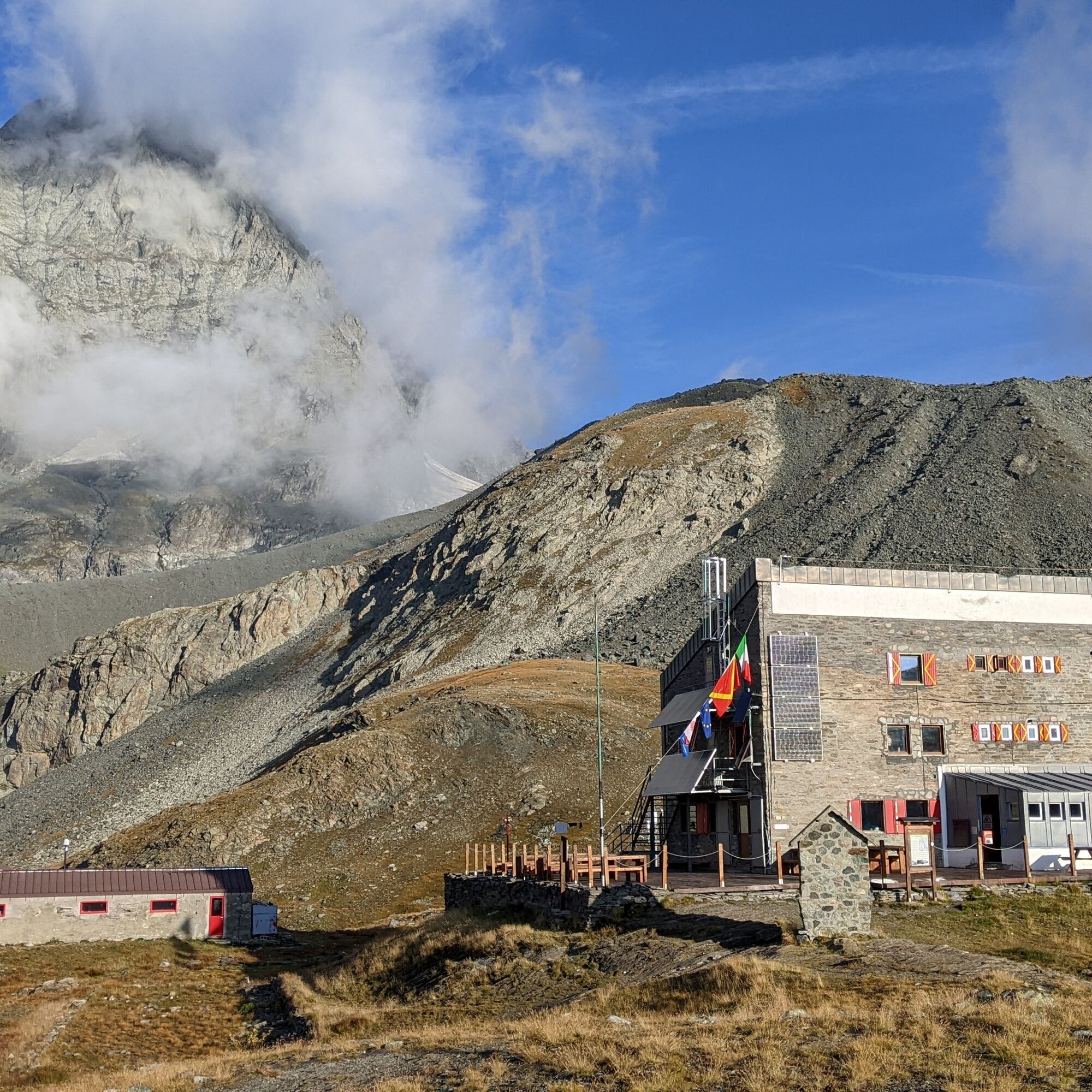
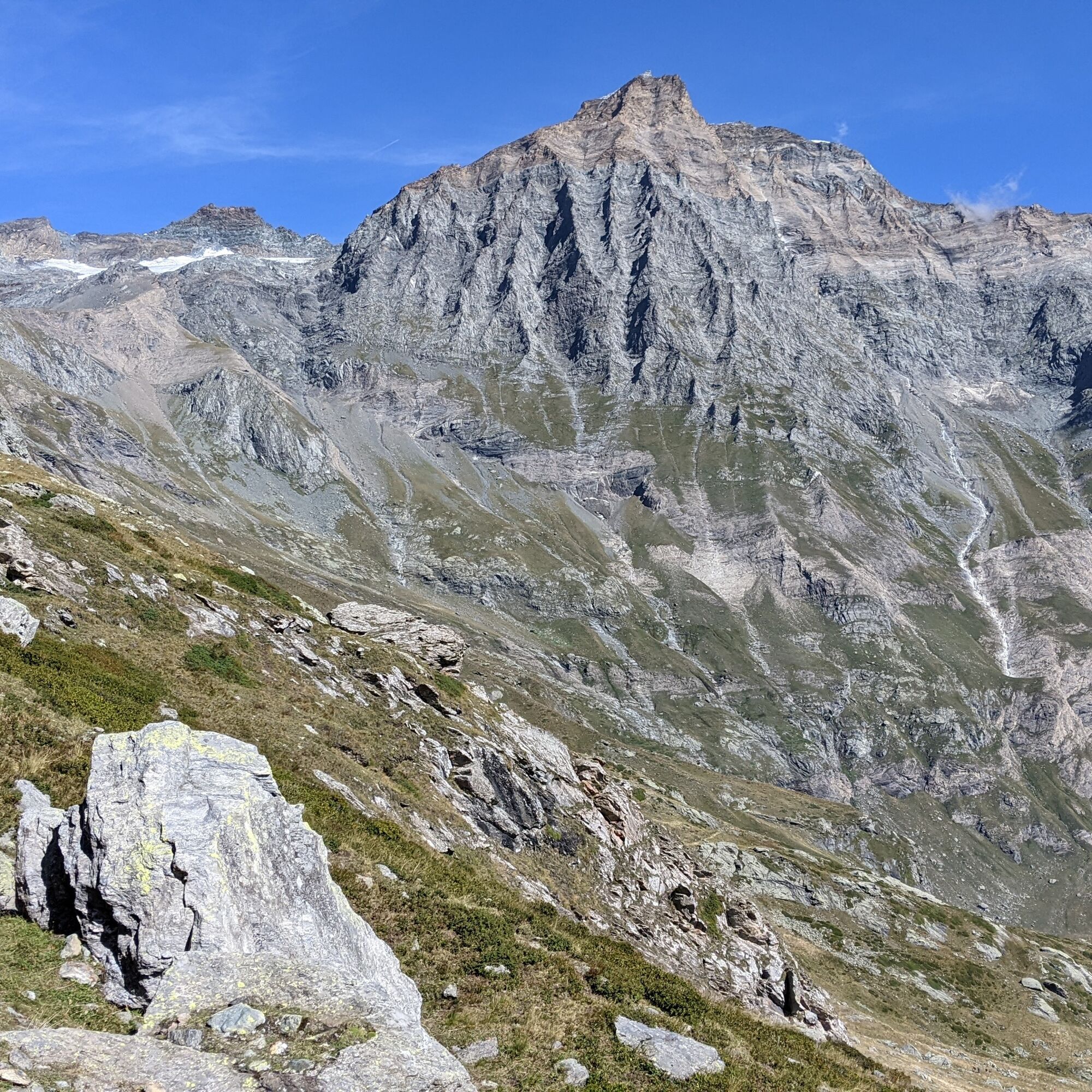
The itinerary starts from the bottom of Pian della Mussa quickly gaining altitude, walking among meadows and heaths from which the view dominates much of the Val d'Ala below. At the Gastaldi refuge (open from mid-June to early September) you are amazed in front of the vertical walls of Uja di Bessanese (3606 m) and the basin below shaped by its glacier, now nearly extinct.
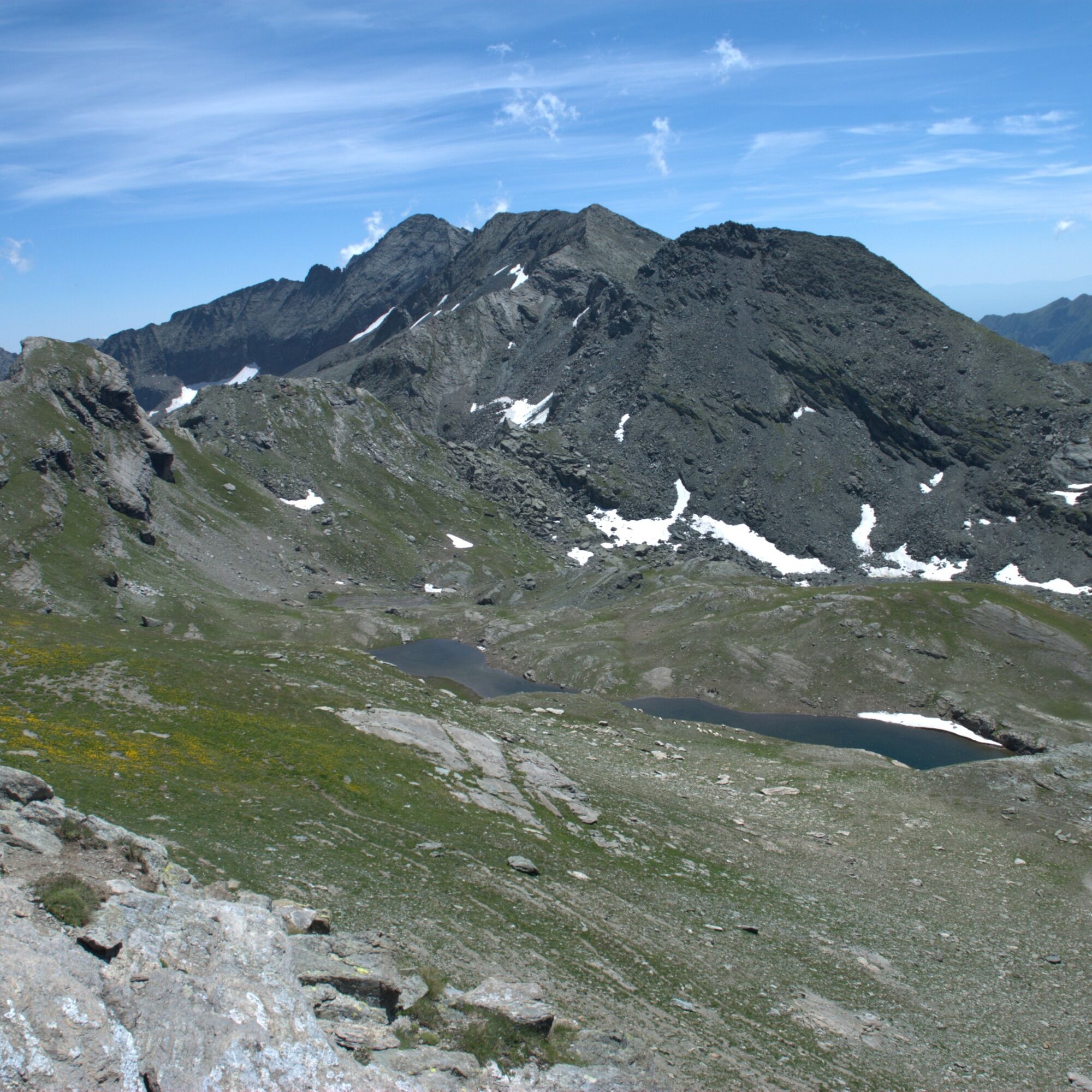
Then you reach the two glacial lakes, first Crotas and then Bessanetto, where animals are often brought to graze.
You then reach the Mangioire pass, a narrow pass that allows access to the suspended valley of Saulera, in the lower part of which are some alpine pastures. Throughout the route there are numerous blooms, even rare, that can be observed during the whole summer. Marmots, ibex, chamois, golden eagles, bearded vultures, and griffon vultures are often encountered.

The route starts at the bottom of Pian della Mussa, taking the path to the left of the paved road before it climbs to the Città di Ciriè refuge. Head towards the characteristic Venoni rock (an ancient alpine pasture built against a huge rock), but once the stream is crossed, turn right following the signs for the Gastaldi refuge. Shortly after, the real ascent begins, climbing with many switchbacks to reach Pian dei Morti, where at an altitude of 2209 m, near a rock, a fork with signposts is found: take the path on the left. After several switchbacks, you reach an area with rocky steps equipped with rope handrails.
Continue climbing until you reach a saddle from where the refuge is in sight.
From the refuge, descend into the basin of Crot del Ciaussinè (heading south) to the base and cross the stream (bridge). Climb to the left of Rocca Affinau (signage Tour della Bessanese / 222a).
At about 2632 m, leave the Tour della Bessanese path to follow trail traces on the left. After crossing a first pass (2802 m), you can see Lago del Crotas; continuing towards southeast you reach Lago di Bessanetto and then the Mangioire pass (2765 m).
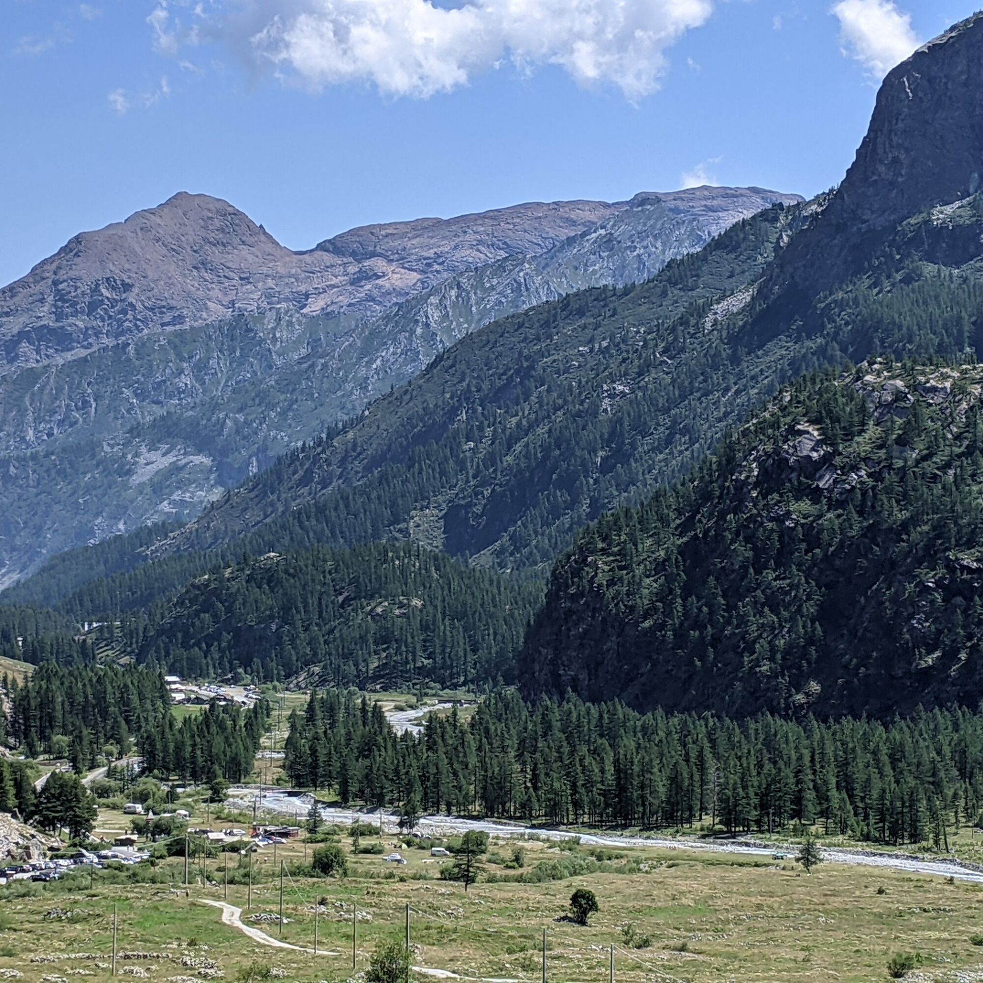
From this point, a long and steep descent begins to about 2120 m, where it is recommended to take the fork on the left. After a stretch of false flat, you face the last steep slope. Upon reaching a saddle in the forest, turn right and shortly after to the left. This leads to the middle of Pian della Mussa.
Immediately after the bridge on the Stura, turn left onto a path and shortly you end on the paved road and then at the starting point.
Non-slip sole footwear, wind/rain protection, one or more warm layers, hat and sunglasses, gloves, food reserves are recommended.
At the beginning of the season, crampons may be useful to cross remaining snowfields.
The route develops at high altitude: remember that the weather can change quickly and temperatures drop; the sun's ultraviolet rays are less filtered.
In many places there is no cellular network coverage.
Next to the main building of the Gastaldi refuge is the winter bivouac, equipped with 10 beds with blankets, in case of need outside the refuge opening period.
Coming from the plain, after passing the town of Germagnano continue straight towards Ceres - Balme. Just before Ceres, at the traffic light continue straight for Balme and travel the entire Val d'Ala, pass Balme and overcome the hairpin bends that lead to Pian della Mussa. At Pian della Mussa, continue until car access is prohibited near the Città di Ciriè refuge.
Pian della Mussa is reached in the summer period by a bus line (no. 188) departing from Ceres. Check the Cavourese website for schedules and costs.
Where the road ends, there are parking spaces.
WARNING: usually in July and August, parking is charged daily; only on Saturdays and Sundays in September. Consult the Balme municipality website for details and updated rates.
For more information about the area, visit the Tourism in the Lanzo Valleys portal
To split the route into two days, spend a night at the welcoming Gastaldi refuge
Popularne wycieczki w okolicy
- 4,7
Rocciamelone partedjo dalla Riposa. Mompantero, Piemont/Italien
średniWędrówka 10,6 km - 5,0
The Grand Méan lake via the Evettes circus
ciężkiWędrówka 13,6 km - 5,0
BALME Green Lakes and Lago Paschiet
średniWędrówka 7,51 km - 5,0
LEMIE Ovarda Lakes loop
ciężkiWędrówka 15,9 km - 4,7
High Way of the Lanzo Valleys | Stage 6 Tazzetti Refuge - Lake of Malciaussia
średniWędrówka 5,49 km - 5,0
Alta Via delle Valli di Lanzo | Stage 4 Rifugio Citt di Ciri - Rifugio Cibrario
ciężkiWędrówka 12,0 km USSEGLIO Lake Nero from Lake Malciaussia
światłoWędrówka 4,79 kmUSSEGLIO Lake behind the Tower and of the Rossa
ciężkiWędrówka 17,1 kmVIU' Lake Viana from Alpe Bianca
średniWędrówka 5,56 kmHike from the Avérole refuge through the hamlet
średniWędrówka 9,36 km

Wędrówki i tropienie


Nie przegap ofert i inspiracji na następne wakacje
Twój adres e-mail została dodana do listy mailingowej.