







RW_N41 Straniger Alm - Klein Kordin Alm (SBW_6 - Constellation hike)
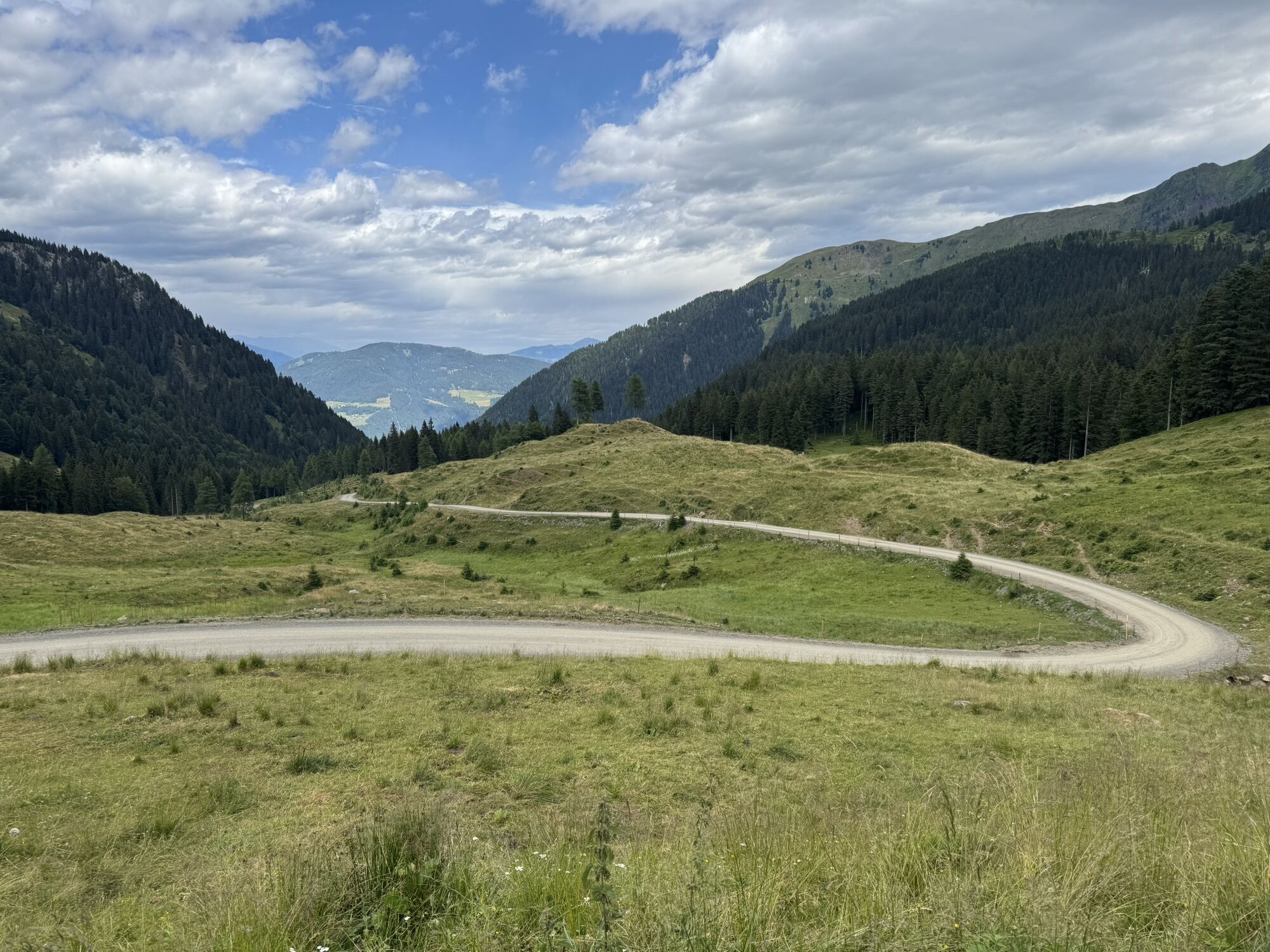
Located between Plöcken and Nassfeld and high above the Gail valley, the cheesemakers of Straniger Alm and Klein Kordin Alm can focus on what they love most: making delicacies like cheese, smoked Schotten,...
Located between Plöcken and Nassfeld and high above the Gail valley, the cheesemakers of Straniger Alm and Klein Kordin Alm can focus on what they love most: making delicacies like cheese, smoked Schotten, and homemade ice cream from the milk of their alpine cows, which spend their summer here. Above all, the regional and alpine-typical Gailtaler alpine cheese (g.g.A: Europe-wide protected designation of origin). You can experience this up close on this wonderfully easy constellation hike while enjoying the lovely alpine landscape on both sides of the Carinthian-Friulian border.
Highlights:
Cheese Alpine Pasture 1: Straniger Alm Cheese Alpine Pasture 2: Klein Kordin Alm Gugel – a small summit on the ridge between Straniger and Klein Kordin Alm Malga Valbertad Alta – authentic Italian alpine pasture Kordin Saddle as part of the Lanzenpass – Findenig geotrail in the Carnic Alps Geopark
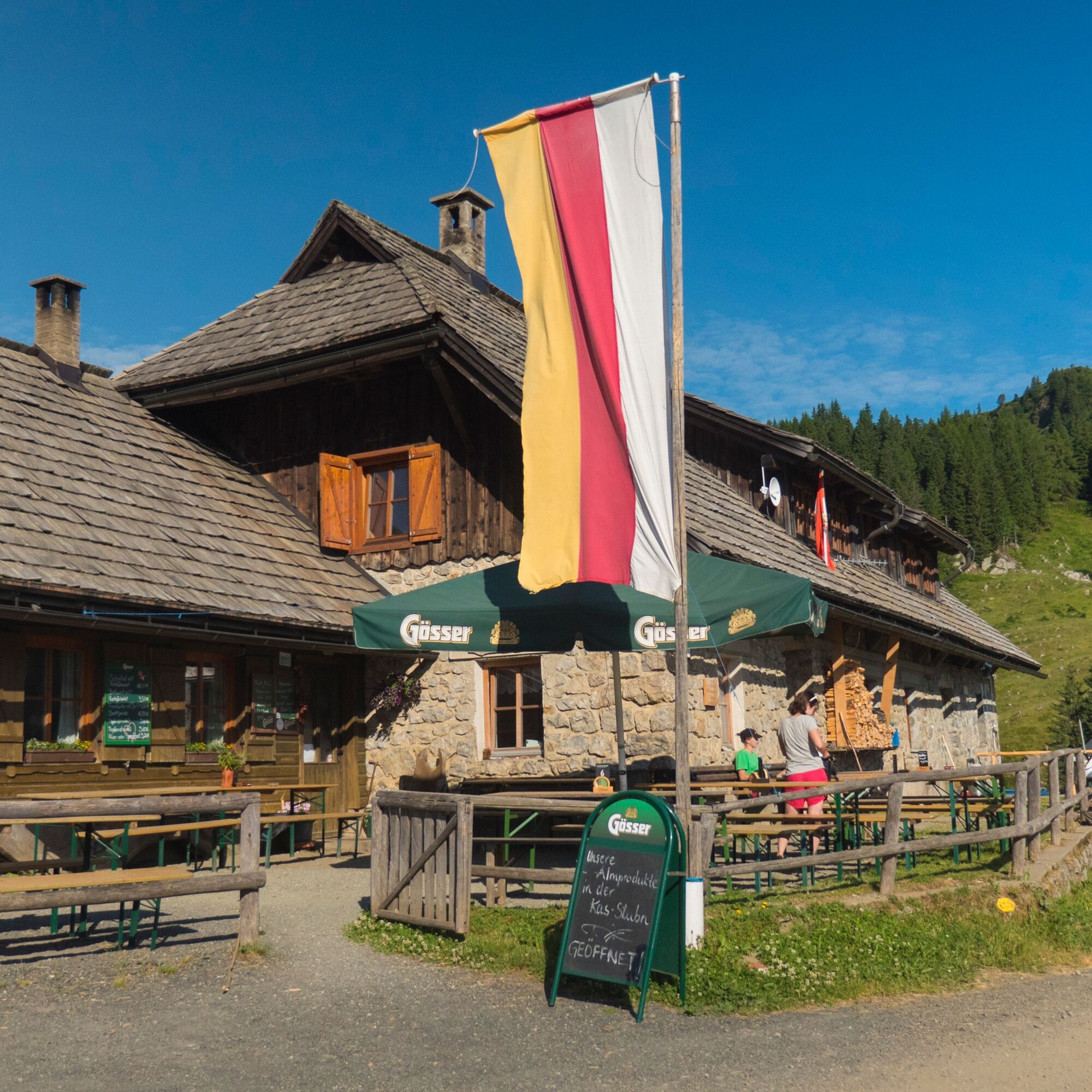

From the starting point of this constellation hike at Straniger Alm, follow the road for a few minutes south towards Straniger Saddle until a fork in the path. You will walk the left path over the Gugel to Klein Kordin Alm at the end of your circular hike in the opposite direction – but now choose the gravel road that goes right over the nearby Straniger Saddle (1,578 m) and from here on Italian territory at a constant height to Malga Valbertad Alta – a very authentic Italian alpine pasture (Path no. 449 “Sentiero d. Malgari”).
Now continue the path a short distance further, ignore an alpine path branching off to the right, and at the next fork on a ridge turn left onto gravel road no. 448. This will take you uphill to Casera Cordin Grande and shortly afterwards to the 1,749 m high Kordin Saddle between the peaks of Straniger Kopf and Schulterkofel. Here you cross the border again and continue hiking on the Carinthian side of the Carnic Alps from now on.
At Kordin Saddle – as on many parts of this constellation hike – besides the traditionally lived alpine farming, another theme becomes apparent: as part of the Lanzenpass – Findenig geotrail in the Carnic Alps Geopark, geological features literally become visible in this section of the Carnic Alps. For example, at Kordin Saddle, you will see marine deposits and limestone layers of the Auernig Formation, while at the beginning of your hike on the west side of Straniger Kopf the so-called “2er Riebe” (west side of Straniger Kopf) shows the red rock of the Gröden Formation.
From Kordin Saddle, hike now on trail no. 403 in the same direction (north) over the gentle alpine area of Klein Kordin Alm, until just before the small summit of Gugel, where the gravel road sharply turns right to the nearby Klein Kordin Alm – a secluded Gailtaler cheese alpine pasture (you already see it from above). An ideal place to stop – here you can taste specialties such as the typical Gailtaler alpine Schotten (a special kind of cheese) or the regional and alpine-typical Gailtaler alpine cheese (g.g.A: Europe-wide protected designation of origin).
Back at the fork, you will reach in a few minutes the small 1,691 m high summit of Gugel, which separates the alpine areas of Klein Kordin Alm and Straniger Alm. The path now makes a left curve and takes you along the northwest side of Straniger Kopf at about the same height to the above-mentioned fork near Straniger Saddle. From here you know the way back to Straniger Alm and will reach it in a few minutes.
Plan enough time to explore the cheese alpine pasture Straniger Alm. The alpine farmers are very innovative and are known for making slightly different specialties from traditional cheese.
Tak
For the constellation hikes, a “normal” equipment for alpine hikes on unpaved and partially rocky paths in the southern Limestone Alps is sufficient. However, sturdy footwear with a good tread sole for unpaved paths is a “must,” and it is recommended to bring telescopic trekking poles to relieve the knees during the sometimes longer descents. In summer, good sun protection and sufficient water are very important (there are no refreshment options on every stage). Sufficient warm clothing for possible weather changes is also important even in high summer. For all mountain huts along the trail, you also need to bring a hut sleeping bag and a towel.
Here is the detailed equipment list for your trail trip.
Achtsamkeit für Natur – Grundbesitzer – deine Gesundheit.... und die Sicherheit am Berg haben höchste Priorität bei deiner Tour und der damit verbundenen Tourenplanung!
Deshalb erkundigt euch vor jeder Wanderung über die Verhaltensregeln - Sicherheit-am-Berg - sowie die aktuelle Wetterlage.
Müllentsorgung:
Abfall ist nicht immer zu vermeiden - in der Natur hat er aber nichts zu suchen und ist ordnungsgemäß (bevorzugterweise im Tal bzw. zu Hause) zu entsorgen.
Notrufnummern:
Euronotruf: 112 (Zugang in jedes verfügbare Netz)
Alpinnotruf Österreich: 140
Access via Gailtalstraße B111 to Kirchbach. In the town center, turn south towards Oberdöbernitzen. Just after crossing the Gail, turn left and follow Gailtal Schattseiten Landesstraße until just past Hotel Restaurant Michal, where you turn left. Then continue on the gravel alpine road with many switchbacks up to Straniger Alm.
Arrival in Kirchbach is possible hourly by public transport (S4 to Hermagor and then Bus 5058 to Kirchbach). Continue with the alpine shuttle to Straniger Alm (phone reservation required).
Free parking is available at the starting point at Straniger Alm.
Cheese Alpine Pasture: Straniger Alm
Location: secluded innovative alpine pasture in a less known quite lovely part of the Carnic Alps Remarkable: Enjoyment of the regional and alpine-typical Gailtaler alpine cheese (g.g.A: Europe-wide protected designation of origin), also in the original version with cow and goat milk as well as creative recipes like turmeric Kasspatzn at the alpine pastureCheese Alpine Pasture: Klein Kordin Alm
Location: secluded natural alpine pasture in a less known part of the Carnic Alps below the mighty Hochwipfel
Remarkable: Enjoy fresh products such as Gailtaler alpine Schotten or the regional and alpine-typical Gailtaler alpine cheese (g.g.A: Europe-wide protected designation of origin), each from their own alpine dairy. Possibility of cow sponsorships. Especially lovingly designed alpine pasture, run with passion.
On these day hikes, you can deeply immerse yourself in the history, nature, and culture of the landscape you are exploring.
Popularne wycieczki w okolicy
- 4,8
Tarvisio - Venzone (C101)
średniKolarstwo długodystansowe 64,7 km - 4,3
Malurch Nassfeld
średniWędrówka 9,60 km - 4,6
ST_N7 Gartnerkofel (2,195 m)
Wycieczka narciarska 3,94 km - 5,0
Nassfeld Grenze - Gartnerkofel
światłoWędrówka 8,41 km - 4,6
KL_N2 Däumling
średniVia ferrata 1,78 km - 3,7
Hermagor: Gartnerkofel
Wędrówka 7,70 km - 5,0
Plöckenhaus - Polinik - Plöckenhaus
ciężkiWędrówka 10,9 km - 4,9
RW_N34 Watschiger Alm - Gartnerkofel (SBW_3 - constellation hike)
średniTrasa tematyczna 6,20 km - 4,7
RW_N22 Garnitzen Gorge Geotrail
średniTrasa tematyczna 6,73 km - 4,6
KL_N5 Crete Rosse
średniVia ferrata 6,96 km
Wędrówki i tropienie


Nie przegap ofert i inspiracji na następne wakacje
Twój adres e-mail została dodana do listy mailingowej.





