The Hâble d'Ault Bird Reserve
światło
Pobierz tę trasę na swój telefon komórkowy
The Hâble d'Ault Bird Reserve
światło
Wędrówka
6,05
km
Zeskanuj kod QR i rozpocznij nawigację w aplikacji bergfex.

Wędrówki i tropienie


The Hâble d'Ault Bird Reserve
światło
Odległość
6,05
km
Czas trwania
01:27
h
Ascent
-
hm
Poziom morza
3 -
8
m
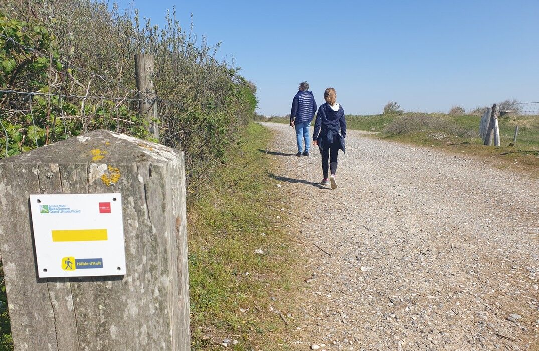
Ścieżka do pobrania
The Hâble d'Ault Bird Reserve
światło
Wędrówka
6,05
km
The Hâble d'Ault is a unique site in France. This wetland protected by a pebble barrier is a prime location for naturalists. No fewer than 270 bird species frequent it. The walk allows you to discover...
Opis
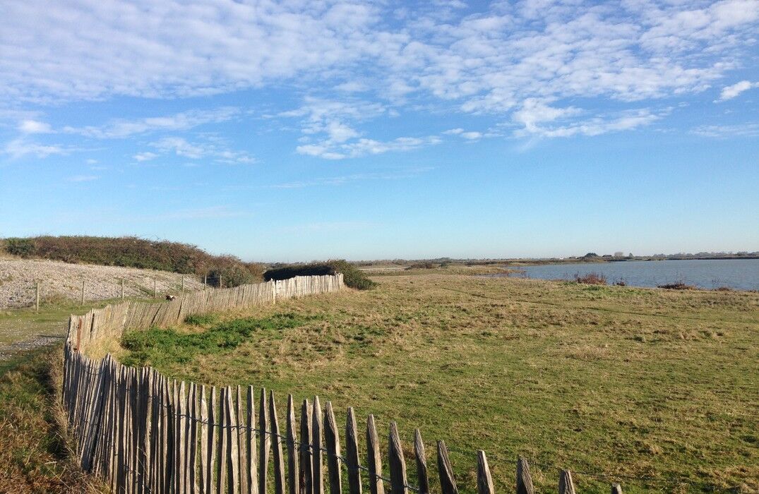
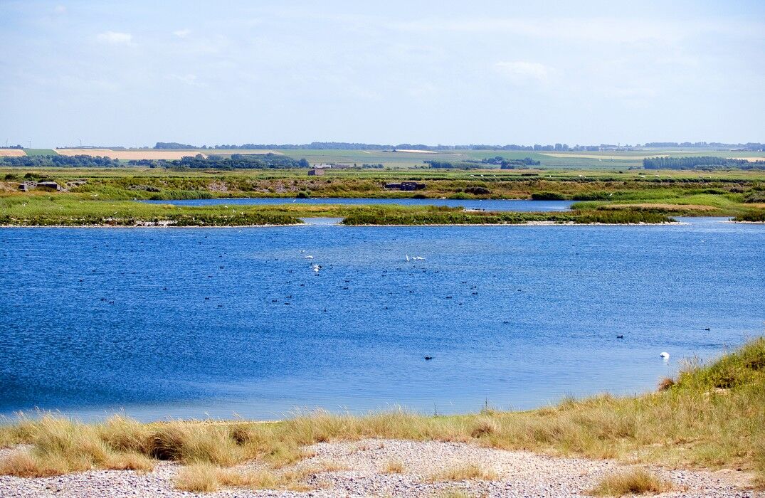
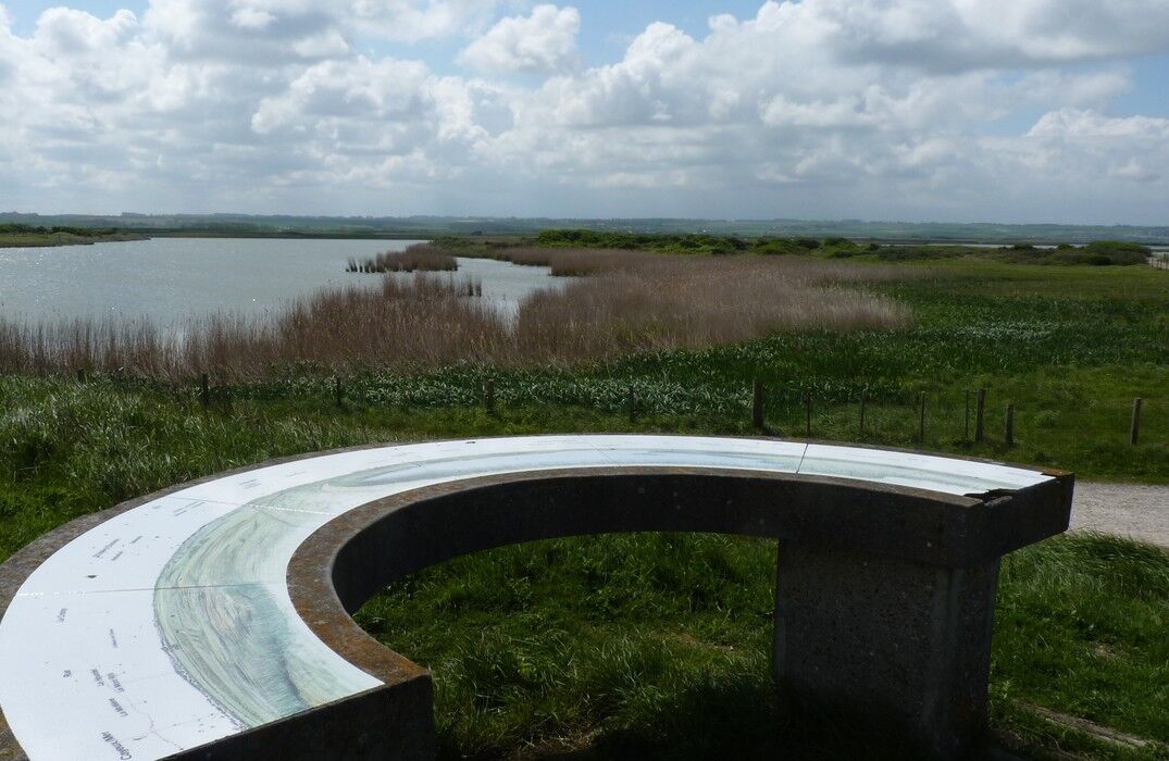
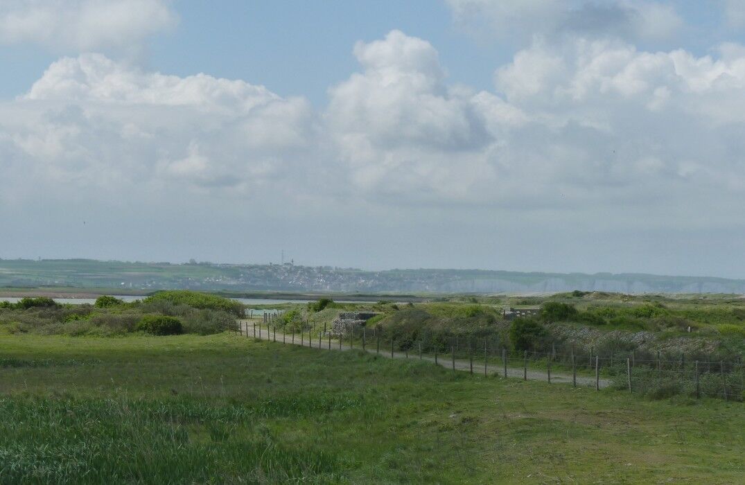
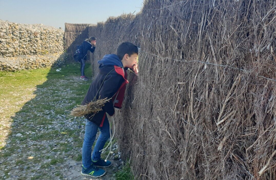
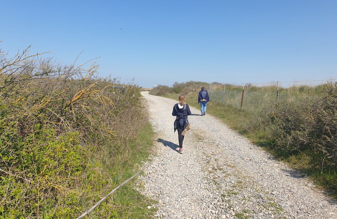
The Hâble d'Ault is a unique site in France. This wetland protected by a pebble barrier is a prime location for naturalists. No fewer than 270 bird species frequent it. The walk allows you to discover a multitude of natural environments in the heart of the Bas Champs. The long straight path may seem a bit monotonous but do not hesitate to climb to the top of the dyke to admire the sea and cliffs. The return path, more winding, is much more pleasant and equipped with some observation posts. Don't forget your binoculars, very useful for spotting small passerines!
Baie de Somme Railway Station in Cayeux, located 1.8 km from the starting point
Baie de Somme Railway Station in Cayeux, located 1.8 km from the starting point
Autor
Dostarczone przez Somme Tourisme
Wycieczkę The Hâble d'Ault Bird Reserve zapewnia outdooractive.com.

Dodatkowe informacje i wskazówki
Dodatkowe informacje
Nie ma jeszcze recenzji
Popularne wycieczki w okolicy
Greenway "Path between Glass & Sea"
światłoWędrówka 35,8 kmLamotte Circuit
światłoWędrówka 11,4 kmCircuit vélo – Gravelot
średniJazda na rowerze 36,8 kmThe Baie de Somme coastal path
ciężkiWędrówka 51,3 kmLa Vélomaritime® - EuroVelo4 - From Fort Mahon to Mers les Bains
światłoMountainbike 80,0 kmLes Crocs - around the Marquenterre
światłoWędrówka 15,8 kmCircuit of the Isle
światłoWędrówka 11,4 kmWalk in Saint-Valery-sur-Somme
światłoWędrówka 7,10 kmCircuit vélo – Tour de Baie
światłoJazda na rowerze 30,6 kmMésange Circuit
światłoDroga rowerowa 38,4 km
Wędrówki i tropienie

Ponad 550.000 propozycji wycieczek, szczegółowe mapy i intuicyjny planer tras sprawiają, że aplikacja jest niezbędna dla wszystkich entuzjastów przyrody.

Nie przegap ofert i inspiracji na następne wakacje
Zapisz się do newslettera
Błąd
Wystąpił błąd. Spróbuj ponownie.Dziękujemy za rejestrację
Twój adres e-mail została dodana do listy mailingowej.
Wycieczki po całej Europie
Austria Szwajcaria Niemcy Włochy Słowenię Francja Holandia Belgia Polska Liechtenstein Czechy Słowacja Hiszpania Chorwacja Bośnia i Hercegowina Luksemburg Andorra Portugalia Islandia Wielka Brytania Irlandia Grecja Albania Macedonia Północna Malta Norwegia Czarnogóra Mołdawia Kosowo Węgry San Marino Rumunia Estonia Łotwa Białoruś Cypr Litwa Serbia Bułgaria Monako Dania Szwecja Finlandia