







Wein-Tauber hiking trail - circular route from Bronnbach
The circular route from Bronnbach of the Wein-Tauber hiking trail leads you through meadows, forest and along vineyards. Quite "incidentally" you can experience the culture of Tauberfranken.
It starts...
The circular route from Bronnbach of the Wein-Tauber hiking trail leads you through meadows, forest and along vineyards. Quite "incidentally" you can experience the culture of Tauberfranken.
It starts in Bronnbach at the former Cistercian monastery to the wine village of Reicholzheim and back across wide fields. You hike along the charming slopes of the Tauber valley and cross vineyard terraces (where it can also get a bit steeper). The paths are consistently easy to walk. Time and again, information boards provide you with information about the history and wine culture of this area. In both villages along the way, there are places to eat and overnight accommodations.

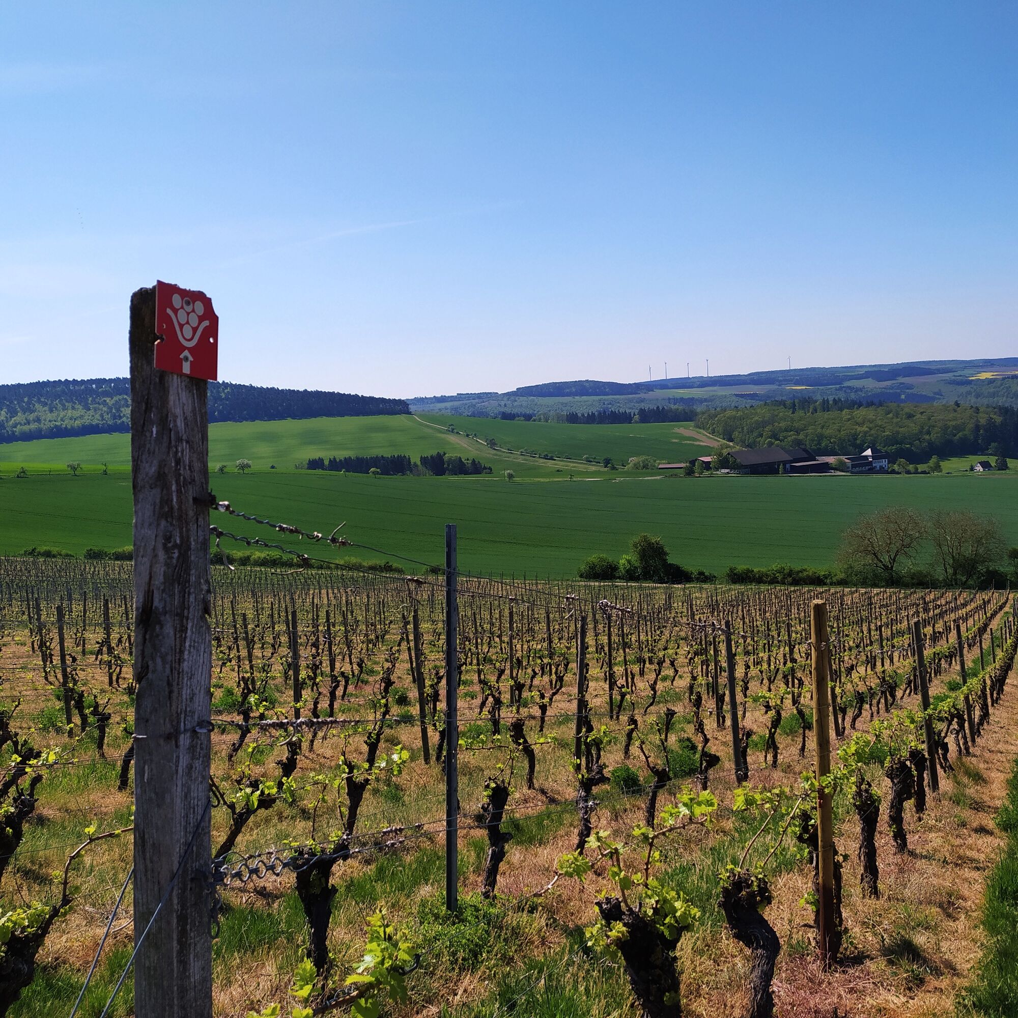
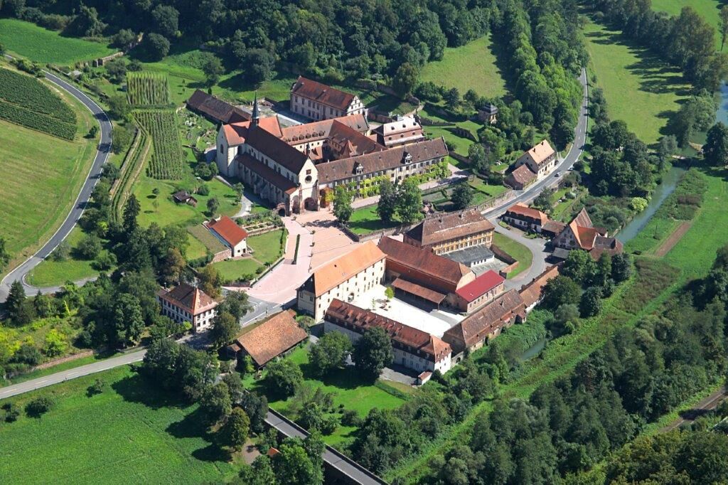

You start in Bronnbach at the monastery's Orangerie and initially walk about 250m along the street on the right side of the Tauber before turning right into a protected forest. Cross a small stream and walk along the forest edge. After the second bridge, go down to the left before walking through the vineyard terraces. The Satzenberg vineyard is the only still cultivated terrace area in Tauberfranken. From here, you can enjoy the beautiful view of Bronnbach and Reicholzheim.
Fourteen stone crosses mark your further path to the wine village of Reicholzheim. You pass through the village (a hearty wine tasting stop is recommended here) up to St. George's Church, then briefly climb steeply uphill. Further to the left, you reach the Heiligenweinberg with views of the wine village and the Tauber valley. Before reaching the Trinity Chapel, a small detour to the "High Rock", the highest waterfall (about 10m) in the Tauber valley, is worthwhile.
After the chapel, follow the hiking trail over the heights of Reicholzheim, and after crossing an agricultural path, go through bushes and hedges into the Reicholzheim ridge. Here you reach the highest point of the route with magnificent views as far as the Spessart and Odenwald. From now on, it is all downhill. First to the former monastery estate "Schafhof" and on the last stretch to Bronnbach, you walk parallel to the stream of the Bronnbach. After about 3 hours of hiking and having covered about 10 km, you reach our starting point again.
Places to eat along the route:
Restaurant Orangerie - Hotel Kloster Bronnbach
Hotel Restaurant Marta
Tak
Sturdy footwear and drinks are recommended
You reach Wertheim-Bronnbach via
- Autobahn A3, exit: Marktheidenfeld/Wertheim (distance: 16 km) or exit: Wertheim/Lengfurt (distance: 16 km)
- Autobahn A81, exit Tauberbischofsheim (distance: 24 km)
The Westfrankenbahn runs hourly between Crailsheim, Wertheim and Aschaffenburg with good connections to the hubs Würzburg and Lauda.
From the stop in Bronnbach, you cross the Tauber and are about 400m from the starting point of the hike.
Sufficiently signposted parking spaces are available at the Bronnbach monastery.
Tourist Information Wertheim
https://www.tourismus-wertheim.de
Visit the former Cistercian abbey Bronnbach from the 12th century and enjoy a glass of wine in the Orangerie.
 Uzyskaj wgląd Zawsze na żywo z ponad 9 500 kamer internetowych. bergfex Jako użytkownik Pro, możesz teraz zobaczyć odpowiednie kamery internetowe dla wielu wycieczek w aplikacji wycieczki od. Pozwala to na bezpośredni podgląd aktualnych warunków.
 Popularne wycieczki w okolicy
- 5,0
On the way to Himmelreich
średniWędrówka 15,0 km - 4,0
Around the Kaffelstein
światłoWędrówka 4,71 km Wertheim - Urphar - Wertheim
średniWędrówka 12,8 kmMainRadweg Wertheim bis Miltenberg
Jazda na rowerze 35,7 km- 4,5
Homburg Wine Hiking Trail
średniWędrówka 7,65 km South Spessart Trail
ciężkidługodystansowy szlak pieszy 60,8 kmEuropean Cultural Trail: From the Castle Hall to the Monastery Shine - At the Holle Tree and Piper Hans
średniWędrówka 21,6 kmFranconian Mary’s Way in the southern Spessart
średnidługodystansowy szlak pieszy 25,6 km- 4,0
Schleusen-Wanderung
światłoWędrówka 7,15 km - 4,0
Rund um den Apfelberg
światłoWędrówka 8,18 km
Wędrówki i tropienie


Nie przegap ofert i inspiracji na następne wakacje
Twój adres e-mail została dodana do listy mailingowej.





