


Ill cycle path Schruns - Partenen
Poziom trudności: 2
Zdjęcia naszych użytkowników
From the Aktivpark in Schruns-Tschagguns the route mostly follows the Ill to Inner Montafon. In the village centre of Partenen - the starting point of the famous Silvretta High Alpine Road - is the Energieraum...
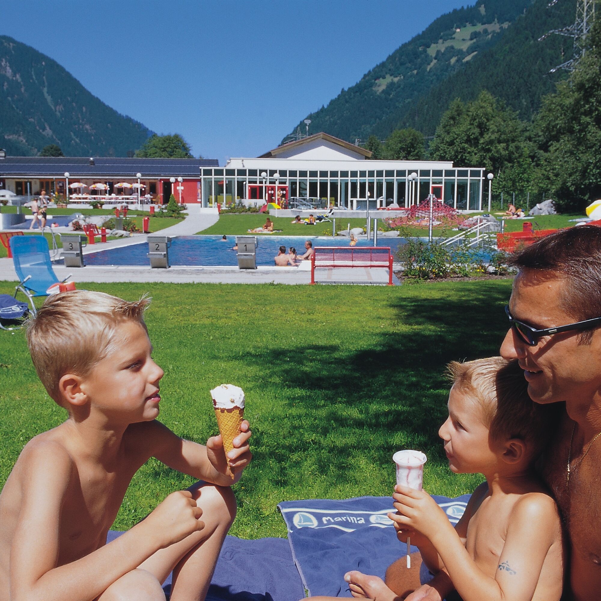
From the Aktivpark in Schruns-Tschagguns the route mostly follows the Ill to Inner Montafon. In the village centre of Partenen - the starting point of the famous Silvretta High Alpine Road - is the Energieraum Partenen (Vallülasaal), a combination of exhibition and museum. In summer there are numerous bathing options such as the all-weather pool Aquarena in St. Gallenkirch, the Mountain Beach leisure park in Gaschurn, the outdoor pool in Partenen or finally the Alpenbad Montafon.

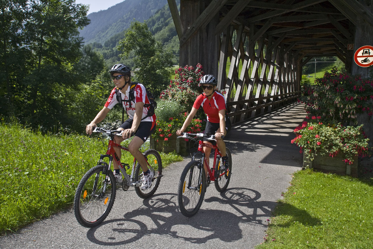
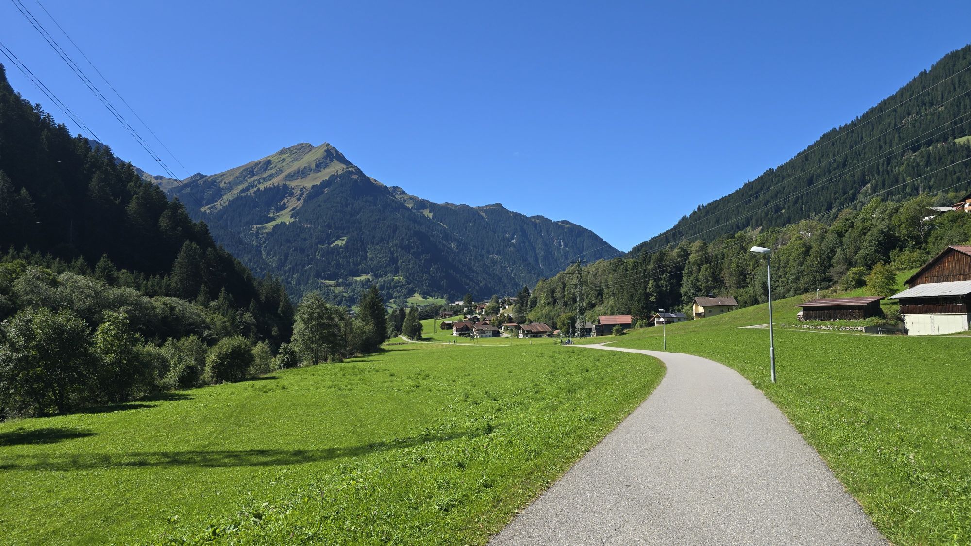
From the Aktivpark Montafon in Schruns-Tschagguns the route leads along the Ill cycle path to Partenen. The same way back to Schruns.
Tak
Tak
Spare battery, charger, bicycle helmet, day cycling backpack (approx. 20 liters) with rain cover, comfortable sports shoes, possibly cycling shoes, weather-appropriate and durable clothing in multiple layers, possibly cycling jersey, possibly cycling gloves, air pump, bicycle tool, sun and rain protection, provisions and drinking water, drinking bottle and suitable holder, first aid kit, pocket knife, mobile phone, possibly mobile phone holder for the handlebar, possibly headlamp and reflectors, map material
EMERGENCY: 144
112 Euro emergency number (works with any mobile phone/network)
www.vorarlberg.travel/sicherheitstipps
Drive on the A14 to the Bludenz/Montafon exit and then continue on the Montafonerstraße L188 to Schruns. Federal road L188 takes you directly to Aktivpark Montafon, which is located on the right side of the road.
Just leave your car parked.
The regional buses run throughout Montafon. The main lines depart every half hour from Schruns station.
Bus stop at the start/finish of the route: Schruns Sports Ground/Aktivpark / line 2a, line 2b
Timetable: www.vmobil.at
Arrival by train to Montafon
From Bludenz station the Montafonerbahn runs every half hour. There are also direct connections from Lindau (D) and from Bregenz.
Timetable: www.oebb.at
Aktivpark Montafon in Schruns-Tschagguns
2
Free Aktivkarte for e-mountain biking available at all Montafon tourist offices.
energie.raum, Vallülasaal Partenen: Here you learn interesting facts about energy via video installations. In the heart of the exhibition, you get insights into the completed machine cavern of the Kopswerk II.
Interesting short films as well as an ORF report about the Silvretta High Alpine Road complete the offer.
Kamery internetowe z trasy
-
Hochjoch Bahn Bergstation
-
Matschwitz Mittelstation
-
Bergstation Hochalpila Bahn
-
Innerberg
-
Galtür - Kopssee
-
Galtür - Kopssee
-
Galtür - Kopssee
-
Galtür - Kopssee
-
Galtür - Kopssee
-
Galtür - Kopssee
-
Golm - Matschwitz
-
Panorama Bahn - Berg
-
Nova Stoba
-
Breitspitzbahn
-
Breitspitzbahn
-
Breitspitzbahn
-
Breitspitzbahn
-
Breitspitzbahn
-
Breitspitzbahn
-
Breitspitzbahn
-
Bartholomäberg
-
Bartholomäberg
-
St.Gallenkirch - Pension Rudigier
-
Tschagguns
-
Gortipohl - Gasthaus Muntafuner Stöbli
-
Schruns
-
Bartholomäberg - Ferienhotel Fernblick
-
Gortipohl Landhaus Rudigier
-
Wormserhütte
-
Wormserhütte
-
Kapellbahn
-
Schlepplift Innerbach
-
Bartholomäberg
-
Vermiel, Garfrescha
-
Valisera Berg
-
Bartholomäberg - Ferienhotel Fernblick
-
Bartholomäberg - Ferienhotel Fernblick
-
Bartholomäberg - Ferienhotel Fernblick
-
Wohlfühlpension Garni Tirolerhof
Popularne wycieczki w okolicy
-
5,0
Ski tour to the Lindauer Hut (1,744 m)
światłoWycieczka narciarska 14,0 km -
4,7
Smuggler’s path
średniTrasa tematyczna 8,60 km -
4,2
Golmerbahn Bergstaion Grüneck - Golmer Höhenweg - Geißspitze - Lindauer Hütte - Latschau
średniWędrówka 11,5 km -
4,4
Golm-Rundwanderweg im Rätikon
średniTrasa tematyczna 7,28 km -
3,0
Bergstation Grüneck Golmerbahn - Alpe Latschätz - Lindauer Hütte - Latschau
światłoWędrówka 11,1 km -
2,8
Bielerhöhe and circular hike around the Silvretta reservoir
średniWędrówka 13,1 km -
4,4
Madrisella summit path
średniTrasa tematyczna 10,8 km -
4,8
Heilbronner lodge
średniWędrówka 13,0 km -
4,8
Kristberg - Wasserstubental - Silbertal
światłoWędrówka 13,8 km -
4,6
Over the historic mine and Fritzensee to Rellseck
średniWędrówka 7,25 km

Wędrówki i tropienie


Nie przegap ofert i inspiracji na następne wakacje
Twój adres e-mail została dodana do listy mailingowej.