


Bike route - Zechstein reefs in the Orla Basin - Thuringia
Poziom trudności: 2
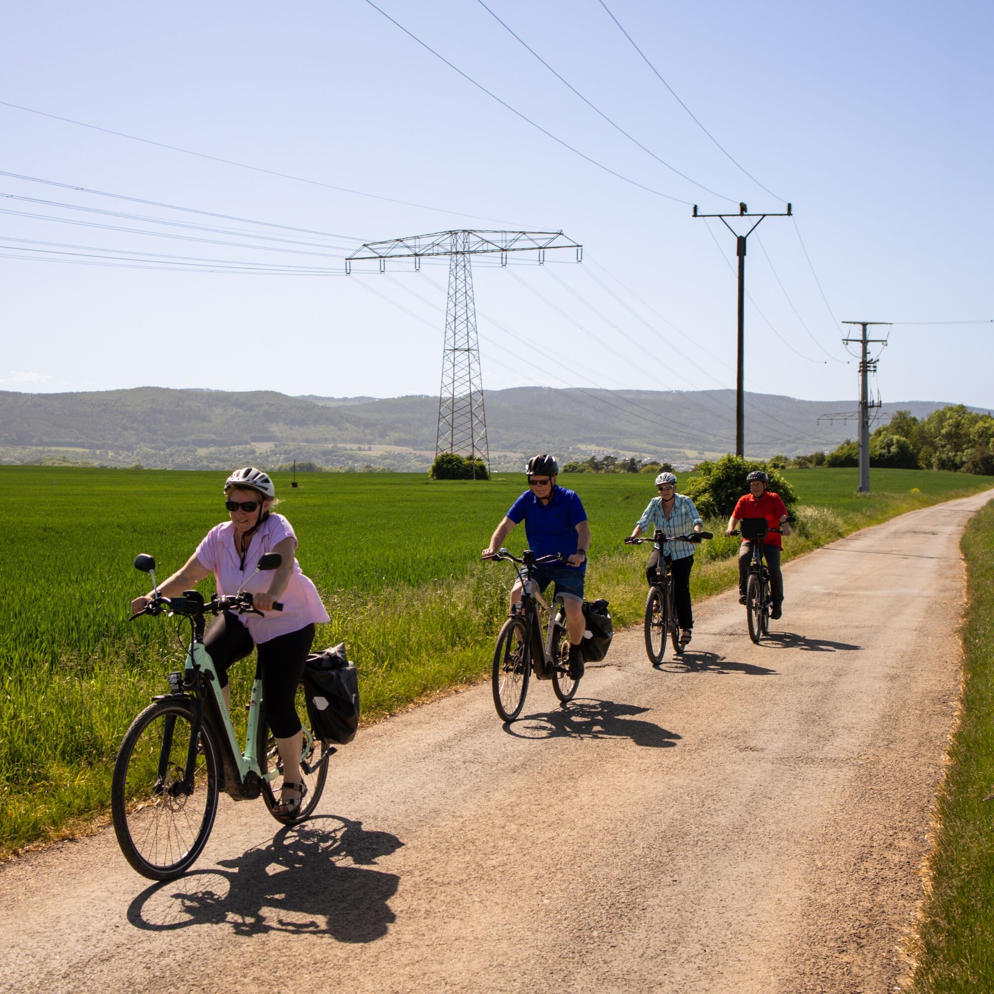
This bike route connects, among other things, the two rivers Saale and Orla. It also serves as the connection between the well-known Saale bike path and the regional Orla cycling route.
Worth a visit in...
This bike route connects, among other things, the two rivers Saale and Orla. It also serves as the connection between the well-known Saale bike path and the regional Orla cycling route.
Worth a visit in one of Thuringia's oldest towns with a historic old town is Saalfeld, home to the most colorful show caves in the world. The Saalfeld Fairy Grottoes and the magical little fairy world attract visitors both young and old.
Another detour for those interested in technology and history can be made to the gas engine center of the former Maxhütte in Unterwellenborn. In this industrial monument, you can clearly trace the production processes of historic and operational technology.
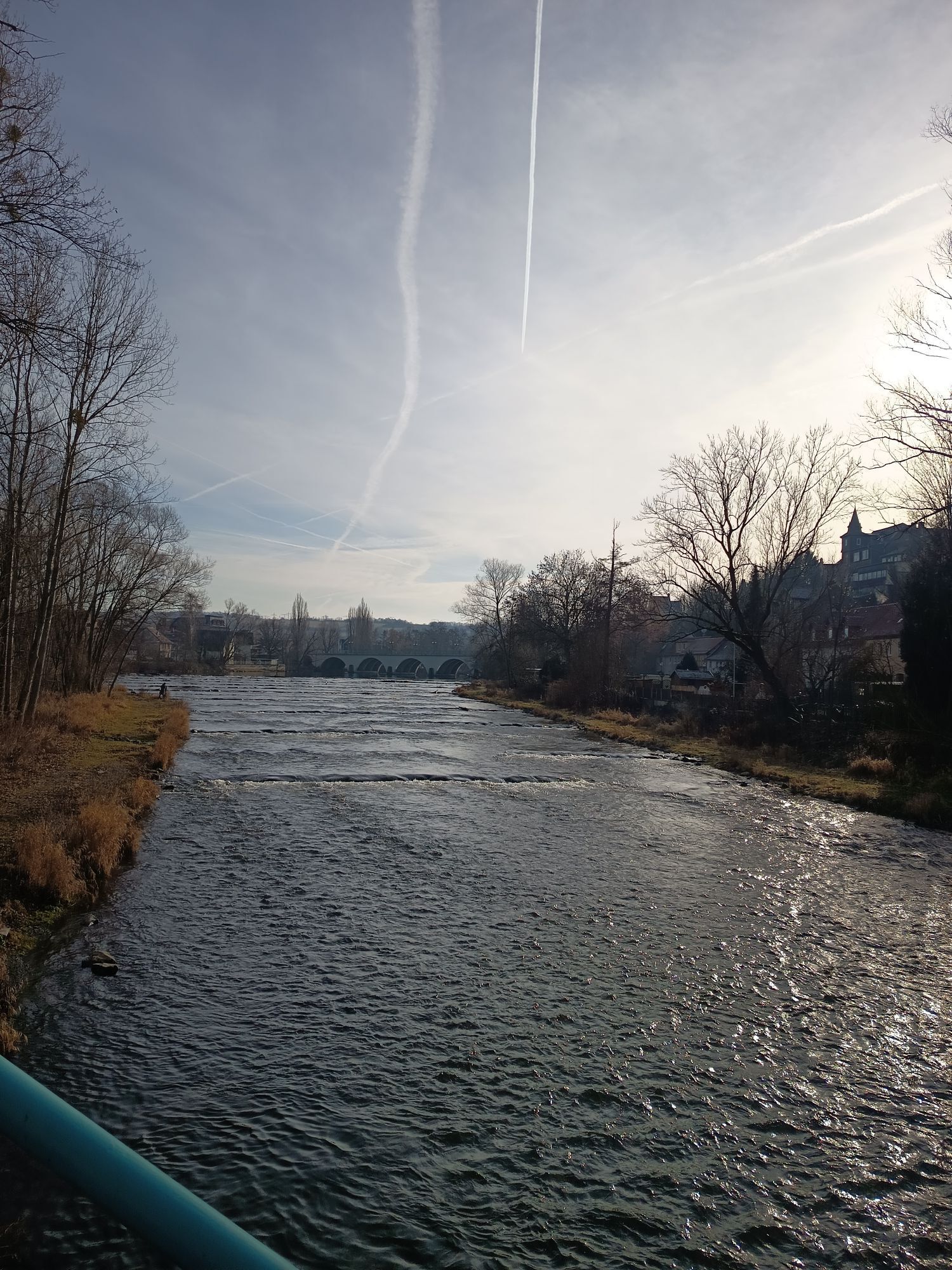
The route continues through idyllic villages, meadows, and fields with constant views of the geologically interesting and Europe-wide unique Zechstein reefs.
In the charming small town of Pößneck, visitors can enjoy delicious beer from the Rosenbrauerei, the popular jelly bananas, and other sweet specialties from the Heinerle-Berggold chocolate factory, historic buildings, and many offerings for cultural enthusiasts and active people.


Saalfeld-Unterwellenborn-Oberwellenborn-Birkigt-Lausnitz-Rockendorf-Krölpa-Pößneck-Wernburg-Ranis-Seisla-Dobian-Oelsen-Könitz-Kamsdorf-Saalfeld
Tak
Tak
Functional clothing
sufficient drink supplies
First aid kit
GPS navigation device
Flat tire repair kit
The route partly runs on public roads. Please always watch out for other road users and adhere to traffic regulations.
Check your bike's roadworthiness before the ride (lights [front / rear], reflectors)
The route is fully accessible for use with e-bikes and pedelecs.
Coming from the A9, exit Triptis - B 281 Pößneck - Könitz towards Saalfeld
Coming from the A71, exit Stadtilm - B90 towards Saalfeld
For those arriving by train, the route can start at the stations in Saalfeld, Unterwellenborn, or Könitz.
Bus connections are available in Saalfeld, Unterwellenborn, Oberwellenborn, Könitz, and Kamsdorf.
Information on bicycle transport with bus or train:
Train: www.bahn.de
Bus: From 01.05 to 31.10, the Kombus bike buses operate in the districts of Saalfeld-Rudolstadt or Saale-Orla-Kreis, connecting to Jena, Gera, Erfurt, Weimar, Ilmenau, and Neuhaus am Rennweg.
More information is available at https://www.kombus-online.eu/angebote/Fahrrad/Rad_allgemein/
Kamsdorf visitor mine
Saalfeld train station
Saalfeld fire department
2
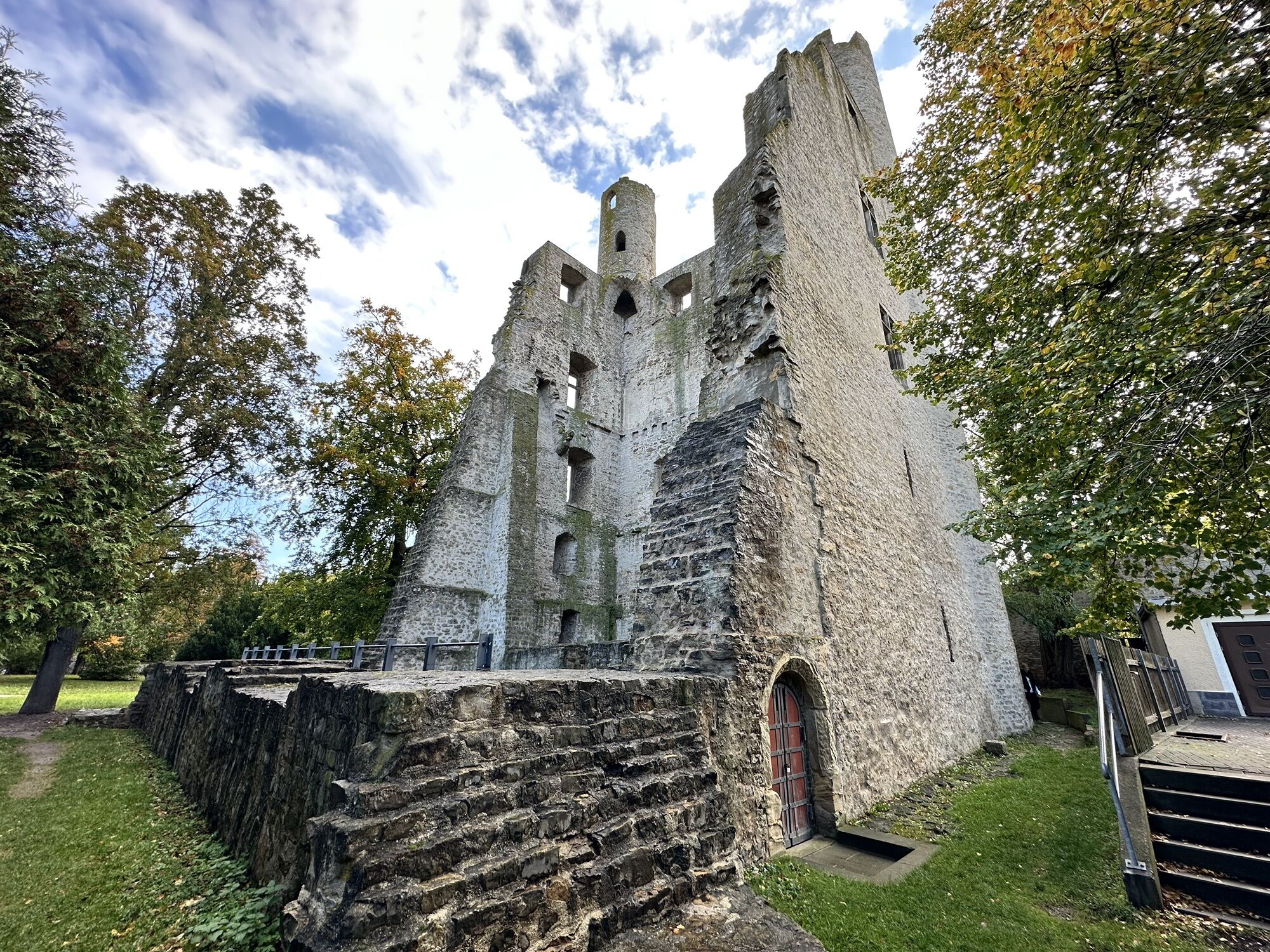
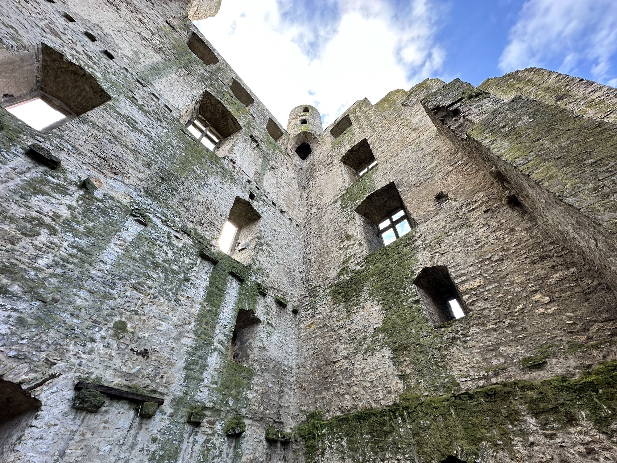
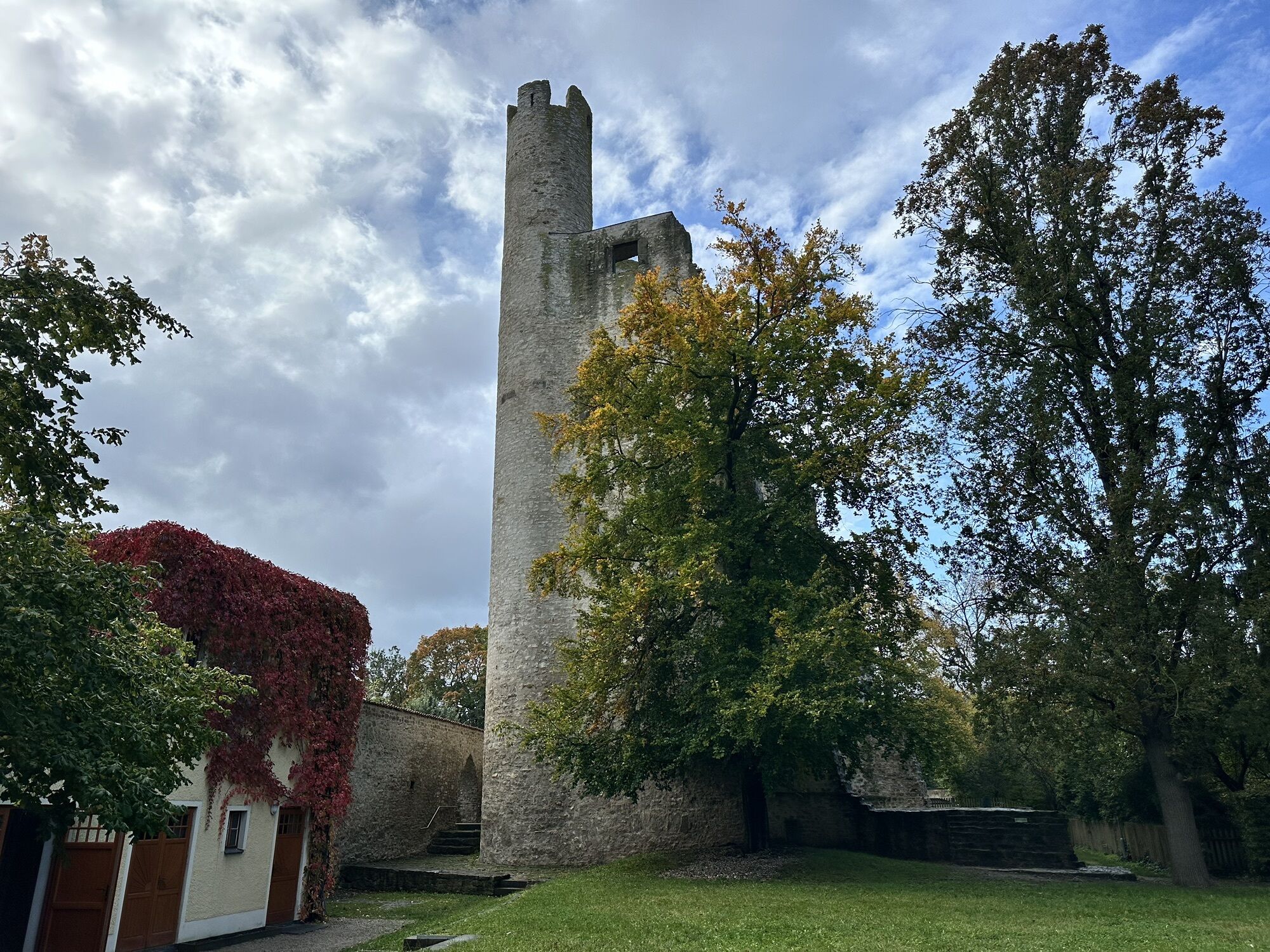
Ranis Castle Ranis – Historical building with a view
Popularne wycieczki w okolicy
-
4,9
Circular hiking trail - H5 "The Water Route" - Thuringian Forest
średniWędrówka 6,58 km -
4,7
Circular hiking route - H3 "The Bird's Eye View" - Thuringian Forest
średniWędrówka 8,78 km -
4,0
Zur Jagdanlage Rieseneck bei Hummelshain
światłoWędrówka 5,21 km -
4,0
Circular route - "Wichtelweg" - Wilhelmsdorf
światłoTrasa tematyczna 2 km -
5,0
Hohenwarte Reservoir Way - Section 2 - Camping Wilhelmsdorf Portenschmiede → Ziegenrück
ciężkiWędrówka 18,2 km -
4,0
Von Ziegenrück zur Fernsicht
średniWędrówka 5,50 km -
5,0
Urwaldpfad Leutenberg - Thuringian Urwaldpfade
średniWędrówka 6,82 km -
5,0
Kulm route
średniWędrówka 9,39 km -
3,0
Circular route - "On archaeological trail of King Otto I." - Saale region
światłoWędrówka 6,55 km -
4,0
Circular hike - "Round route 3" - start and finish country hotel Edelhof Kolkwitz - Thuringia
średniWędrówka 9,42 km
Wędrówki i tropienie


Nie przegap ofert i inspiracji na następne wakacje
Twój adres e-mail została dodana do listy mailingowej.