


Circular hiking route - H3 "The Bird's Eye View" - Thuringian Forest
Zdjęcia naszych użytkowników
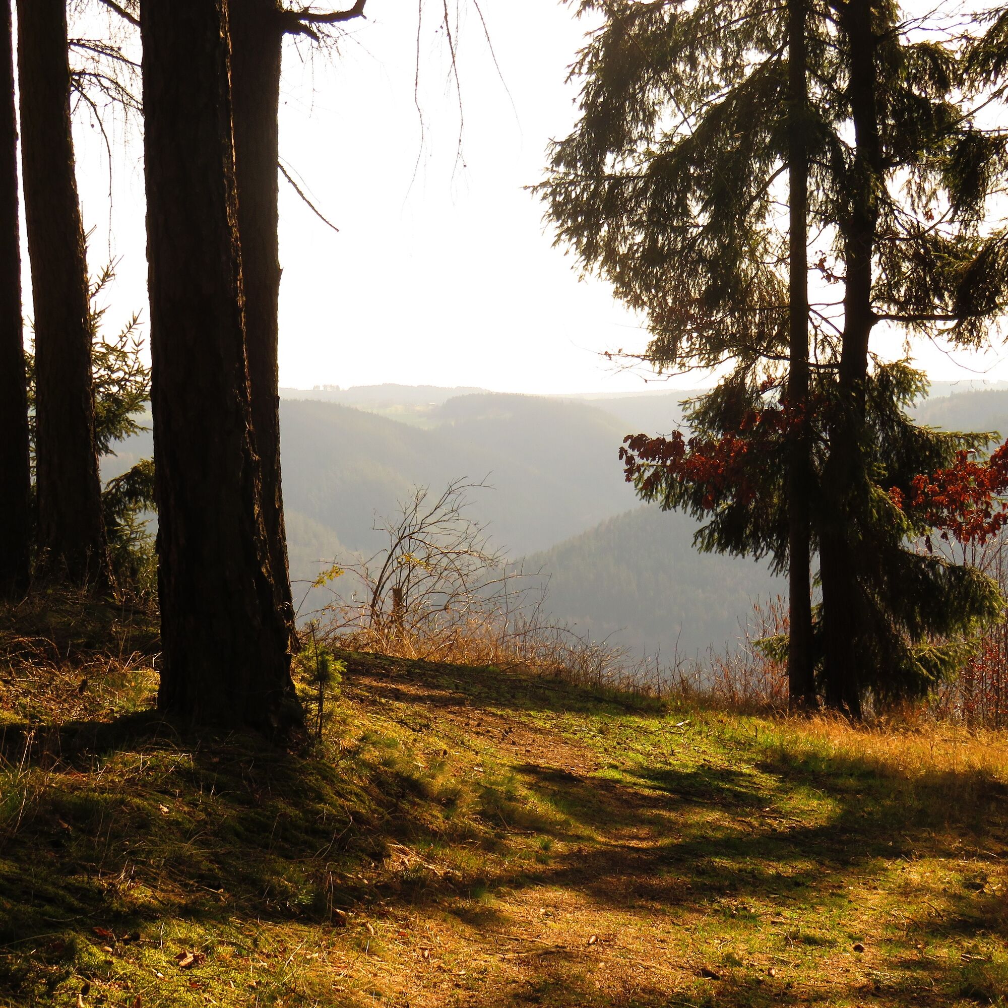
Romantic paths and natural forest trails wind through a beautiful mixed forest. Time and again, the green thicket offers a view of the Saale valley and sweetens your ascent to the highest point at 504m....
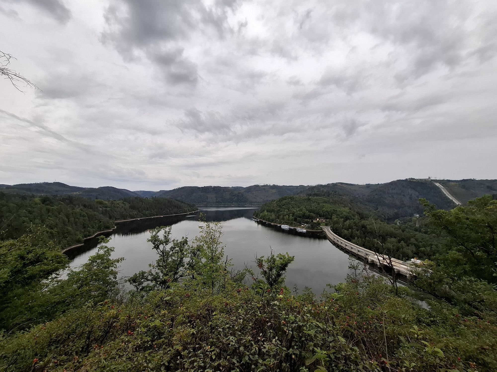
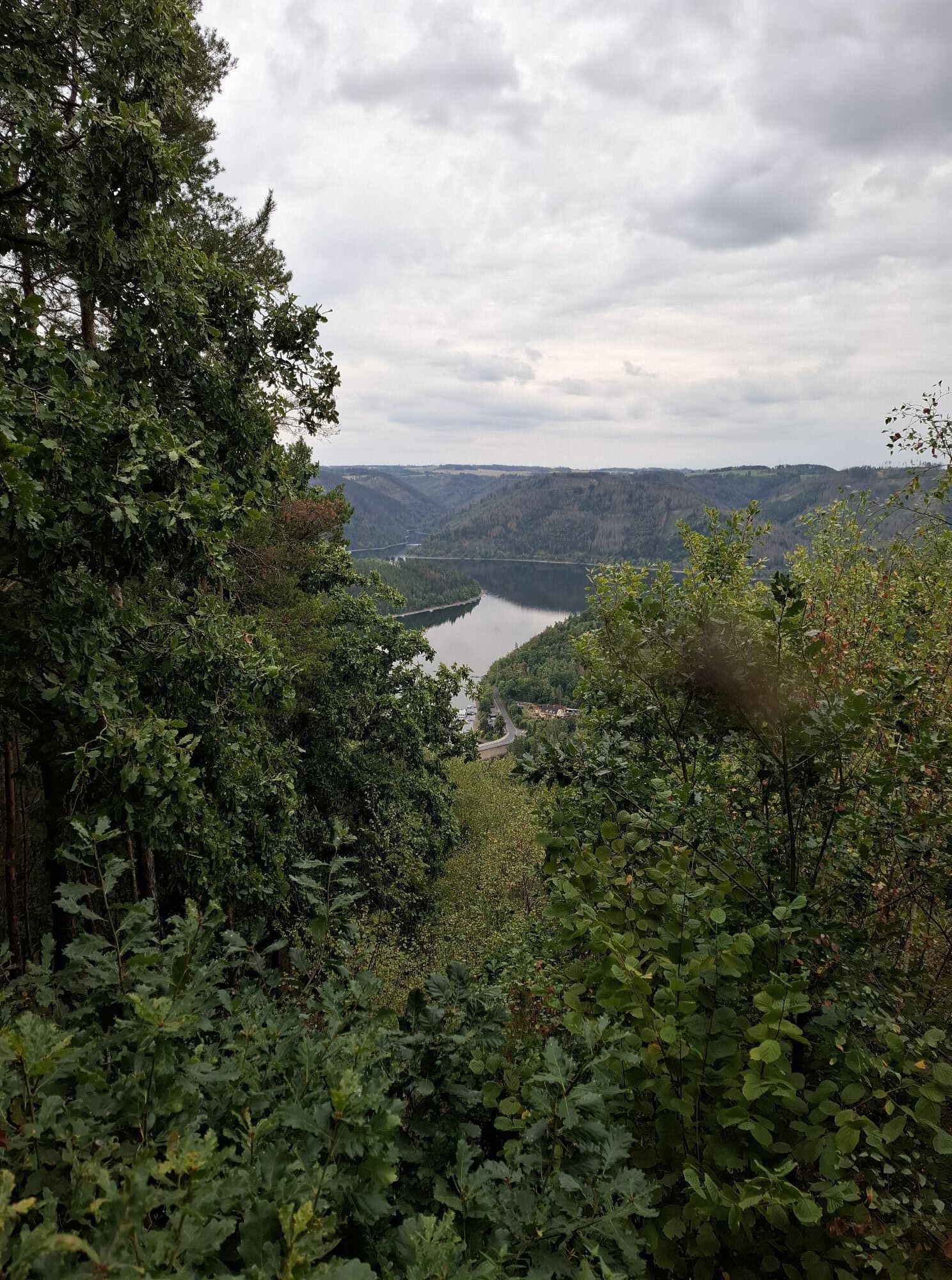
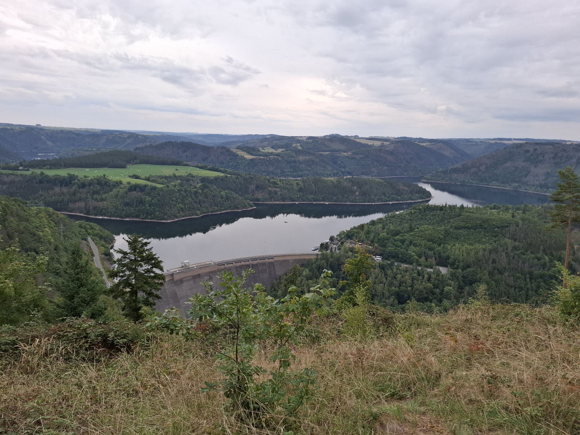
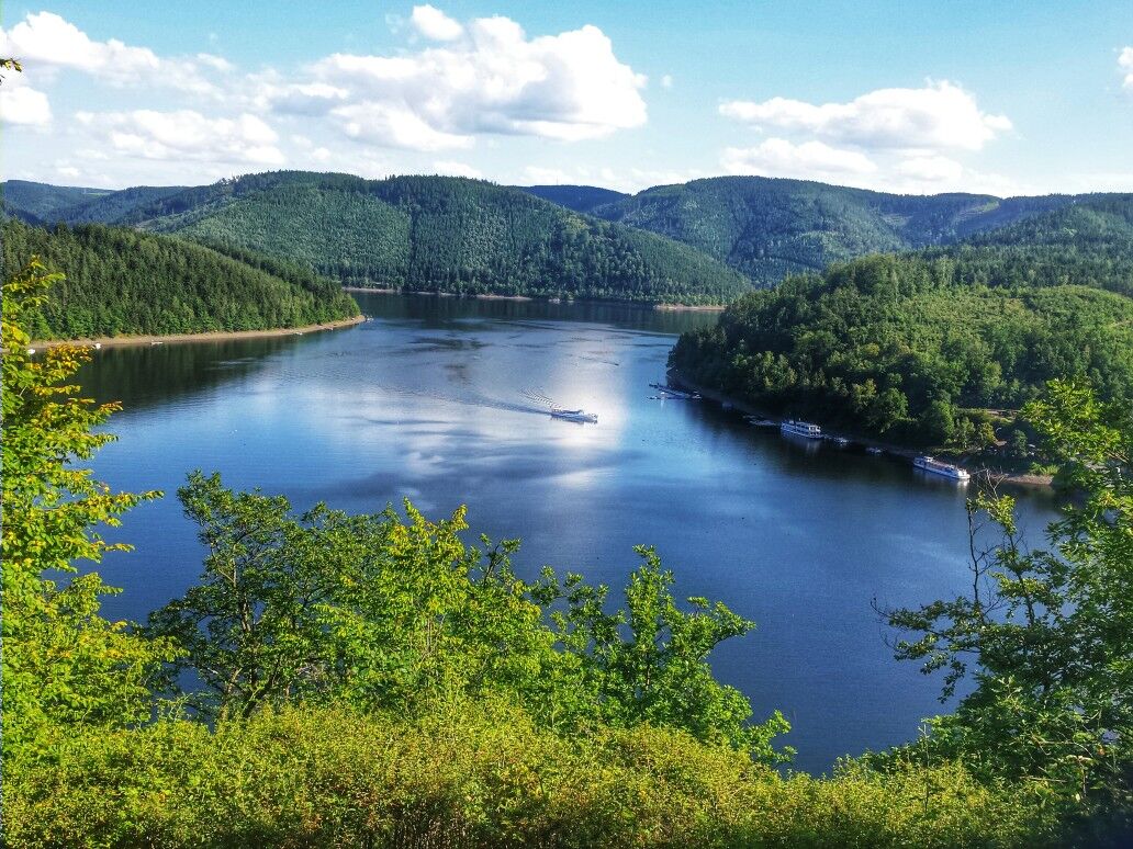
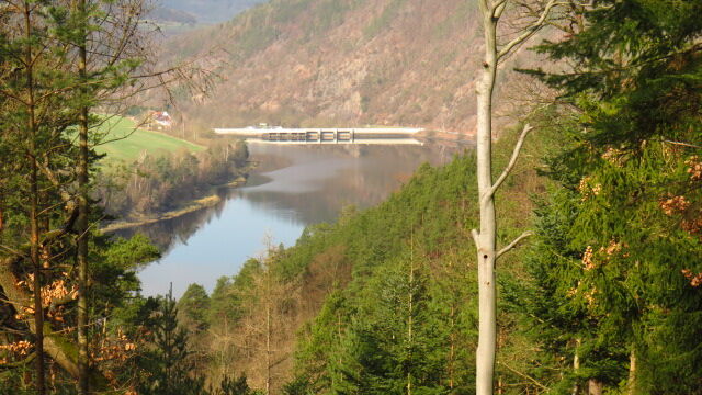
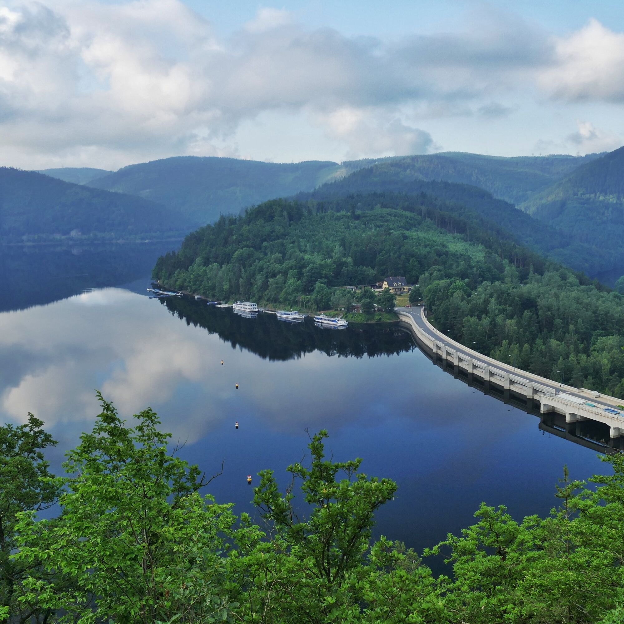
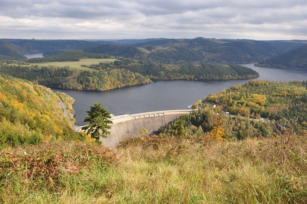
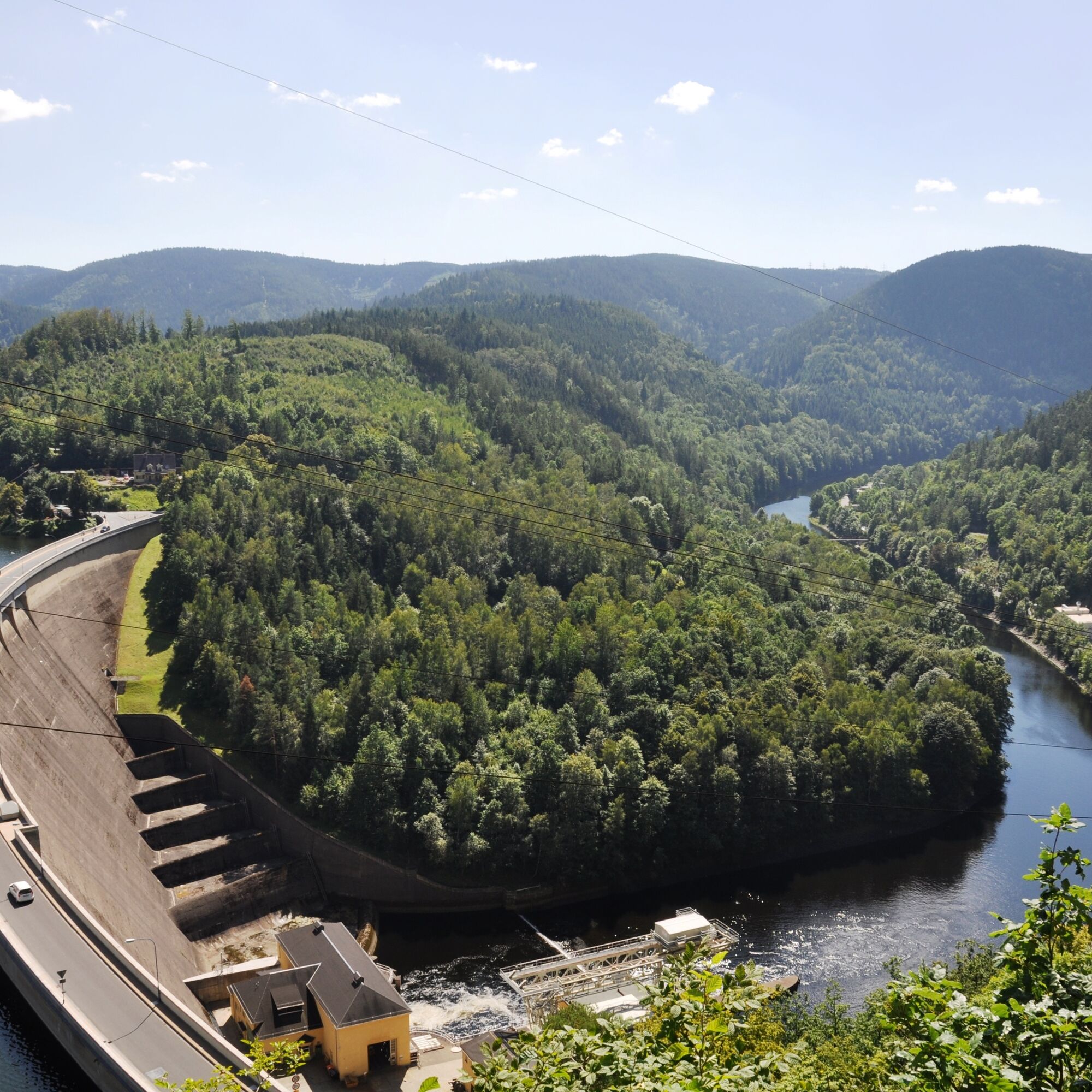
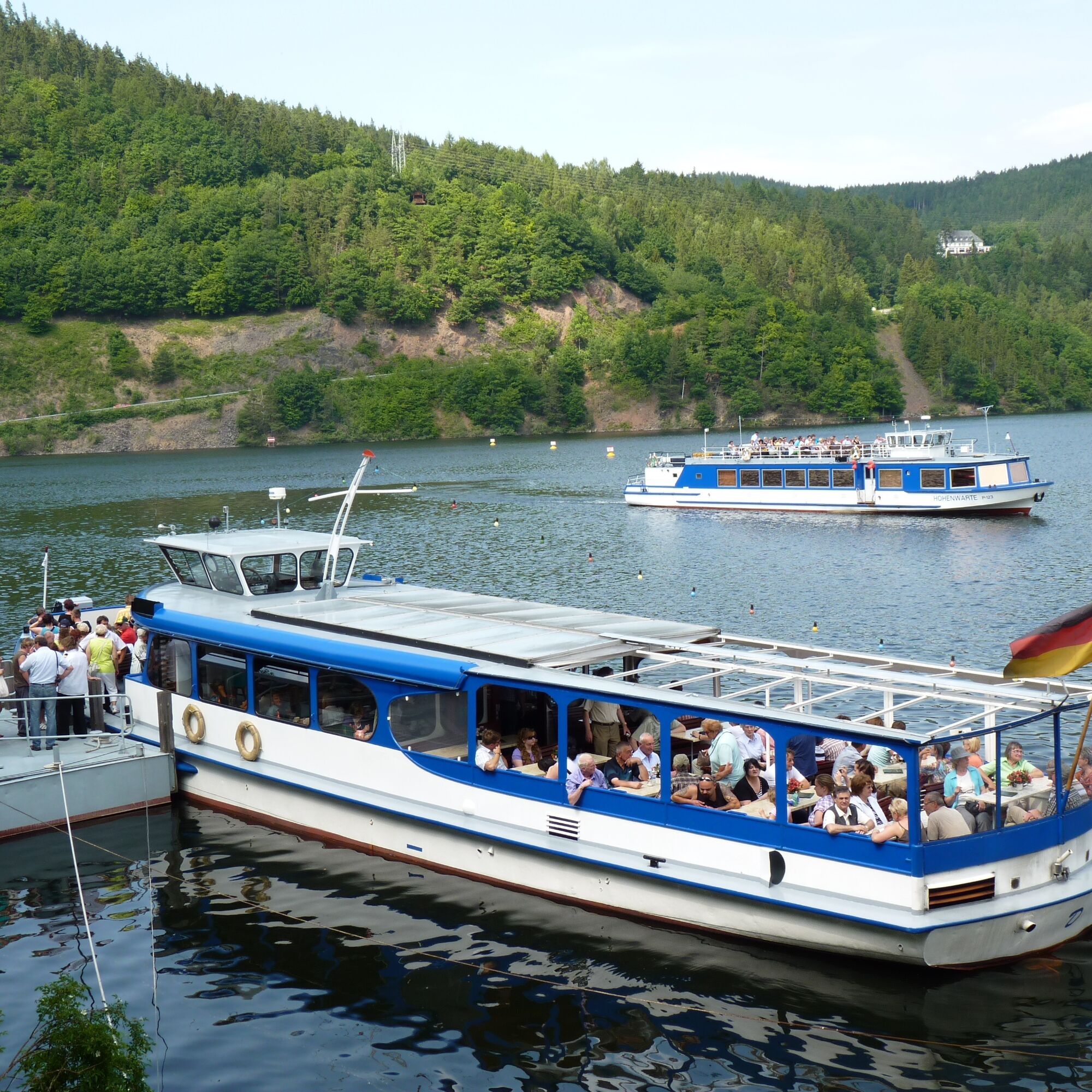
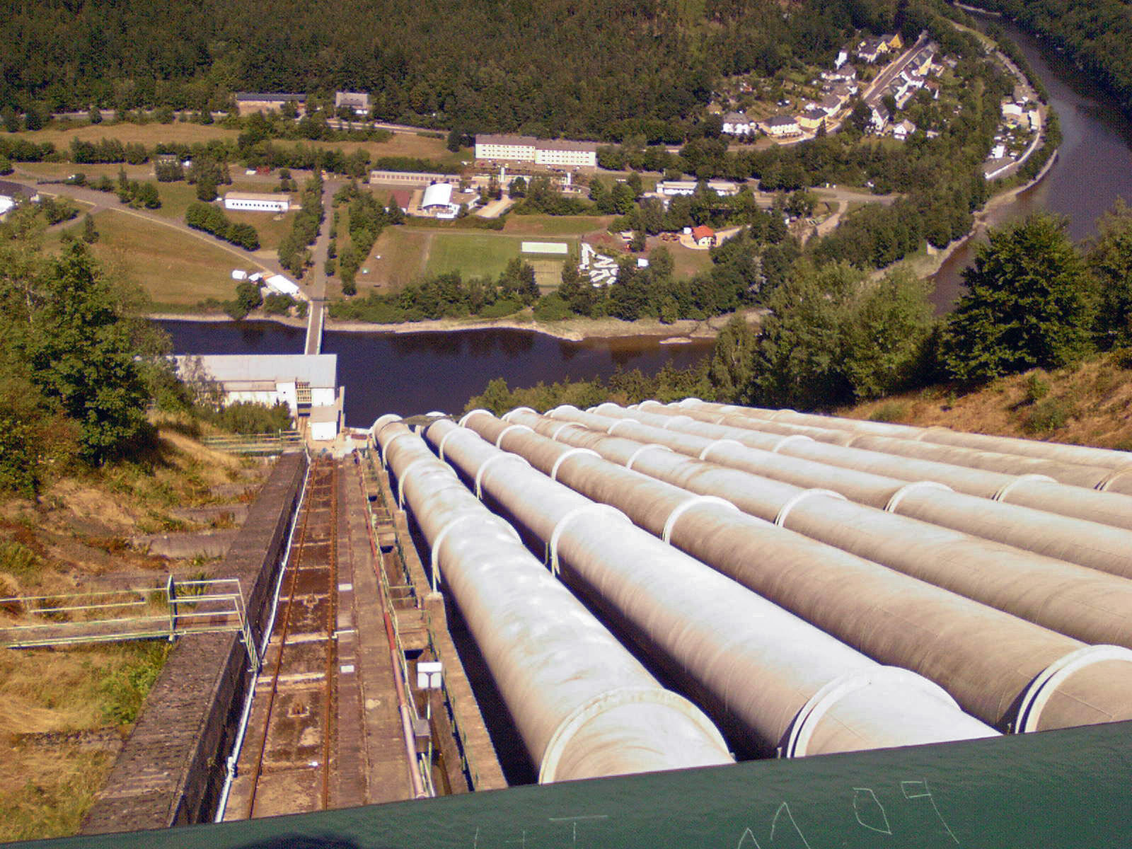
Romantic paths and natural forest trails wind through a beautiful mixed forest. Time and again, the green thicket offers a view of the Saale valley and sweetens your ascent to the highest point at 504m. Breathtaking views offer a panorama of the Saale course and the mountains. Nestled between slate and forests, the reservoir winds into the horizon before disappearing into the mountains. At your feet lies the Eichicht balancing basin with its wall. You also experience the small village of Hohenwarte and the massive dam with its power plants from here, from a completely different perspective. Let yourself be enchanted by this expanse and enjoy the views from larger and smaller rest areas. In the village of Hohenwarte, from the church you have the option to join our experience route H4.
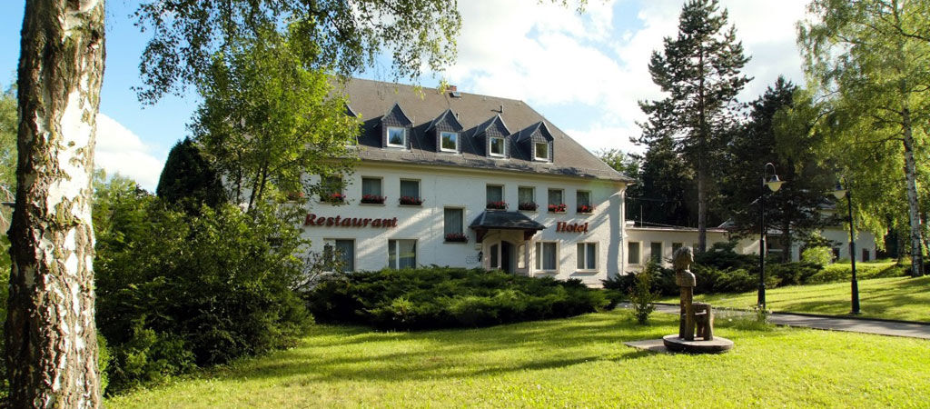
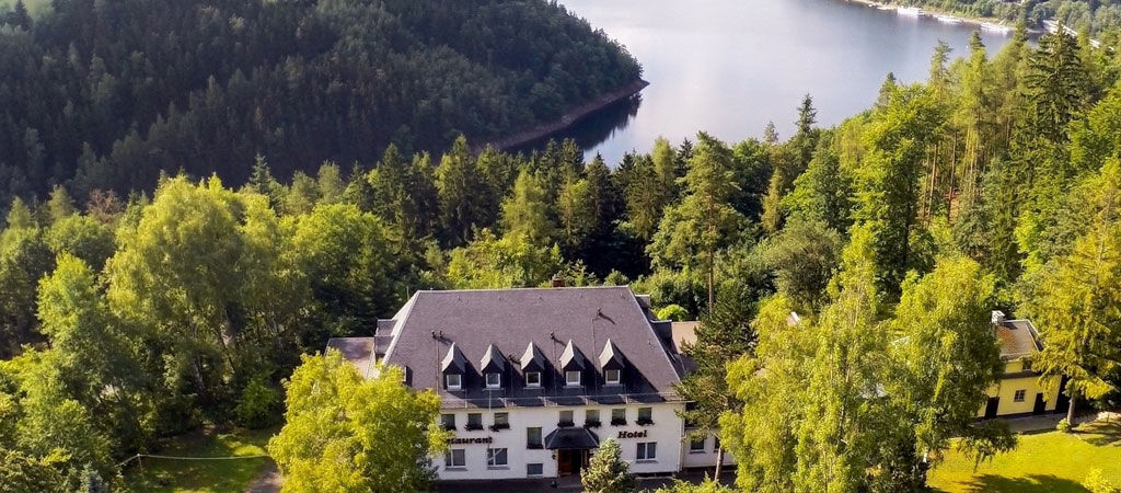
Start: parking lot "Waldhotel am Stausee"

Parking lot "Waldhotel am Stausee" - Günthers Heil - Hohenwarte - Am Altholz - Philosophenweg - To Grösselsgraben - Tannerberghütte - Gustavsruh - Klinkhardtshöhe - Parking lot "Waldhotel am Stausee"
Follow the pictogram - yellow with a round arrow and H3 in the center
Tak
Sturdy footwear
Drinks
Food
Hiking stick / Nordic walking poles if needed
To protect our animals and plants:
- stay on the paths
- Please do not leave any food scraps, packaging material, or other items on the path
Coming from the A9, take exit 26 (Triptis) and continue on the B281 west towards Neustadt an der Orla. Follow the federal road further via Pößneck towards Saalfeld. Leave the B281 at Unterwellenborn (Stahlwerk Thüringen) south towards Großkamsdorf / Goßwitz / Bucha. Continue south in Bucha on L2384 to Hohenwarte dam.
You can easily reach Hohenwarte by KomBus line 546 from Saalfeld (connection to Deutsche Bahn). The line bundle 5 provides coordinated public transport connections around the entire reservoir.
Use the Deutsche Bahn travel portal under the following link to search for connections: → Arrival in Hohenwarte
Thuringian Sea hiking bus operates as a midibus around the reservoir. KomBus service telephone: 03671 / 52 51 999
Stop at "Waldhotel am Stausee"
Stop at hiking parking lot dam
Registration for visits -> Bunker, pumped storage power plant, and church at the tourist info Hohenwarte municipality
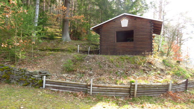
Rest area "Tannenberghütte"
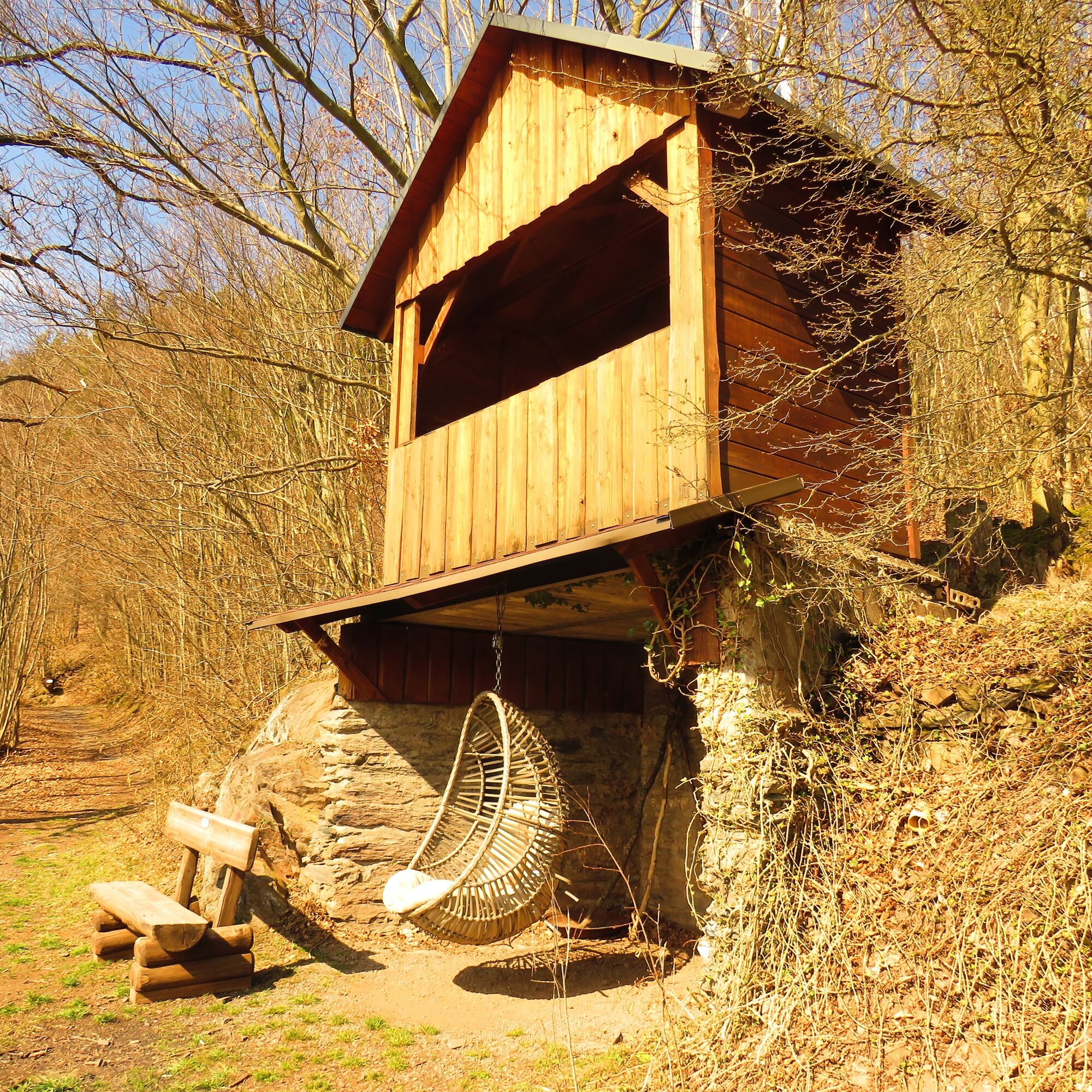
Viewpoint "Gustav's Ruh"
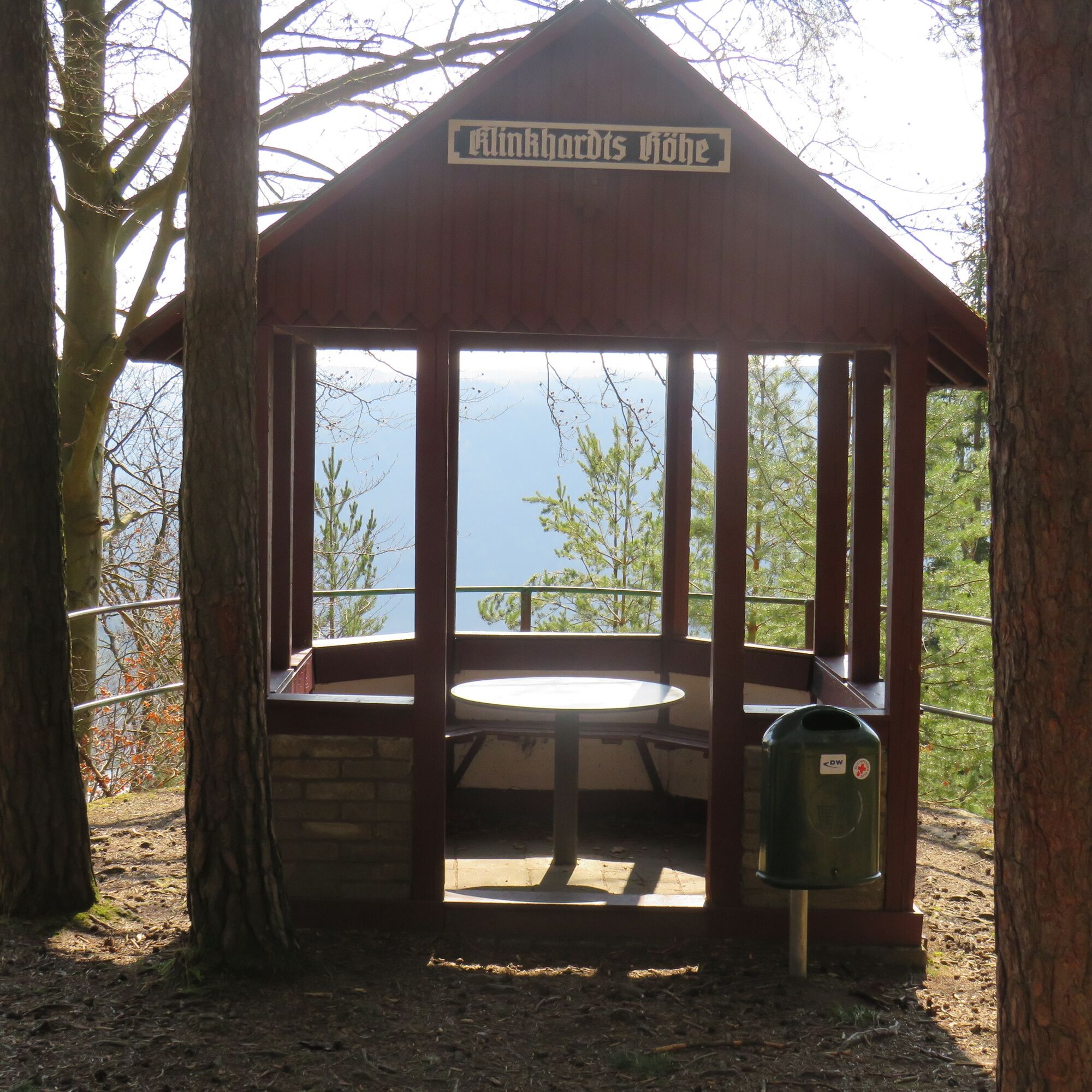
Rest area "Klinkhardt's Height"
"Waldhotel am Stausee" (restaurant option with a view over the reservoir)
Viewpoint "Günther's Heil"
Via a small detour you can reach in Hohenwarte
the playground and sports field Attention! no entry for dogs on the grounds. The "Cafe Auszeit", Preßwitzer Str. 1 The Saaletal inn, Preßwitzer Str. 14 The fishing hut, Preßwitzer Str. 18Visits
Bunker and church in Hohenwarte (possible with prior registration at the municipality / tourist info) Pumped storage power plant and dam (possible with prior registration at the municipality / tourist info)Popularne wycieczki w okolicy
-
4,8
Circular hiking trail - H5 "The Water Route" - Thuringian Forest
średniWędrówka 6,58 km -
Circular route - Otter Bay and Devil's Pulpit - Ziegenrück
średniWędrówka 16,8 km -
4,0
Circular route - "Wichtelweg" - Wilhelmsdorf
światłoTrasa tematyczna 2 km -
5,0
Hohenwarte Reservoir Way - Section 2 - Camping Wilhelmsdorf Portenschmiede → Ziegenrück
ciężkiWędrówka 18,2 km -
4,0
Von Ziegenrück zur Fernsicht
średniWędrówka 5,50 km -
5,0
Urwaldpfad Leutenberg - Thuringian Urwaldpfade
średniWędrówka 6,82 km -
5,0
Kulm route
średniWędrówka 9,39 km -
5,0
Circular hiking trail - Saale, Wisenta Valley and Plothengrund - Ziegenrück
średniWędrówka 20,6 km -
4,0
Circular hike - "Round route 3" - start and finish country hotel Edelhof Kolkwitz - Thuringia
średniWędrówka 9,42 km -
3,0
Im Tal der Wisenta nach Walsburg
światłoWędrówka 4,71 km
Wędrówki i tropienie


Nie przegap ofert i inspiracji na następne wakacje
Twój adres e-mail została dodana do listy mailingowej.