


Val Varaita Trekking: Tappa 2 Isasca - Frassino
Walking under the watchful eye of Monviso, you start from Isasca towards the hamlet of Castello and, after a pleasant walk among the chestnut trees, you reach the Chiot houses. After Brossasco, you will...
The itinerary was promoted within the platform as part of the PITEM M.I.T.O. project. – Outdoor OFF - Interreg Italy-France Cross-Border Cooperation Program ALCOTRA 2014-2020.

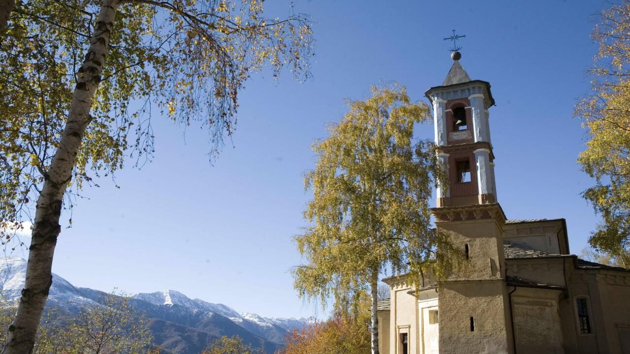
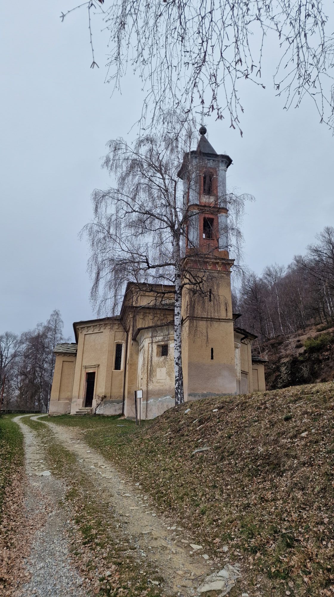
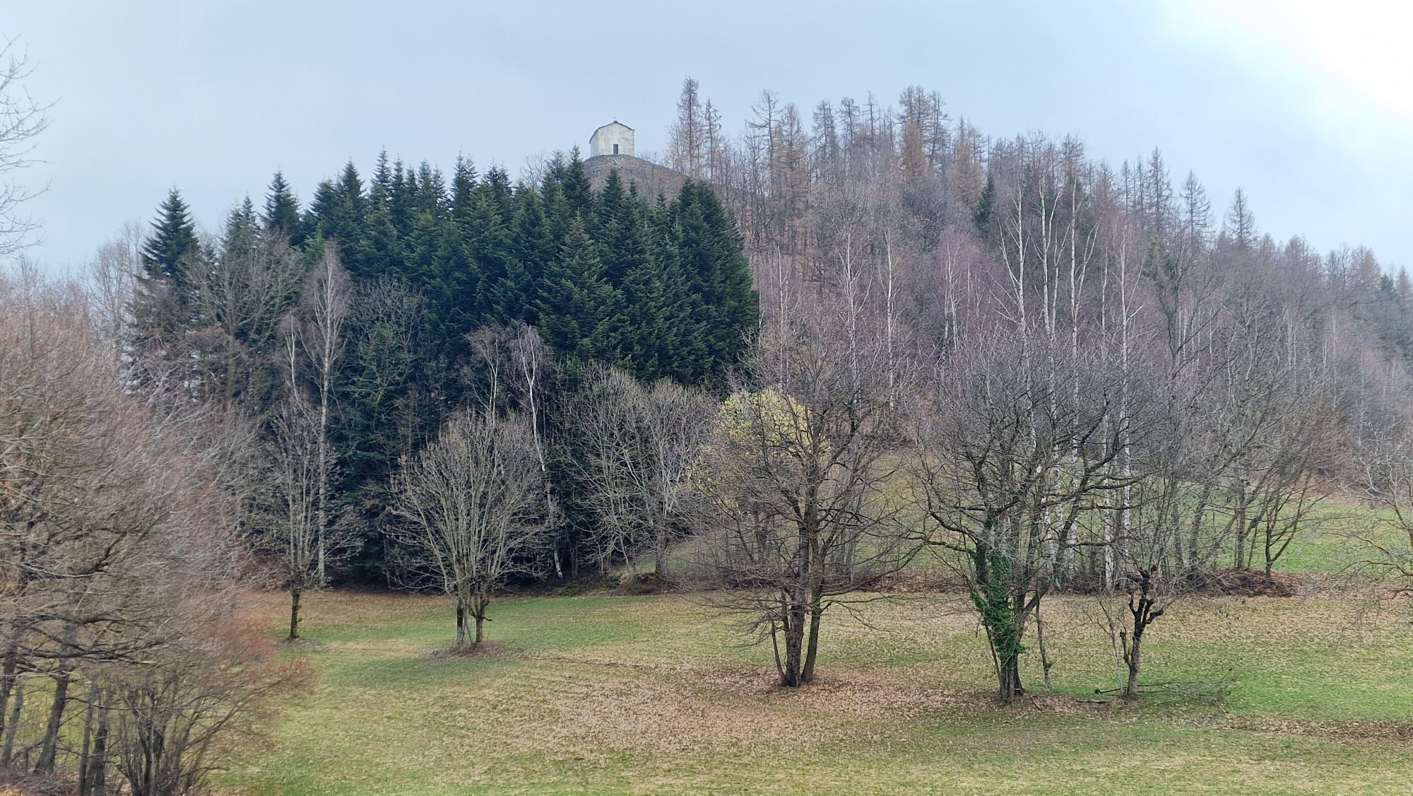
From the square of Isasca we take the road that connects Venasca with the town and with the pass of Brondello, we turn right and, a few meters later, left towards the hamlet of Castello. We go up the steep paved road up to the hamlet and take the dirt road that goes down under the houses, on a stony ground. A pleasant path among the chestnut trees takes us to a crossroads with a road on the right that leads to the Chiot houses. We keep to the left and join the asphalt road that climbs up from Brossasco. We continue on the downhill asphalt that takes us to the village (via Verdi). We go up next to the wash house and we arrive in front of the parish church of S. Andrea. We take via Camposanto, a flat route until we cross via Gilba, where we turn left passing next to the curious church of San Giacomo, with an octagonal plan. Shortly after a bottleneck, we turn right onto a dirt road that passes in front of the houses and takes us to a small bridge under the impressive penstock. We reach “Tiglieto”, a small enclosed park, turn right and take via Vecchia Val Varaita on the left. We go up among the houses following the white and red trail signs, dirt climb, then again steep asphalt to the right. At the beginning of the Costabella hamlet which coincides with the end of the carriage road, we turn left where a dirt road, first a cart track and then a mule track, climbs up in the woods gradually gaining altitude. You pass by the side of an old abandoned but well-preserved meira reaching the dirt road built for the construction of the Enel pipeline, keeping to the left, with a flat and panoramic route, we reach the village of S.Eusebio with the ancient parish church from which we continue on the road to Perotti village. From the hairpin bends with cemented surfaces, a pleasant detour starts to the right which leads to the chapel of San Michele, built overlooking the Gilba valley. Continuing on the road we meet the hamlet of Pantoisa and we reach the sanctuary of Madonna della Betulla. Always straight on the dirt road, and then turn left onto a path that takes us on level ground to the hamlet of Nivo Soprano. We pass on a beautiful little road with vertical loses on the sides, ignoring the path that descends to the left. We are once again on a dirt road and we keep to the right reaching the chapel of San Bernardo delle Sottole. We take the dirt road to the left as far as the village of Campo Soprano (Ciamp Subiran), where the track becomes paved. Keeping to the left at the first crossroads, we reach the S.Claudio chapel from which the mule track descends to the houses of Ciamp subiran (Campo Soprano), cross which we take the old road to Frassino on the left, which crosses the new paved road until you reach the village. As an alternative to the direct descent to Frassino, from Campo Soprano keeping further to the left, you can take the mule track that descends to Borgata Preit near which you will find the B&B l'Estelo, with rooms for overnight stays. From here it reconnects to Frassino passing through Borgata a Valle (Ruà d'aval).
Tak
Linea autobus BUSCOMPANY Saluzzo-Costigliole-Pontechianale bit.ly/2zKdJ5A - fermata a Frassino
Parrocchiale di S.Andrea (XV s.) - chiesa di S:Giacomo (XVIII s.) - chiesa di S.Eusebio (portale megalitico del XV s.) - Santuario Madonna della Betulla (XVIII s.) - Cappella di S.Michele (XIV s. punto panoramico) - cappella S.Bernardo delle Sottole (XIX s.)
Popularne wycieczki w okolicy
-
4,0
Historic Mountain Routes | Cannon Road
ciężkiMountainbike 43,2 km -
5,0
Strada dei Cannoni
średniWędrówka 56,1 km -
Occitan Routes: Stage 1 Ciciu di Villar - Frazione Sant'Anna di Roccabruna
średniWędrówka 15,9 km -
Occitan Routes: Stage 3 Pagliero hamlet of San Damiano Macra - Camoglieres hamlet
średniWędrówka 10,6 km -
Occitan Routes: Stage 2 Frazione Sant'Anna di Roccabruna - Frazione Pagliero di San Damiano Macra
średniWędrówka 8,49 km -
Valle Varaita Trekking
średniWędrówka 170,2 km -
Monviso horizon
średniWędrówka 75,5 km -
Orizzonte Monviso - Stage 1: Hiking refuge La via del sale - Hiking refuge Pian Munè
średniWędrówka 15,8 km -
Val Varaita Trekking: Tappa 12 Venasca - Costigliole Saluzzo
średniWędrówka 18,1 km -
Orizzonte Monviso - Stage 2A: Pian Munè hiking refuge - Croce Tournour crossroads (Paesana)
światłoWędrówka 2,17 km
Wędrówki i tropienie


Nie przegap ofert i inspiracji na następne wakacje
Twój adres e-mail została dodana do listy mailingowej.