






Orizzonte Monviso - Stage 2A: Pian Munè hiking refuge - Croce Tournour crossroads (Paesana)
From the junction with the main route of Orizzonte Monviso, located at an altitude of 1100 m, the fork leading to the archaeological site of Bric Lombatera branches off to the left at the beginning of...
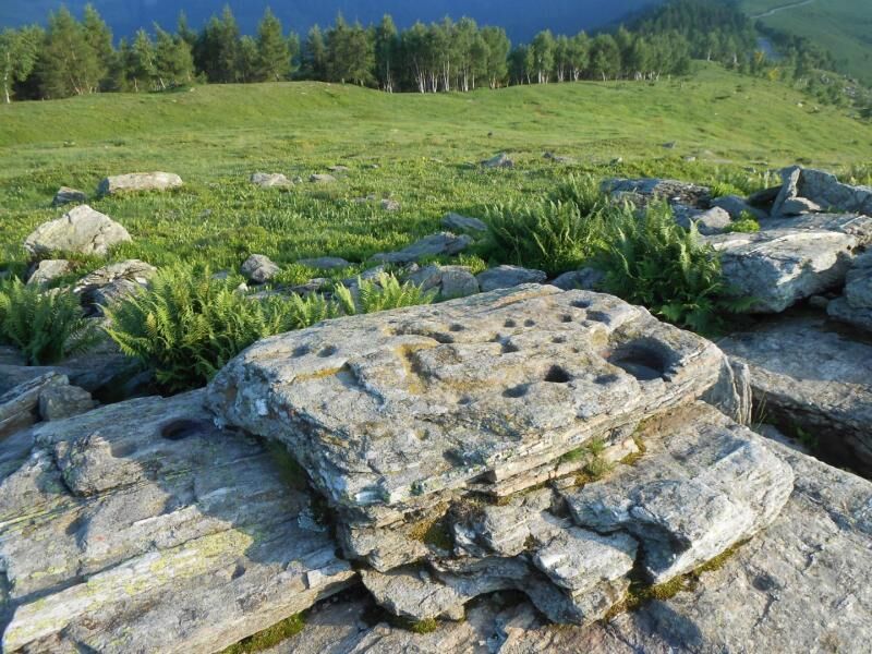
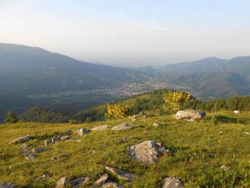
From the junction with the main route of Orizzonte Monviso, located at an altitude of 1100 m, the fork leading to the archaeological site of Bric Lombatera branches off to the left at the beginning of Stage 2 of the main ring. The route climbs up the pastureland slope with a steady pace, characterised by some long straight stretches connected by hairpin bends, which shortly afterwards come to the dirt road that cuts across the slope and reaches the Meire Vivaio and the other mountain pastures in the area where the OM ring passes. Continue directly uphill again with a series of hairpin bends, always on grassy ground, through which you will once again reach the ridge that now with a slower pace, leads to the top of Bric Lombatera, with a wonderful view of the Monviso group and the OM route that crosses the whole slope of Paesana in front of you to reach the slope of Oncino.

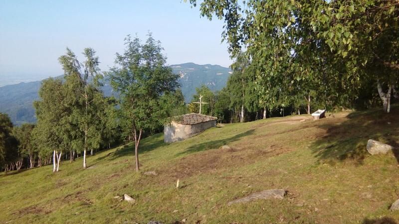

From the square in front of the church of Santa Margherita di Paesana, proceed in a south-west direction until you meet and cross the provincial road that goes up towards the upper valley. Enter the narrow road (towards Macari - Oca - Rossetti villages) which at the end of the straight road, at a crossroads, makes a sharp detour to the left: ignore the left branch which becomes a dirt road (itinerary of the stage 1 variant of the original route , which runs along the provincial road going beyond the village of Paesana into the Croesio valley, until you come out on the Pratoguglielmo road just before the Fantoni hamlet) and follow the asphalted road on the right which goes up sharply with a narrow hairpin bend, and then stretches out until at a crossroads a little further on (approx. 640m). Continue straight (leaving aside the road to the Macari on the right) on a road which, having become a dirt road, initially climbs with a couple of long hairpin bends and then stretches out towards an open area, near a crossroads. The route now develops easily on a wide dirt surface surrounded by vegetation which, although thick, is not invasive. Once you reach the crossroads (approximately 715m), continue on the right (the left branch leads to the localities of Oca and Rossetti), maintaining the main path which climbs gently to the right of a squat hill, until you reach the inhabited area of Airetta (approximately 745m) . Proceed, ignoring the right and left branches, until you come out after about 200m on the asphalt road: cross it and take the dirt road Via Bosco Lay which runs parallel to the main road until you reach a crossroads near a renovated house (leave aside the closed right branch from the barrier), from which you continue surrounding the wooded slope on a suggestive route among chestnut trees and other tall trees. Maintain the main axis of the forestry track (ignoring the deviations to the right and left) until you cross the asphalt road again (approximately 835m): here you turn sharply to the right uphill and advance for about thirty metres, then turn sharply to the left taking a forest track that enters the woods again. After a couple of hairpin bends you pass the Comba Fantoni (do not consider the deviations to the right and left with respect to the uphill route), then you pass above the houses in the Bertoni hamlet where the route becomes asphalted again and develops again in a more open. The road, slightly but constantly uphill, leads downstream from the core of the Bonetti village and, just before a clear bend, crosses the dirt road coming from the Croesio valley on the left (variant stage 1). After the hairpin bend, you head upstream from the Bonetti houses until you rejoin the asphalt road which, with a modest descent of around 500 m long, leads you to find on the left the sign for the resumption of the Orizzonte Monviso route (slightly uphill forestry track - approx. 1005m). Take the forest track that opens upstream from the asphalt road above the Fantoni village, and after 50m (a characteristic wooden totem is visible on the right) continue on the path that bends sharply to the left and enters the woods. Having passed a hut, we continue with a long half-hill slope with a very moderate slope, on a comfortable and smooth surface, covering the entire slope until climbing over the ridge at some isolated rocks in the woods (approximately 1080m). The traverse continues with a constant slope on a smooth surface, crossing an area characterized by sparser vegetation, then thicker again, until it finally emerges: the panorama will increasingly open up. The path, which has become a wide mule track with a grassy surface, continues to climb gently, stretching inside the valley until it reaches a crossroads: leave the branch that leads to other mountain pastures on the right (Meire Pra l'Erasca) and continue directly on the dirt road reaching a little further on near the former Forestry Nursery (approx. 1254m) characterized by the dense presence of coniferous trees; from here (variant stage 2, the original route at this point descends into the Erasca combale to climb up the opposite side to the Tournour road) continue up to the hairpin bend beyond which you turn right and walk onto the dirt road that leads to the crossroads with branch towards the huts below (approximately 1280m). Ignore this branch and follow the left branch of the dirt road which, slightly uphill, reaches the starting station of the ski lift called "Vivaio" which is part of the Pian Muné ski area; go up the grassy slope following the system poles in the first section and, when the slope increases, cut left zigzagging along the track until you cross the dirt road that connects the main road with the upper part of the valley. Crossing the road again, follow the path that branches off to the left and moderately climbs the grassy slope in view of the ridge which will shortly lead to the asphalt road coming from Paesana, and after a few tens of meters to the Pian Muné hiking refuge.
We recommend the use of trekking boots, trousers and a windbreaker in technical fabric.
Considering the ease of this route, nothing to report
A6 TURIN - SAVONA motorway, exit: Marene toll booth; turn left and merge onto the SS 662 towards Savigliano, continue until Saluzzo, then follow the directions from Saluzzo to the Po Valley along the SP 26 or SP 260; A21 TURIN – ALESSANDRIA – PIACENZA motorway, Asti est exit – then continue towards Alba- Bra- Marene- Savigliano- Saluzzo- Valle Po exit (SS 662); from TURIN, ring road, Pinerolo exit, continue on the SP 161 then SP .27 for Barge, Paesana.
From Turin and Cuneo: Atibus, timetables on the website www.buscompany.it/ati, Turin-Saluzzo, Cuneo-Saluzzo, Saluzzo-Paesana lines. From Turin and Pinerolo: Cavourese bus lines, timetables on the website www.cavourese.it, Turin – Pinerolo and Pinerolo - Barge lines. From Barge and Paesana: Dossetto Bus, timetables on the website www.dossettobus.it, Barge - Paesana - Crissolo line
Bric Lombatera, archaeological site
Popularne wycieczki w okolicy
-
4,0
Historic Mountain Routes | Cannon Road
ciężkiMountainbike 43,2 km -
5,0
Rifugio Quintino sella - monte Monviso
średniWspinaczka 9,13 km -
BRICHERASIO The Via della Pietra
światłoKolarstwo długodystansowe 11,5 km -
5,0
01-Monviso Ring. Rifugio Alevè - Rifugio Quintino sella Pontechianale, Piemont/Italien
światłoWędrówka 11,8 km -
LUSERNA S.G. Upslowtour - Luserna Stone Loop 9
średniJazda na rowerze 38,1 km -
5,0
02 Monviso Ring. Rifugio Quindino Sella - Rifugio Giacoletti. Crissolo, Piemonte/Italia
światłoWędrówka 7,11 km -
RORÀ "Health and Nature" route
średniWędrówka 10,4 km -
The "Lounga scursa" (Long Shortcut)
Wędrówka 5,94 km -
BAGNOLO P.TE Route of the quarries
ciężkiMountainbike 38,6 km -
LUSERNETTA San Bernardo - Rocche Finestre Loop
średniWędrówka 11,4 km

Wędrówki i tropienie


Nie przegap ofert i inspiracji na następne wakacje
Twój adres e-mail została dodana do listy mailingowej.





