






Orizzonte Monviso - Stage 1: Hiking refuge La via del sale - Hiking refuge Pian Munè
From La Via del Sale hiking refuge in Sanfront, you cross the centre of the village, passing the main square on the right; the constantly uphill asphalt road bends to the left crossing the Albetta stream...
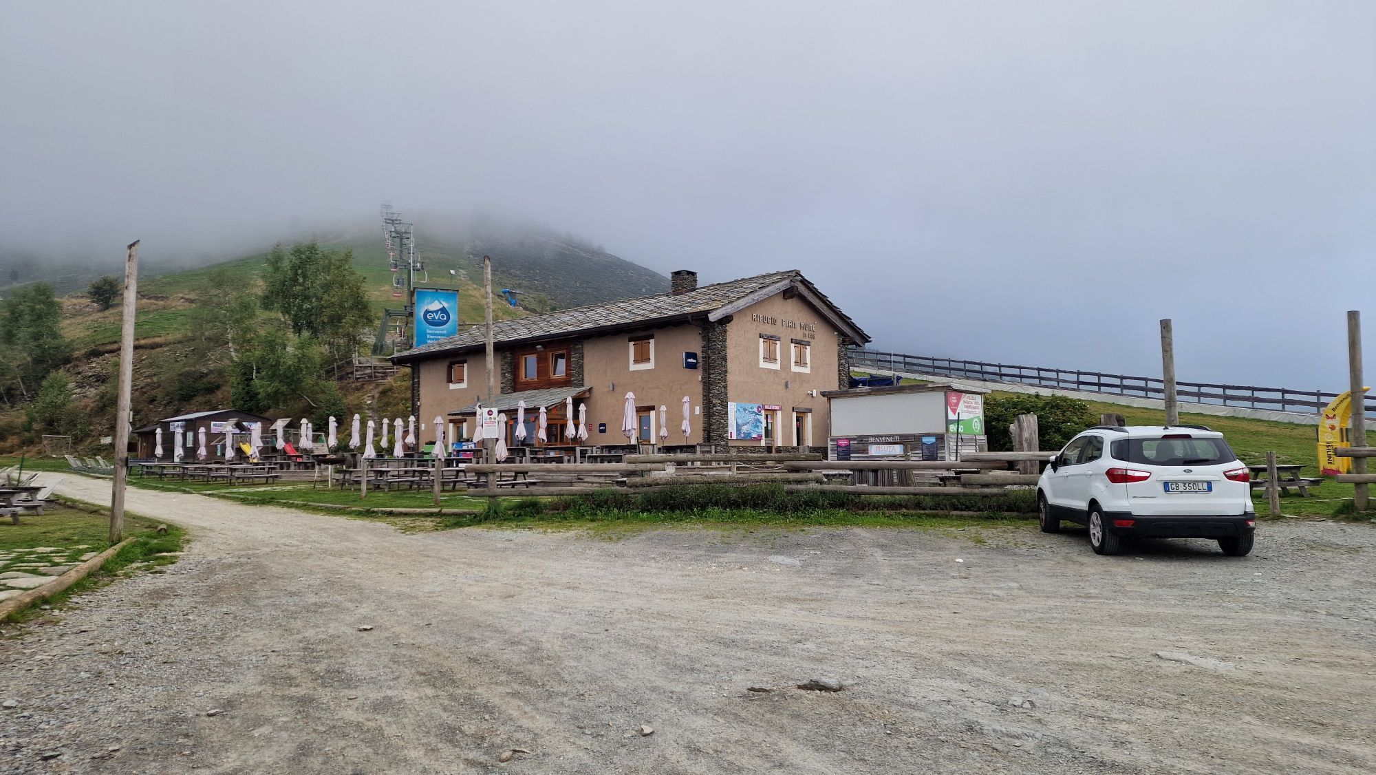
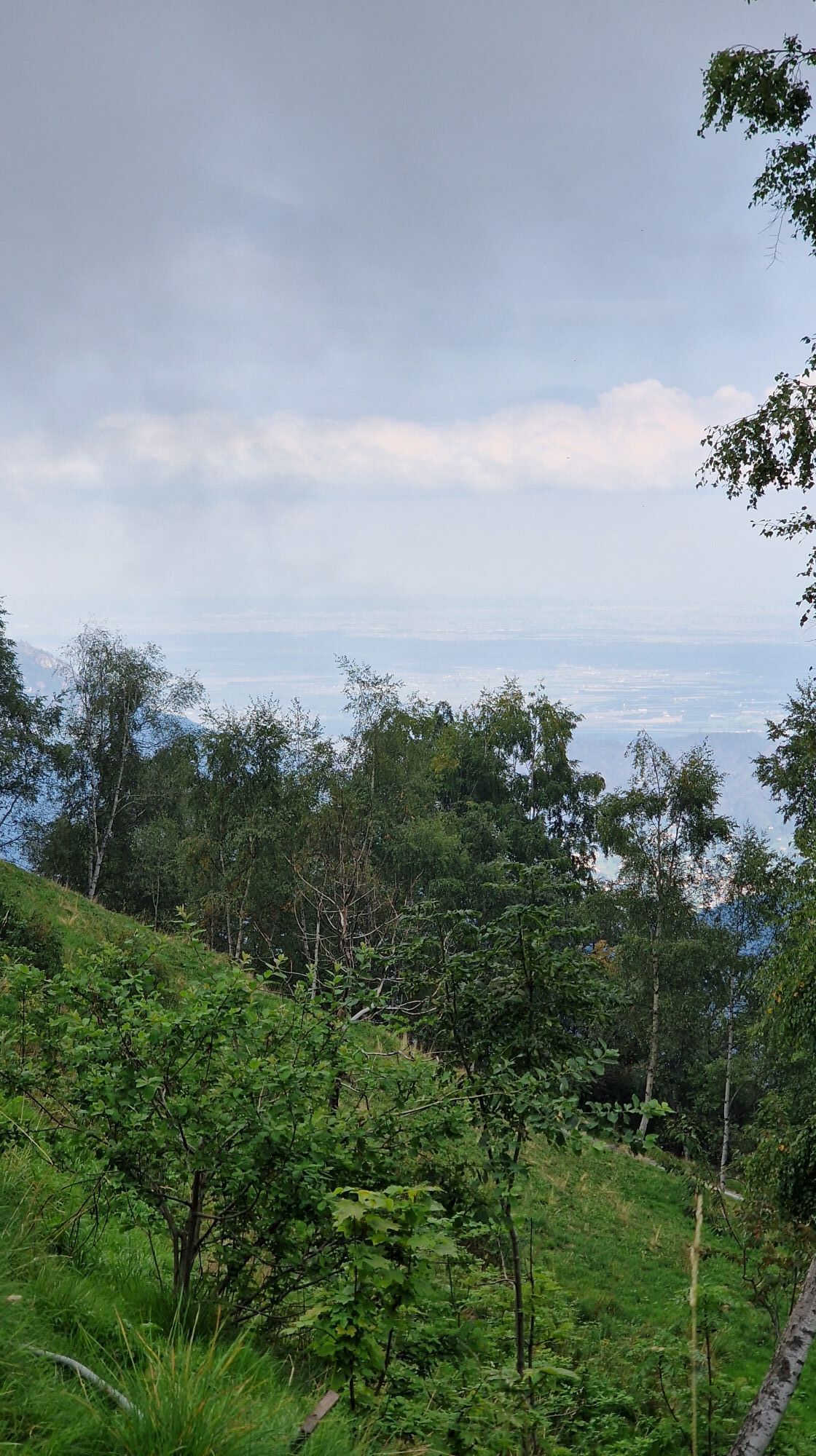
From La Via del Sale hiking refuge in Sanfront, you cross the centre of the village, passing the main square on the right; the constantly uphill asphalt road bends to the left crossing the Albetta stream and, in a linear course, goes up the homonymous narrow valley (ignore the forks to the left and right) to a wide hairpin bend to the right (water point on the left), which leads to a crossroads after a few hundred metres. Continue by turning sharply left uphill with a steady gradient, passing some small and practically uninhabited clusters of houses immersed in a suggestive wood of tall chestnut trees; after a series of hairpin bends, the road levels out and reaches the characteristic chapel of San Bernardo (1075m - equipped area and water point). The track now becomes a dirt road for a couple of hundred metres, and continues to encircle the slope on good terrain without any excessive gradients, passing through mixed woods first of chestnut, ash and birch trees, then larch and fir trees for a short stretch, until it finally comes out into an open field (group of huts on the left). The dirt road now increases decisively in gradient: a series of long hairpin bends climb up the increasingly panoramic side, alternating easier stretches with more demanding ones due to the uneven ground; for a section, the track is slightly sloping and then gains altitude once more at the end of the climb that concludes its demanding part near a sharp turn to the left that leads to a panoramic hillock with a drinking trough for herds. The track now runs along a mostly flat stretch, firstly in an open clearing, then in a suggestive wood with some ascents and descents until it reaches the wide and grassy clearing of Colle di Gilba (1524m), a communication point and intersection with the nearby Valle Varaita (equipped area and water point). The descent begins a few dozen metres back from the pass, just at the beginning of the clearing, and bends again in the direction of Valle Po (signposts) along a path that is initially grassy but soon becomes technical both for the terrain (at times windy with parts on stones and roots) and for the gradient (a steeper first part, which flattens slightly to descend again afterwards), for about 700 mt, until coming to a crossroads (signposts), where the demanding part of the descent ends. Now you go left along a nice stretch in the thick pinewood that has a special environment in some parts and leads onto the opposite side of the valley. The first part is well cyclable, followed by the crossing of the first stream and then a second one with a greater water flow (narrower and more uneven terrain both upstream and downstream). The path, which shows clear evidence of its history, continues on sloping ground until the third and last crossing of a larger stream (due to rather evident landslides and rockfalls, you climb a little bit and then descend), beyond which you join the forest path coming from the valley. After approximately 500 metres along a larger path with better terrain, you reach the Bertorello Forest Refuge (1375m) immersed in a large pine forest. You go onto the uphill fork which, after the refuge, leads to some higher mountain huts and then up to Pian Mun, where the hiking refuge is located next to the departure of the chairlift of the local ski resort.

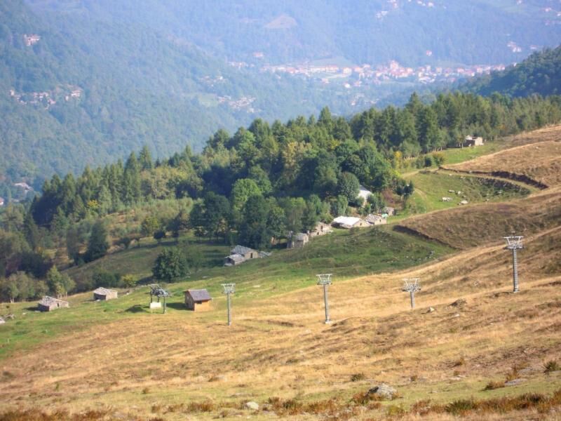
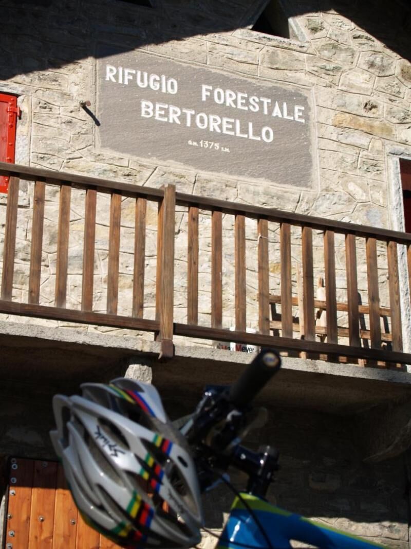
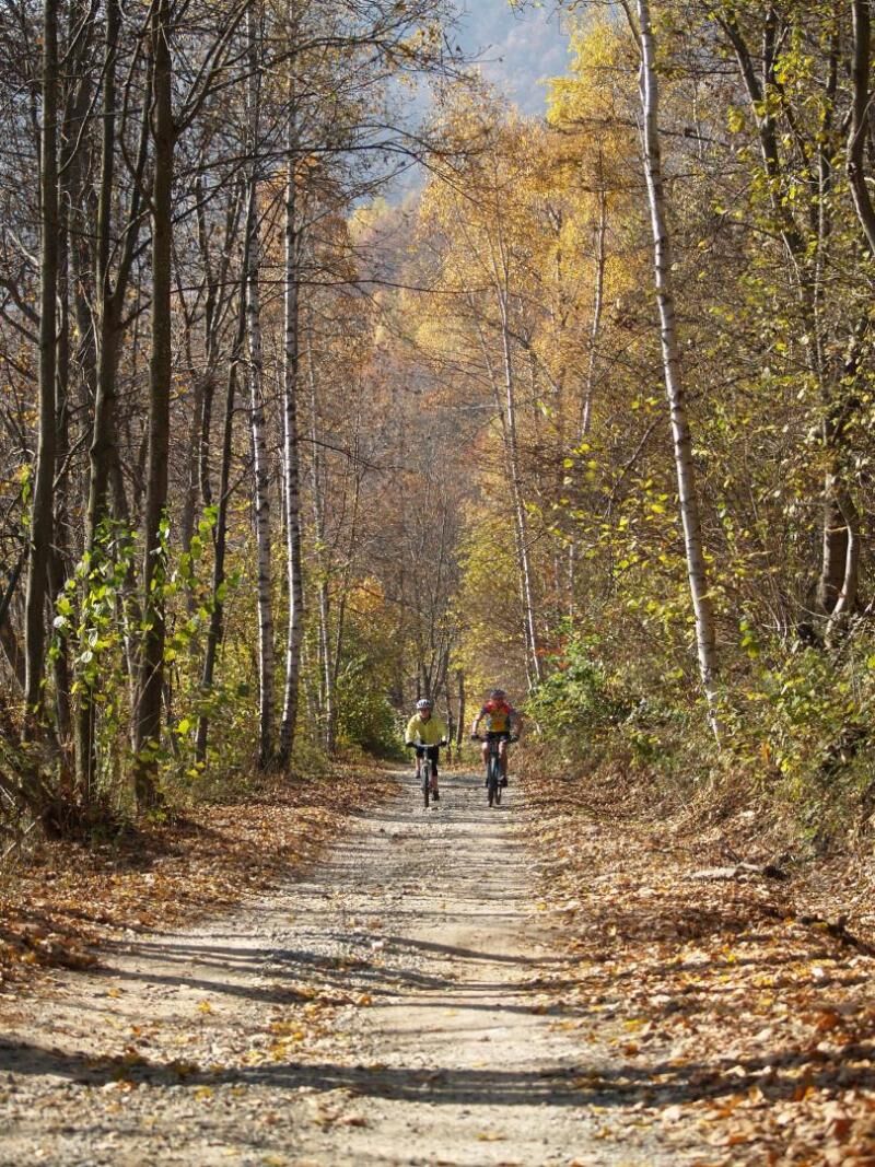

From the La Via del Sale hiking refuge in Sanfront you cross the town centrally, passing the main square on the right; the road, constantly climbing on asphalt, turns left crossing the Albetta stream and with a linear trend goes up the comba of the same name (ignore branches on the left and right) up to a large hairpin bend towards the right (water point on the left) which after a few hundred leads of meters at a crossroads. Continue turning sharply to the left on a steep climb and constant slope, passing some small, almost uninhabited rural hamlets immersed in a picturesque forest of tall chestnut trees; the road, after a series of hairpin bends, flattens out and reaches the characteristic chapel of San Bernardo (1075m - equipped area and water point). The route, from a few hundred metres, has become a dirt road and continues contouring the slope on a good surface and without excessive slopes, passing mixed woods first of chestnut, ash and birch, then for a short stretch larches and firs, until it finally exits in an open field (cluster of huts on the left). The dirt road now significantly increases in slope: a series of long hairpin bends go up the increasingly panoramic side, alternating smoother stretches with more challenging ones due to the uneven surface; the route extends for a stretch on a slight slope to gain altitude again at the end of the climb which ends its challenging part near a sharp turn to the left which leads to a panoramic hill with a drinking trough for the herds. You now travel along a long, mostly flat stretch, first in an open clearing, then inside a suggestive forest with some ups and downs until you reach the large, grassy clearing of Colle di Gilba (1524m), a point of communication and intersection with the nearby Valle Varaita (equipped area and water point). The descent begins a few tens of meters back from the hill, just at the beginning of the clearing, and bends again towards the Po valley (directions) along an initially grassy path which soon becomes technical both due to the surface (at times tortuous with passages on stones and roots) and for the slope (a steeper first stretch which then flattens out slightly before descending again afterwards), all for about 700m up to a crossroads (signs), where the challenging part of the descent ends. Now go left along a nice stretch on a slight slope inside the dense pine forest which in some places offers a very special environment and leads to the opposite side of the valley. The first part is well cycled, followed by the crossing of the first stream and then a second with a greater water flow (narrower and more uneven surface in correspondence with both upstream and downstream). The path, which bears clear evidence of long standing, continues on a slight slope until the third and final crossing of a more important stream (due to very evident landslides and mudslides, it goes up a little and then descends), beyond which it joins the track forestry that comes from the valley. With a pleasant surface and greater width you reach, after about 500m, the Bertorello Forest Refuge (1375m) immersed in a vast pine forest. You join the uphill branch which, beyond the refuge, heads towards some huts higher up and up to the Pian Muné area where, next to the departure point of the chair lift of the local ski resort, stands the hiking refuge.
Considering that the excursion takes place on a predominantly mountainous and high altitude route, the use of suitable clothing such as trekking boots - trousers and windbreaker in technical fabric is recommended.
Nothing to report in this regard
A6 TURIN - SAVONA motorway, exit: Marene toll booth; turn left and merge onto the SS 662 towards Savigliano, continue until Saluzzo, then follow the directions from Saluzzo to the Po Valley along the SP 26 or SP 260; A21 TURIN – ALESSANDRIA – PIACENZA motorway, Asti est exit – then continue towards Alba- Bra- Marene- Savigliano- Saluzzo- Valle Po exit (SS 662); from TURIN, ring road, Pinerolo exit, continue on the SP 161 then SP .27 for Barge, Paesana.
From Turin and Cuneo: Atibus, timetables on the website www.buscompany.it/ati, Turin-Saluzzo, Cuneo-Saluzzo, Saluzzo-Paesana lines. From Turin and Pinerolo: Cavourese bus lines, timetables on the website www.cavourese.it, Turin – Pinerolo and Pinerolo - Barge lines. From Barge and Paesana: Dossetto Bus, timetables on the website www.dossettobus.it, Barge - Paesana - Crissolo line.
From the La Via del Sale hiking refuge in Sanfront you cross the town centrally, passing the main square on the right; the road, constantly climbing on asphalt, turns left crossing the Albetta stream and with a linear trend goes up the comba of the same name (ignore branches on the left and right) up to a large hairpin bend towards the right (water point on the left) which after a few hundred leads of meters at a crossroads. Continue turning sharply to the left on a steep climb and constant slope, passing some small, almost uninhabited rural hamlets immersed in a picturesque forest of tall chestnut trees; the road, after a series of bends, flattens out and reaches the characteristic chapel of San Bernardo (1075m - equipped area and water point). The route, from a few hundred metres, has become a dirt road and continues contouring the slope on a good surface and without excessive slopes, passing mixed woods first of chestnut, ash and birch, then for a short stretch larches and firs, until it finally exits in an open field (cluster of huts on the left). The dirt road now significantly increases in slope: a series of long hairpin bends go up the increasingly panoramic side, alternating smoother stretches with more challenging ones due to the uneven surface; the route extends for a stretch on a slight slope to gain altitude again at the end of the climb which ends its challenging part near a sharp turn to the left which leads to a panoramic hill with a drinking trough for the herds. You now travel along a long, mostly flat stretch, first in an open clearing, then inside a suggestive forest with some ups and downs until you reach the large, grassy clearing of Colle di Gilba (1524m), a point of communication and intersection with the nearby Valle Varaita (equipped area and water point). The descent begins a few tens of meters back from the hill, just at the beginning of the clearing, and bends again towards the Po valley (directions) along an initially grassy path which soon becomes technical both due to the surface (at times tortuous with passages on stones and roots) and for the slope (a steeper first stretch which then flattens out slightly before descending again afterwards), all for about 700m up to a crossroads (signs), where the challenging part of the descent ends. Now go left along a nice stretch on a slight slope inside the dense pine forest which in some places offers a very special environment and leads to the opposite side of the valley. The first part is well cycled, followed by the crossing of the first stream and then a second with a greater water flow (narrower and more uneven surface in correspondence with both upstream and downstream). The path, which bears clear evidence of long standing, continues on a slight slope until the third and final crossing of a more important stream (due to very evident landslides and mudslides, it goes up a little and then descends), beyond which it joins the track forestry that comes from the valley. With a pleasant surface and greater width you reach, after about 500m, the Bertorello Forest Refuge (1375m) immersed in a vast pine forest. You join the uphill branch which, beyond the refuge, heads towards some huts higher up and up to the Pian Muné area where, next to the departure point of the chair lift of the local ski resort, stands the hiking refuge.
Chapel of San Bernardo Colle di Gilba, panoramic viewpoint and intervalley crossroads
Popularne wycieczki w okolicy
-
4,0
Historic Mountain Routes | Cannon Road
ciężkiMountainbike 43,2 km -
5,0
Rifugio Quintino sella - monte Monviso
średniWspinaczka 9,13 km -
5,0
01-Monviso Ring. Rifugio Alevè - Rifugio Quintino sella Pontechianale, Piemont/Italien
światłoWędrówka 11,8 km -
BAGNOLO P.TE Route of the quarries
ciężkiMountainbike 38,6 km -
Occitan Routes: Stage 3 Pagliero hamlet of San Damiano Macra - Camoglieres hamlet
średniWędrówka 10,6 km -
Occitan Routes: Stage 2 Frazione Sant'Anna di Roccabruna - Frazione Pagliero di San Damiano Macra
średniWędrówka 8,49 km -
Valle Varaita Trekking
średniWędrówka 170,2 km -
Monviso horizon
średniWędrówka 75,5 km -
Orizzonte Monviso - Stage 3: Lossa hiking refuge (Oncino - Serre hamlet) - Crissolo
średniWędrówka 9,84 km -
Orizzonte Monviso - Stage 4: Crissolo - Hking refuge La Galaberna
średniWędrówka 6,08 km

Wędrówki i tropienie


Nie przegap ofert i inspiracji na następne wakacje
Twój adres e-mail została dodana do listy mailingowej.





