






Maritime Alps Park | "Ciciuvagando" to discover stone mushrooms
Poziom trudności: T2
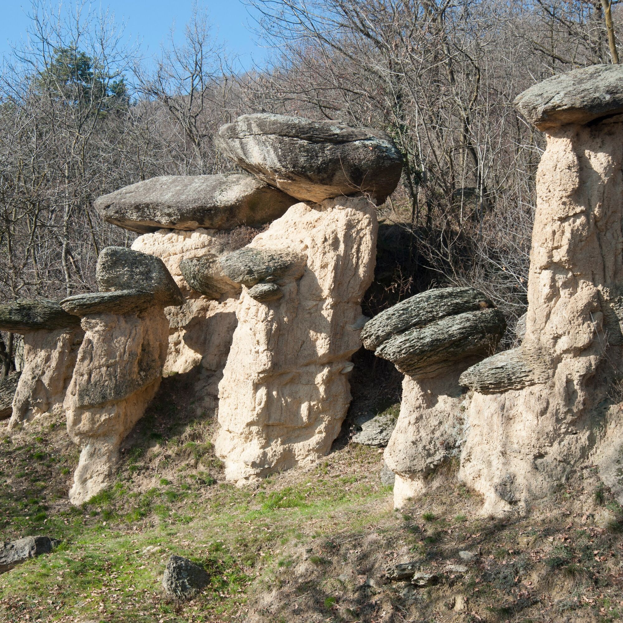
It's a true open-air exhibition dedicated to the "erosion columns" that rise at the foot of Mount San Bernardo. Known in Piedmontese as "Ciciu 'd pera," they are natural morphological sculptures with a...
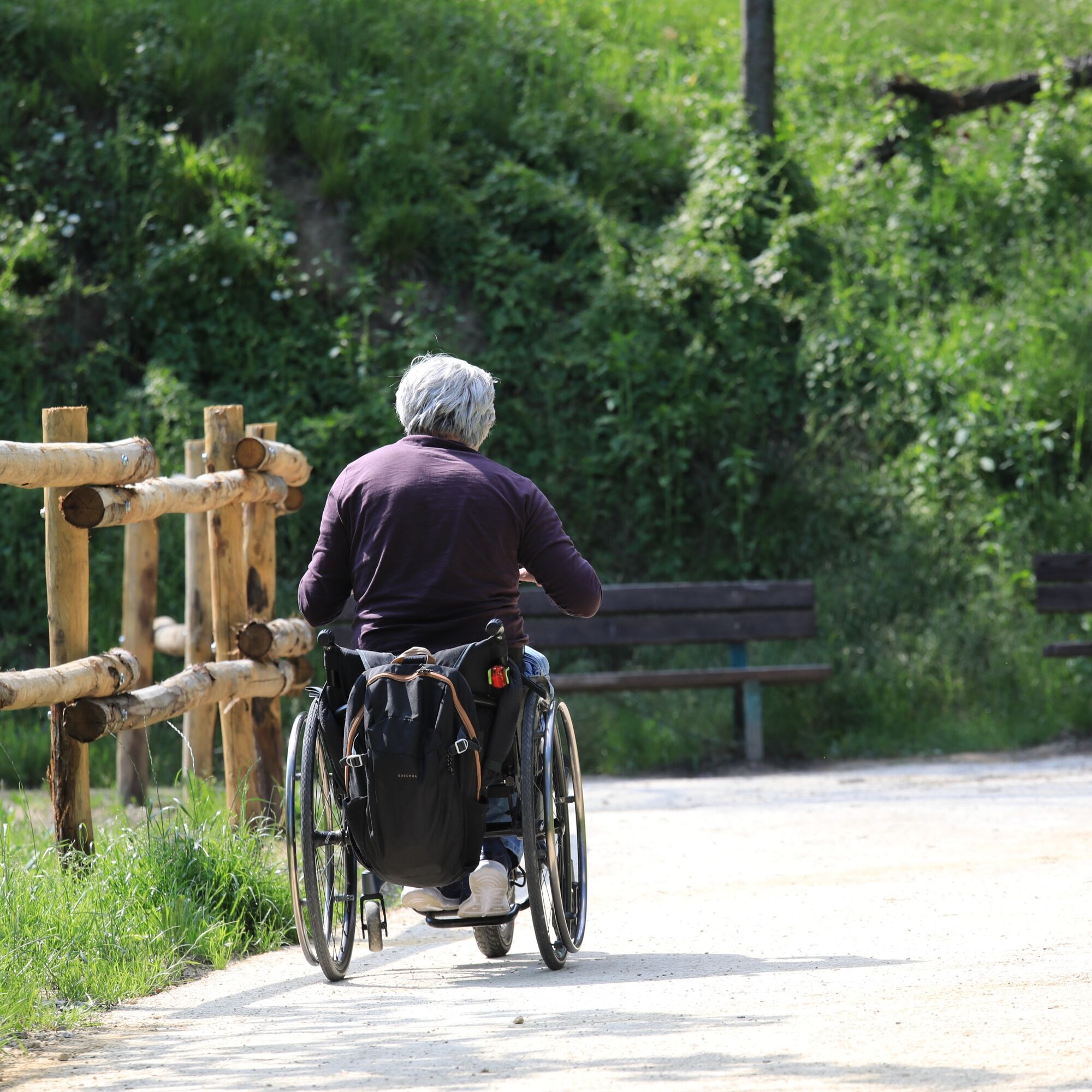
"Ciciuvagando" is also an inclusive route, thanks to a circular path of approximately 1.2-2.5 km, specifically redeveloped in 2024 to be accessible to people in wheelchairs, strollers and with motor disabilities.


Tak
Tak
Tak
From Cuneo, reach Dronero (Via Caraglio) following the SS 22 for about 20 km; pass through Dronero and turn right towards Busca, following the Provincial Road 24 for over 2 km until you reach a left intersection for Villar San Costanzo. Continue for another 2 km, following the signs for the Reserve. From Turin: after passing Saluzzo, follow the SS 589 towards Busca, continue towards Dronero on Provincial Road 24, arriving after about 8 km at the intersection for Villar San Costanzo. Turn right and continue for another 2 km following the signs to the entrance to the Reserve.
T2
New services have also been available since 2026, including e-MTB rentals and the sale of Valle Maira-branded merchandise, maps, guides, and books on local history and culture, as well as materials related to the territories of the Alpi Marittime Protected Areas Management Agency (two parks, eight nature reserves, and 20 Natura 2000 Network areas).
The entrance fee to the protected area is €4; admission is free for children up to 10 years old, seniors over 65, and people with disabilities, along with any accompanying adults. The contribution is intended to guarantee the opening of the Visitor Center, the tourist information service, and the maintenance and cleaning of the equipped areas.
Guided tours, experiential workshops, and citizen science workshops for schools of all levels and organized groups are always available by reservation.
In a subsequent phase, corporate team building and equestrian tourism options will be developed, respecting the site's naturalistic vocation and the principles of environmental sustainability.
INFORMATION AND CONTACTS:
+39 379 1789427
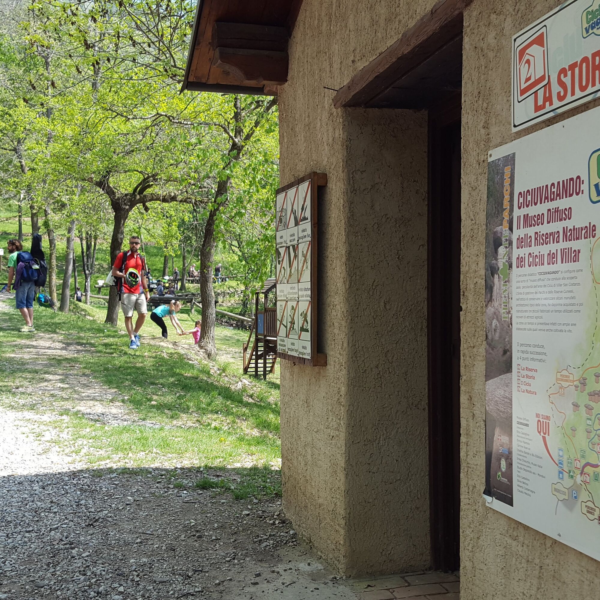
The tourist route is marked with the "Ciciuvagando" sign and takes about thirty minutes to complete, excluding stops. Along the route, which initially coincides with the hiking trail, three small rural buildings ("ciabot") have been renovated, once used as tool sheds when vineyards were common in the area. Decorated with information panels, the three buildings dedicated to "History," "The Ciciu," and "Nature," now serve, along with the reserve's visitor center, as useful rest stops for those undertaking the short walk independently.
Popularne wycieczki w okolicy
- 4,0
Historic Mountain Routes | Cannon Road
ciężkiMountainbike 43,2 km Along the roads of champions
ciężkiDroga rowerowa 173,6 kmOccitan Routes: Stage 1 Ciciu di Villar - Frazione Sant'Anna di Roccabruna
średniWędrówka 15,9 kmOccitan Routes: Stage 3 Pagliero hamlet of San Damiano Macra - Camoglieres hamlet
średniWędrówka 10,6 kmOccitan Routes: Stage 2 Frazione Sant'Anna di Roccabruna - Frazione Pagliero di San Damiano Macra
średniWędrówka 8,49 kmVal Varaita Trekking: Tappa 12 Venasca - Costigliole Saluzzo
średniWędrówka 18,1 kmPercorsi Occitani: Tappa 15 Cartignano - Dronero
średniWędrówka 7,82 kmValle Bronda Trekking - Stage 2A: Martiniana Po - Brondello (crossroads at 835 m altitude)
średniWędrówka 8,35 kmValle Bronda Trekking | Stage 3 Brondello - Pagno
średniWędrówka 13,9 kmOccitan Routes: Stage 14 Borgata Chiesa - Cartignano
średniWędrówka 18,5 km

Wędrówki i tropienie


Nie przegap ofert i inspiracji na następne wakacje
Twój adres e-mail została dodana do listy mailingowej.





