






CESANA T.SE Mollieres - Solomiac
The winter hike between Mollieres and Solomiac is a simple experience but perfect for those who wish to immerse themselves in the magic of the snowy forest. Wrapped in muffled silence, you walk among centuries-old...
The winter hike between Mollieres and Solomiac is a simple experience but perfect for those who wish to immerse themselves in the magic of the snowy forest. Wrapped in muffled silence, you walk among centuries-old and majestic trees. Every step is a discovery: from the footprints of wild animals on the snow to the ice-covered branches that shine under the sun rays reaching the trail only for a few hours.
The hike allows, starting from the Mollieres junction on State Road 24, to reach the characteristic alpine hamlet called Solomiac, where you can admire from the outside the peculiar facade of Casa Cossoul and, looking up, recognize Cima Monte Chaberton, where its Fortress stands silently.
The route follows a stretch of the historic Via Francigena, a spiritual path that in the summer months comes alive with pilgrims and enthusiasts and connects the Colle del Montgenèvre to the Lower Susa Valley.

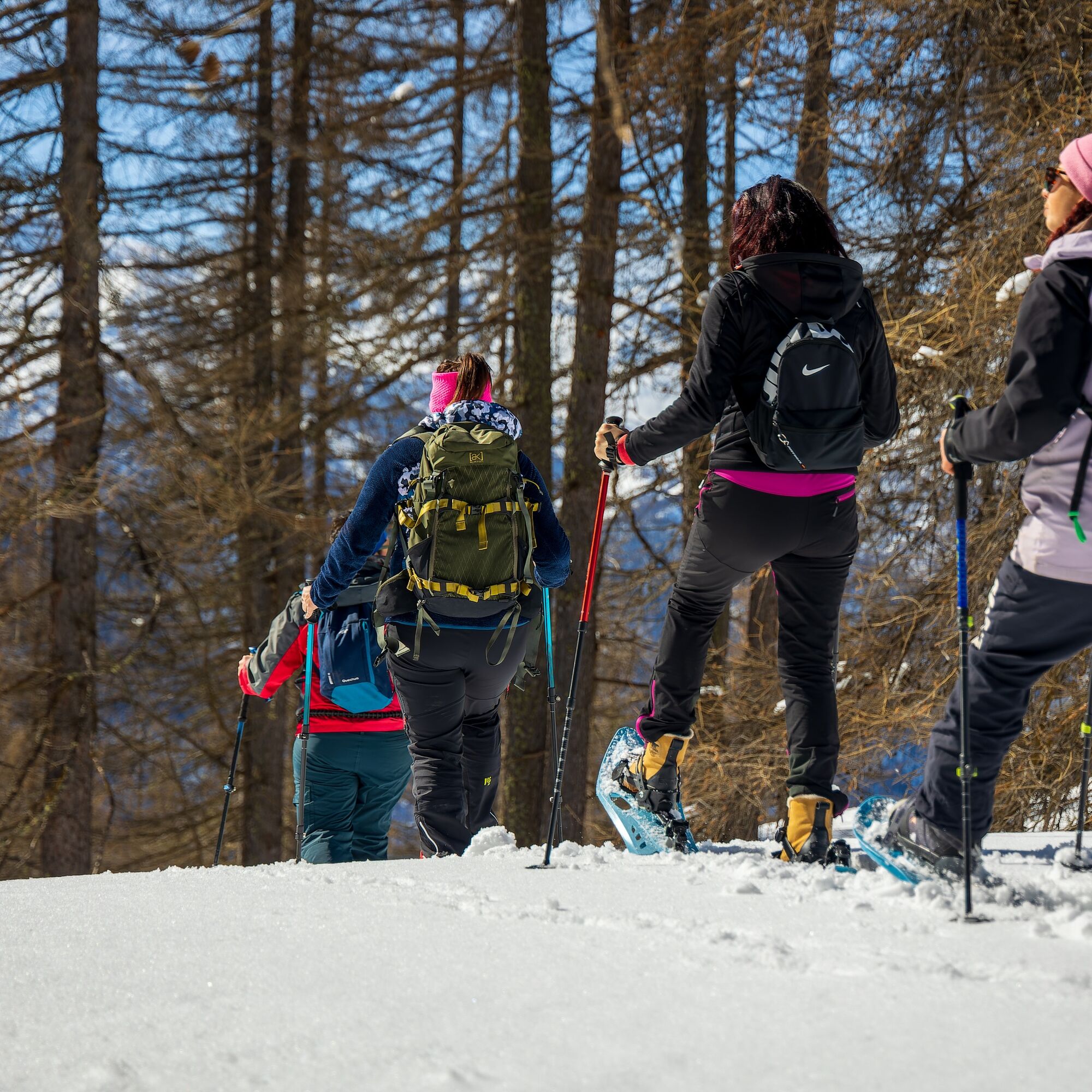

From the junction on SS24 road towards Mollieres, you can park and reach the small village on foot. Passing a parking lot in the center of Mollieres, and leaving the Church of Sant'Antonio Abate on the right, continue along the road passing near the old oven of the hamlet. Straight ahead for 300 meters, the paved road ends to make way for the path/trail from which the winter hike starts.
Clothing and footwear suitable for the winter mountain environment: Snowshoes – poles - ARVA, shovel and probe
Hiking activity in snowy environments requires the use of electronic signaling and search systems as provided by Legislative Decree no. 40/2021 art. 26
Before undertaking any hike it is recommended to:
- check the weather and avalanche bulletins of ARPA Piemonte, http://www.arpa.piemonte.it/bollettini
- get information from local Tourism Offices, Ski Schools or Alpine Guides.
- In case of avalanche danger it is not recommended to undertake any hike.
We also remind you that:
The indicated trails are exclusively tracked by the passage of people on foot: no mechanical maintenance or grooming service, daily or periodic, is provided.
The difficulty level indicated on each route may vary depending on the snow cover conditions.
Hiking activity in snowy environments requires the use of electronic signaling and search systems as provided by Legislative Decree no. 40/2021 art. 26
From Turin follow the signs for the North Ring Road towards Trafori - Frejus. Take the A32 motorway towards Bardonecchia and exit the motorway at Monginevro Sestriere exit. At the tunnel exit continue to the right towards Cesana, stop at the junction on the left towards the hamlet of Mollieres.
Mollieres bus stop of Arriva 285 line Oulx-Sestriere
Parking is available near the junction on SS24 or near the main square of Mollieres; start walking towards the Via Francigena/Solomiac signs
Bring a backpack with water and food, there are no refreshment points or fountains along the route
Do not litter the environment but carry your waste away, possibly collecting that left by others.
The travel times reported are indicative and may vary depending on weather conditions and personal abilities.
Weather and snow situation: http://www.arpa.piemonte.it/bollettini
At Solomiac the trail continues: to the right and uphill towards Sansicario Alto or to the left, downhill towards Fenils/Cesana T.se
Uzyskaj wgląd
Zawsze na żywo z ponad 9 500 kamer internetowych. bergfex Jako użytkownik Pro, możesz teraz zobaczyć odpowiednie kamery internetowe dla wielu wycieczek w aplikacji wycieczki od. Pozwala to na bezpośredni podgląd aktualnych warunków.
Popularne wycieczki w okolicy
-
5,0
BARDONECCHIA Forte Jafferau Loop
ciężkiMountainbike 36,8 km -
5,0
BARDONECCHIA Col des Acles - Passo della Mulattiera
średniWędrówka 6,23 km -
BARDONECCHIA - Loop Colle della Scala - Col de Montgenèvre - Colle del Sestriere
ciężkiDroga rowerowa 91,9 km -
5,0
SESTRIERE Monte Rognosa
ciężkiWędrówka 6,42 km -
BARDONECCHIA Monte Jafferau
ciężkiWędrówka 11,6 km -
CESANA T.SE Lago Nero - Seven Colors Lake
średniWędrówka 3,51 km -
5,0
CESANA T.SE Thures - Cima Bosco
ciężkiRakieta do chodzenia po śniegu 3,94 km -
5,0
CESANA T.SE Cesana - Fenils
światłoWędrówka 4,60 km -
4,0
BARDONECCHIA Sentiero dei Cosetti by Luciano Ferraris
światłoWędrówka 3,24 km -
OULX Borgata Seu (Gran Bosco Natural Park)
światłoRakieta do chodzenia po śniegu 5,93 km
Wędrówki i tropienie


Nie przegap ofert i inspiracji na następne wakacje
Twój adres e-mail została dodana do listy mailingowej.





