


CESANA T.SE Lago Nero - Seven Colors Lake


The path connects Lago Nero (municipality of Cesana Torinese) with Lac Gignoux / Seven Colors Lake (in the French department of Hautes Alpes) passing through the tiny Lac Saurel, running at an altitude...
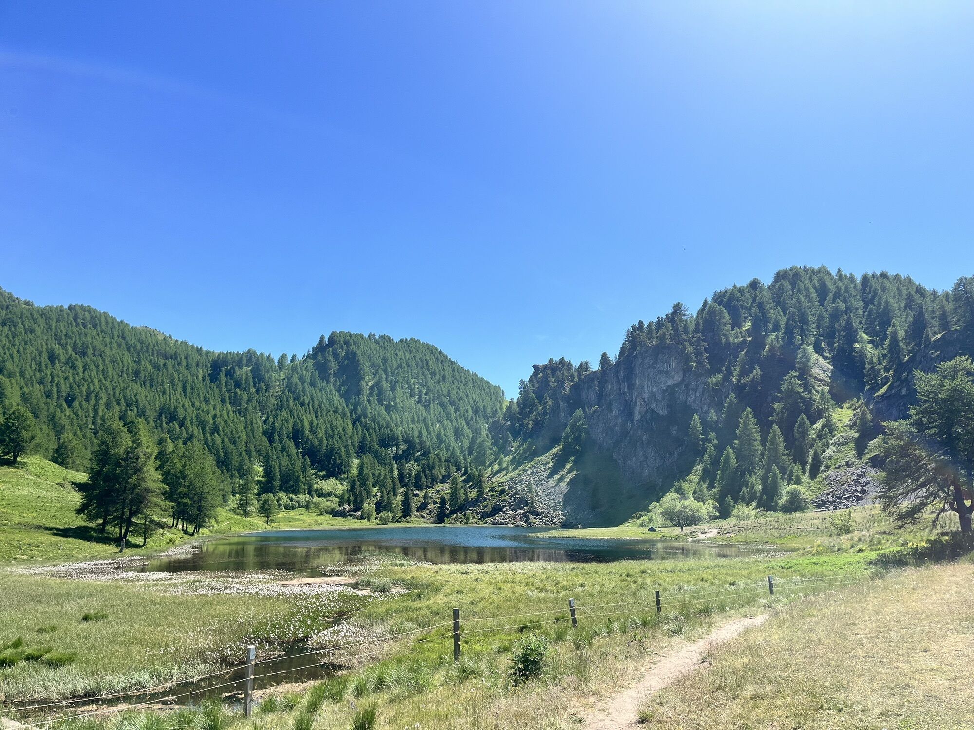
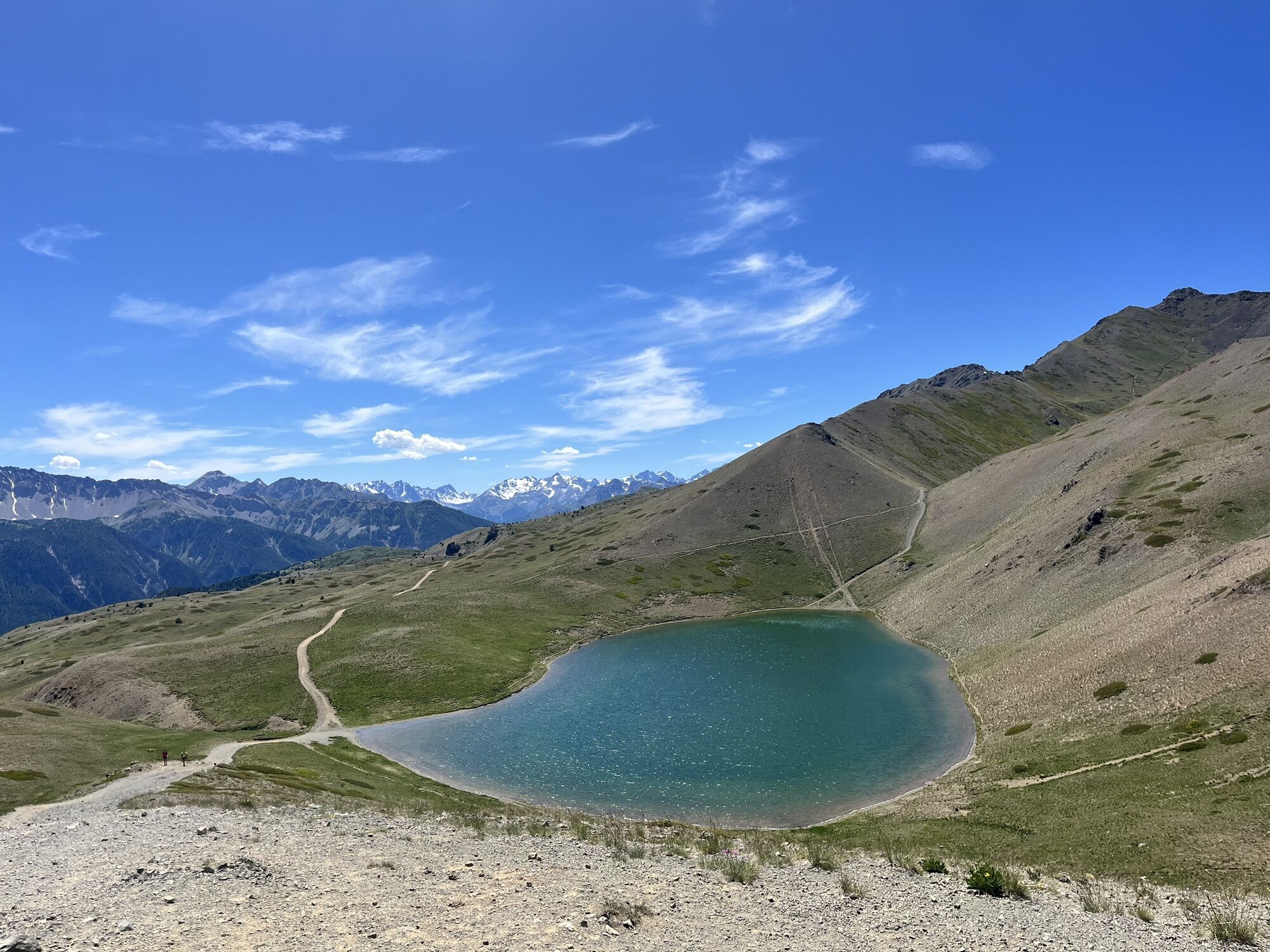
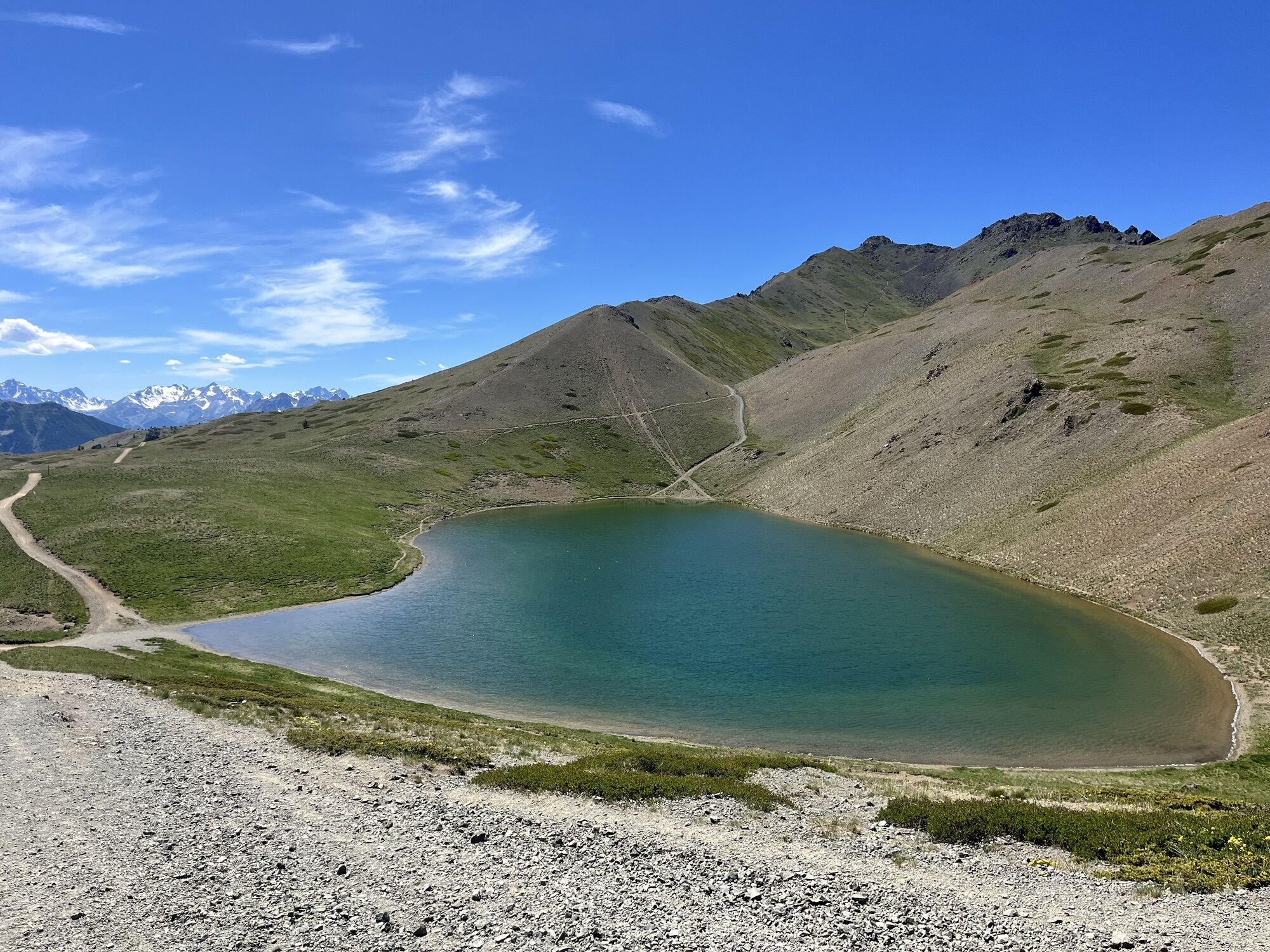
The path connects Lago Nero (municipality of Cesana Torinese) with Lac Gignoux / Seven Colors Lake (in the French department of Hautes Alpes) passing through the tiny Lac Saurel, running at an altitude between about 2000 and 2400 meters. After the first stretch in the mixed forest of larches and Swiss pines, the path crosses a lunar area made up of a succession of small hills and hollows where junipers and bilberries proliferate: this area is called "Monti della Luna" (Moon Mountains). Near Col Saurel you cross into France to admire the hues of the Seven Colors Lake, nestled in a basin at the foot of mountains of different geological formation. Along the entire route, it is possible to spot various demolished or damaged military positions.
Support and technical description by Barbara Demonte - Environmental trekking guide.

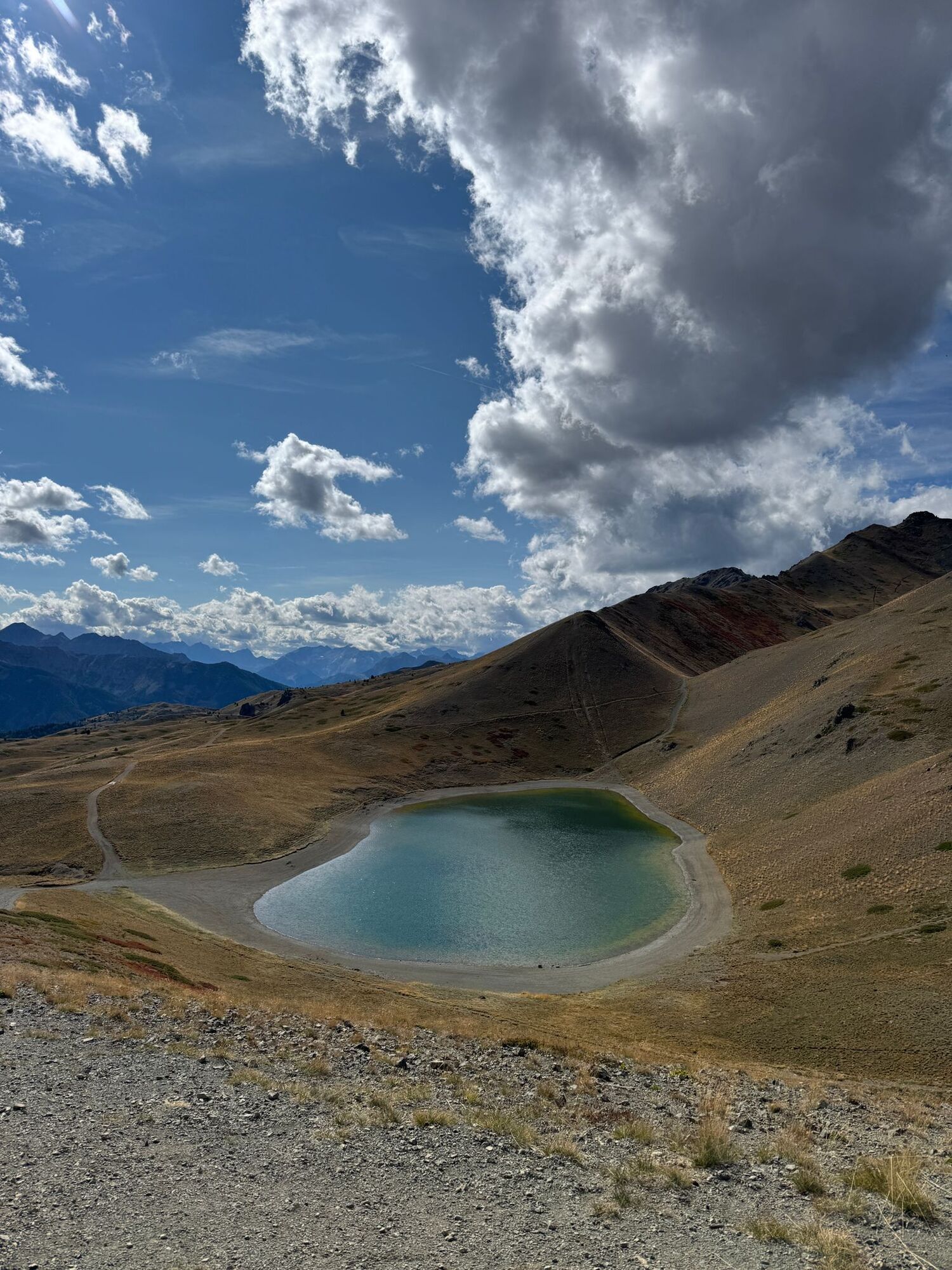
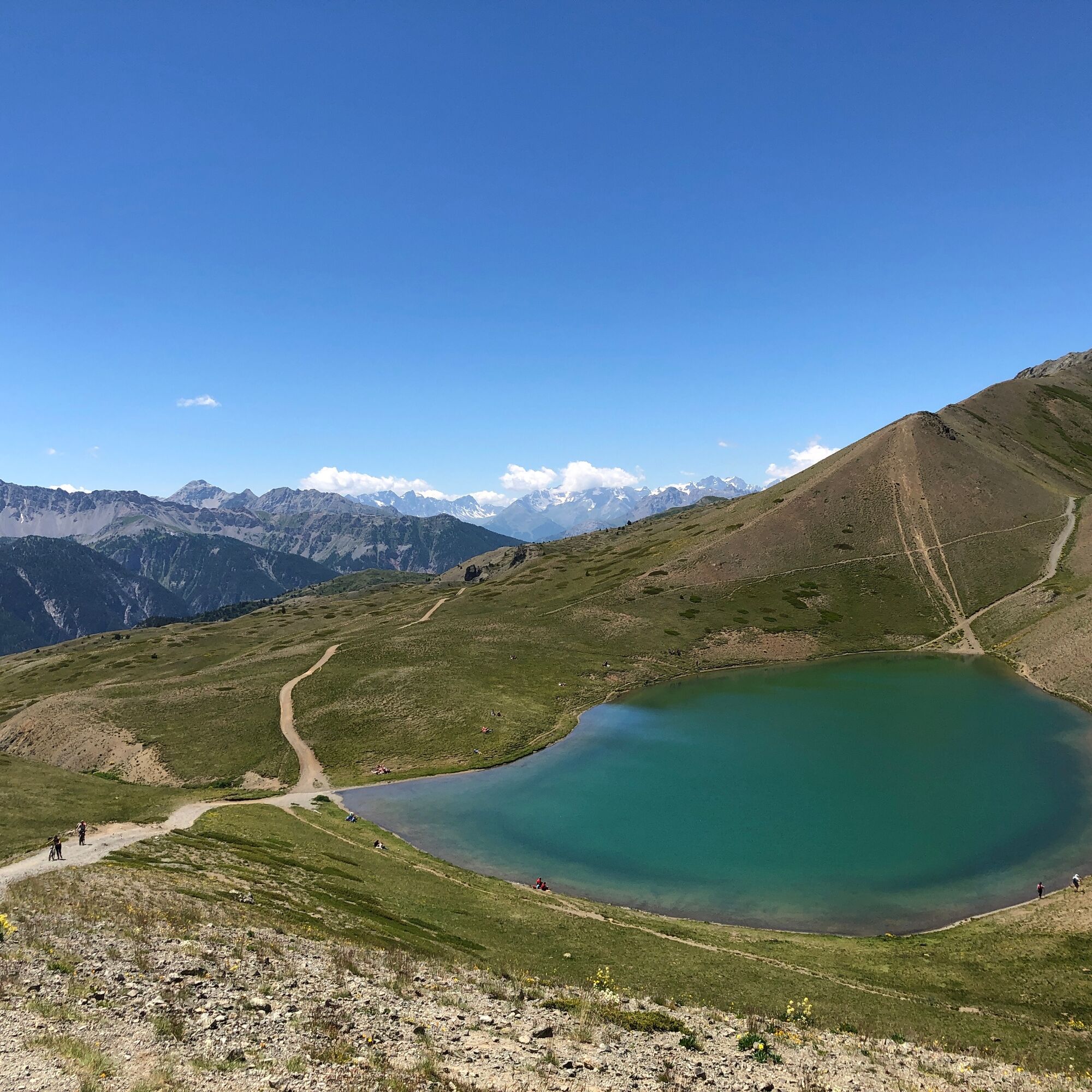
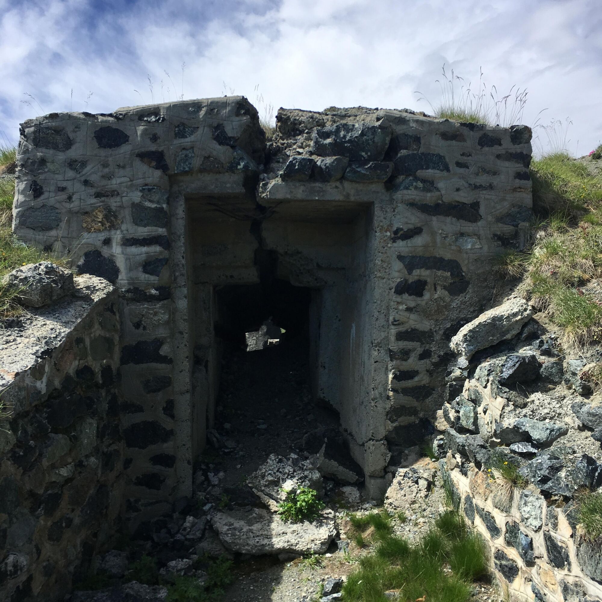

The route starts at the chapel of the Madonna del Lago Nero (in the municipality of Cesana Torinese) at about 2020 meters elevation, located on the northern shore of the lake itself. Access is from Bousson, a hamlet of Cesana Torinese (about 4 km away heading towards Sauze di Cesana) following the dirt road that leads to Capanna Mautino (about 6 km), passable by car (since it is a military road, the use of a 4x4 is recommended), or on foot following path no. 11. In Bousson, parking is available in the square on the right of the provincial road coming from Cesana, after passing the old village and the bridge over the Ripa stream, turning right towards Lago Nero just before the bridge over the Thuras stream, beyond which the barracks stand. At Lago Nero, parking is available in the spaces near the chapel of the Madonna del Lago Nero. From here, follow the carriage road which, after a few hairpins, reaches the Capanna Mautino refuge at about 2,110 meters (alternatively, you can follow the various visible cuts along the section). From here, proceed towards the Saurel, Bercia, and Bousson passes still on the carriage road and after 4 hairpins, ignoring the path near a military position, at 2180 meters you reach a fork with signs where you leave the dirt road that leads to Colle Bercia to turn sharply left following the indication for Col Bousson. After just 100 meters you reach a plateau with a destroyed military position on the left and an observation post of the Taurinense Alpine Brigade on the right. Here you must pay attention since there are no signs at the moment: do not continue along the carriage road but turn right just before the observatory to intercept the path that then becomes evident. The path begins to climb crossing the alpine meadow, until it reaches the tiny Lac Saurel at about 2290 meters elevation; continuing up along the path, at 2380 meters you intersect the carriage road coming from Colle Bercia, and following it to the left, after about fifty meters you reach Col Saurel (2388 m) from which you can see down the Seven Colors Lake; descending on the wide path, you reach the lake at about 2330 meters.
Tak
Wear clothing and footwear suitable for the environment and the season.
From Torino follow signs for the Tangenziale Nord towards Trafori - Frejus. Take the A32 motorway towards Bardonecchia and exit the motorway at Monginevro Sestriere exit. After exiting the tunnel, continue to the right towards Cesana and from there towards Bousson
Reachable by public transport
Train from Torino P.N to Bardonecchia (stops at Oulx-Cesana-Claviere-Sestriere) + Arriva bus line 285 from Oulx to Sestriere, stop Bousson
In Bousson parking is available in the square on the right of the provincial road coming from Cesana, after passing the old village and the bridge over the Ripa stream, turning right towards Lago Nero just before the bridge over the Thuras stream, beyond which the barracks stand.
At Lago Nero parking is available in the spaces near the chapel of the Madonna del Lago Nero.
- Before undertaking any hike, it is recommended to check the weather reports or ask for information at the local Tourist Offices.
- It is good practice not to hike alone and always inform someone of your destination.
- Do not litter but carry your waste with you, possibly collecting any left by others.
- The indicated travel times are approximate and may vary depending on weather conditions and personal abilities.
Refreshment point at the Capanna Mautino refuge.
Fountain at Lago Nero and at Capanna Mautino.
Kamery internetowe z trasy
Popularne wycieczki w okolicy
- 5,0
SESTRIERE Monte Rognosa
ciężkiWędrówka 6,42 km BARDONECCHIA - Loop Colle della Scala - Col de Montgenèvre - Colle del Sestriere
ciężkiDroga rowerowa 91,9 km- 5,0
CESANA T.SE Thures - Cima Bosco
ciężkiRakieta do chodzenia po śniegu 3,94 km - 5,0
CESANA T.SE Cesana - Fenils
światłoWędrówka 4,60 km GR® 5 La grande traversée des Alpes
średniWędrówka 95,6 kmCESANA T.SE Val Thuras
średniWędrówka 7,58 kmCESANA T.SE The Lakes Route
średniWędrówka 10,2 kmCESANA T.SE Bousson - Lago Nero
średniRakieta do chodzenia po śniegu 4,68 kmPRAGELATO The winter charm of the Val Troncea Natural Park
światłoRakieta do chodzenia po śniegu 4,62 kmCima dormillouse
światłoWycieczka narciarska 18,7 km
Wędrówki i tropienie


Nie przegap ofert i inspiracji na następne wakacje
Twój adres e-mail została dodana do listy mailingowej.