


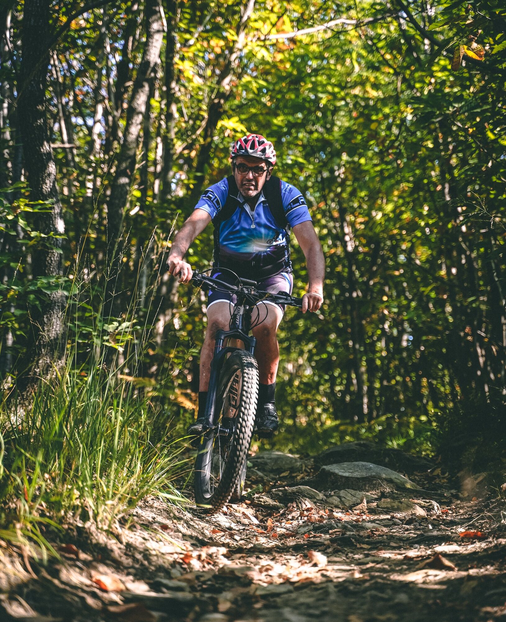
SAN SECONDO Upslowtour - Loop 14 Memory and partisan routes
Poziom trudności: 4
The loop winds through towns and hilly areas, on dirt roads, paths, and paved roads, crossing the municipalities of San Secondo di Pinerolo, Prarostino, Luserna San Giovanni, and Bricherasio. Along the...
The loop winds through towns and hilly areas, on dirt roads, paths, and paved roads, crossing the municipalities of San Secondo di Pinerolo, Prarostino, Luserna San Giovanni, and Bricherasio. Along the route, there are numerous monuments, plaques, and commemorative markers, including the “Lighthouse of Freedom” in Prarostino, built in the 1950s in memory of all the victims of Nazi fascism.
A route that allows you to discover the culture and environment of part of the municipalities of the lower Val Pellice, getting lost in its enchanting landscapes, its wooded areas and hills full of orchards and vineyards, but also to discover and retrace the history and events that characterized local life during the Second World War. A life made of clashes, shootings, roundups, and Resistance.
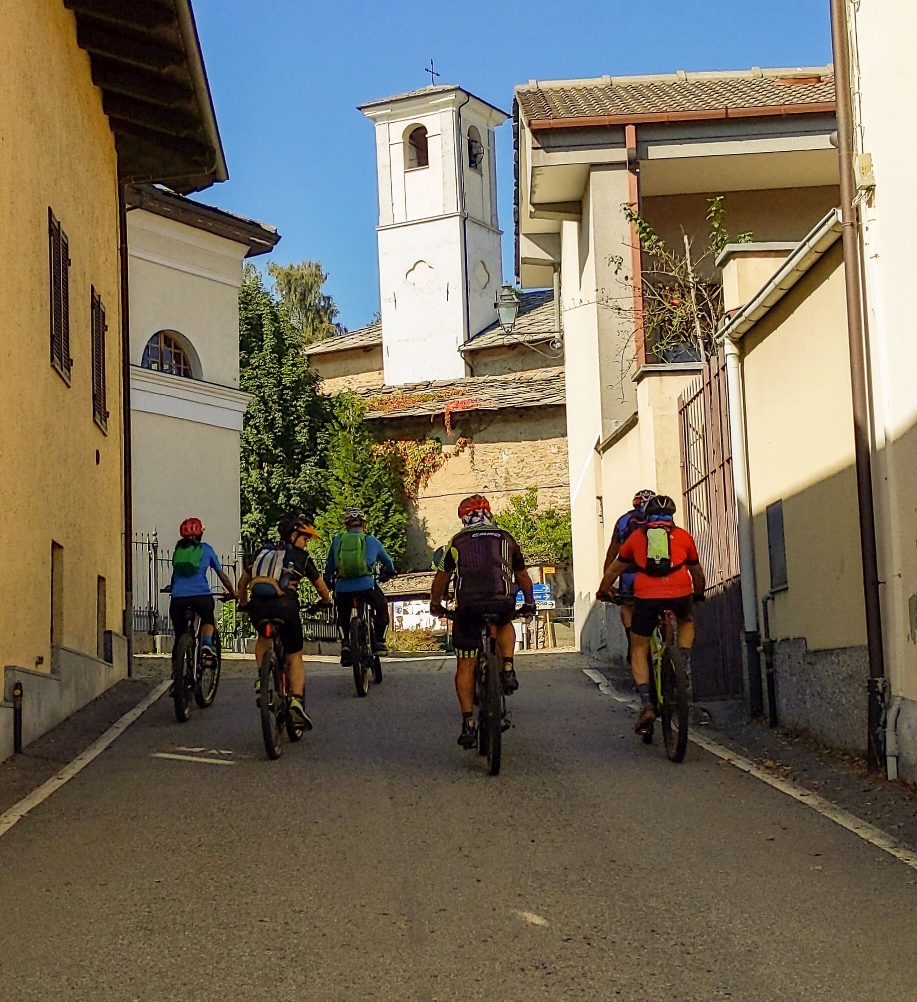
The route starts from Piazza Avis, in the center of San Secondo di Pinerolo, and passing in front of the town hall, you reach the intersection with Via Rol, where the Monument to the Fallen of the two world wars is located. Keep left to reach the Parish Church and the Avenue of Remembrance, then go down Via San Rocco turning left towards Miradolo.
After admiring the Church of Santa Maria Assunta, a 17th-century baroque building, continue along Via Colombini and Via Gay arriving at the hamlet Camussi (where the pillar in memory of the partisan Giuseppino Fossat is located), then turn left taking a dirt path that climbs steeply to reach the hamlet Gay of Prarostino (505 m a.s.l.).
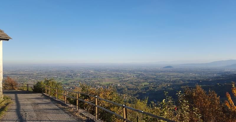
Turn left and follow the paved road that leads to the hamlet Pocapaglia, then to the right overcome another steep stretch reaching Via Collaretto (725 m a.s.l). The road continues with a slight climb, allowing you to enjoy a splendid view of the hamlets of Prarostino and the Pinerolo plain, from which emerges the unmistakable silhouette of the Rocca di Cavour.
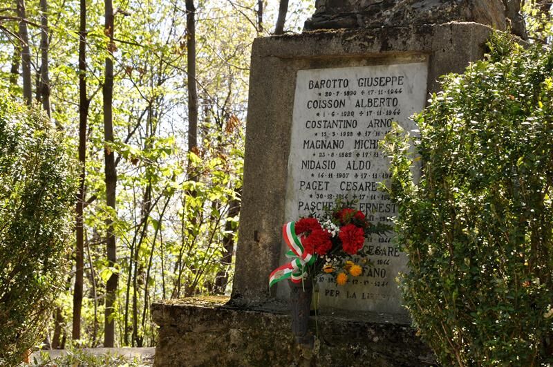
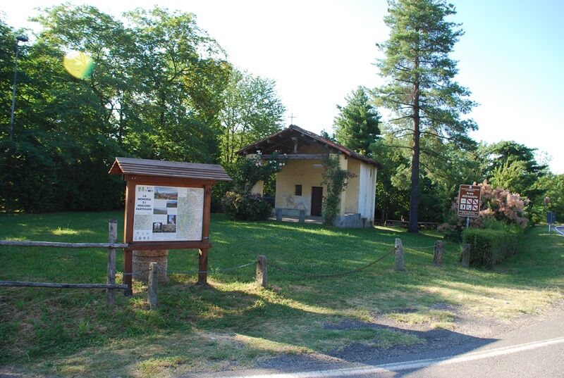
Thus, you arrive at San Bartolomeo (730 m a.s.l.), the main town of the Municipality of Prarostino, where the “Lighthouse of Freedom” is located, a monument dedicated to the over 600 fallen of the Pinerolo Resistance, erected here because it is clearly visible from the surrounding area, and because the first partisan group in the area was established in Prarostino. Here you can also refill water and, if necessary, recharge the e-bike battery at the free charging station near the town hall.
We descend slightly along Via Massera, then keep right finding the monument dedicated to the Martyrs of Bric (massacre that took place in November 1944 where nine civilians died at the hands of the Nazis). The road becomes a path that, with some ups and downs, arrives near the hamlet Badoni, then returns to the asphalt on Via Piani and then turns left into Strada Santa Caterina, which begins to descend steeply towards Bricherasio.
Paying attention to the signs, at a certain point turn right following a path that descends through the woods arriving at Pian Morero (here for a short stretch less experienced riders have to get off the bike). In the area there are entrances to some old graphite mines. The dirt road continues up to the hamlet Cuccia (555 m a.s.l.) from where, turning right, it descends along the Chiamogna Stream, arriving near the locality Cartera.
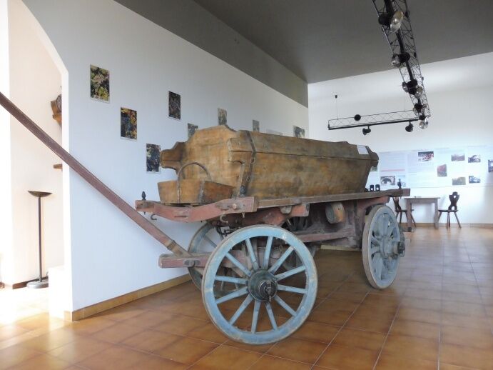
Turn left and take again a gravel track that, crossing fresh broadleaf woods, passes the hamlets Ciabot d’le Masche and Torretti, then always keeping left, crosses the Chiamogna Stream, arriving at the hamlet San Michele (400 m a.s.l.), where the Resistance Ecomuseum is located, a documentation center on the partisan war.
Following the signs, proceed towards the hamlet Cappella Moreri, then climb Strada Cesani Marciottina up to the hamlet Serborello (450 m a.s.l.) and continue on Strada Canavero, returning to the territory of the Municipality of San Secondo di Pinerolo. The route continues along the mid-slope on secondary roads: Via Rivoira Don, Via Marco Polo, and Via Lombarda, which quickly lead back to the starting point.
Appropriate clothing and equipment are recommended.
The trail section between Strada Santa Caterina and Strada Comba presents some technical difficulties and should be covered with caution.
From Turin, take the A55 motorway to Pinerolo, then follow the SP 161 of the Val Pellice for about 3 km and at the first roundabout turn right onto SP 165 for another 2 km arriving at the center of San Secondo di Pinerolo.
Alternatively, you can follow the ring road of Pinerolo up to the intersection with SP 164 of Prarostino and reach San Secondo (2.5 km) passing through the hamlet Miradolo.
After reaching Pinerolo by bus or train, it is possible to get to San Secondo di Pinerolo directly by bike in about 15 minutes (4.5 km) passing through the hamlet Miradolo.
It is also possible to start the loop route from Bricherasio, taking from Pinerolo the bus of the Arriva or Cavourese companies that reach the town center.
At the starting point of the route there are numerous free parking spaces.
4
For all details and updates on the route, you can visit the UPSLOWTOUR website or the LIVE INFO section.
Before undertaking any excursion, it is advisable to check the weather reports or inquire at the local Tourist Offices.
It is good practice not to undertake an excursion alone and always inform someone of your destination.
Do not litter in the environment but carry your waste with you, possibly collecting that left by others.
The indicated travel times are approximate and may vary depending on weather conditions, your abilities, and the type of bike used.
In the hamlet of San Bartolomeo there is a free e-bike charging point and a bike maintenance totem.
Rideability: 100%
Recommended direction: COUNTERCLOCKWISE
Technical difficulty MC/MC
Popularne wycieczki w okolicy
-
5,0
Invincibles valley - Alpe Caugis
Wędrówka 15,3 km -
BRICHERASIO The Via della Pietra
światłoKolarstwo długodystansowe 11,5 km -
PINEROLO Route to Monte Muretto
średniWędrówka 2,12 km -
BOBBIO PELICE Trekking in the hamlets and forests around Bobbio
średniWędrówka 7,72 km -
PRAROSTINO From Piani to Sonagliette and back - SLOWLY TOGETHER
światłoWędrówka 6,60 km -
TORRE PELLICE The Shepherds' Way
światłoMountainbike 11,0 km -
TORRE PELLICE Naturalistic trail "The Jay"
światłoWędrówka 10,2 km -
LUSERNA S.G. Upslowtour - Angrogna Valley Ring 11
średniJazda na rowerze 35,0 km -
TORRE PELLICE Hike to Bars d'la tajola (and Monte Castlus)
średniWędrówka 4,40 km -
VILLAR PELLICE Inverso path
światłoWędrówka 5,62 km
Wędrówki i tropienie


Nie przegap ofert i inspiracji na następne wakacje
Twój adres e-mail została dodana do listy mailingowej.