






VIU' Colle Pian Fium and Big Bench Mezzenile
Poziom trudności: S2
The tour starts from Alpe Bianca, a locality positioned on a dominant and scenic basin. From the esplanade, take the ex-military dirt track that climbs toward the Pian Fium Pass (1,999 m). This section...
The tour starts from Alpe Bianca, a locality positioned on a dominant and scenic basin. From the esplanade, take the ex-military dirt track that climbs toward the Pian Fium Pass (1,999 m). This section runs entirely along the ridge and is a true panoramic balcony. From the Pian Fium pass you descend on the same slope, then entering as a variant of a loop trail, the splendid alpine pastures of the Conca dei Tornetti. The landscape here is dominated by grasslands and old stone huts active in the summer for the production of Toma di Lanzo cheese. Colle della Dieta and Big Bench of Mezzenile variant: the trail intercepts the paved road that climbs from Viù and points toward the Colle della Dieta (1,459 m), a historic road pass that connects Viù to Mezzenile. The Big Bench of Mezzenile is located near the pass and directly overlooks the valley.From the pass area you return on the same road in the direction of the Conca degli Asciutti, you reach the characteristic hamlet of Tornetti (1,170 m) from which you face the last asphalt ascent that takes you back to the Alpe Bianca square with constant gradients.
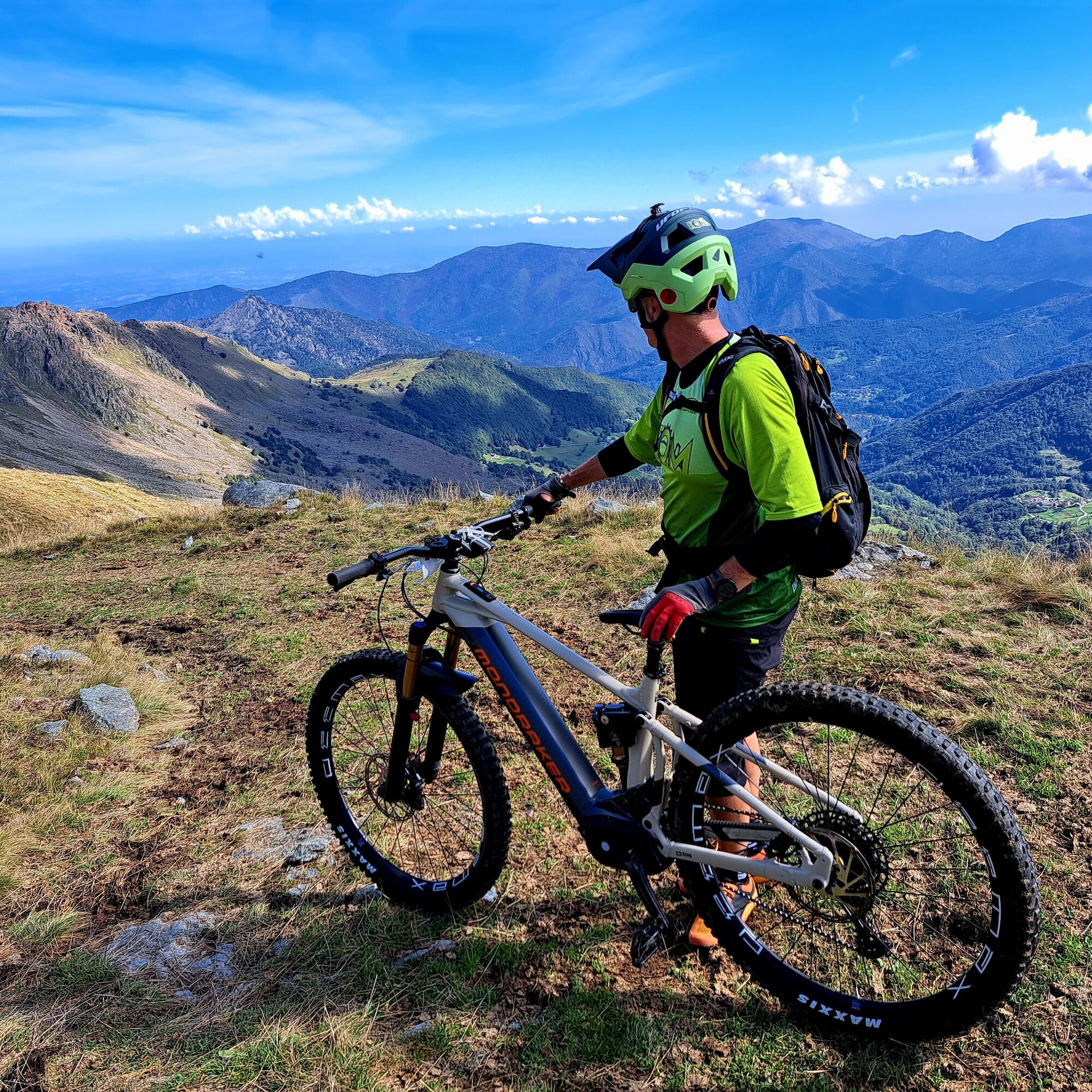

Type of terrain: Compact forest and inter-farm dirt roads (ex-military), secondary mountain asphalt sections (Colle della Dieta area) and trails/single-track in pastures and forest.
Difficulty (MTB): MC / BC (Medium / Good Cyclists - CAI Scale). From a technical point of view, it does not present extreme trialistic passages, but requires good vehicle control on fast mountain dirt roads and grassy trail sections.
Tak
Grazing Animals and Guard Dogs: The Conca dei Tornetti is an intensive alpine grazing area. If you encounter herds or flocks protected by herding dogs (Maremmani or Abruzzese), visibly slow down, don't yell, get off your bike and walk past them calmly, interposing the bike frame between you and the dog.
Water drainage ditches: On the dirt slopes from Colle Pian Fium and toward the Asciutti there are stone or metal cross channels for rain drainage. Tackle them at moderate speed while lifting the front wheel slightly to avoid pinching inner tubes or damaging rims.
Water Supply: You'll find very fresh water fountains at the hamlet of Tornetti and near some of the alpine pastures, but on the ridge section between Alpe Bianca and Pian Fium there is no water; leave with water bottles already full.
n Car: From Turin, take the Tangenziale Nord and take the Venaria Reale or Caselle exit, following the SP2 to Lanzo Torinese. After passing Lanzo, follow the signs for Valle di Viù (SP1). Pass the village of Viù and, shortly after the center, follow the signs on the right indicating Polpresa/ Tornetti/ Alpe Bianca. The road goes up the mountain passing several hamlets until it ends at the large square of Alpe Bianca. (About 1 hour and 15 minutes from Turin).
Where to Park: The square at Alpe Bianca is immense, completely free and barrier-free, perfect for parking and packing your bicycles and backpack in comfort.
More practical alternative directly in the square of the hamlet of Tornetti
S2
The Visual Aspect: This imposing rock formation, which dominates the basin from above, is historically nicknamed "the little Dolomite of the Lanzo Valleys." The reason immediately jumps out at you: unlike the typically rounded, ice-smoothed shapes of the surrounding mountains, Rocca Moros soars with vertical limestone spires, craggy walls, and jagged gullies that are strikingly reminiscent of the profiles of the famous massifs of Trentino and Veneto.
Contrast in Landscape: As you ride along the pastoral basin, the visual contrast is magnificent. You'll switch in moments from the soothing green softness of high alpine pastures to the stark gray harshness of these rock walls that seem almost "out of place" in the context of the Western Graian Alps.
A Sentinel for Riders: For those who ride this loop by MTB, the silhouette of Rocca Moros serves as a constant visual and photographic landmark. On days when the fog rises, its spires cutting through the clouds create a ghostly and evocative atmosphere of rare alpine beauty.
This route represents the essence of pastoral and hiking mountain biking: it does not seek the thrill of extreme enduro descents, but rather the pleasure of high altitude travel, contact with the traditions of alpine pastoralism, and the geometric beauty of the landscapes of the Lanzo Valleys. The combination of the ex-military epic of Pian Fium and the playfulness of Mezzenile's Big Bench makes this loop extremely rewarding and suitable for a wonderful day in the saddle!
Popularne wycieczki w okolicy
-
5,0
BALME Green Lakes and Lago Paschiet
średniWędrówka 7,51 km -
CERES Santa Cristina Loop
średniWędrówka 7,84 km -
5,0
BALME Arnas Ring - Pian della Mussa
ciężkiWędrówka 13,6 km -
MONASTEROLO Ca' Bianca and Big Bench
światłoWędrówka 4,13 km -
COLLE DEL LYS Partisan Trail
średniWędrówka 11,6 km -
VALLO TORINESE Passo della Croce and the Turu
średniWędrówka 4,29 km -
5,0
LEMIE Ovarda Lakes loop
ciężkiWędrówka 15,9 km -
USSEGLIO Lake behind the Tower and of the Rossa
ciężkiWędrówka 17,1 km -
5,0
Alta Via delle Valli di Lanzo | Stage 4 Rifugio Citt di Ciri - Rifugio Cibrario
ciężkiWędrówka 12,0 km -
Grande Traversata delle Alpi - GTA: Central Piedmont Section
średniWędrówka 318,3 km
Wędrówki i tropienie


Nie przegap ofert i inspiracji na następne wakacje
Twój adres e-mail została dodana do listy mailingowej.





