


ALA DI STURA Pian Belfé - Punta Karfen - Alpe Lungimala
Poziom trudności: S3
The route covers significant inclines and high-altitude terrain that will thrill riders with excellent riding technique and E-MTB or Trail/Enduro biamped MTB. The tour kicks off from Ala di Stura's central...
The ascent to Pian Belfé and Punta Karfen.
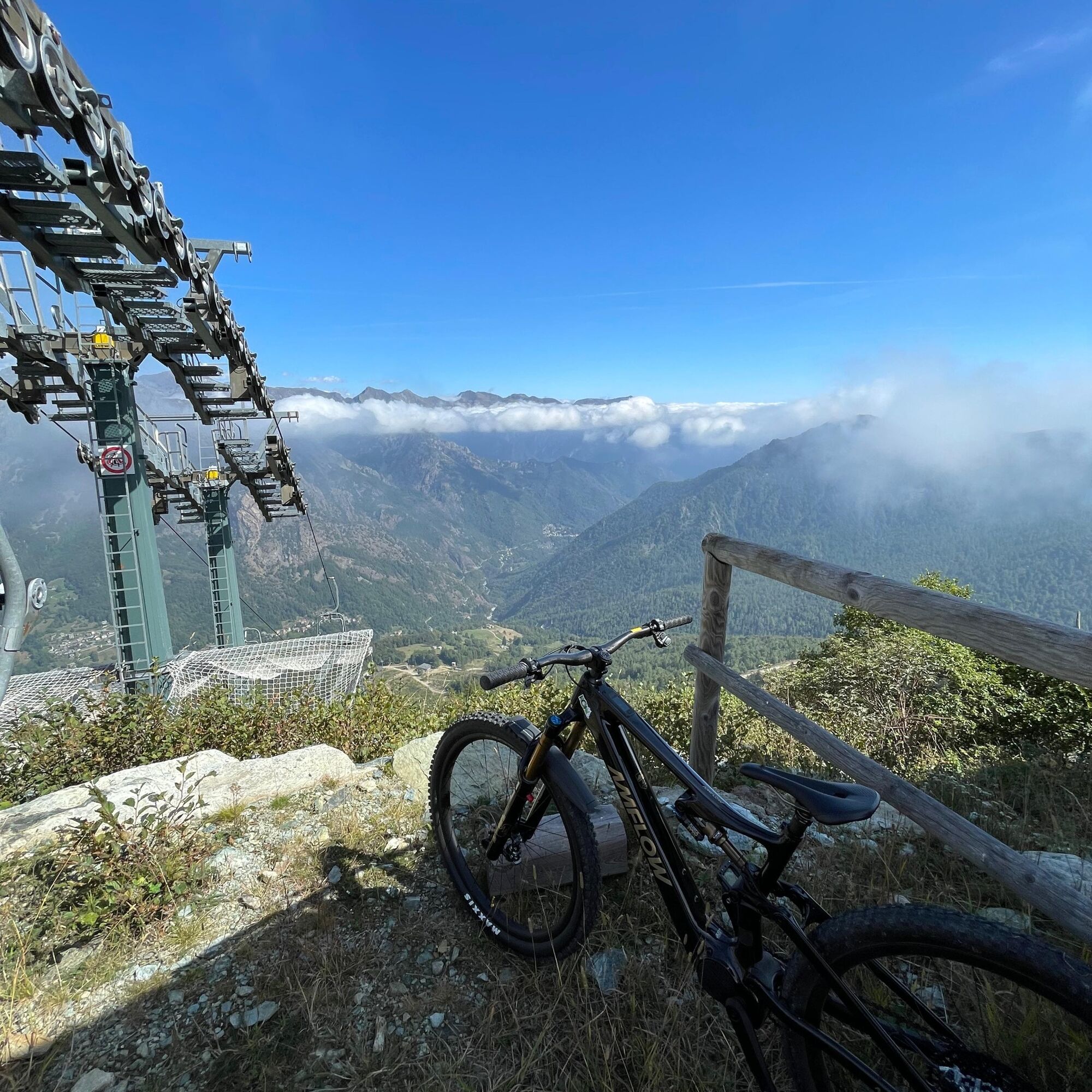
From the base of the chairlift, we take the inter-modal track up the mountainside, not before skirting the Stura di Ala and taking a few photo ops.
Pian Belfé (about 1,350 m): The climb into the forest is steady, but it is only a prelude to the next part. As the trees thin out you reach the pastures of Pian Belfé (chairlift arrival station).
Punta Karfen (1,940 m) - RECOMMENDED FOR EXPERIENCED PEDALATORS: Continuing up the service dirt road and the high altitude meadows, you reach the very panoramic ridge of Punta Karfen. Fatigue here disappears: your gaze literally plunges over the entire Val d'Ala, dominated by the majestic walls of Uja di Ciamarella and Bessanese in the background.
The Descent: Alpe di Lungimala Variant and the Brady Horses.
Donning the protective gear, the descent begins. The trail detours to take the spectacular variant that touches Lungimala Alp.
The peculiarity: This is an iconic place. The aerial pastures of the alpine meadow are historically home to wonderful herds of horses living in the wild during the summer and fall seasons. Pedaling carefully and respectfully among these beautiful animals, surrounded by the silence of the mountains, makes for a magical route.
The Technical Single Track and the Return.
From Alpe di Lungimala, the trail changes character and becomes a technical single track of high alpine school.
You face rock passages, tight turns (hairpin bends) and sections where line choice is key.
The guided trail again crosses the area of Pian Belfé (Alpe Belfé) and then dives into the last and exhilarating section in the forest that leads with pinpoint accuracy back to the base of the chairlift departure, from which you briefly ascend to the village square.
Type of terrain: Asphalt and compact dirt road in the low links, inter-farm dirt road and steep forestry on the uphill, alpine single-track on dirt, fixed rock, high altitude grasslands and technical sections in the undergrowth.
Difficulty (MTB): BC / OC (Good uphill / Excellent downhill cyclists - CAI Scale). Requires excellent vehicle mastery in the narrow and steep alpine rocky terrain.
Tak
Weather and Elevation: Karfen Peak is close to 2,000 meters in elevation. On these ridges, the weather can change in a matter of minutes, and fog can reset visibility to zero. Consult the weather report carefully and always carry a thermal/wind shell in your backpack.
Bottom and Undergrowth: The technical descent has fixed stones that require good bike frame protection and strong tires (preferably Enduro/Downhill reinforced casing to avoid cuts). In the undergrowth towards Pian Belfé, watch out for moisture and roots hidden by foliage.
Energy Management: The climb is a constant "wall" of nearly 1,000 meters of elevation gain without a breather. If you're using an E-MTB, don't overdo the assists in the first half lest you risk running out of gas right on the final ramps leading up to the Peak.
By Car: From Turin, take the Tangenziale Nord and take the Venaria Reale or Caselle exit, following the SP2 to Lanzo Torinese. After passing Lanzo, follow the signs for Val d'Ala / Balme (SP1). Drive up the valley past Pessinetto, Mezzenile and Ceres. Continue along the hairpin bends of the provincial road until you enter the town of Ala di Stura. (About 50 km, 1 hour's drive from Turin).
Where to Park: The ideal starting point is the main town square (Central Square / Town Hall Square). It has ample free parking (barring events), fountains, and is close to the village bars for the essential pre-departure coffee.
S3
This ride takes the title "His Eminence" not by chance. It is the perfect synthesis of Piedmontese cyclomountaineering: it combines the technicality of the trails, the ruggedness of the inclines, the majesty of the high-altitude views and that poetic encounter with the local wildlife at Alpe di Lungimala that will remain etched in your memories for a very long time.
When you arrive at the Punta Belfé station, veer directly toward Alpe Lungimala. From here return to the valley on the same route as the outward journey.
Popularne wycieczki w okolicy
-
5,0
CERESOLE REALE Bellagarda ponds
średniWędrówka 7,60 km -
5,0
BALME Green Lakes and Lago Paschiet
średniWędrówka 7,51 km -
CERES Santa Cristina Loop
średniWędrówka 7,84 km -
5,0
BALME Arnas Ring - Pian della Mussa
ciężkiWędrówka 13,6 km -
COLLE DEL LYS Partisan Trail
średniWędrówka 11,6 km -
VALLO TORINESE Passo della Croce and the Turu
średniWędrówka 4,29 km -
5,0
LEMIE Ovarda Lakes loop
ciężkiWędrówka 15,9 km -
5,0
Alta Via delle Valli di Lanzo | Stage 4 Rifugio Citt di Ciri - Rifugio Cibrario
ciężkiWędrówka 12,0 km -
Lake Dres - Ceresole Reale
średniWędrówka 7,24 km -
USSEGLIO Lake behind the Tower and of the Rossa
ciężkiWędrówka 17,1 km
Wędrówki i tropienie


Nie przegap ofert i inspiracji na następne wakacje
Twój adres e-mail została dodana do listy mailingowej.