





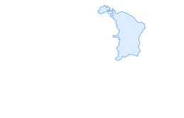

Helsana Trail Alt St. Johann Unterwasser blue

This Helsana Trail leads you from Alt St. Johann first along the Thur to Unterwasser, then follows a steep climb over the Alp road before you can enjoy a gentle run back to the starting point over alpine...
This Helsana Trail leads you from Alt St. Johann first along the Thur to Unterwasser, then follows a steep climb over the Alp road before you can enjoy a gentle run back to the starting point over alpine meadows and forests without major climbs. Throughout the entire loop, it also offers a magnificent view of the Alpstein with Säntis and Wildhuser Schofberg.



This Helsana Trail leads you from Alt St. Johann first along the Thur to Unterwasser, then follows a steep climb over the Alp road before you can enjoy a gentle run back to the starting point over alpine meadows and forests without major climbs. Throughout the entire loop, it also offers a magnificent view of the Alpstein with Säntis and Wildhuser Schofberg.
Possibly a light running backpack (about 5 to 10 liters) with rain cover, trail running shoes, possibly special running socks, weather-appropriate and breathable clothing in a layering system, possibly trail running poles, sun and rain protection, provisions and drinking water, first aid kit, pocket knife, mobile phone, possibly headlamp and reflectors, map material
During the winter months, this trail is not accessible.
Take the A3 at Reichenburg towards Rapperswil and then via the Ricken Pass to Wattwil. Then continue up the Toggenburg to Alt St. Johann. From Eastern Switzerland:
From St. Gallen to Herisau and further over the Wasserfluh to Lichtensteig. Or from St. Gallen to Wil, take the Toggenburg exit. Follow the main road to Alt St. Johann. From the southern German area:
Via Bregenz and St. Margrethen on the A13 to Haag, then take the exit towards Toggenburg/Wildhaus. Or via Konstanz to Wil, then take the Toggenburg exit and follow the main road to Alt St. Johann.
By train to Nesslau-Neu St. Johann or Buchs SG, then by post bus to the stop "Alt St. Johann Dorf".
At the valley station of the Sellamattbahn, paid parking spaces are available.
Toggenburg Tourism
Hauptstrasse 104
9658 Wildhaus
Tel.: +41 (0) 71 999 99 11
Email: info@toggenburg.swiss
Web: www.toggenburg.swiss
This trail is also ideal for an evening round.
Kamery internetowe z trasy

Popularne wycieczki w okolicy
-
4,8
Walensee Riviera Weesen - Quinten
średniWędrówka 10,2 km -
4,7
Riviera Lake Walen Walenstadt-Quinten
średniWędrówka 10,4 km -
4,6
Weesen - Quinten - Walenstadt
ciężkiWędrówka 20,6 km -
5,0
Staubern-Runde (15.8.2021)
średniWędrówka 8,65 km -
4,9
Säntis-Gipfeltour, Wasserauen / Appenzell Innerrhoden
ciężkiWędrówka 21,1 km -
4,8
Tour Brülisau - Saxerlücke - Hoherkasten⛰
ciężkiWędrówka 16,6 km -
4,6
Wasserauen - Seealpsee - Wasserauen
średniWędrówka 7,71 km -
4,5
7-Peak Tour Flumserberg
ciężkiWędrówka 15,0 km -
4,6
Säntis
średniWycieczki górskie 17,5 km -
4,9
Alpine and Cultural Trail Schrina
średniTrasa tematyczna 11,5 km
Wędrówki i tropienie


Nie przegap ofert i inspiracji na następne wakacje
Twój adres e-mail została dodana do listy mailingowej.





