
GR® de Pays Routes in Mountains & Lakes in Haut-Languedoc - Between Gijou and Raviège
ciężki
Pobierz tę trasę na swój telefon komórkowy
GR® de Pays Routes in Mountains & Lakes in Haut-Languedoc - Between Gijou and Raviège
ciężki
Wędrówka
78,20
km
Zeskanuj kod QR i rozpocznij nawigację w aplikacji bergfex.


Wędrówki i tropienie




GR® de Pays Routes in Mountains & Lakes in Haut-Languedoc - Between Gijou and Raviège
ciężki
Odległość
78,20
km
Czas trwania
21:15
h
Ascent
2 063
hm
Poziom morza
514 -
1 155
m
Ścieżka do pobrania
GR® de Pays Routes in Mountains & Lakes in Haut-Languedoc - Between Gijou and Raviège
ciężki
Wędrówka
78,20
km
From this diversity of environments, the Gijou valley retains a wild tonality, a showcase for a preserved and protected fauna, such as the European Otter. Marked by the old railway line "du Petit Train...
Opis
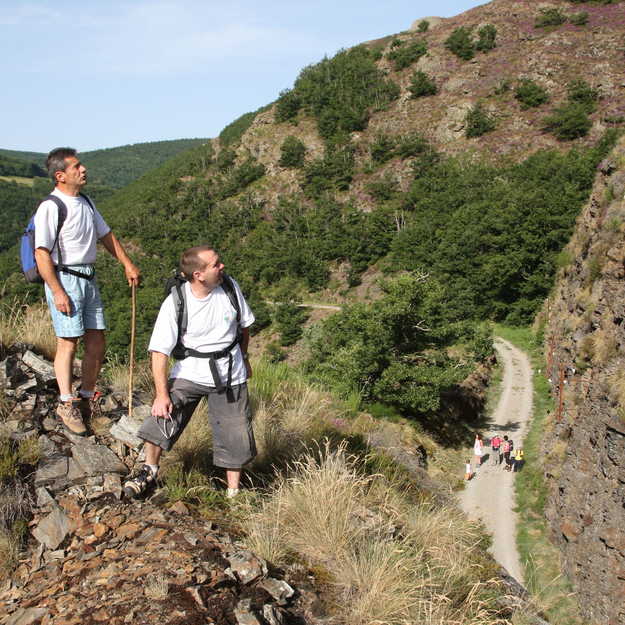
From this diversity of environments, the Gijou valley retains a wild tonality, a showcase for a preserved and protected fauna, such as the European Otter. Marked by the old railway line "du Petit Train de Lacaune," it is also a place where History and stories intermingle.
Trasa
Lacaune
(798 m)
Wioska
0,4 km
Roc des Ecus
(1 074 m)
Szczyt
2,5 km
Col du Pradel
(915 m)
Siodełko górskie
13,7 km
Puech de Biège
(933 m)
Szczyt
49,2 km
Église Saint-Amans
(586 m)
Miejsce kultu
58,9 km
Gijounet
(567 m)
Wioska
69,4 km
Lacaune
(798 m)
Wioska
78,1 km
Trasa
GR® de Pays Routes in Mountains & Lakes in Haut-Languedoc - Between Gijou and Raviège
ciężki
Wędrówka
78,20
km
Le Causse
(805 m)
Sąsiedztwo
0,0 km
Louradou
(791 m)
Sąsiedztwo
0,0 km
Prat de Lugan
(780 m)
Sąsiedztwo
0,0 km
Maresquier
(802 m)
Sąsiedztwo
0,3 km
Lacaune
(798 m)
Wioska
0,4 km
À la Maison
(805 m)
Restauracja
0,5 km
Peyruc
(815 m)
Sąsiedztwo
0,8 km
Roc des Ecus
(1 074 m)
Szczyt
2,5 km
Plo des Parcs
(1 154 m)
Korytarz/teren
4,8 km
Tastavy
(837 m)
Korytarz/teren
11,9 km
Les Barthèzes
(843 m)
Rozliczenie
12,3 km
Col d'Empy
(913 m)
Siodełko górskie
13,2 km
Col du Pradel
(915 m)
Siodełko górskie
13,7 km
La Végende
(766 m)
Rozliczenie
15,7 km
Grualgues
(689 m)
Rozliczenie
16,9 km
Église Saint-Étienne
(708 m)
Miejsce kultu
19,1 km
La Salvetat-sur-Agout
(698 m)
Wioska
19,5 km
Calas
(675 m)
Rozliczenie
23,4 km
Mas d'Azaïs
(722 m)
Rozliczenie
26,3 km
Lamontélarié
(821 m)
Wioska
39,9 km
Le Margnès
(801 m)
Wioska
43,0 km
Lassouts
(812 m)
Rozliczenie
47,9 km
Puech de Biège
(933 m)
Szczyt
49,2 km
Puech du Singladou
(1 023 m)
Szczyt
51,3 km
Berlats
(597 m)
Wioska
56,9 km
Église Saint-Amans
(586 m)
Miejsce kultu
58,9 km
La Vitarelle
(577 m)
Rozliczenie
58,9 km
Combes
(629 m)
Korytarz/teren
59,4 km
Saussonnières
(613 m)
Rozliczenie
60,3 km
Carayon
(614 m)
Rozliczenie
64,4 km
Gijounet
(567 m)
Wioska
69,4 km
Les Peyrels
(596 m)
Korytarz/teren
69,5 km
Grotte de la Garrigue
(746 m)
Wejście do jaskini
74,6 km
A Fordo Blanc
(759 m)
Korytarz/teren
75,8 km
Farayuc
(786 m)
Rozliczenie
76,1 km
Bernique
(792 m)
Sąsiedztwo
77,4 km
Louradou
(791 m)
Sąsiedztwo
77,6 km
Prat de Lugan
(780 m)
Sąsiedztwo
77,6 km
Lacaune
(798 m)
Wioska
78,1 km
Le Causse
(805 m)
Sąsiedztwo
78,1 km
Autor
Dostarczone przez Tarn Tourisme


Informacje o trasie
Trasa
> The stage from Lacaune to La Salvetat-sur-Agout (18.5 km - 5h30 – yellow and red markings):
Point 1: From the Tourist Office, go up rue de la Balme to place du Général de Gaulle. Pass in front of the town hall and reach place de la Vierge.
Point 2: Climb rue de la Murette. At the top, before D607, turn left onto chemin des Castels. At the next fork, turn right, then go up a small path lined with holly. About 600 m further, reach a gravel path which is taken for a few meters before turning left onto a trail. At the end, make a left-right onto a small road to continue on a “draille” (an old path used for sheep transhumance) lined with flagstones. At the next junction, go straight ahead. The trail then turns right and climbs steeply towards roc des Écus.
Point 3: Go straight on the first trail on the left, lined with heather. In the forest, go down left onto a wide path, then follow the sandy track of the Plo des Parcs plateau, between pastures and beech woods.
Point 4: At the fork on the edge, turn left. Continue on the main track to a path start, on the left.
Point 5: Continue on the track, cross the Lunès bridge. The track runs alongside the Rieufrech stream. Further on, it turns right and reaches a junction.
Point 6: Leave the track for a trail on the right, still along the stream. Reach an intersection.
Point 7: Turn left and continue to Rieufrech (watch the markings) where a paved road is taken. Reach D62B at a small bridge. Take this road to the right, pass Tastavy, then enter the Barthèzes.
Point 8: Cross the hamlet turning right to follow an old road leading to Col d’Empy (913 m). At the top, pass a holiday center and take the track on the right crossing the pass and descending onto the Pradel plateau (915 m).
Point 9: Continue straight on a trail joining La Végende. Cross the hamlet.
Point 10: Back on the road (D150E5), turn left onto a path, then right at the next intersection to reach Grualgues. Find D150E5 and take it to the left. Reach D150; turn right. Just before the junction with D907, turn left to cross the Vèbre. At the end of the bridge, continue straight. The trail moves away from the road to skirt pastures, cross a thicket, and emerge onto a small road. Cross it and continue straight to reach, behind the gendarmerie, a junction.
> The stage from La Salvetat-sur-Agout to Calas bridge (4.5 km - 1h15 – white and red markings):
Point 11: Climb right. Go down opposite, cross the next street and continue descending. At the low wall facing the meadows, go left. Cross the stream and climb the stairs. Reach rue Camin de la Font, then climb right to the War Memorial.
Point 12: Enter the historic center passing under the archway, rue de la Poterne. Before Saint-Albin church, turn left onto rue des Consuls. Pass the Tourist Office at place des Archers. Go left onto rue de la Plateforme. Turn right then continue right on cours du Viguier. At the end of the street, continue left on rue des Compagnons. Immediately turn right onto rue de Montarnaud. Left, go down rue de la Portanelle to the road. Turn left onto D907 opposite the town hall. Turn right onto place Compostelle and a few meters further, turn left onto chemin du Redoundel. Continue straight, pass the stadium. At the junction, turn right. Continue on the road then path and, at the fork, climb left. Before the hamlet of Marcouls, continue right on a hairpin bend and climb in the undergrowth. Reach a junction, follow the path left to a road. Turn right, pass behind the Salvetat factory, and reach the hamlet of Lassoubs. Continue along the grassy path between houses and enter the woods above the meadows. Follow the trail descending to a small road. Turn left and walk a few meters to the departmental road.
> The stage from Calas bridge to La Sagnotte (11 km – 2h45 – yellow and red markings):
Point 13: Cross Calas bridge and turn left on a small road leading to Calas. Continue alongside the lake and reach Gua des Brasses. At the end of the road, go right on a path between two houses. Leave a side path to the left and climb to D14E3; take it left for 100 m toward Lamontélarié. Turn right to reach Mas d’Azais.
Point 14: Cross the hamlet on the main street. At the right hairpin, go left on a path alongside a meadow. At a cleared area, climb an old trail lined with slabs. Join the track at Peyre Besse. On the left, it passes in front of a house, then opens onto a meadow. Go right then descend left on the track. Reach a junction by a reservoir.
Point 15: Ignore all left side paths and climb the track through the woods. At a bracken field, stay on the main route, then skirt a meadow to reach Gareaux. Before the houses, pass right around an “S” bend. Continue on a path bordered by stone walls. Reach above the Rec Rouge valley, descend and ignore a path on the right. Continue descending to a track. Turn right to join Vialanove. In the hamlet, pass between two ruins.
Point 16: Turn left on a trail. It crosses a valley. At the crossroads, continue straight leaving those to the right. Reach a fork, descend left. Continue on a boxwood-bordered trail, leave a path on the left and emerge at a fork. Point 17: Go straight on. At the calvary, go straight ahead. Keep close to the right, then climb left on a path. Continue straight. Leave the wide path and descend left on a trail, then on a disused stretch of road. It opens onto D62. Follow it right to the road junction of D62 and D52, at La Sagnotte.
> The stage from La Sagnotte to Puech Roucous (5 km – 1h15 – yellow and red markings):
Point 18: Start on a natural ascending path. About 100 m further, follow a path on the right and continue straight to the forest edge. Take a path on the right, 40 m further. Circle Camarios on the right and emerge on a bend of a track.
Point 19: Take it left to Larreloc. Before the house, turn right to descend the winding path to Sicardens ruins. Continue to the road, near Brizaude. Go right and, at the next junction, turn right again. Pass Lande Haute and follow right a path cutting two road hairpins, below Puech Roucous.
> The stage from Puech Roucous to Caillé-Haut (10.5 km – 2h35 – yellow and red markings):
Point 20: Continue straight on the path. Back on the road, turn right towards Lamontélarié. Reach an electrical transformer.
Point 21: Turn left to D66; cross it to continue straight on. Ignore the first left intersection and stay on main path until a road taken left. Pass Oustalanau and cross Rieumalet.
Point 22: After the last building in the hamlet, turn right on a path to descend to D66 which is followed right for about 400 m before turning left towards Barthas.
Point 23: Turn right on a path joining a small road at Lagrange entrance; follow it left to a bridge crossing Falcou stream.
Point 24: Just after the bridge, climb right on a stoned and paved track. Reach Bartassade. Turn left, pass under farm buildings. After a right-left bend, the path enters the woods. At first intersection, turn right. Leave a trail on left and continue in forest, under Belvère (895 m) and Plo de Vermillou (882 m). Reach a crossroads.
Point 25: Turn left and reach Lassouts. Cross the hamlet leaving the road to Prat Lautié on the left.
Point 26: Shortly after leaving hamlet, turn left on a path lined with walls. The forest briefly gives way to a meadow landscape before entering woods again. At the first crossroads, stay on the main path, right then left a few meters later to reach the Caillé-Haut cross.
> The stage from Caillé-Haut to Berlats (7.8 km - 2h – yellow and red markings):
Point 27: Cross the road to climb the track alongside a wind turbine field. At forest edge, take left path, then right among firs to climb Puech du Singladou (1023 m). At the summit, follow the track right to the next junction. Point 28: Descend left on the main road ignoring paths for about 2 km. Reach a crossroads.
Point 29: Turn right to join D622 which is taken left for about 80 m before turning right onto a passable track. Cross a path and continue on the track along Puech Carbonniès (842 m). Reach the start of a left bend.
Point 30: Go straight on a path that soon runs along the west side of Puech de la Pallet (788 m) and descend to Berlats.
> The stage from Berlats to La Roseraie (9.2 km – 2h15 – yellow and red markings):
Point 31: From the Berlats War Memorial parking, follow D154 right towards Béguinié. In front of the hamlet houses, turn left. At the castle, turn right then straight on. Turn left at the next fork. Reach a crossroads.
Point 32: Take left path descending to Vitarelle.
Point 33: At the church, turn right to go around the cemetery and follow the ascending path to D55. At the shed, turn right to reach hamlet of Nel.
Point 34: Leave the road and pass left between buildings. Continue in a hollow path to Estang, then follow a road right to directly reach Saussonnières.
Point 35: At the first hamlet junction, leave a small square on the right and cross the hamlet following the road. Further on, reach a junction with a triangular traffic island. Follow the road left and emerge in a bend on D54; follow left for around 80 m.
Point 36: Climb right on a passable track. At the monuments, turn right on main road ignoring other paths on both sides along the next kilometer. Reach a fork.
Point 37: Take the left way. At the next crossroads, on the forest’s edge, turn right and continue on the trail descending towards Carayon, bypassing a wooded hillock. Find D54 and take it left for about 120 m.
Point 38: Enter a boxwood-bordered trail ignoring the next path on left. Descend to emerge onto a small road which is followed left to D81; follow left to a small bridge over the Gijou, at a place called La Roseraie.
> The stage from La Roseraie to Lacaune (12.2 km – 3h – yellow and red markings):
On GR de Pays > towards Viane – 1 km – 15 min Continue straight along D81 on the pedestrian side road.
Point 39: Cross the bridge over Gijou and reach a junction. Turn right towards Feignatol, then follow a quarry and find D81. Continue on it for about 500 m.
Point 40: Climb left towards a parking of the Greenway to follow for over 8 km. After a long wooded section, reach the old Gijounet station.
Point 41: Continue on the Greenway which winds with the curves of the Gijou. Pass through two tunnels and two viaducts at the Gourp Fumant site. Continue on the path of the old railway line. Further on, cross D81, keep direction to emerge on a road near Oustalous. Cross and leave the Greenway by going left a few meters.
Point 42: Descend the path towards Farayruc. At the first houses, take the descending trail. Cross Recouzines stream, then the Gijou, leave a path on the right and skirt north of Puech du Maés (859 m). At the end, find D81 at a place called l’Ouradou. Take D81 (rue René Cassin) right to enter Lacaune. At the roundabout, turn right and via rue de la Balme reach the Tourist Office.
Point 1: From the Tourist Office, go up rue de la Balme to place du Général de Gaulle. Pass in front of the town hall and reach place de la Vierge.
Point 2: Climb rue de la Murette. At the top, before D607, turn left onto chemin des Castels. At the next fork, turn right, then go up a small path lined with holly. About 600 m further, reach a gravel path which is taken for a few meters before turning left onto a trail. At the end, make a left-right onto a small road to continue on a “draille” (an old path used for sheep transhumance) lined with flagstones. At the next junction, go straight ahead. The trail then turns right and climbs steeply towards roc des Écus.
Point 3: Go straight on the first trail on the left, lined with heather. In the forest, go down left onto a wide path, then follow the sandy track of the Plo des Parcs plateau, between pastures and beech woods.
Point 4: At the fork on the edge, turn left. Continue on the main track to a path start, on the left.
Point 5: Continue on the track, cross the Lunès bridge. The track runs alongside the Rieufrech stream. Further on, it turns right and reaches a junction.
Point 6: Leave the track for a trail on the right, still along the stream. Reach an intersection.
Point 7: Turn left and continue to Rieufrech (watch the markings) where a paved road is taken. Reach D62B at a small bridge. Take this road to the right, pass Tastavy, then enter the Barthèzes.
Point 8: Cross the hamlet turning right to follow an old road leading to Col d’Empy (913 m). At the top, pass a holiday center and take the track on the right crossing the pass and descending onto the Pradel plateau (915 m).
Point 9: Continue straight on a trail joining La Végende. Cross the hamlet.
Point 10: Back on the road (D150E5), turn left onto a path, then right at the next intersection to reach Grualgues. Find D150E5 and take it to the left. Reach D150; turn right. Just before the junction with D907, turn left to cross the Vèbre. At the end of the bridge, continue straight. The trail moves away from the road to skirt pastures, cross a thicket, and emerge onto a small road. Cross it and continue straight to reach, behind the gendarmerie, a junction.
> The stage from La Salvetat-sur-Agout to Calas bridge (4.5 km - 1h15 – white and red markings):
Point 11: Climb right. Go down opposite, cross the next street and continue descending. At the low wall facing the meadows, go left. Cross the stream and climb the stairs. Reach rue Camin de la Font, then climb right to the War Memorial.
Point 12: Enter the historic center passing under the archway, rue de la Poterne. Before Saint-Albin church, turn left onto rue des Consuls. Pass the Tourist Office at place des Archers. Go left onto rue de la Plateforme. Turn right then continue right on cours du Viguier. At the end of the street, continue left on rue des Compagnons. Immediately turn right onto rue de Montarnaud. Left, go down rue de la Portanelle to the road. Turn left onto D907 opposite the town hall. Turn right onto place Compostelle and a few meters further, turn left onto chemin du Redoundel. Continue straight, pass the stadium. At the junction, turn right. Continue on the road then path and, at the fork, climb left. Before the hamlet of Marcouls, continue right on a hairpin bend and climb in the undergrowth. Reach a junction, follow the path left to a road. Turn right, pass behind the Salvetat factory, and reach the hamlet of Lassoubs. Continue along the grassy path between houses and enter the woods above the meadows. Follow the trail descending to a small road. Turn left and walk a few meters to the departmental road.
> The stage from Calas bridge to La Sagnotte (11 km – 2h45 – yellow and red markings):
Point 13: Cross Calas bridge and turn left on a small road leading to Calas. Continue alongside the lake and reach Gua des Brasses. At the end of the road, go right on a path between two houses. Leave a side path to the left and climb to D14E3; take it left for 100 m toward Lamontélarié. Turn right to reach Mas d’Azais.
Point 14: Cross the hamlet on the main street. At the right hairpin, go left on a path alongside a meadow. At a cleared area, climb an old trail lined with slabs. Join the track at Peyre Besse. On the left, it passes in front of a house, then opens onto a meadow. Go right then descend left on the track. Reach a junction by a reservoir.
Point 15: Ignore all left side paths and climb the track through the woods. At a bracken field, stay on the main route, then skirt a meadow to reach Gareaux. Before the houses, pass right around an “S” bend. Continue on a path bordered by stone walls. Reach above the Rec Rouge valley, descend and ignore a path on the right. Continue descending to a track. Turn right to join Vialanove. In the hamlet, pass between two ruins.
Point 16: Turn left on a trail. It crosses a valley. At the crossroads, continue straight leaving those to the right. Reach a fork, descend left. Continue on a boxwood-bordered trail, leave a path on the left and emerge at a fork. Point 17: Go straight on. At the calvary, go straight ahead. Keep close to the right, then climb left on a path. Continue straight. Leave the wide path and descend left on a trail, then on a disused stretch of road. It opens onto D62. Follow it right to the road junction of D62 and D52, at La Sagnotte.
> The stage from La Sagnotte to Puech Roucous (5 km – 1h15 – yellow and red markings):
Point 18: Start on a natural ascending path. About 100 m further, follow a path on the right and continue straight to the forest edge. Take a path on the right, 40 m further. Circle Camarios on the right and emerge on a bend of a track.
Point 19: Take it left to Larreloc. Before the house, turn right to descend the winding path to Sicardens ruins. Continue to the road, near Brizaude. Go right and, at the next junction, turn right again. Pass Lande Haute and follow right a path cutting two road hairpins, below Puech Roucous.
> The stage from Puech Roucous to Caillé-Haut (10.5 km – 2h35 – yellow and red markings):
Point 20: Continue straight on the path. Back on the road, turn right towards Lamontélarié. Reach an electrical transformer.
Point 21: Turn left to D66; cross it to continue straight on. Ignore the first left intersection and stay on main path until a road taken left. Pass Oustalanau and cross Rieumalet.
Point 22: After the last building in the hamlet, turn right on a path to descend to D66 which is followed right for about 400 m before turning left towards Barthas.
Point 23: Turn right on a path joining a small road at Lagrange entrance; follow it left to a bridge crossing Falcou stream.
Point 24: Just after the bridge, climb right on a stoned and paved track. Reach Bartassade. Turn left, pass under farm buildings. After a right-left bend, the path enters the woods. At first intersection, turn right. Leave a trail on left and continue in forest, under Belvère (895 m) and Plo de Vermillou (882 m). Reach a crossroads.
Point 25: Turn left and reach Lassouts. Cross the hamlet leaving the road to Prat Lautié on the left.
Point 26: Shortly after leaving hamlet, turn left on a path lined with walls. The forest briefly gives way to a meadow landscape before entering woods again. At the first crossroads, stay on the main path, right then left a few meters later to reach the Caillé-Haut cross.
> The stage from Caillé-Haut to Berlats (7.8 km - 2h – yellow and red markings):
Point 27: Cross the road to climb the track alongside a wind turbine field. At forest edge, take left path, then right among firs to climb Puech du Singladou (1023 m). At the summit, follow the track right to the next junction. Point 28: Descend left on the main road ignoring paths for about 2 km. Reach a crossroads.
Point 29: Turn right to join D622 which is taken left for about 80 m before turning right onto a passable track. Cross a path and continue on the track along Puech Carbonniès (842 m). Reach the start of a left bend.
Point 30: Go straight on a path that soon runs along the west side of Puech de la Pallet (788 m) and descend to Berlats.
> The stage from Berlats to La Roseraie (9.2 km – 2h15 – yellow and red markings):
Point 31: From the Berlats War Memorial parking, follow D154 right towards Béguinié. In front of the hamlet houses, turn left. At the castle, turn right then straight on. Turn left at the next fork. Reach a crossroads.
Point 32: Take left path descending to Vitarelle.
Point 33: At the church, turn right to go around the cemetery and follow the ascending path to D55. At the shed, turn right to reach hamlet of Nel.
Point 34: Leave the road and pass left between buildings. Continue in a hollow path to Estang, then follow a road right to directly reach Saussonnières.
Point 35: At the first hamlet junction, leave a small square on the right and cross the hamlet following the road. Further on, reach a junction with a triangular traffic island. Follow the road left and emerge in a bend on D54; follow left for around 80 m.
Point 36: Climb right on a passable track. At the monuments, turn right on main road ignoring other paths on both sides along the next kilometer. Reach a fork.
Point 37: Take the left way. At the next crossroads, on the forest’s edge, turn right and continue on the trail descending towards Carayon, bypassing a wooded hillock. Find D54 and take it left for about 120 m.
Point 38: Enter a boxwood-bordered trail ignoring the next path on left. Descend to emerge onto a small road which is followed left to D81; follow left to a small bridge over the Gijou, at a place called La Roseraie.
> The stage from La Roseraie to Lacaune (12.2 km – 3h – yellow and red markings):
On GR de Pays > towards Viane – 1 km – 15 min Continue straight along D81 on the pedestrian side road.
Point 39: Cross the bridge over Gijou and reach a junction. Turn right towards Feignatol, then follow a quarry and find D81. Continue on it for about 500 m.
Point 40: Climb left towards a parking of the Greenway to follow for over 8 km. After a long wooded section, reach the old Gijounet station.
Point 41: Continue on the Greenway which winds with the curves of the Gijou. Pass through two tunnels and two viaducts at the Gourp Fumant site. Continue on the path of the old railway line. Further on, cross D81, keep direction to emerge on a road near Oustalous. Cross and leave the Greenway by going left a few meters.
Point 42: Descend the path towards Farayruc. At the first houses, take the descending trail. Cross Recouzines stream, then the Gijou, leave a path on the right and skirt north of Puech du Maés (859 m). At the end, find D81 at a place called l’Ouradou. Take D81 (rue René Cassin) right to enter Lacaune. At the roundabout, turn right and via rue de la Balme reach the Tourist Office.
Nie ma jeszcze recenzji
Popularne wycieczki w okolicy
-
4,0
LAUZE HIKE
średniWędrówka 9,41 km -
HIDDEN HIKING TRAIL
średniWędrówka 17,5 km -
CAR TOURISTIC ROUTE - MONTS DE LACAUNE
światłoMotorrad 154,6 km -
CAR TOURISTIC ROUTE - THE LAKE ROUTE
światłoMotorrad 129,1 km -
The Payrac discovery trail
światłoWędrówka 1,79 km -
Cycle Route - C4 Around the Laouzas lake by bike
światłoDroga rowerowa 19,8 km -
From Laouzas to Montalet
ciężkiWędrówka 15,4 km -
Randonnée VTT Le Lac par l'Orée du Bois
ciężkiMountainbike 26,9 km -
La balade Monteliote
ciężkiWędrówka 13,0 km -
Frescati Mountain Bike Ride
średniMountainbike 24,1 km
Wędrówki i tropienie

Ponad 550.000 propozycji wycieczek, szczegółowe mapy i intuicyjny planer tras sprawiają, że aplikacja jest niezbędna dla wszystkich entuzjastów przyrody.

Nie przegap ofert i inspiracji na następne wakacje
Zapisz się do newslettera
Błąd
Wystąpił błąd. Spróbuj ponownie.
Dziękujemy za rejestrację
Twój adres e-mail została dodana do listy mailingowej.
Wycieczki po całej Europie
Austria
Szwajcaria
Niemcy
Włochy
Słowenię
Francja
Holandia
Belgia
Polska
Liechtenstein
Czechy
Słowacja
Hiszpania
Chorwacja
Bośnia i Hercegowina
Luksemburg
Andorra
Portugalia
Islandia
Wielka Brytania
Irlandia
Grecja
Albania
Macedonia Północna
Malta
Norwegia
Czarnogóra
Mołdawia
Kosowo
Węgry
San Marino
Rumunia
Estonia
Łotwa
Białoruś
Cypr
Litwa
Serbia
Bułgaria
Monako
Dania
Szwecja
Finlandia





