


MONT SAINT-BAUDILLE HIKE
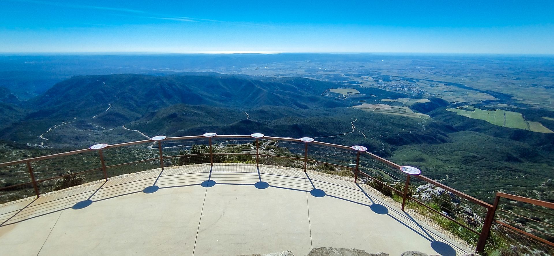
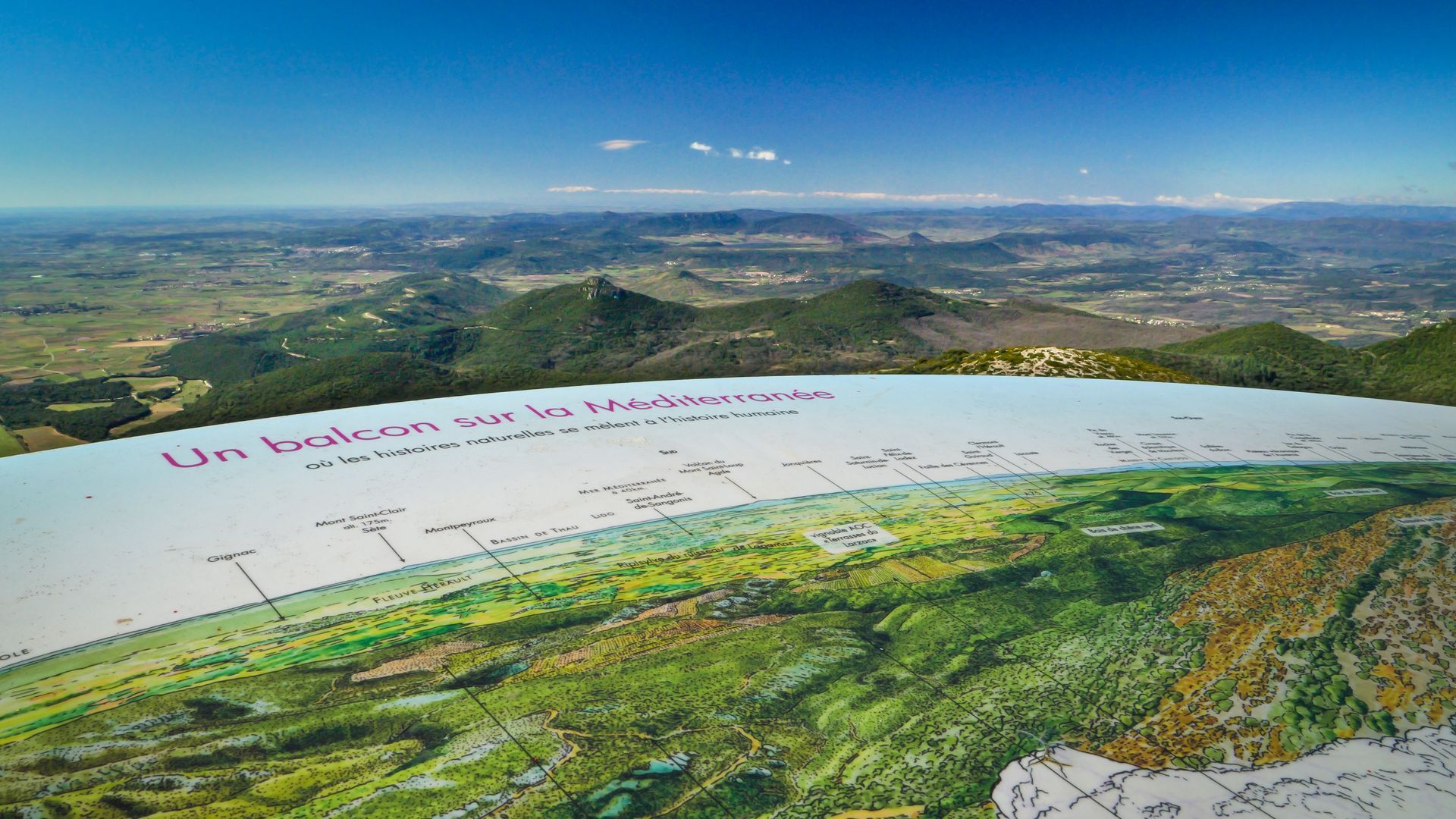
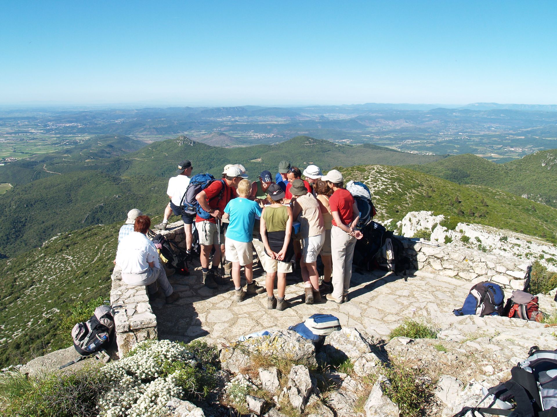
This route allows access to the viewpoint of Mont Saint-Baudille, one of the most beautiful panoramas in Hérault.At the summit, orientation tables make it possible to discover all the geotouristic units...
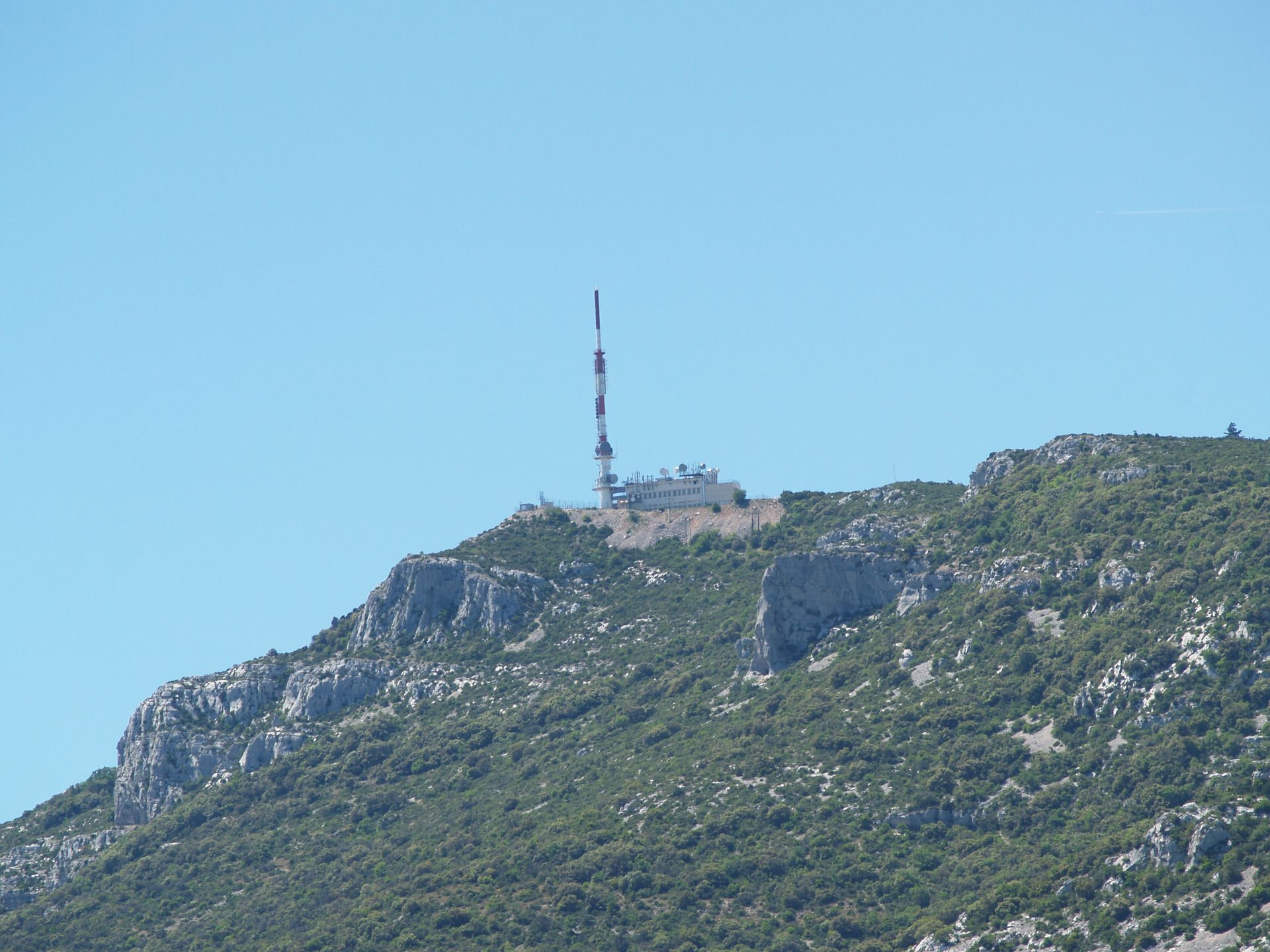
This route allows access to the viewpoint of Mont Saint-Baudille, one of the most beautiful panoramas in Hérault.
At the summit, orientation tables make it possible to discover all the geotouristic units of the Terres d'Hérault Geopark.
The route crosses the departmental estate of Font-de-Griffe and the limestone landscapes of Pioch Farrio.

1
1 - From the parking to the summit access of Mont Saint Baudille From the parking, go up the service road on the left for 100 m to reach the orientation table access.
2
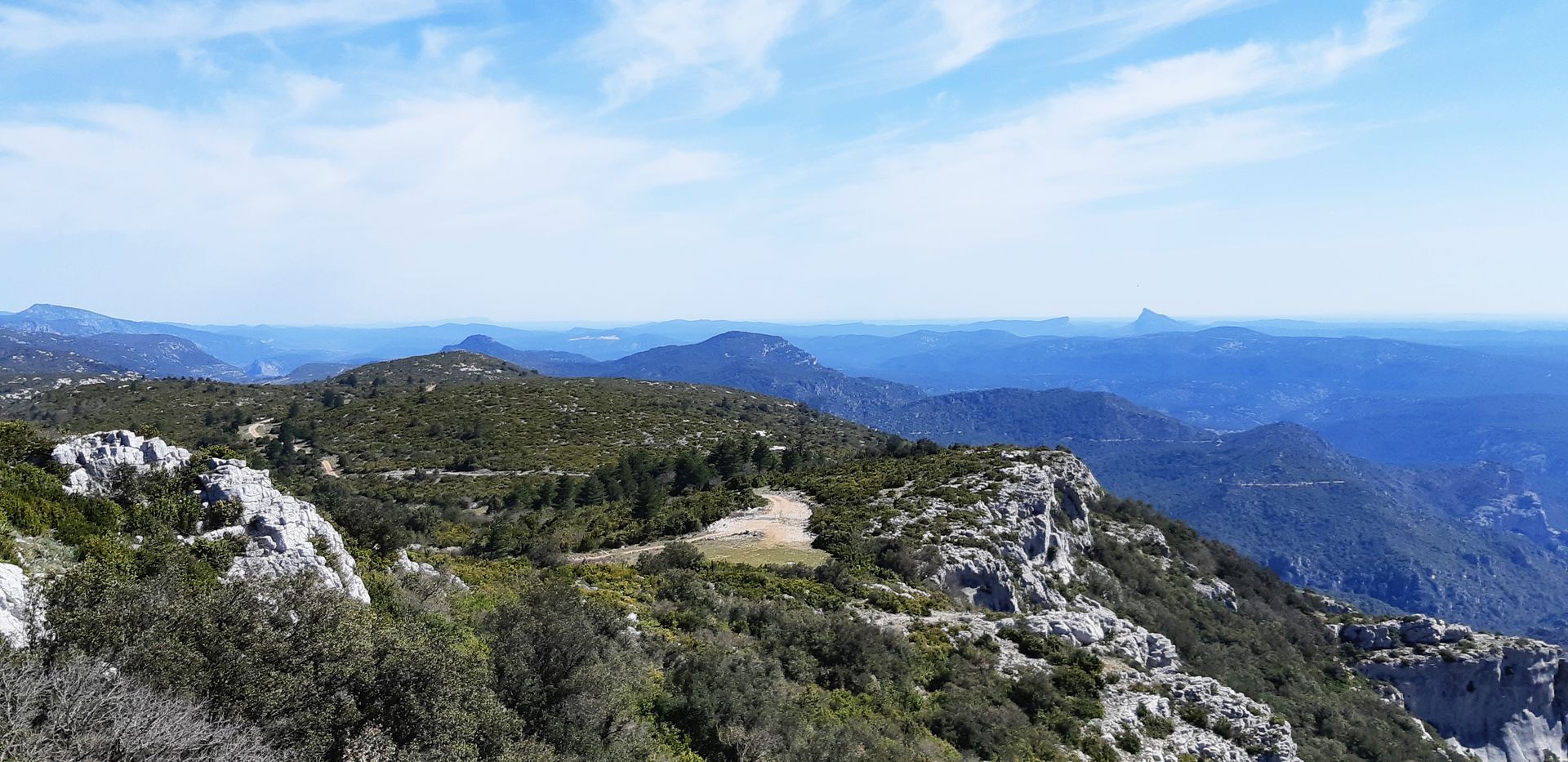
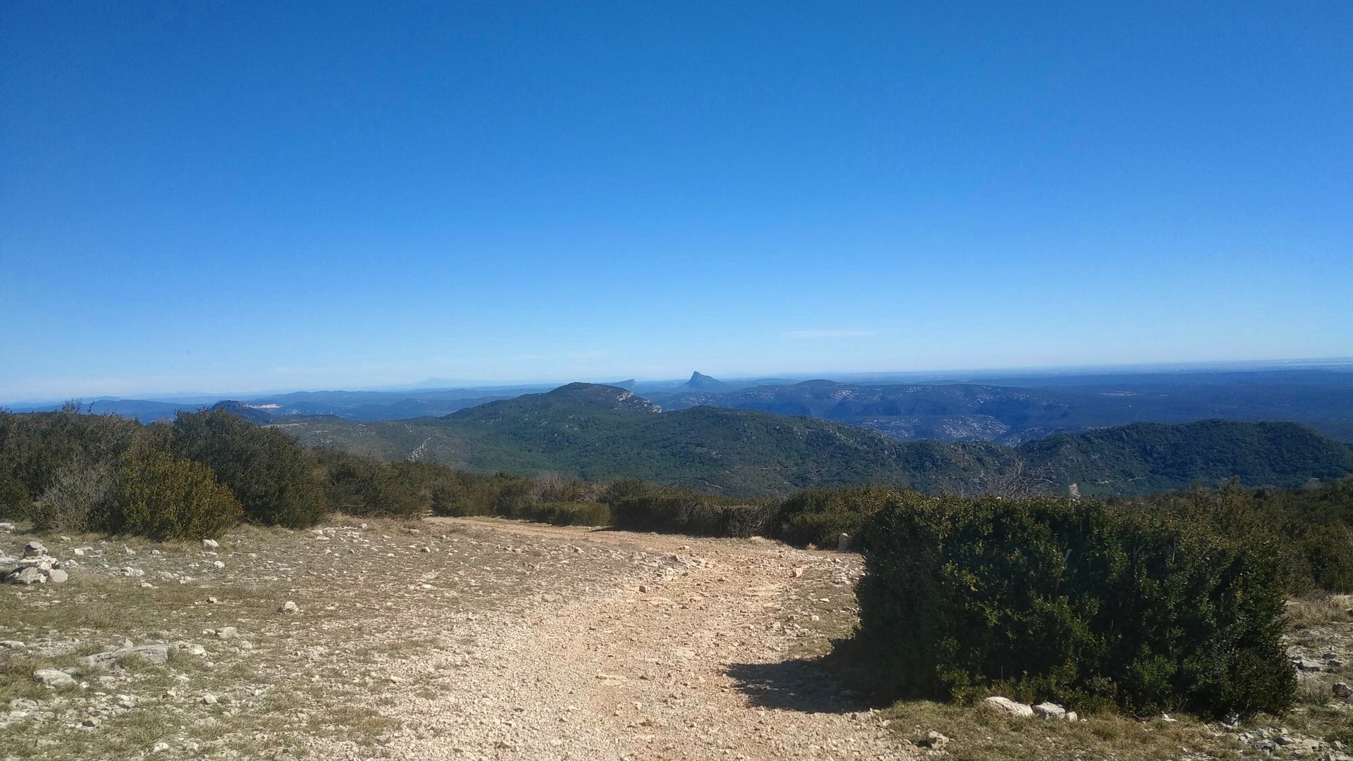
2 - From the viewpoint access to the Col de la Mulatière Access to the orientation table (yellow triangle marking): continue along the road, then go around the relay on the left alongside the fence. After admiring the panorama, retrace your steps then descend the rocky path along the ridge line and reach the Col de la Mulatière.
3
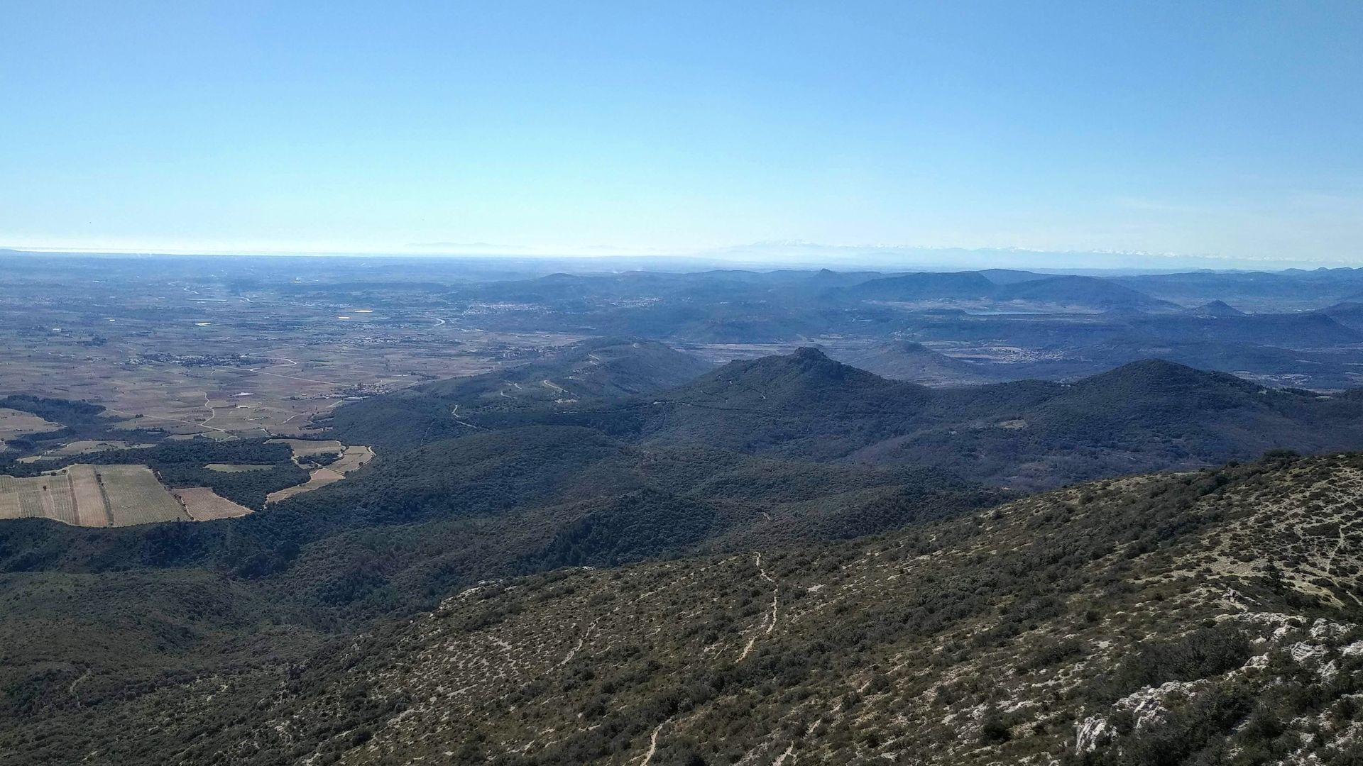
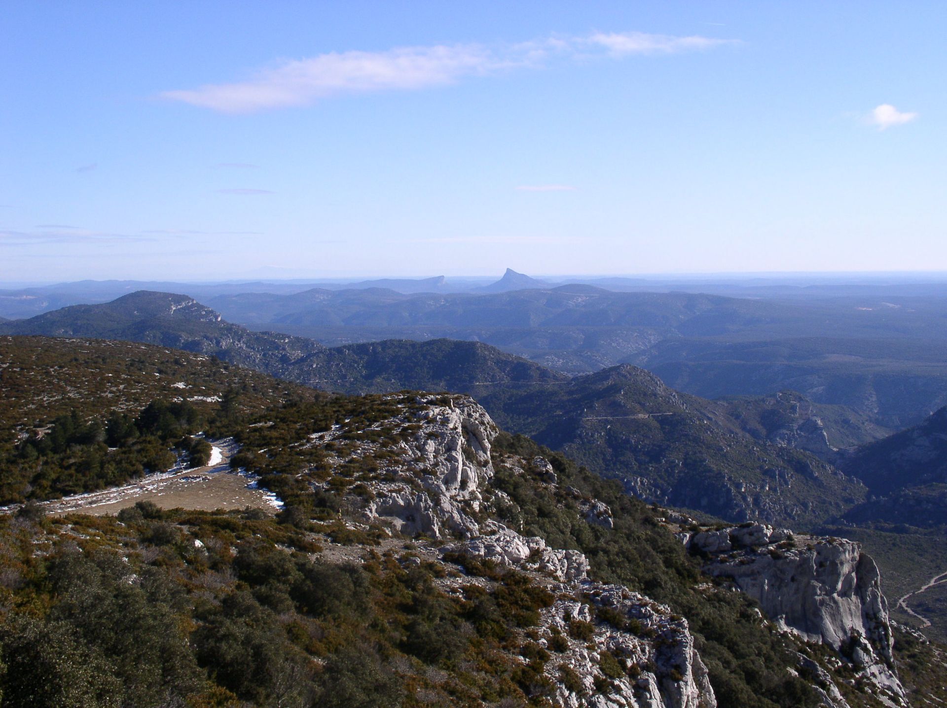
3 - From the Col de la Mulatière to the Font du Griffe At the col, turn left, go down the switchback path through the scrubland (viewpoint on the left of Pic Saint-Loup and the Hortus plateau, then the massif of Saint-Guilhem-le-Désert and the Hérault wine-growing plain on the right).
4
4 - The Font du Griffe and RD122 Take the track to the left and find the building of Font-du-Griffe. Join and take the D122 on the right for 2 km leaving several track starting points on the right.
5
5 - Path starting from RD122 towards the ridges Leave the road and take the path on the left which climbs on the side, go up a ravine on the left and reach a slight col.
6
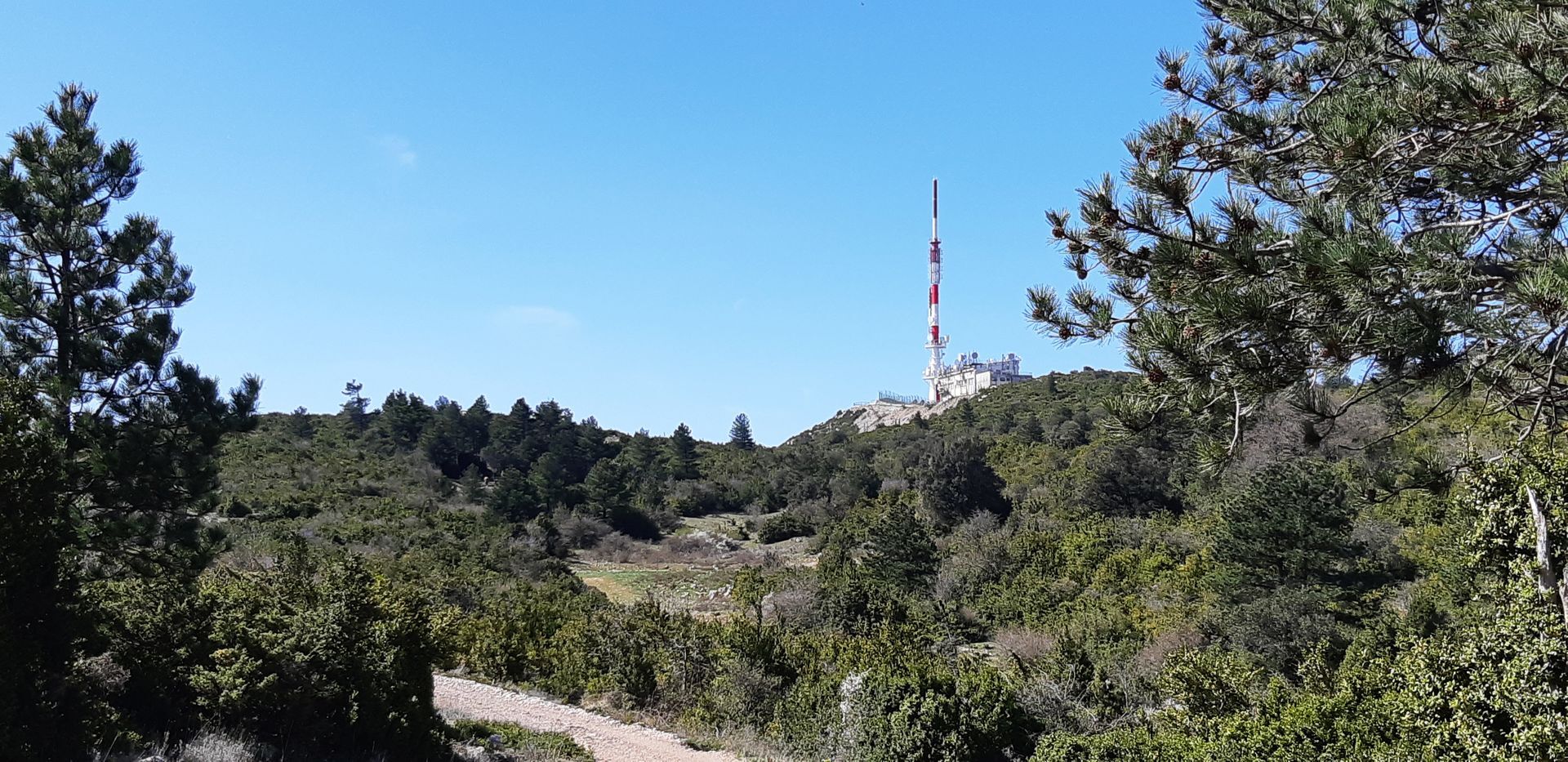
6 - On the Séranne ridges Take the track to the left. It passes north of Pioch Farrio and climbs gently for 3 km towards the radio relay. Return to the Mont Saint-Baudille parking lot.
7
7 - Return to the start Back at the start of the hike, don’t hesitate to climb back to the Mont Saint-Baudille viewpoint to see again the information panels on the Terres d'Hérault Geopark.
D122
D122
Rocky and technical descent between points 2 (access to the summit of Mont Saint-Baudille) and 4 (Font du Griffe)
Steep climb between points 5 (RD122) and (ridges)
Yellow PR
+33 4 67 57 58 83
Saint-Guilhem Tourist Office - Hérault Valley
PDESI
Popularne wycieczki w okolicy
- 5,0
LES VAILHÉS HIKING TRAIL
średniWędrówka 9,28 km - 5,0
CIRCUIT N°1 LE LAC DU SALAGOU - ESPACE VTT-FFC DU SALAGOU
średniMountainbike 26,9 km - 4,0
CYCLE LOOP No.4 - THE HÉRAULT GORGES AND THE COL DES LAVAGNES
średniJazda na rowerze 53,3 km RANDONNEE DE PEYRE MARTINE
średniWędrówka 15,4 kmHIKING OF THE FENESTRETTES
średniWędrówka 10,4 kmNAVACELLES HIKE - CAUSSE AND VIS GORGES
średniWędrówka 19,6 kmTRAIL OF THE TOUR OF LAKE SALAGOU (SHORES OF CLERMONT) - GR® OF THE REGION BETWEEN 2 LAKES Avène – Salagou
średniTrailrunning 25,6 kmHIKING TOUR IN THE HEART OF THE CAUSSE - GR® DE PAYS TOUR DU LARZAC MÉRIDIONAL
średniWędrówka 56,7 kmHIKING OF THE BALCONIES OF THE HERAULT
średniWędrówka 17,9 kmCAYROUX HIKE
średniWędrówka 11,5 km

Wędrówki i tropienie


Nie przegap ofert i inspiracji na następne wakacje
Twój adres e-mail została dodana do listy mailingowej.