


HIKING TOUR IN THE HEART OF THE CAUSSE - GR® DE PAYS TOUR DU LARZAC MÉRIDIONAL
WARNING (information April 2025): Following a collapse of the path on the GR® 7, the route is impassable through the gorges of the Vis between St-Maurice-Navacelles and the hamlet of Navacelles. The connection...
This hike is one of the 4 loops of the GR® de Pays Tour du Larzac Méridional that crosses the southern Larzac plateau, between Hérault and Aveyron.
A beautiful 3-day hike accessible to any regular walker, discovering exceptional landscapes and heritage.
Listed as a UNESCO World Heritage Site (Causses and Cévennes, Cultural Landscape of Mediterranean Agropastoralism), Larzac is rich in historical and natural heritage.
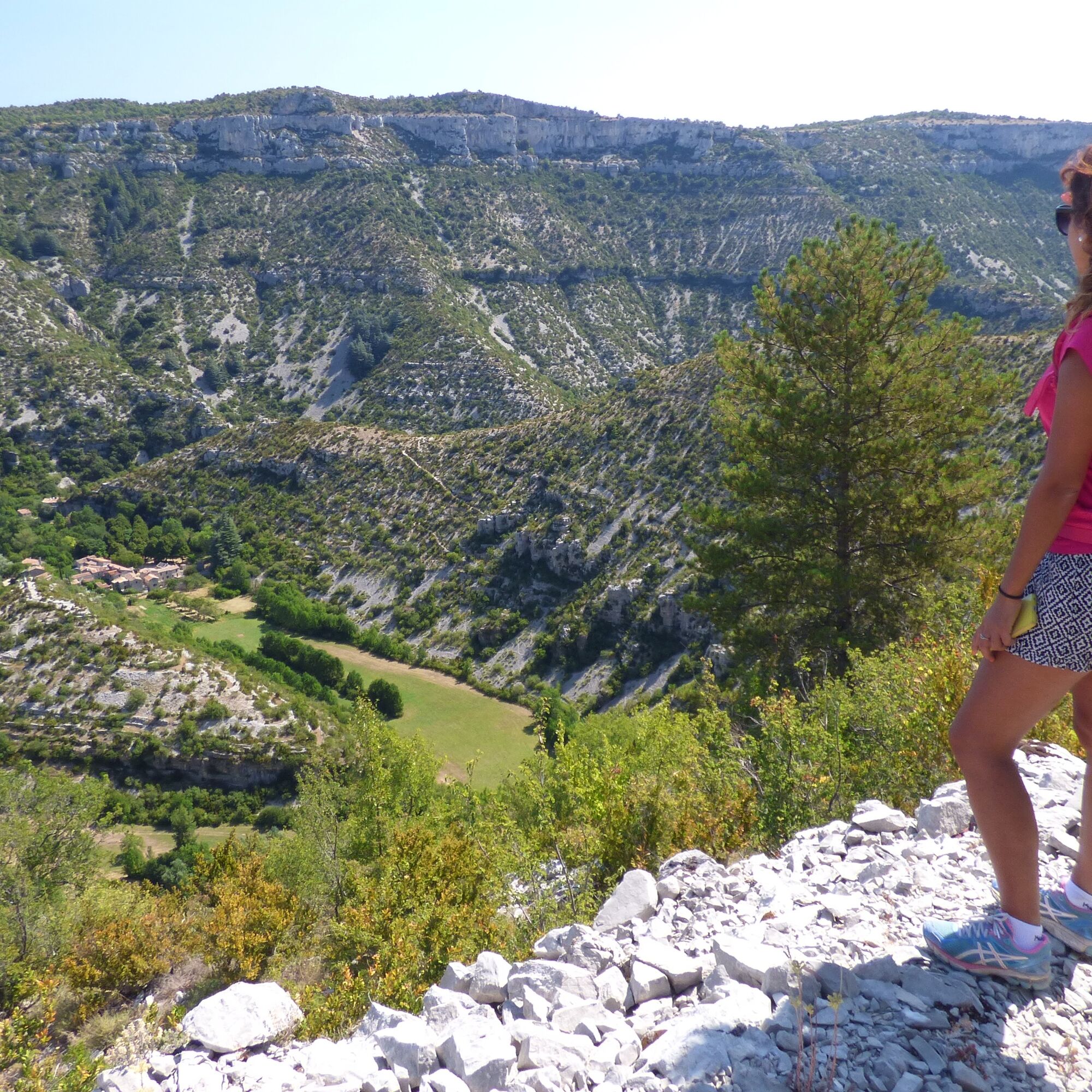
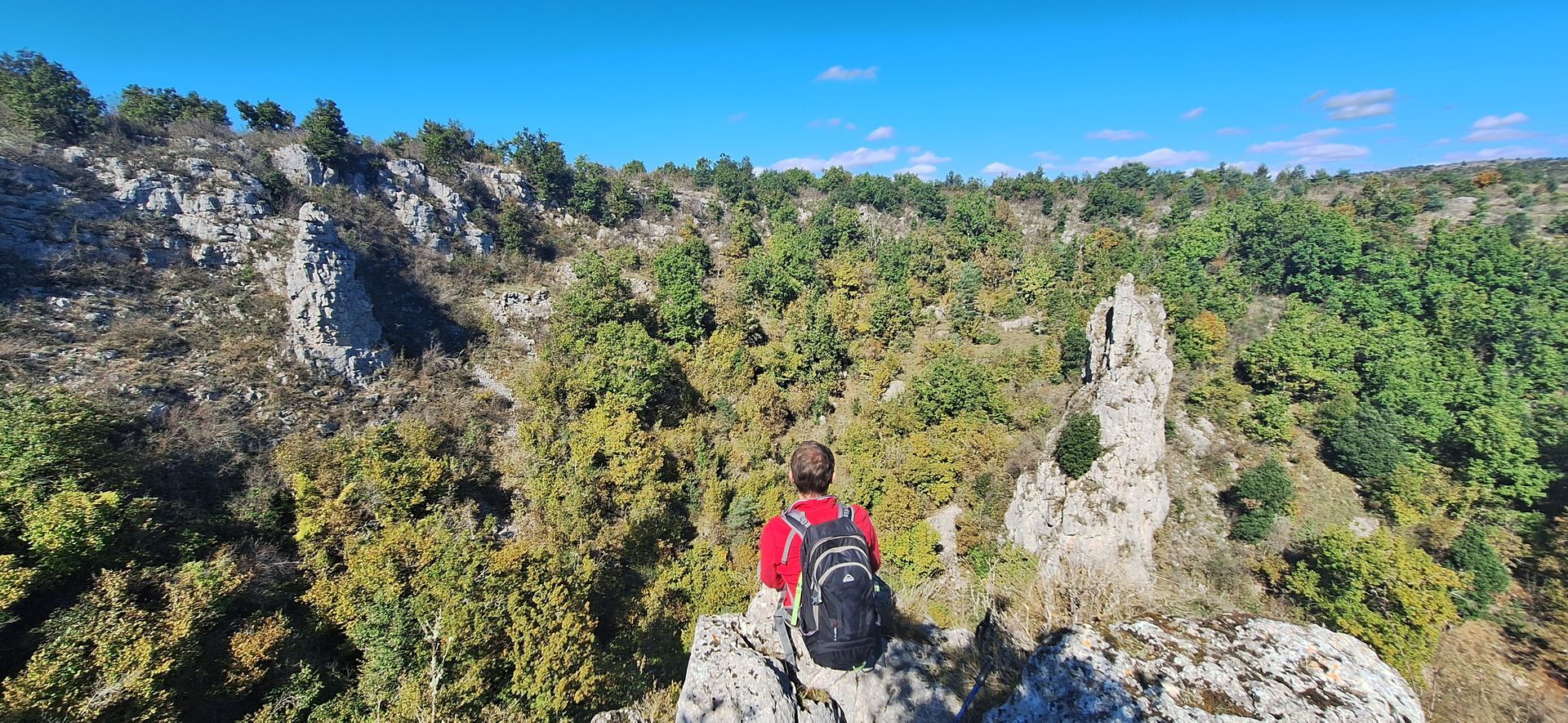
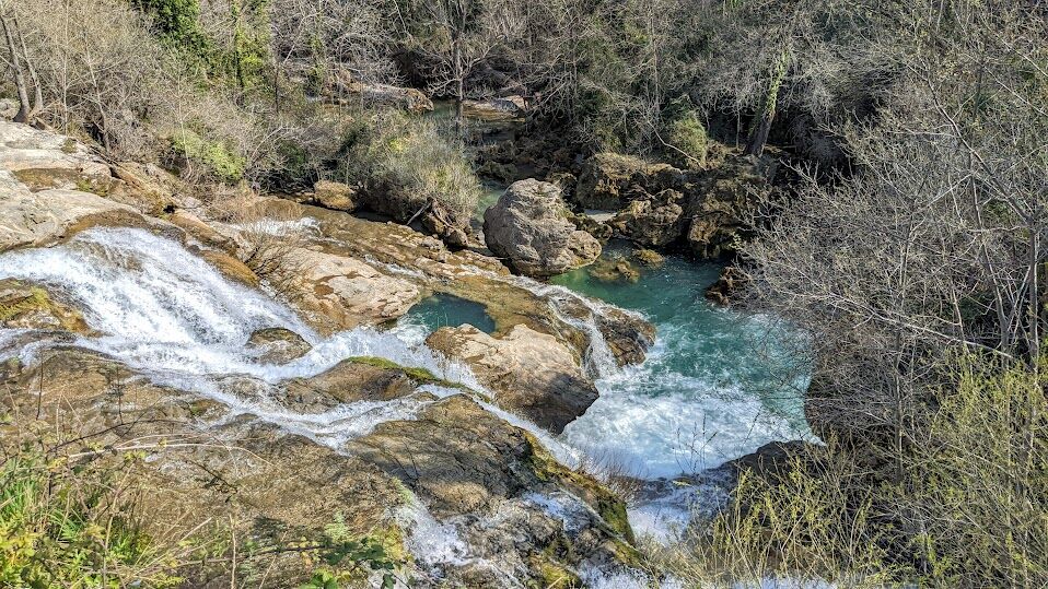
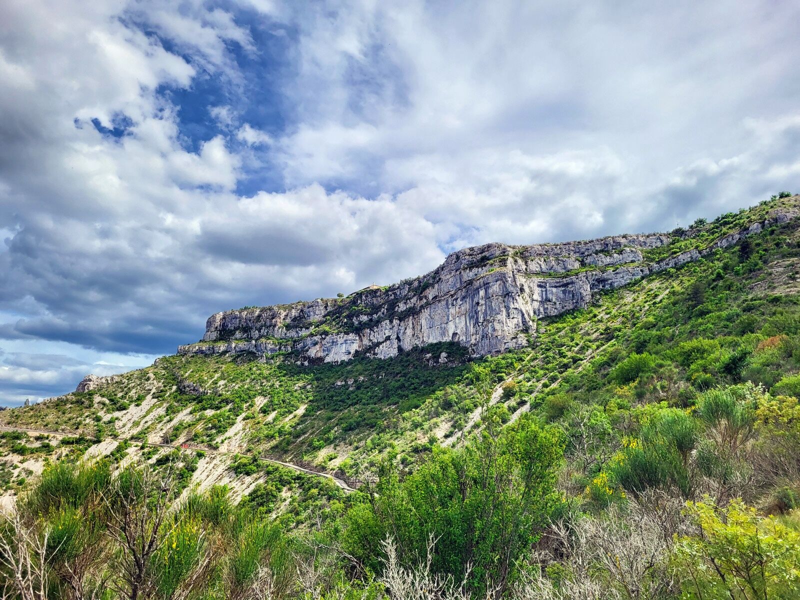
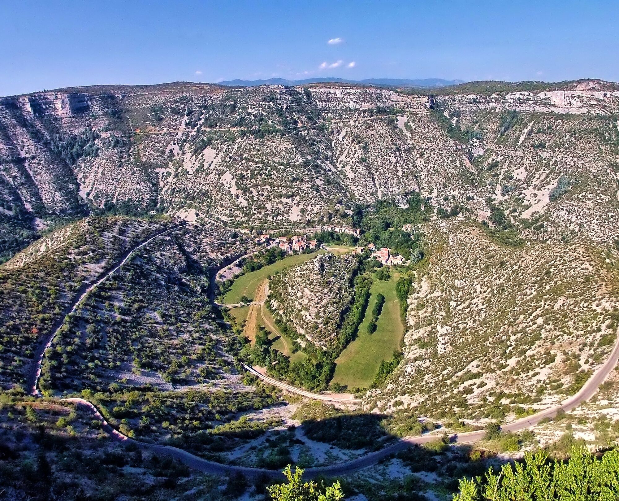
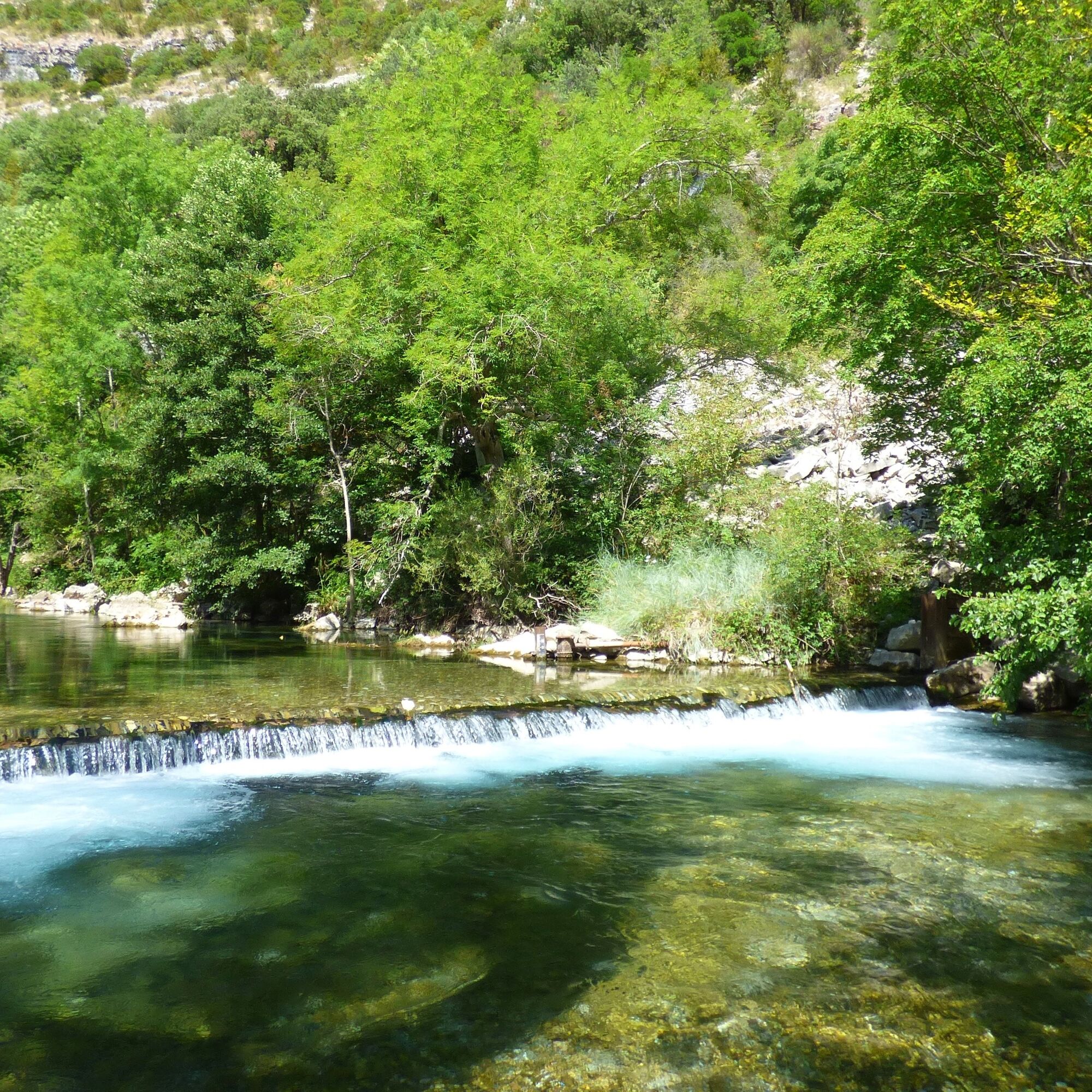
The route takes hikers through remarkable natural sites, notably the Cirque de Navacelles, labeled Grand Site de France, where the Vis river has sculpted a spectacular meander. The path winds along the Vis gorges, offering breathtaking views of the cliffs, then crosses the causse discovering geological formations of the Geopark Terres d'Hérault (cirques, causses, sotchs...).
The picturesque villages of Navacelles, Vissec, Sorbs, Saint-Pierre-de-la Fage, and La Vacquerie punctuate the route, allowing discovery stops.


1
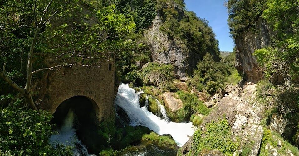
STAGE 1: SAINT-MAURICE-NAVACELLES - VISSEC - From the parking lot, go back towards D 25 and cross it. Reach the calvary square, follow the castle on the right and exit Saint-Maurice-Navacelles to join the GR® de Pays Tour du Larzac Méridional, heading North (Cirque de Navacelles) following the GR® 7. Until Navacelles, the route is also common with the PR Navacelles, Causse and Gorges de la Vis. - Continue for 10km on the shared section of GR®7 and PR until the hamlet of Navacelles: after 2km on the causse, the path descends into the gorges of the Vis, then continues to the hamlet overlooking the Vis. - In the hamlet of Navacelles, do not cross the medieval bridge, and stay on the GRP for 8.5km to Vissec. The route is common with the PR Cirque de Navacelles and des Moulins de la Foux until the fork to the Moulins de la Foux: a detour to visit the site is recommended (200m round trip by PR).
2
STAGE 2: VISSEC - LA VERNÈDE - After the stop at Vissec, resume the GRP TLM west of the village for 800m. The path becomes common with the PR de Regagnas for 1km. - At Camp d'Alton, you join the PR des Vallées sèches aux Sotchs. The GRP follows it by turning right towards the Sotchs for 2.5km. - After reaching the plateau, leave the PR and turn left (access to the Sotch de Robert) and continue following the GRP markings for 2km. You meet the PR route just before a lavogne, to cross Sorbs. - Shortly after the Sorbs church, at the statue of Notre Dame de Sorbs (PR trailhead parking), leave the PR to continue straight on following the GRP markings for about 5 km towards Saint-Michel-d'Alajou. - At the junction with the "Tour du Pays d’Alajou" loop of the GRP, cross the village of Saint-Michel-d'Alajou and head Southeast (La Vernède) for 4.5km, following the common markings of GRP and Passa Meridia (green posts)
3
STAGE 3: LA VERNÈDE - SAINT-MAURICE - From the Passa Meridia departmental relay of La Vernède, follow the common route of GRP and Passa Meridia for 5km to Saint-Pierre-de-la-Fage. - Pass the Temple, take the GRP markings to the left then pass in front of the church. At the junction with the ‘Tour du Pays d’Alajou’ loop of the GRP, a detour is recommended to admire the moulin de St Pierre de la Fage. Back at the church, head towards the forest southeast following the common markings of GRP and Passa Meridia. - After 1 km, continue straight south leaving the Passa Meridia markings. After 500m the route becomes common with the PR de Notre-Dame de Parlatges. Continue south for 1 km. - At the junction with GR® 7 and the ‘Tour sur les Pentes de la Séranne’ loop of GRP TLM, turn left on the track to pass in front of the locality of Cantercel following the common markings of GRP and Passa Meridia. - Leave the Passa Meridia markings at the bergerie de Tedenat to continue left (north) on the common route of GRP and PR de Notre-Dame de Parlatges. After 1.5 km, you reach the village of La Vacquerie. - In La Vacquerie, pass between the church and calvary (at 50m), then let the PR go left and continue straight for 10km on the common route of GRP and GR® 7 to Saint-Maurice-Navacelles.
4
Return to Saint-Maurice-Navacelles Arriving in Saint-Maurice-Navacelles allows a walk along the Saint-Maurice church at the hamlet of La Clastre, then an icehouse. Back in the village center, turn right towards the church to find the departure parking after crossing the RD 25.
Our favorite stages, in 3 days: - Day 1: Saint-Maurice-Navacelles / Vissec (19 km, +450m / -550m) - Day 2: Vissec / La Vernède (17 km, +450m / -210m) - Day 3: La Vernède / Saint-Maurice de Navacelles (21 km, +300m / -400m)
Other possible stages, in 4 days: - Saint-Maurice / Navacelles (10 km / +150m), - Navacelles / Sorbs (16 km / +550m), - Sorbs / Saint-Pierre-de-la-Fage (16 km / +250m), - Saint-Pierre-de-la-Fage / Saint-Maurice (15 km / +300m)
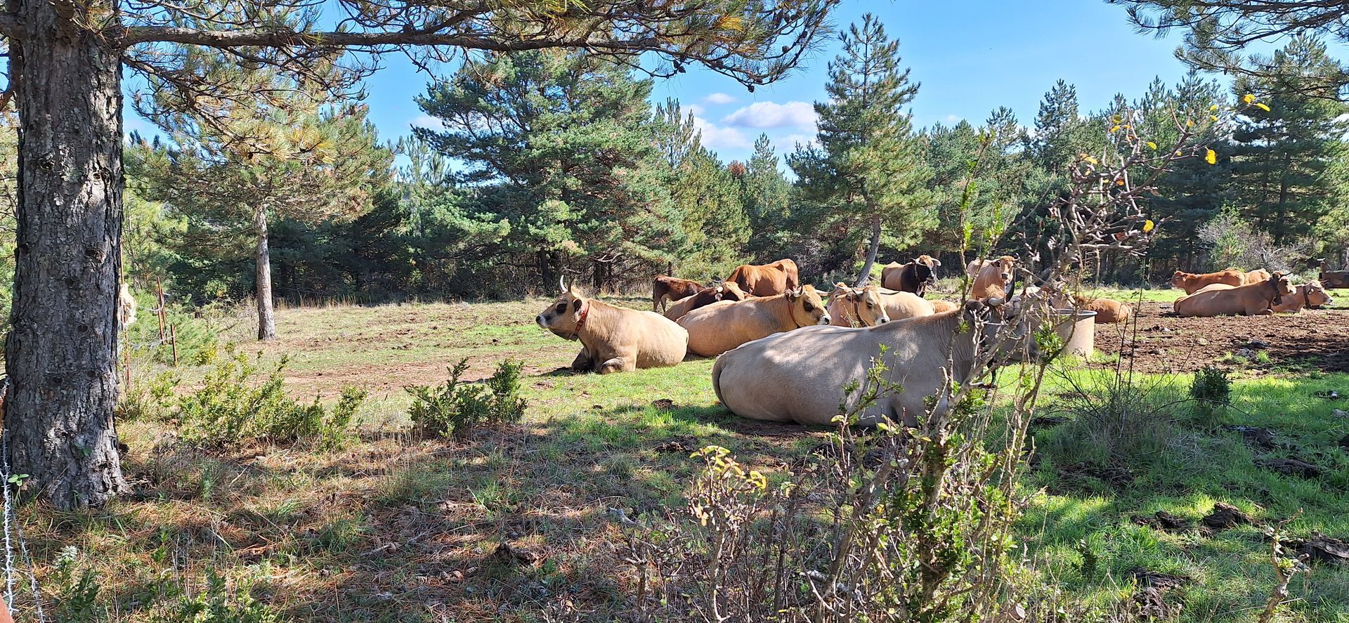
This route crosses a pastoral area: herds and guard dogs are present most of the year, be sure to close the gates properly. When encountering herd guard dogs, adopt the right behaviors: - Stay calm, do not threaten or pet them, - Keep your dogs on a leash, and do not carry them in your arms, - Keep a safety distance of 30 meters.
Yellow and red country GR
+33 4 67 88 86 44
Lodévois and Larzac Tourist Office
GRP - FFR
Popularne wycieczki w okolicy
CIRQUE DE NAVACELLES AND MOULINS DE LA FOUX HIKING TRAILS
średniWędrówka 9,73 km- 4,0
CYCLE LOOP No.4 - THE HÉRAULT GORGES AND THE COL DES LAVAGNES
średniJazda na rowerze 53,3 km RANDONNEE DE PEYRE MARTINE
średniWędrówka 15,4 kmHIKING OF THE FENESTRETTES
średniWędrówka 10,4 kmNAVACELLES HIKE - CAUSSE AND VIS GORGES
średniWędrówka 19,6 kmHIKE FROM DRY VALLEYS TO SOTCHS
średniWędrówka 11,5 kmHIKING OF THE SERRE DE GRENOUILLET
średniWędrówka 7,70 kmROUTE NO. 87 - THE LION OF SERVIÈRES - MTB AREA FFC LODÉVOIS AND LARZAC
średniMountainbike 28,0 kmMONT SAINT-BAUDILLE HIKE
średniWędrówka 10,4 kmLA SERANNE PONTEL HIKE
średniWędrówka 17,5 km
Wędrówki i tropienie


Nie przegap ofert i inspiracji na następne wakacje
Twój adres e-mail została dodana do listy mailingowej.