
Radtour 3: Rennrad, Trekking- und E-Bike mittel
średni
Pobierz tę trasę na swój telefon komórkowy
Radtour 3: Rennrad, Trekking- und E-Bike mittel
średni
Jazda na rowerze
32,02
km
Zeskanuj kod QR i rozpocznij nawigację w aplikacji bergfex.


Wędrówki i tropienie



Radtour 3: Rennrad, Trekking- und E-Bike mittel
średni
Odległość
32,0
km
Czas trwania
02:32
h
Ascent
500
hm
Poziom morza
275 -
490
m

Nawiguj po trasie w aplikacji
Zainstaluj aplikację za darmo i śledź trasę dzięki nawigacji GPS i funkcji śledzenia.
Skorzystaj już teraz z funkcji „ bergfex ” w aplikacji
Zeskanuj kod QR za pomocą aparatu
Po zainstalowaniu aplikacji treść otworzy się od razu. Jeśli jeszcze nie masz tej aplikacji, zostaniesz przekierowany do strony, z której możesz ją bezpłatnie pobrać.
Ścieżka do pobrania
Radtour 3: Rennrad, Trekking- und E-Bike mittel
średni
Jazda na rowerze
32,02
km


From the market square in Gallneukirchen, the first ten kilometres are relatively flat in the direction of Katsdorf. Over the next 15 kilometres, however, the Mühlviertel shows its charm and a constant...
Opis
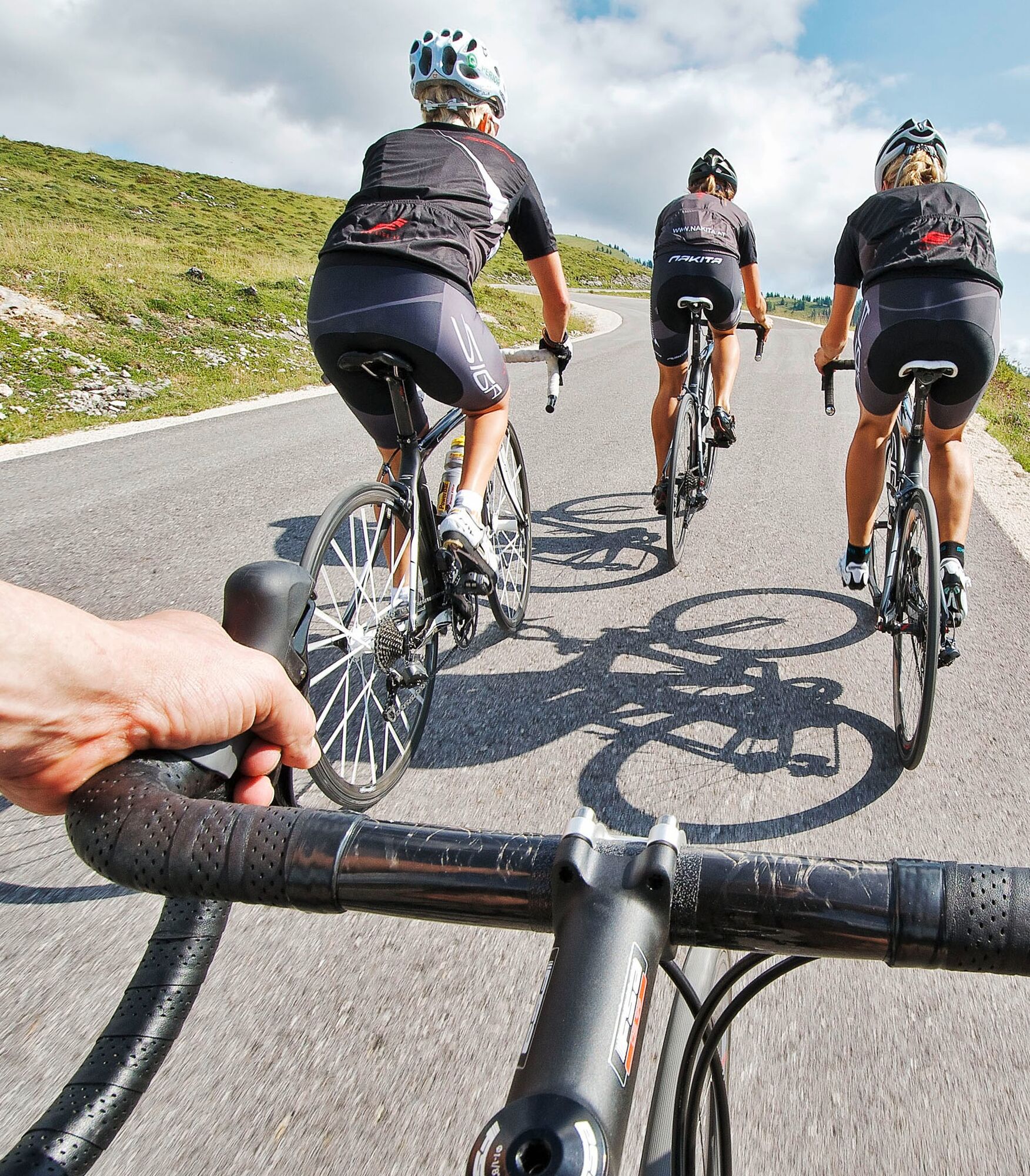
From the market square in Gallneukirchen, the first ten kilometres are relatively flat in the direction of Katsdorf. Over the next 15 kilometres, however, the Mühlviertel shows its charm and a constant uphill-downhill is on the agenda. However, the climbs are short and can be easily mastered at a measured pace. With Gallneukirchen already in sight, the Mirellenstüberl, known far beyond the borders, beckons for a final rest. The Reichinger family invites you to take a break with regional specialities. The lost calories are replenished with marvellous pastries and home-grown produce. The remaining kilometres lead exclusively downhill back to the starting point.
Trasa
Gallneukirchen
(338 m)
Miasto
0,0 km
Pestsäule Baßgeige
(333 m)
Miejsce kultu
5,6 km
OFS Katsdorf
(305 m)
Miejsce kultu
6,8 km
Edtsdorf
(285 m)
Wioska
8,4 km
Unterreichenbach
(356 m)
Rozliczenie
18,0 km
Innertreffling
(402 m)
Wioska
23,2 km
Katholische Pfarrkirche
(337 m)
Miejsce kultu
31,8 km
Trasa
Radtour 3: Rennrad, Trekking- und E-Bike mittel
średni
Jazda na rowerze
32,02
km
Gallneukirchen
(338 m)
Miasto
0,0 km
Simling
(324 m)
Wioska
1,2 km
Engerwitzdorf
(320 m)
Wioska
2,2 km
Klendorf
(308 m)
Wioska
4,5 km
Bach
(296 m)
Wioska
5,1 km
Pestsäule Baßgeige
(333 m)
Miejsce kultu
5,6 km
Sportunion Katsdorf
(324 m)
Restauracja
6,3 km
Katsdorf
(306 m)
Wioska
6,7 km
Pizzeria La Bella
(302 m)
Restauracja
6,8 km
Pfarrkirche Katsdorf
(306 m)
Miejsce kultu
6,8 km
OFS Katsdorf
(305 m)
Miejsce kultu
6,8 km
Edtsdorf
(285 m)
Wioska
8,4 km
Schörgendorf
(285 m)
Rozliczenie
9,7 km
Amberg
(368 m)
Rozliczenie
13,6 km
Unterreichenbach
(356 m)
Rozliczenie
18,0 km
Aigen
(360 m)
Rozliczenie
21,4 km
Kreuzwirt
(400 m)
Restauracja
23,1 km
Innertreffling
(402 m)
Wioska
23,2 km
Friederike Wolfsjaeger
(399 m)
Restauracja
23,2 km
Gallusberg
(424 m)
Rozliczenie
29,3 km
Gallusberg-Siedlung
(361 m)
Rozliczenie
30,3 km
Katholische Pfarrkirche
(337 m)
Miejsce kultu
31,8 km
Gallneukirchen
(338 m)
Miasto
31,9 km
Autor
Dostarczone przez Destination Mühlviertel
Wycieczkę Radtour 3: Rennrad, Trekking- und E-Bike mittel zapewnia outdooractive.com.


Nie ma jeszcze recenzji

Wszystkie kamery internetowe na mapie
Zainstaluj aplikację za darmo i porównaj obrazy na żywo z kilku miejsc, zanim wyruszysz w drogę.
Skorzystaj już teraz z funkcji „ bergfex ” w aplikacji
Zeskanuj kod QR za pomocą aparatu
Po zainstalowaniu aplikacji treść otworzy się od razu. Jeśli jeszcze nie masz tej aplikacji, zostaniesz przekierowany do strony, z której możesz ją bezpłatnie pobrać.
Popularne wycieczki w okolicy
-
4,6
Schwertberg: Weltstoarunde
średniWędrówka 11,4 km -
4,7
Aisttalrundweg + P6
światłoWędrówka 9,36 km -
4,4
Wartberg Ob der Aist, Natura Aist Trail Rundwanderung
światłoWędrówka 8,37 km -
4,4
Linz: City Hiking Trail Pöstlingberg
średniWędrówka 7,71 km -
4,7
Steyregg Donau-Höhen-Rundwanderweg Pulgarn - Hohenstein (und zurück)
światłoWędrówka 7 km -
4,7
Unterweitersdorfer Sagenweg
światłoWędrówka 5,87 km -
4,7
Steyregg Pfenningberg-Gipfelwanderweg
średniWędrówka 4 km -
4,8
Wilson Holz-Route von Steyregg auf den Pfenningberg
światłoWędrówka 9,07 km -
5,0
Steyregg AV 50 Plesching - GH Daxleitner
światłoWędrówka 4 km -
4,1
Donausteig stage 3_S05 Wilhering - Linz: “Over the Prinzensteig through the Linz Gate”
średnidługodystansowy szlak pieszy 13,2 km
Wędrówki i tropienie

Ponad 550.000 propozycji wycieczek, szczegółowe mapy i intuicyjny planer tras sprawiają, że aplikacja jest niezbędna dla wszystkich entuzjastów przyrody.

Nie przegap ofert i inspiracji na następne wakacje
Zapisz się do newslettera
Błąd
Wystąpił błąd. Spróbuj ponownie.
Dziękujemy za rejestrację
Twój adres e-mail została dodana do listy mailingowej.
Wycieczki po całej Europie
Austria
Szwajcaria
Niemcy
Włochy
Słowenię
Francja
Holandia
Belgia
Polska
Liechtenstein
Czechy
Słowacja
Hiszpania
Chorwacja
Bośnia i Hercegowina
Luksemburg
Andorra
Portugalia
Islandia
Wielka Brytania
Irlandia
Grecja
Albania
Macedonia Północna
Malta
Norwegia
Czarnogóra
Mołdawia
Kosowo
Węgry
San Marino
Rumunia
Estonia
Łotwa
Białoruś
Cypr
Litwa
Serbia
Bułgaria
Monako
Dania
Szwecja
Finlandia


