


Rotes-Wasser-Tour from Bracht
Poziom trudności: T2
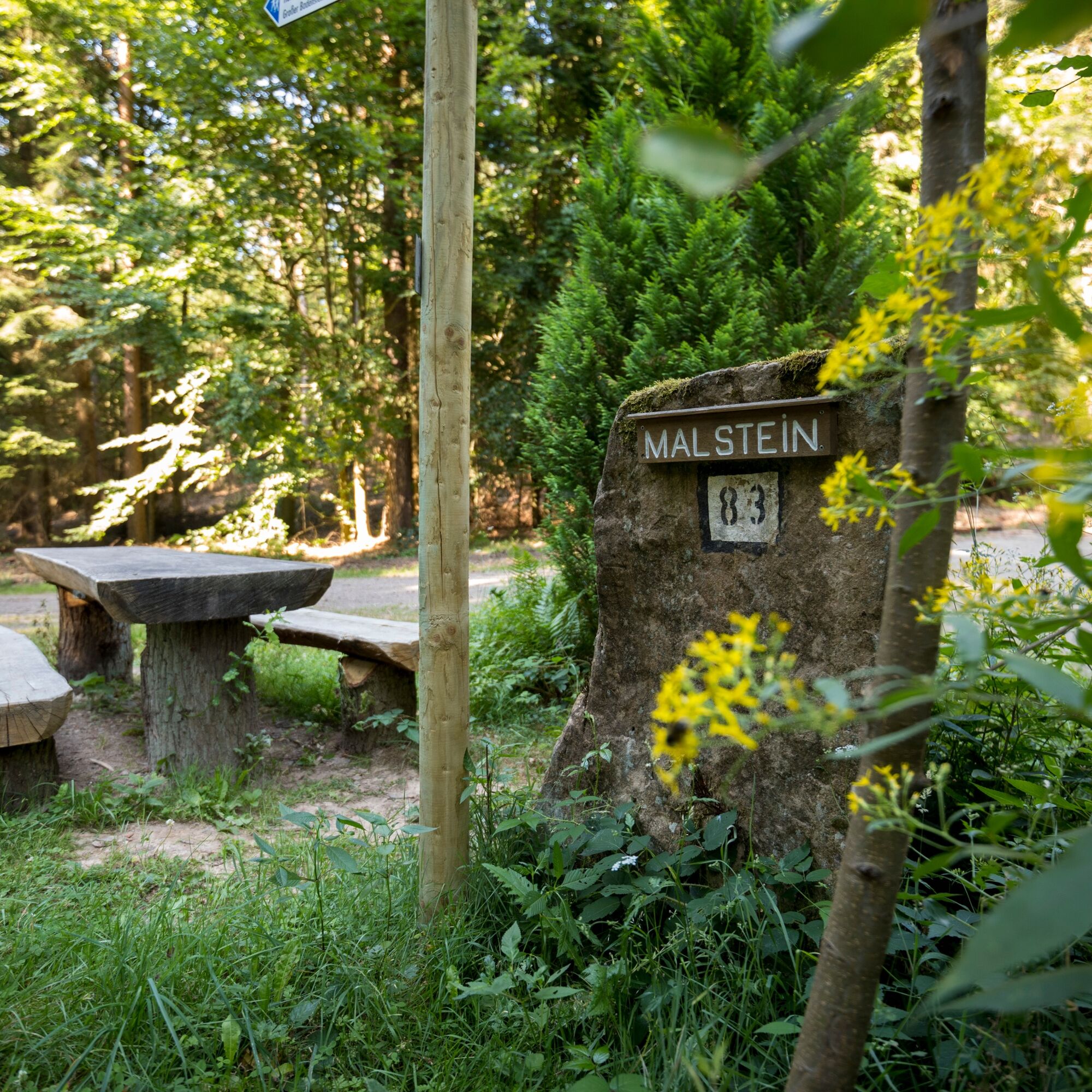
On springy paths, you will go through dense mixed forest up to the Malstein, which marks the watershed between Ohm and Wetschaft. Along an idyllic stream, the Langer Grund stretches out and the path brushes...
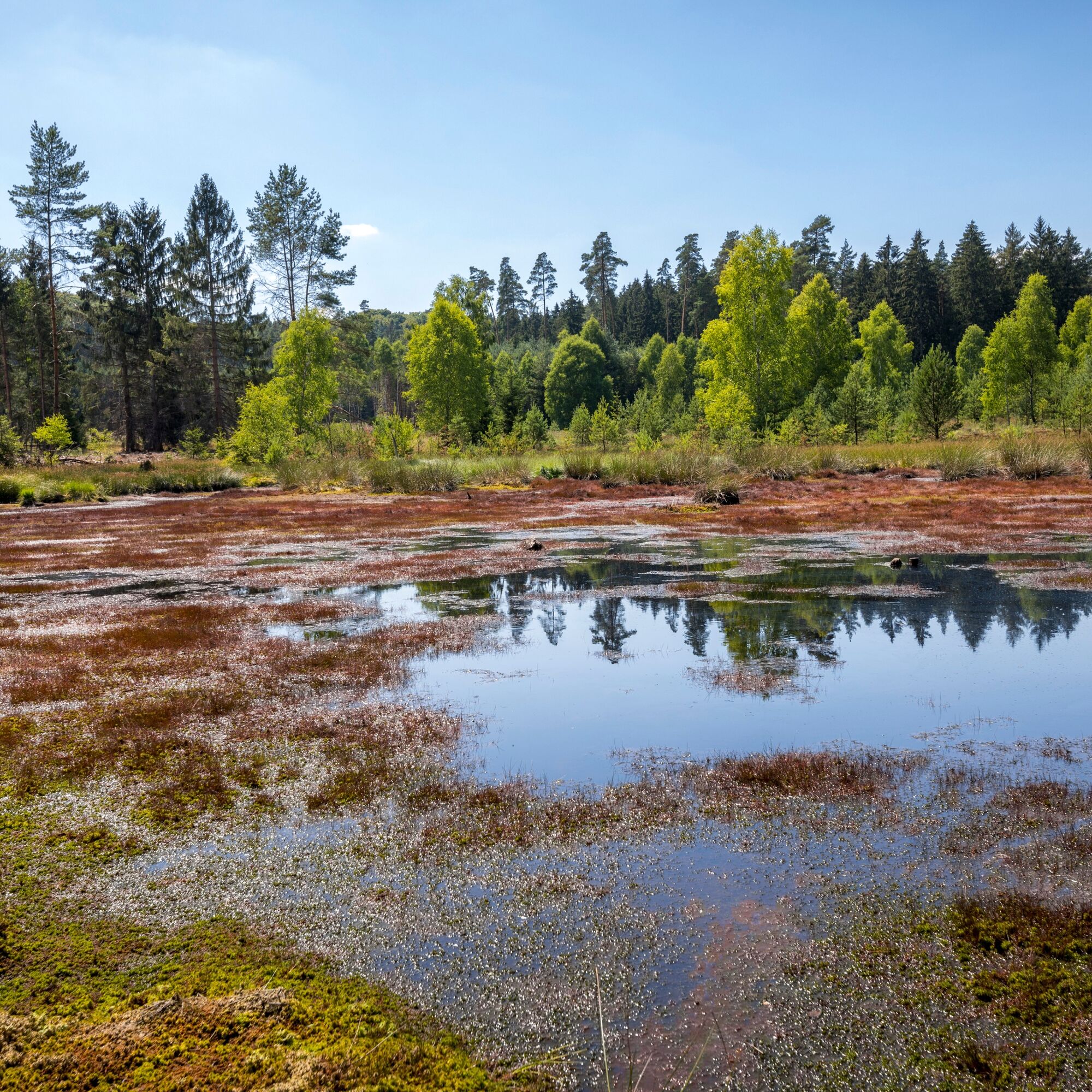
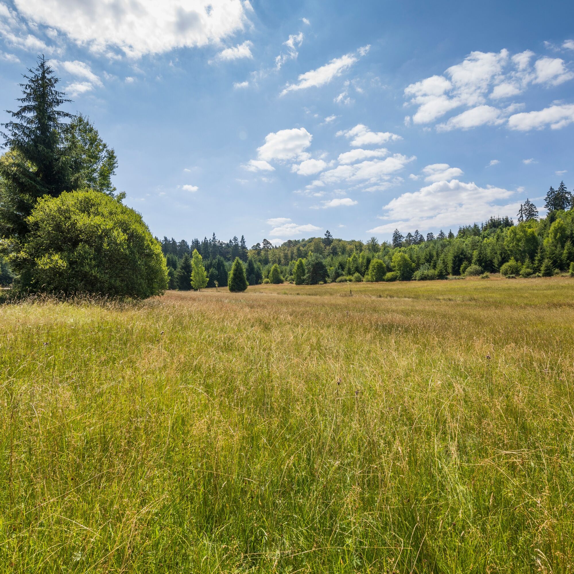
On springy paths, you will go through dense mixed forest up to the Malstein, which marks the watershed between Ohm and Wetschaft. Along an idyllic stream, the Langer Grund stretches out and the path brushes past another remarkable nature reserve with the Franzosenwiesen. The diversity of fauna and flora is unique! You can observe moors, swamps, and floodplain forests with numerous, partly highly endangered species of animals and plants! Feel free to take your time, stop for a moment, and enjoy nature.
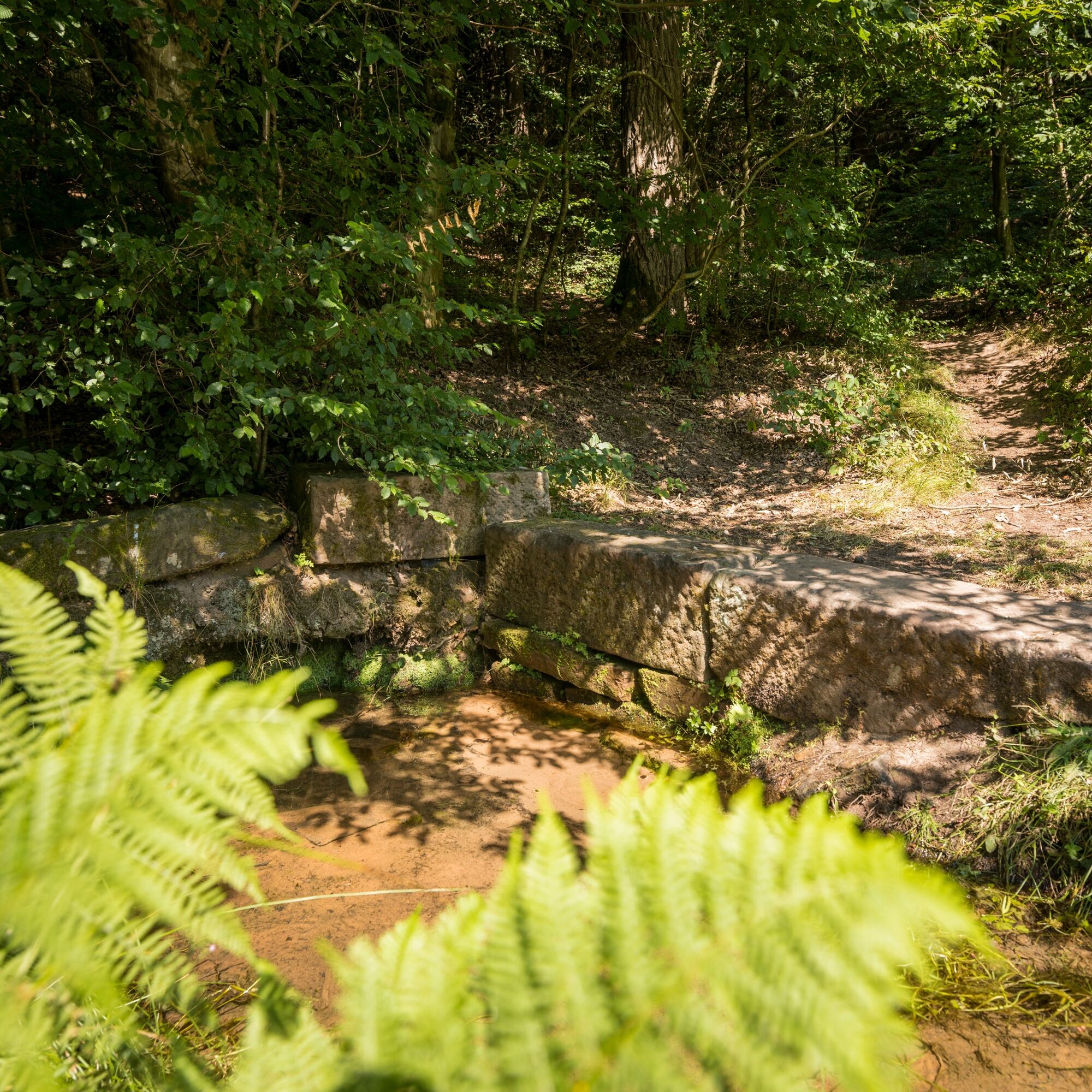
I recommend a short drinking break at the so-called Drusenborn, a legendary ancient Germanic-Celtic spring sanctuary. The swirling sand appears magical and the water is said to have healing effects.
Another relic of past days is the historic Herrenbrücke, part of the Herrenweg, which once connected the hunting lodges Wolkersdorf and Bracht. The so-called Große Badenstein testifies to volcanic activity. Basalt was formerly mined here.
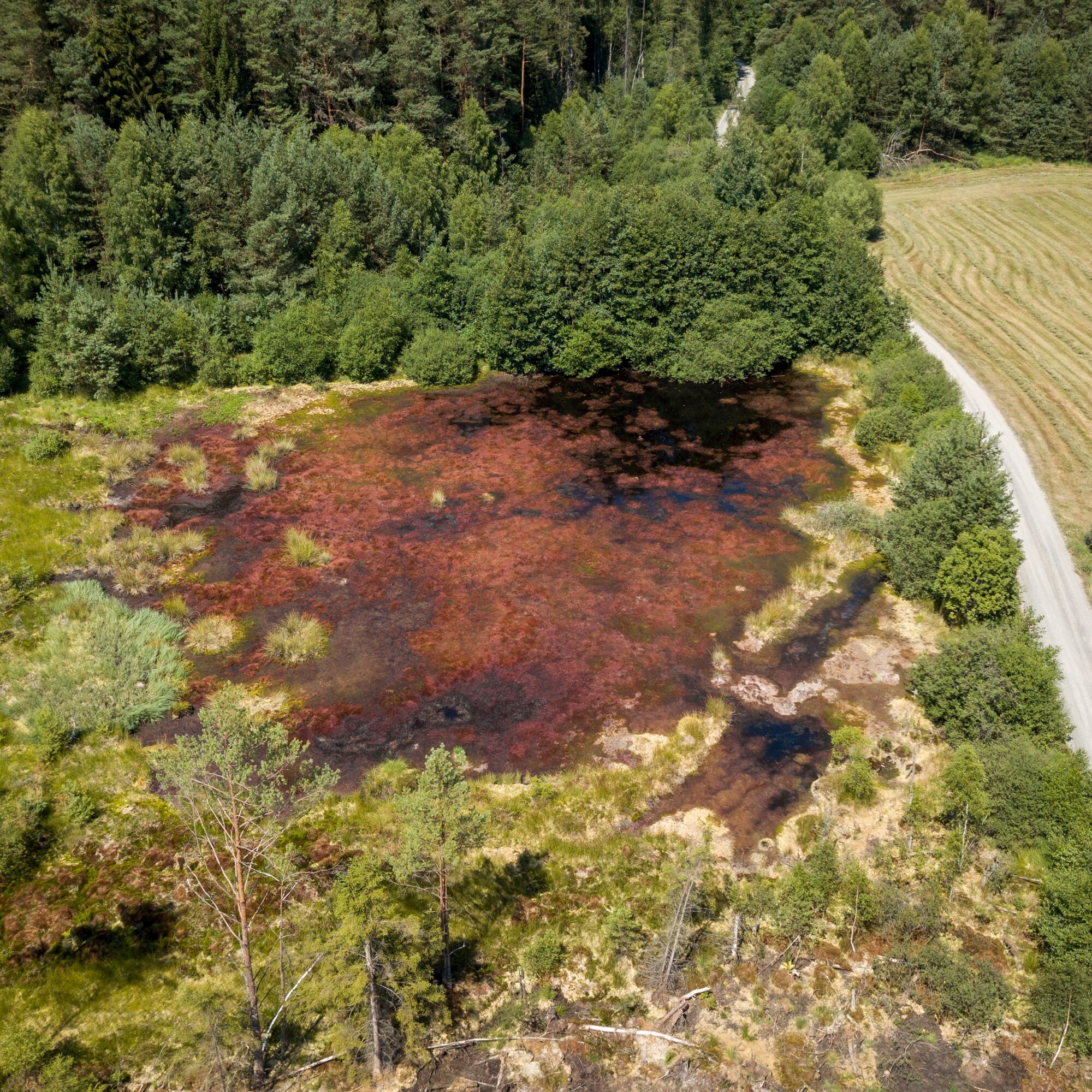
Why is the river Rotes Wasser so red? That comes from the washed-out humic acids of the moor valley floor.

Here I recommend a clockwise hike. You start your hike at the church square in Bracht. Above the last farm in the village, you walk through fields towards the west and pass the former village of Marbach before entering the southern part of the Burgwald. You follow our path heading west until we reach the Langer Grund nature reserve, where we turn right. At the end of a wide left bend, we first arrive at the "Bathing Pond of the Elves and Nixies", the Große Badenstein, and finally cross the Herrenbrücke. Here we reach the river "Rotes Wasser", which we cross here and whose course you now follow.
So we now follow the course of the "Rotes Wasser", pass the "Rennplätzchen", a crossing of two historic trade routes, cross the country road, and can finally refresh ourselves at the Drusenborn pond spring. On the final stretch of our hike, we can once again walk on historic paths and imagine how people once lived in the present-day deserted villages of Altenbracht and Oberndorf. Finally, it goes a few hundred meters along the river valley until we reach the village of Bracht again.
Tak
Tak
Sturdy footwear, weatherproof clothing, and a small garbage bag are recommended, as there are only a few trash cans along the way. A well-filled provision backpack is needed for hiking the route without direct dining opportunities.
In stormy weather, hiking on the Rotes Wasser route is not recommended because the forest sections are large.
Follow the marked turnoff to Bracht at the restaurant Schöne Aussicht towards Bracht on the B3 from Marburg to Kassel. In Bracht, drive straight ahead via the K3 towards the kindergarten and church. The hiking portal is located on the church square.
The hiking portal in Ruaschenberg-Bracht can be reached via the destination stop "Ellerweg". You can get connection information at www.rmv.de. From there, it is 75 meters on foot.
Free hiking parking lot at the church square
Tak
T2
Marburg City and Country Tourism GmbH
Bahnhofstr. 25 | 35037 Marburg
www.marburg-tourismus.de info@marburg-tourismus.de
Tel.: +49 6421 99120 | Fax.: +49 6421 991212
Popularne wycieczki w okolicy
- 5,0
Franzosenwiesentour near Rosenthal
średniWędrówka 19,3 km - 4,0
Panorama path around Rauschenberg
średniWędrówka 15,9 km - 5,0
Eibenhardt Trail near Cölbe
światłoWędrówka 6,26 km Junkernpfad near Cölbe-Schönstadt
średniWędrówka 9,93 kmCliff path near Allendorf (Eder)-Rennertehausen
światłoWędrówka 10,3 km- 3,0
Lahnradweg 2nd stage upstream Marburg - Biedenkopf
średniJazda na rowerze 35,7 km Burgwald Trail Marburg - Frankenberg (South-North)
średniWędrówka 49,0 kmLahnwanderweg 6th stage upstream Marburg - Caldern
światłoWędrówka 15,9 kmWichtelrundweg Christenberg
światłoTrasa tematyczna 0,90 kmFrankenberger Blickwinkel - Stadtwanderweg
światłoWędrówka 8,92 km
Wędrówki i tropienie


Nie przegap ofert i inspiracji na następne wakacje
Twój adres e-mail została dodana do listy mailingowej.