


Lahnradweg 2nd stage upstream Marburg - Biedenkopf
Poziom trudności: 2
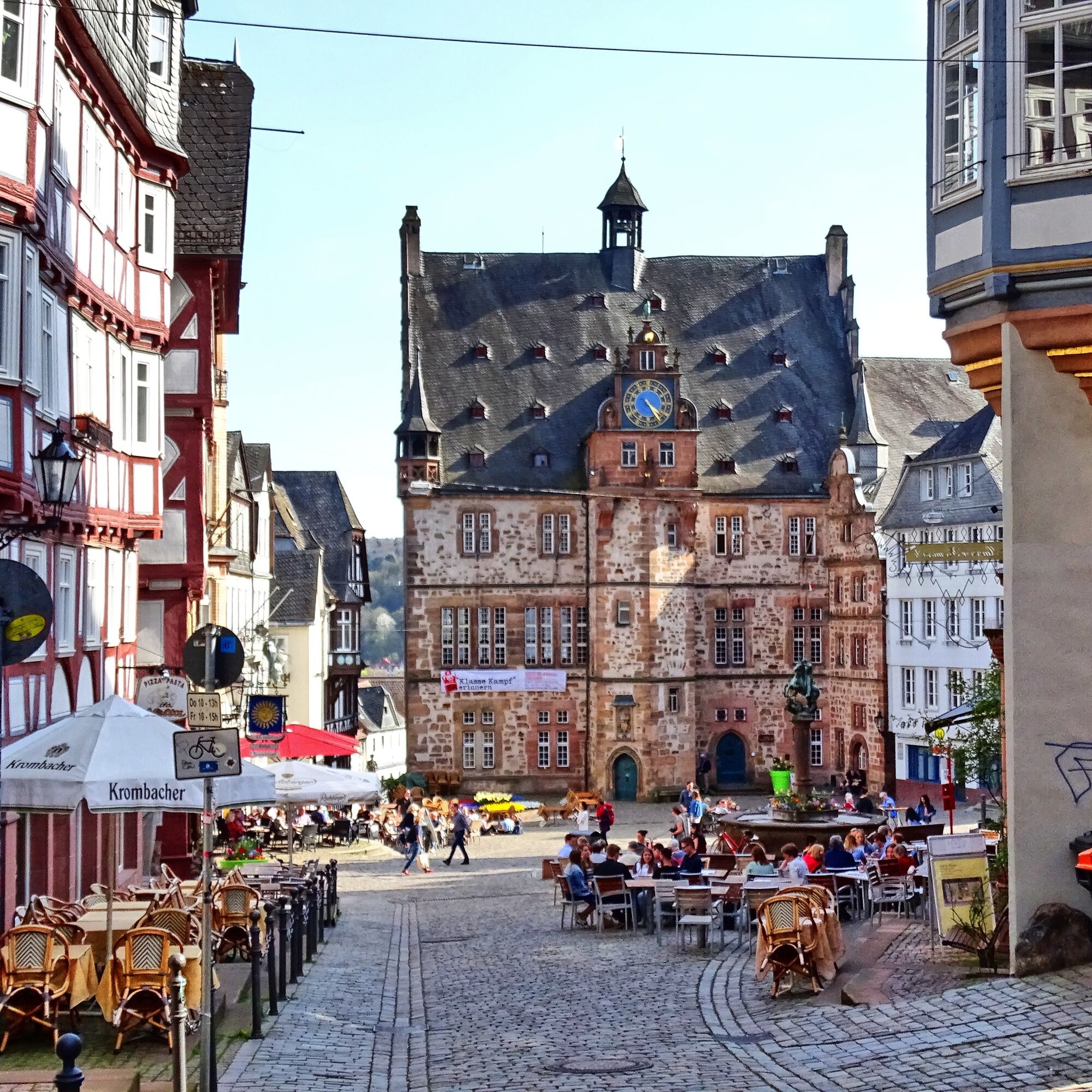
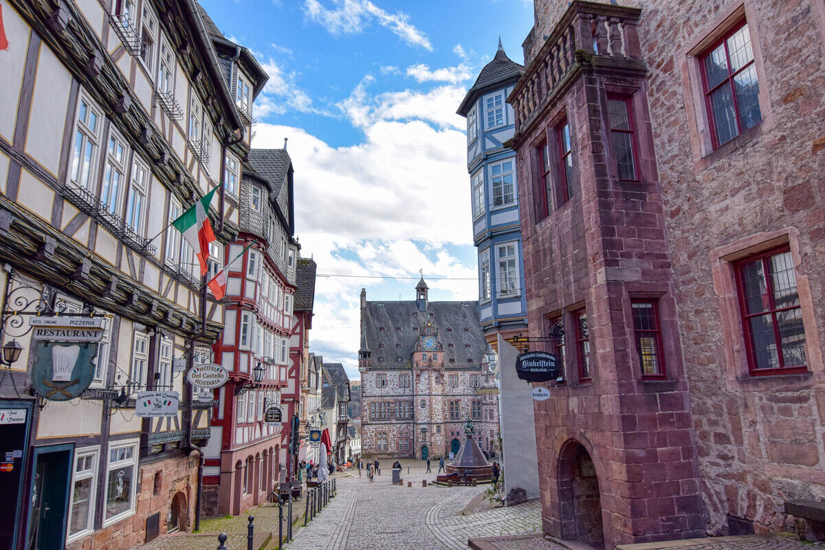
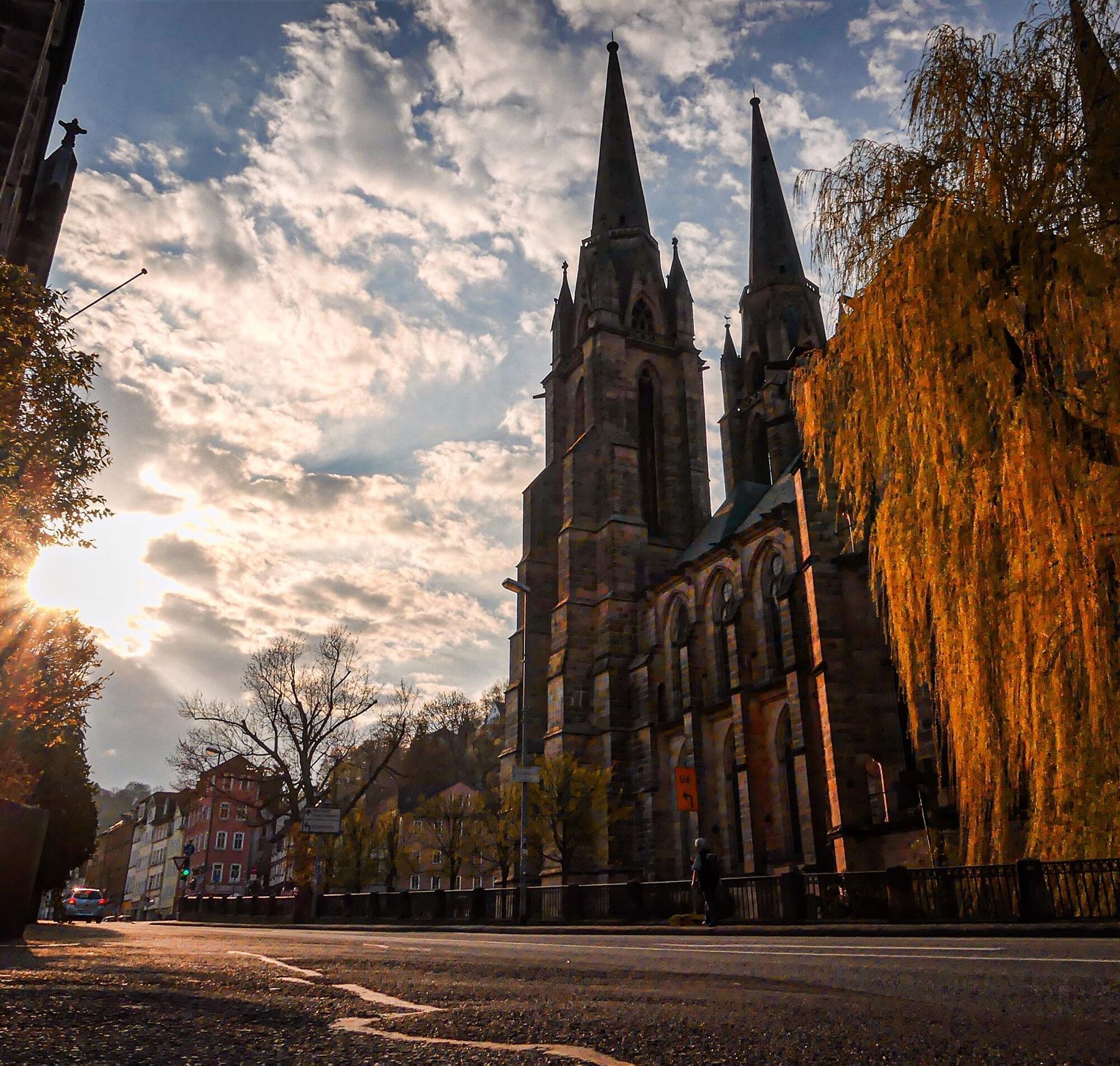
With a view of one of the landgrave castles, namely the one in Marburg, another varied stage of the Lahnradweg begins. The university town undoubtedly presents cultural and historical highlights on this...
With a view of one of the landgrave castles, namely the one in Marburg, another varied stage of the Lahnradweg begins. The university town undoubtedly presents cultural and historical highlights on this route with the ensemble of its old town and the Elisabeth Church. Through wide meadows and fields, past inviting places such as Cölbe, Lahntal, Caldern, or Buchenau, you cycle comfortably along the river to Biedenkopf. The town, with its romantic half-timbered architecture, offers further sights. Of course, this also includes the other landgrave castle, namely the one in Biedenkopf.

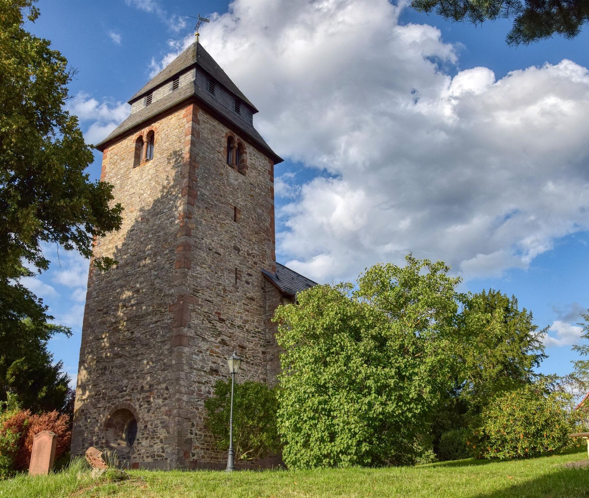
From Marburg station, you go back along Bahnhofstraße to the Lahn. You follow the signs and reach Goßfelden through Wehrda and Cölbe. Goßfelden belongs to the municipality of Lahntal, and in the Otto-Ubbelohde-Haus there, you can admire the artist's works in his former residence and studio. Then it continues via Sterzhausen to Caldern. Here, a visit to the Nikolaikirche with its charming atmosphere in the Paradise Garden is recommended. By the way, the church is one of the Radwegekirchen of the Protestant Church in Germany, offering seasonal devotionals for cyclists and shelter options in bad weather.
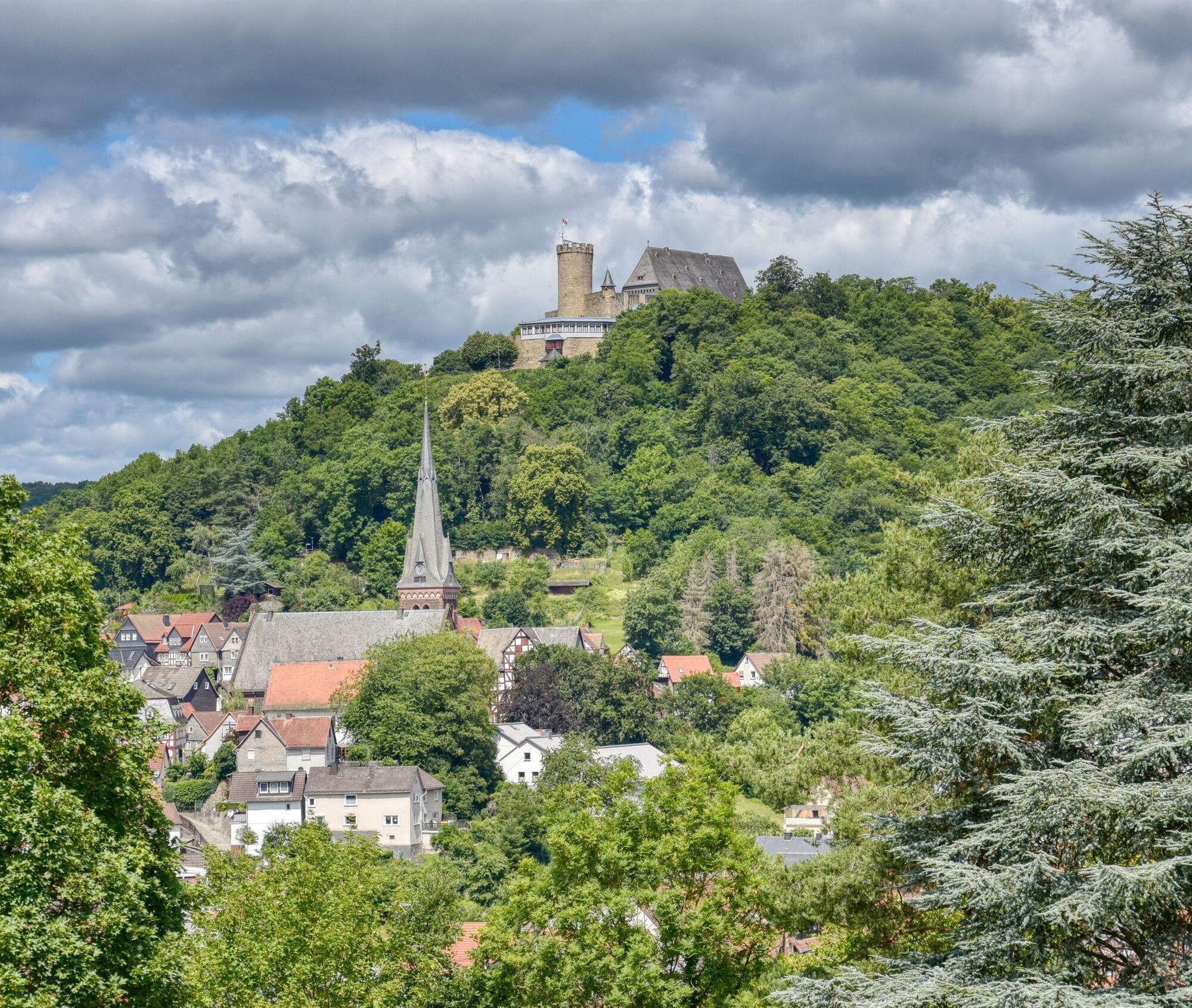
From Caldern, the well-signposted bike path then leads along and across the Lahn via Kernbach to Buchenau. Parallel to the railway line, you cycle to Friedensdorf, where you cross the Lahn again. Via Kombach and Eckelshausen, you finally reach the stage destination in Biedenkopf. In the romantic old town with its numerous places to stop, you can pleasantly end the beautiful cycling day. And not only because of the fantastic view is the way up to the Landgrafenschloss also worth it!
Tak
Trekking or touring bike (e-bike or conventional), spare tube and tools, water bottle, and clothing adapted to the weather.
The Lahnradweg runs mostly on cycle paths, quiet side roads, and field paths. Please still adhere to the traffic regulations and be considerate of other cyclists, agricultural vehicles, and pedestrians.
Via the B 3 to Marburg
Via the B 62 to Biedenkopf
The public transport connection to the Lahnradweg is excellent.
On the second stage lie the stations Marburg, Cölbe, Goßfelden, Sterzhausen, Caldern, Buchenau, Dautphetal, and Biedenkopf.
The rail connections in Hesse belong to the Rhein-Main-Verkehrsverbund.
All information for arriving by public transport can be found on the Bahn website.
In Marburg, there are several parking lots, mostly paid.
In Biedenkopf, there is a free hiking parking lot.
2
The free information flyer "Keep rolling – Cycling experiences in the Lahntal" and more information can be downloaded under Brochures and from the
Lahntal Tourism Association
Brückenstraße 2, 35576 Wetzlar
Tel. 06441-30998-0
The Nikolai Church in Caldern is one of the Radwegekirchen of the Protestant Church in Germany. A cyclist rest area near the church invites you to take a break with seating and shelter options.
Popularne wycieczki w okolicy
- 5,0
Eibenhardt Trail near Cölbe
światłoWędrówka 6,26 km Junkernpfad near Cölbe-Schönstadt
średniWędrówka 9,93 kmRotes-Wasser-Tour from Bracht
średniWędrówka 15,5 kmBurgwald Trail Marburg - Frankenberg (South-North)
średniWędrówka 49,0 kmLahnwanderweg Stage 05 Buchenau – Caldern
średniWędrówka 13,5 kmLahnwanderweg stage 03 Bad Laasphe – Biedenkopf
średniWędrówka 17,6 kmLahnwanderweg 6th stage upstream Marburg - Caldern
ciężkiWędrówka 15,9 kmLahnwanderweg 04. Stage upstream Buchenau - Biedenkopf
światłoWędrówka 12,5 kmLahnwanderweg stage 07 Marburg – Fronhausen
średniWędrówka 24,5 kmWichtelrundweg Christenberg
światłoTrasa tematyczna 0,90 km

Wędrówki i tropienie


Nie przegap ofert i inspiracji na następne wakacje
Twój adres e-mail została dodana do listy mailingowej.