


Water trail along the Nagold
Along the nearly five-kilometer-long water trail along the Nagold, information boards address the topic of “water” from various perspectives. The information boards are titled “Monhardter Bach forest biotope,”...
Along the nearly five-kilometer-long water trail along the Nagold, information boards address the topic of “water” from various perspectives. The information boards are titled “Monhardter Bach forest biotope,” “floodplain forest habitat,” “fish in the Nagold,” or “flower sea meadow” with clearly prepared information on the animal and plant world.
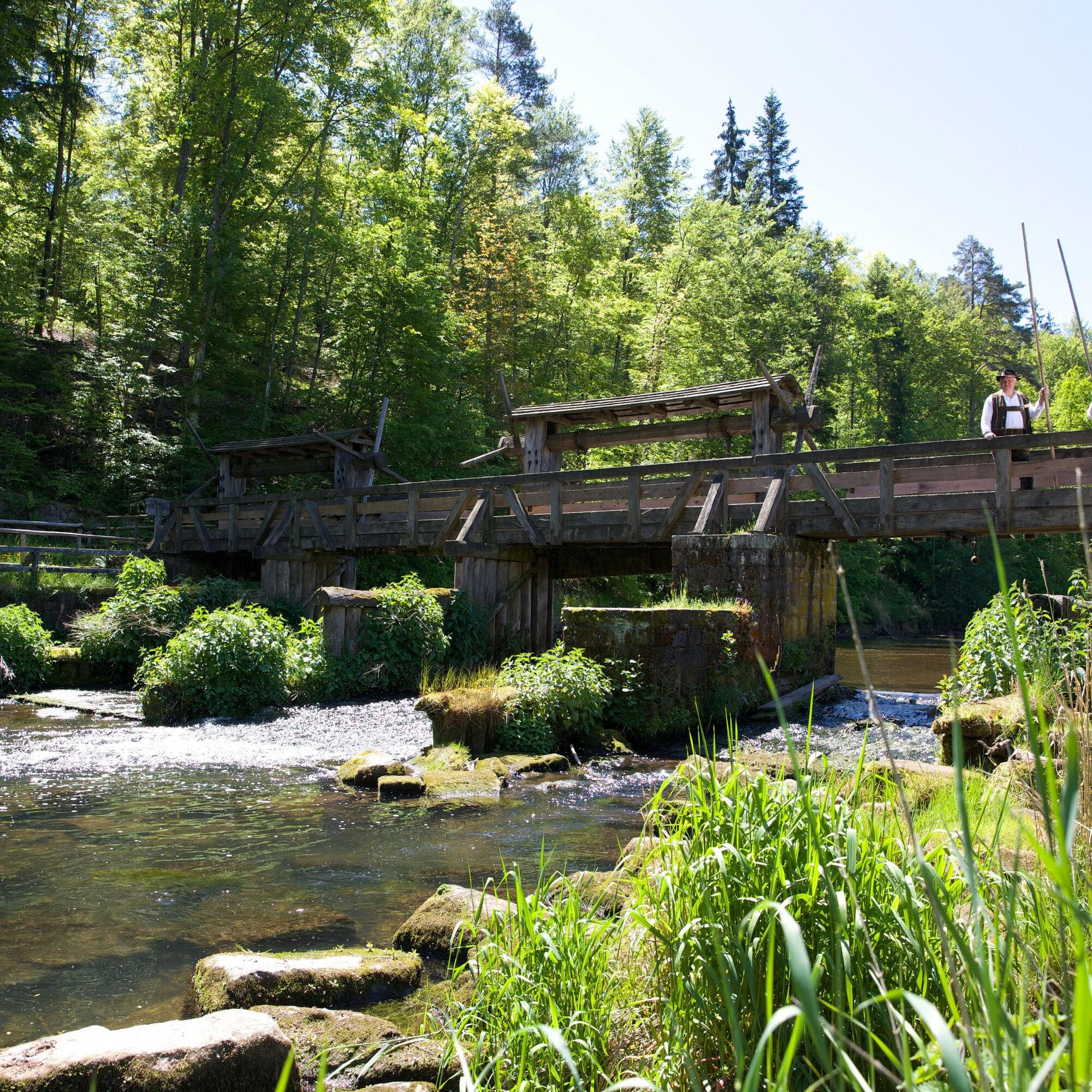
Another group of information boards deals with the technical aspect of water. This includes energy generation today and in the past, a sewage treatment plant, and of course also rafting. The water trail also passes the Monhardter water chamber between Altensteig and Ebhausen, from where in earlier years Black Forest firs were bound into rafts and set off on their journey.
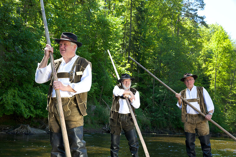
Over generations, Black Forest firs were rafted on the water trail from the Nagold via the Neckar and the Rhine to the Netherlands. The Rafting Guild Upper Nagold Valley keeps the craft memory and its historical significance for the region alive to this day.
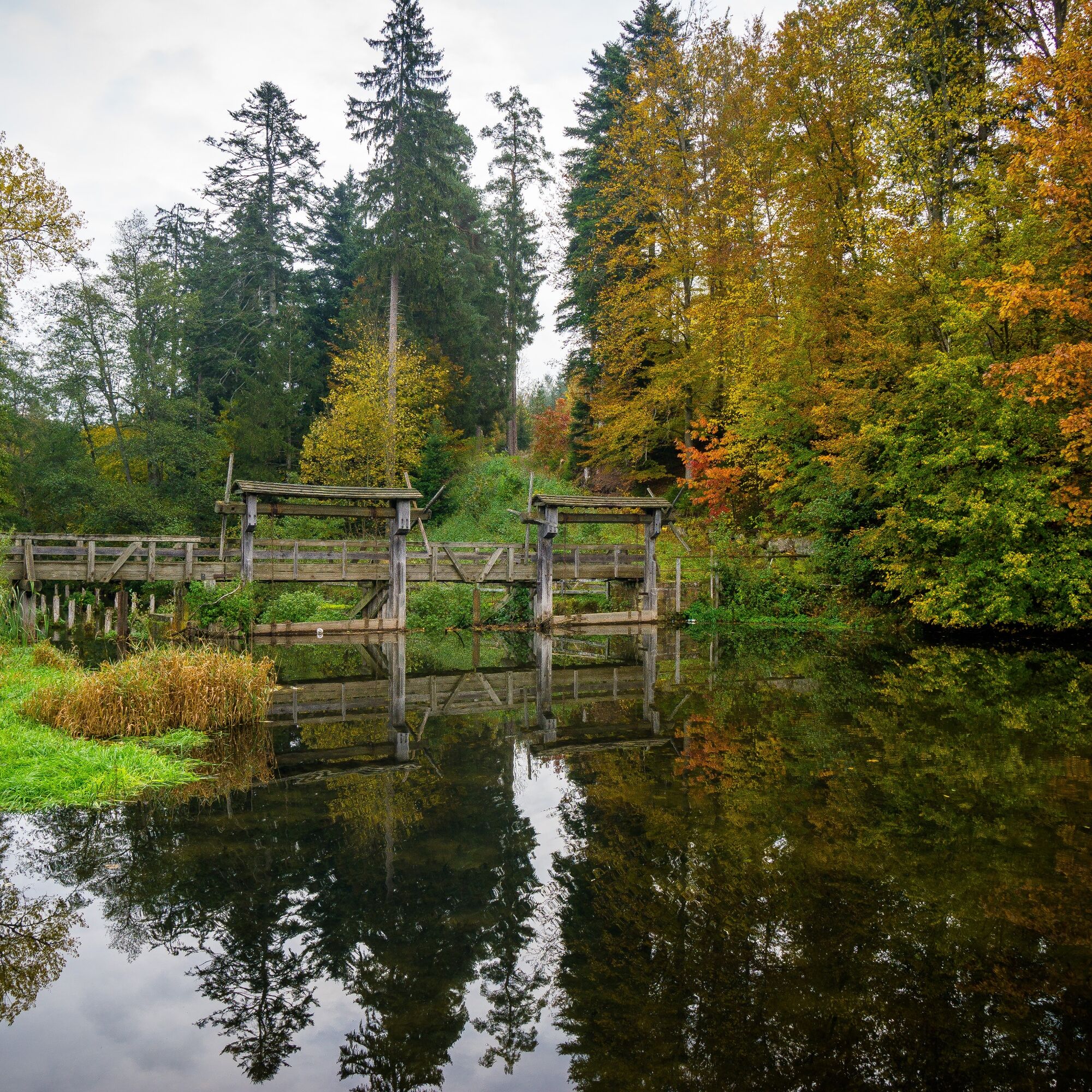

The start of the water trail is the waterworks in Ebhausen. From here, follow the diamond-shaped signs to the first information boards. The route always leads along the Nagold from info point to info point. After the Monhardter water chamber we leave the diamond of the Black Forest Association and walk on a path to the right to the sewage treatment plant of Altensteig, the endpoint of the water trail.
Tak
Sturdy footwear and possibly provisions
Directly via the B28 from Nagold to Ebhausen and Altensteig.
Regiobus line X77 between Herrenberg, via Nagold and Ebhausen to Altensteig (hourly).
Parking is available in Ebhausen, on Ziegelweg.
Citizens' office and city information Altensteig
Rathausplatz 1
72213 Altensteig
0 74 53 94 61 - 211
For an eventful day trip, a detour to the half-timbered town of Altensteig with its historic old town and the Old Castle is worthwhile!
Popularne wycieczki w okolicy
-
5,0
Der Teinacher (Premiumweg & Genießerpfad)
średniWędrówka 12,0 km -
5,0
Water, Woods and Meadowtrail / Zavelstein > Calw (Premium trail & Genussweg)
ciężkiWędrówka 14,4 km -
5,0
AugenBlick route Bad Teinach-Zavelstein Zettelberg
ciężkiWędrówka 15,5 km -
5,0
Hike through the idyllic Kälbertal
średniWędrówka 8,01 km -
5,0
GeoTour Wildberg through the picturesque Lützenschlucht
ciężkiWędrówka 2,80 km -
4,5
Waldeck ruins and the largest water wheel in Europe
średniWędrówka 15,4 km -
5,0
From Altburg over scenic heights to Zavelstein
średniWędrówka 10,6 km -
Exciting circular hike with beautiful views and culture
średniWędrówka 9,98 km -
4,0
Naturpark-AugenBlick-Runde Calw-Holzbronn
średniWędrówka 13,3 km -
3,0
Ecological nature trail around Bad Teinach
średniWędrówka 7,04 km
Wędrówki i tropienie


Nie przegap ofert i inspiracji na następne wakacje
Twój adres e-mail została dodana do listy mailingowej.