


2-day hike from the Refuge d'Avérole - Stage 1 - From the Vincendières to the Refuge d'Avérole

1/ At the hamlet of Les Vincendières, turn left along the Avérole torrent.
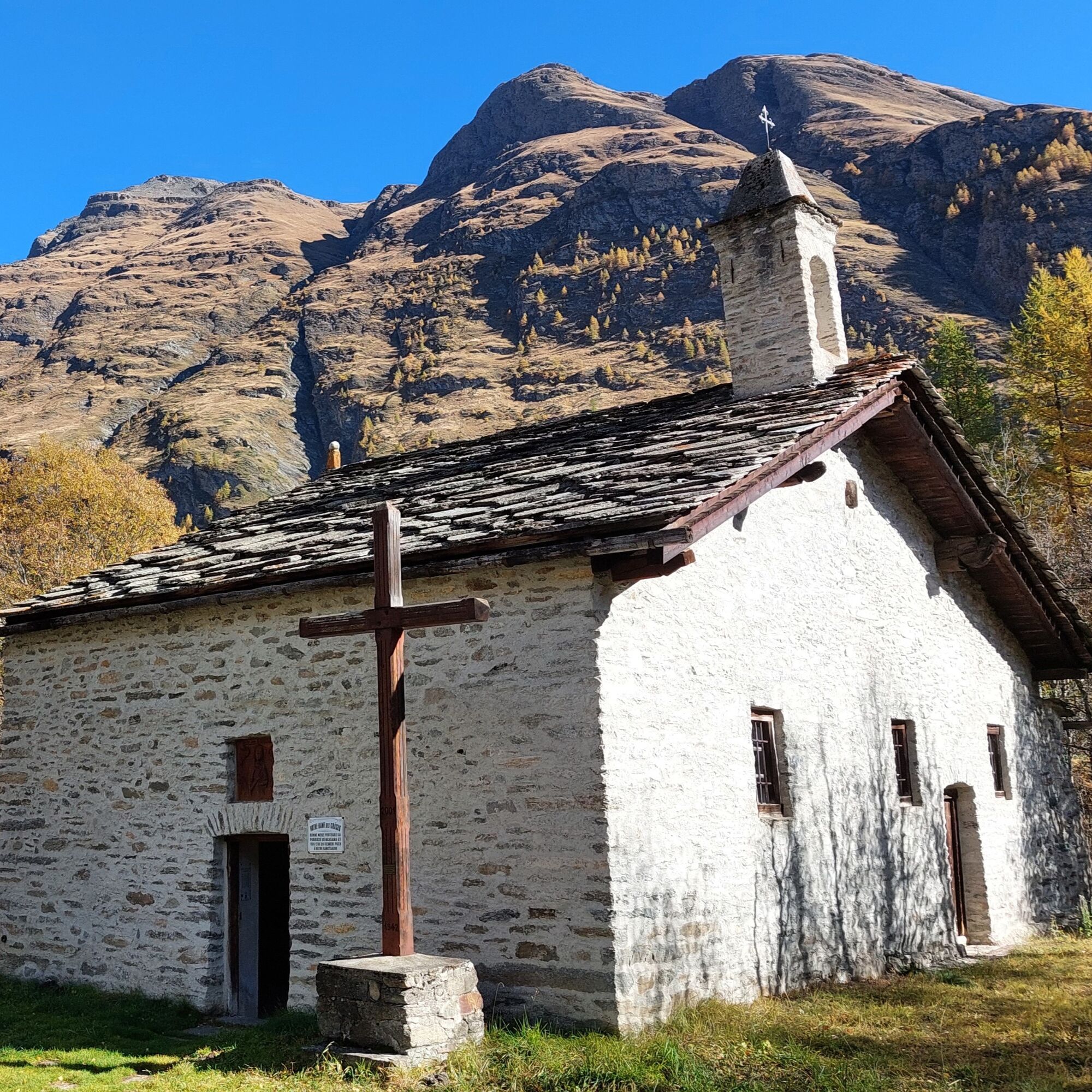
the path that leads just before the hamlet. The sound of running water in this mountain fold will accompany you on your walk, just as it once did the peddlers, passing from house to house to sell their wares on their way to Italy. Pass through the hamlet of Avérole; this valley was not always so depopulated. Look around you and you'll see traces of the old, bustling agricultural life everywhere!
Who built the dry-stone wall that makes the path between the hamlets safe?
Who prayed in the oratories and chapels that dot the route? Who lived in these houses with their typical mountain village slate roofs?
The valley's many inhabitants of yesteryear have left their mark.
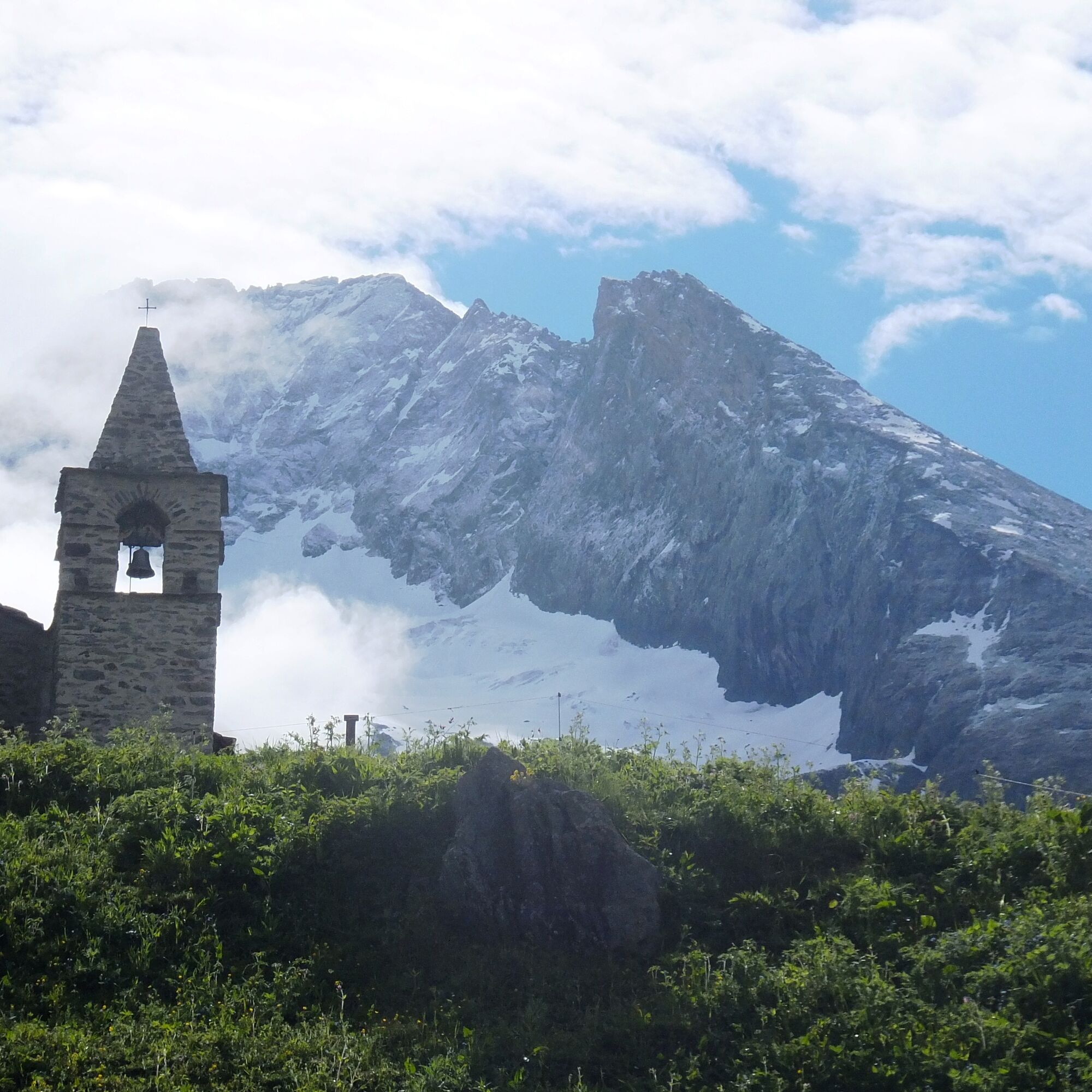
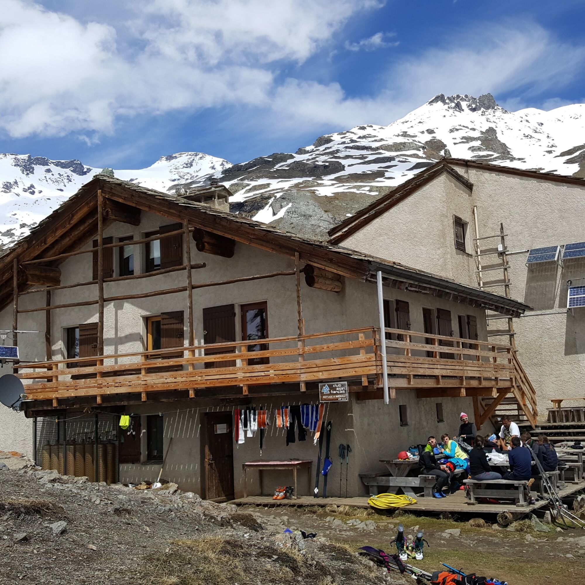
Follow the trail on the left to the foot of the refuge (after 20 minutes on a steep path). It's here, facing the Pointe du Charbonnel (3752 m), that you'll spend the night. Keep your eyes peeled, as the surrounding peaks all rise to over 3,000 m!
The Avérole refuge has been awarded the "Refuge en Famille" label. You must book your overnight stay in the refuge in advance. Stay on the trails and follow the signs, and take your garbage with you.
Popularne wycieczki w okolicy
-
4,7
Rocciamelone partedjo dalla Riposa. Mompantero, Piemont/Italien
średniWędrówka 10,6 km -
5,0
The Grand Méan lake via the Evettes circus
ciężkiWędrówka 13,6 km -
5,0
BALME Green Lakes and Lago Paschiet
średniWędrówka 7,51 km -
5,0
BALME Arnas Ring - Pian della Mussa
ciężkiWędrówka 13,6 km -
little 'Haute-Maurienne Vanoise' circuit
ciężkiDroga rowerowa 32,0 km -
4,7
High Way of the Lanzo Valleys | Stage 6 Tazzetti Refuge - Lake of Malciaussia
średniWędrówka 5,49 km -
USSEGLIO Lake Nero from Lake Malciaussia
światłoWędrówka 4,79 km -
5,0
Alta Via delle Valli di Lanzo | Stage 4 Rifugio Citt di Ciri - Rifugio Cibrario
ciężkiWędrówka 12,0 km -
USSEGLIO Lake behind the Tower and of the Rossa
ciężkiWędrówka 17,1 km -
Hike from the Avérole refuge through the hamlet
średniWędrówka 9,36 km
Wędrówki i tropienie


Nie przegap ofert i inspiracji na następne wakacje
Twój adres e-mail została dodana do listy mailingowej.