Trail du fond d'Etache
ciężki
Nawigacja
Nawigacja
Pobierz tę trasę na swój telefon komórkowy
Trail du fond d'Etache
ciężki
Trailrunning
17,01
km
Zeskanuj kod QR i rozpocznij nawigację w aplikacji bergfex.


Wędrówki i tropienie





Trail du fond d'Etache
ciężki
Odległość
17,01
km
Czas trwania
03:40
h
Ascent
1 153
hm
Poziom morza
1 660 -
2 754
m
Ścieżka do pobrania
Trail du fond d'Etache
ciężki
Trailrunning
17,01
km
Zdjęcia naszych użytkowników
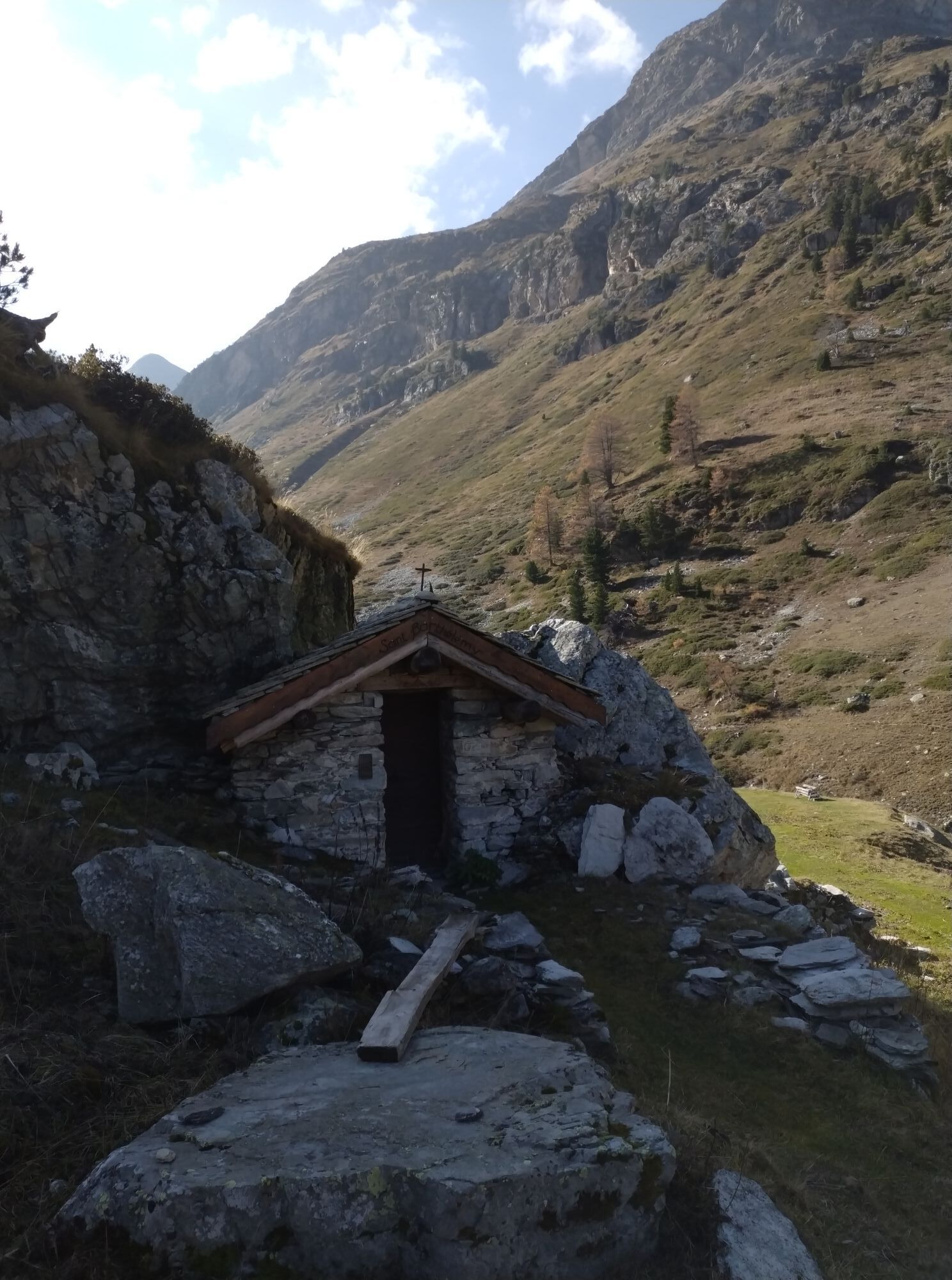

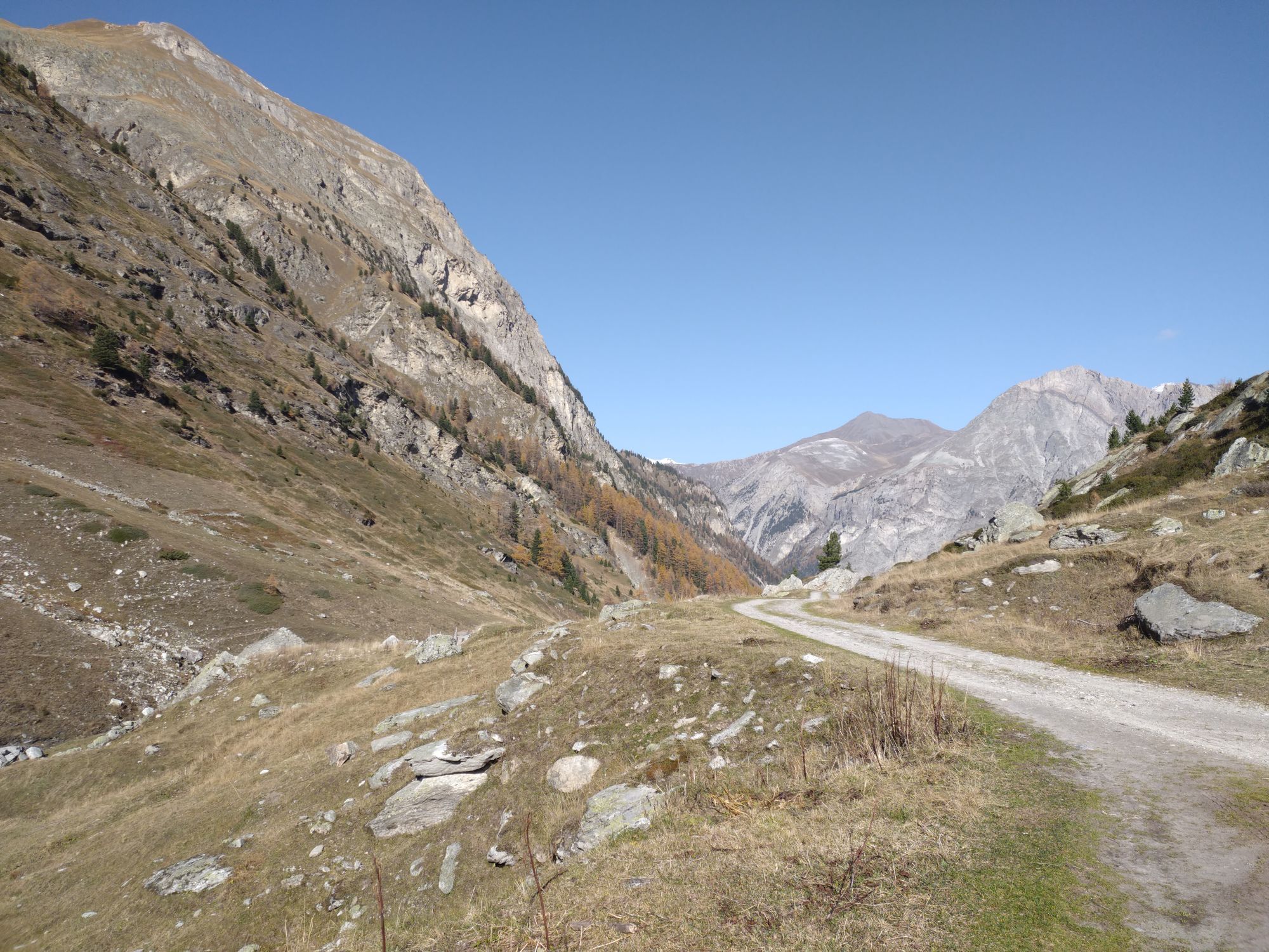
Setting off at a time when the dew is still dripping onto the forest floor, you are soon caressed by the first rays of sunshine. On a path that gradually winds its way through the woods, your steps are...
Opis
Setting off at a time when the dew is still dripping onto the forest floor, you are soon caressed by the first rays of sunshine. On a path that gradually winds its way through the woods, your steps are punctuated
by the quiet, flowing sound of the Etache stream.
After carefully closing the gates as you pass, you suddenly feel the magic of the great high-altitude cembra groves. In the distance, the Grand Bec d'Étache can already be seen.
As you pass by the farm, enhance your picnic with cheeses sold directly all summer long. Barely refueled, the waterfall beckons. But don't stop there. The valley's secrets remain to be discovered. It's time to climb the demanding Plan des Eaux.
Enjoy a refreshing break on the rocks carved out by the torrent before finding your second wind all the way to the highest point of Côte Charbonnière. Enjoy a soothing stopover at Lac du Liael. The whistle of frightened marmots guides you to the Montbas mountain pasture.
Let yourself be carried away by the final descent into the forest. The subtle mix of birdsong will delight walkers and seasoned trail runners alike.
by the quiet, flowing sound of the Etache stream.
After carefully closing the gates as you pass, you suddenly feel the magic of the great high-altitude cembra groves. In the distance, the Grand Bec d'Étache can already be seen.
As you pass by the farm, enhance your picnic with cheeses sold directly all summer long. Barely refueled, the waterfall beckons. But don't stop there. The valley's secrets remain to be discovered. It's time to climb the demanding Plan des Eaux.
Enjoy a refreshing break on the rocks carved out by the torrent before finding your second wind all the way to the highest point of Côte Charbonnière. Enjoy a soothing stopover at Lac du Liael. The whistle of frightened marmots guides you to the Montbas mountain pasture.
Let yourself be carried away by the final descent into the forest. The subtle mix of birdsong will delight walkers and seasoned trail runners alike.
Trasa
Chapelle Saint-Paul
(1 665 m)
Miejsce kultu
0,0 km
Le Planay
(1 658 m)
Rozliczenie
0,0 km
Chalets de la Combe d'Étache
(2 076 m)
Korytarz/teren
4,5 km
Montbas
(2 062 m)
Rozliczenie
14,0 km
La Tuile
(1 688 m)
Rozliczenie
16,7 km
Chapelle Saint-Paul
(1 665 m)
Miejsce kultu
16,9 km
Le Planay
(1 658 m)
Rozliczenie
17,0 km
Trasa
Trail du fond d'Etache
ciężki
Trailrunning
17,01
km
Chapelle Saint-Paul
(1 665 m)
Miejsce kultu
0,0 km
Le Planay
(1 658 m)
Rozliczenie
0,0 km
Chalets de la Combe d'Étache
(2 076 m)
Korytarz/teren
4,5 km
Montbas
(2 062 m)
Rozliczenie
14,0 km
La Tuile
(1 688 m)
Rozliczenie
16,7 km
Chapelle Saint-Paul
(1 665 m)
Miejsce kultu
16,9 km
Le Planay
(1 658 m)
Rozliczenie
17,0 km
Autor
Dostarczone przez Haute Maurienne Vanoise
Wycieczkę Trail du fond d'Etache zapewnia outdooractive.com.


Informacje o trasie
Trasa
To guide you in the field, consult the "step-by-step" directional diagram provided in pdf.
Dodatkowe informacje i wskazówki
Dodatkowe informacje
1/ How is trail running time calculated? Trail times are calculated on the basis of reference paces for a regular runner who practices running on average 1 or 2 times a week. 600m/h ascent in altitude 900m/h ascent on descent 9km/h on the flat
2/ Using GPX tracks As hazards may occur at any time on the routes, the GPX tracks provided are not contractual. They are given for information only. Riders use them at their own risk, depending on their level of technological proficiency and their understanding of the terrain.
2/ Using GPX tracks As hazards may occur at any time on the routes, the GPX tracks provided are not contractual. They are given for information only. Riders use them at their own risk, depending on their level of technological proficiency and their understanding of the terrain.
Nie ma jeszcze recenzji
Popularne wycieczki w okolicy
-
5,0
BARDONECCHIA Colle Sommeiller
średniMountainbike 25,4 km -
5,0
BARDONECCHIA Forte Jafferau Loop
ciężkiMountainbike 36,8 km -
5,0
BARDONECCHIA Decauville
średniWędrówka 7,29 km -
little 'Haute-Maurienne Vanoise' circuit
ciężkiDroga rowerowa 32,0 km -
BARDONECCHIA Monte Jafferau
ciężkiWędrówka 11,6 km -
4,0
BARDONECCHIA Sentiero dei Cosetti by Luciano Ferraris
światłoWędrówka 3,24 km -
5,0
BARDONECCHIA Decauville
światłoRakieta do chodzenia po śniegu 4,11 km -
BARDONECCHIA Frejusia Basins - Decauville - Rochemolles Dam
światłoMountainbike 7,54 km -
BARDONECCHIA Rochemolles Dam - Scarfiotti Refuge
średniWędrówka 7,77 km -
Refuge du Fond d'Aussois - a wild valley in the Vanoise - 2-day hike
światłoWędrówka 9,22 km

Wędrówki i tropienie

Ponad 550.000 propozycji wycieczek, szczegółowe mapy i intuicyjny planer tras sprawiają, że aplikacja jest niezbędna dla wszystkich entuzjastów przyrody.

Nie przegap ofert i inspiracji na następne wakacje
Zapisz się do newslettera
Błąd
Wystąpił błąd. Spróbuj ponownie.
Dziękujemy za rejestrację
Twój adres e-mail została dodana do listy mailingowej.
Wycieczki po całej Europie
Austria
Szwajcaria
Niemcy
Włochy
Słowenię
Francja
Holandia
Belgia
Polska
Liechtenstein
Czechy
Słowacja
Hiszpania
Chorwacja
Bośnia i Hercegowina
Luksemburg
Andorra
Portugalia
Islandia
Wielka Brytania
Irlandia
Grecja
Albania
Macedonia Północna
Malta
Norwegia
Czarnogóra
Mołdawia
Kosowo
Węgry
San Marino
Rumunia
Estonia
Łotwa
Białoruś
Cypr
Litwa
Serbia
Bułgaria
Monako
Dania
Szwecja
Finlandia





