


Refuge du Fond d'Aussois - a wild valley in the Vanoise - 2-day hike
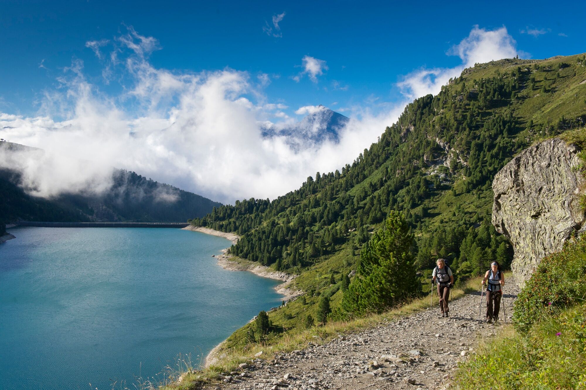
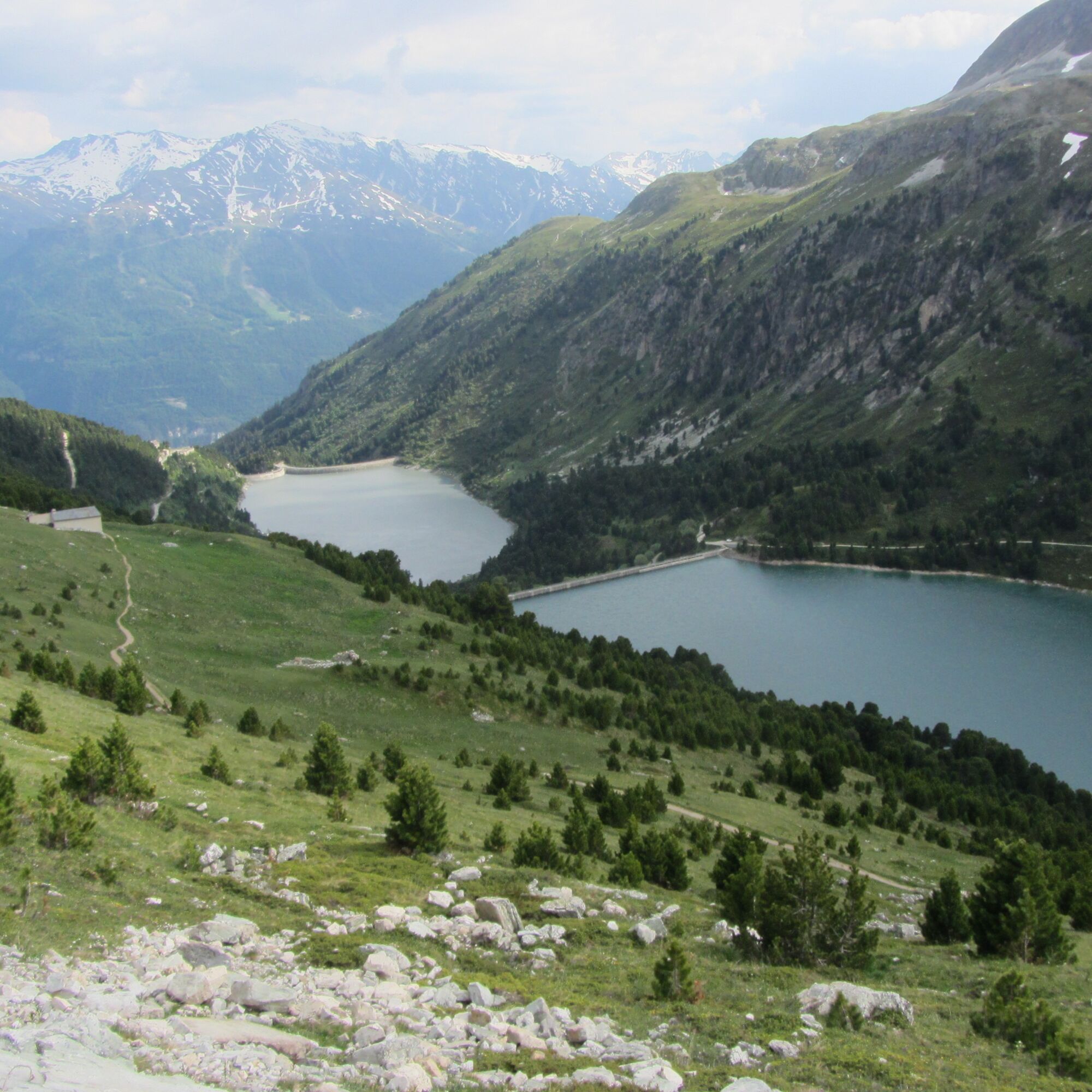
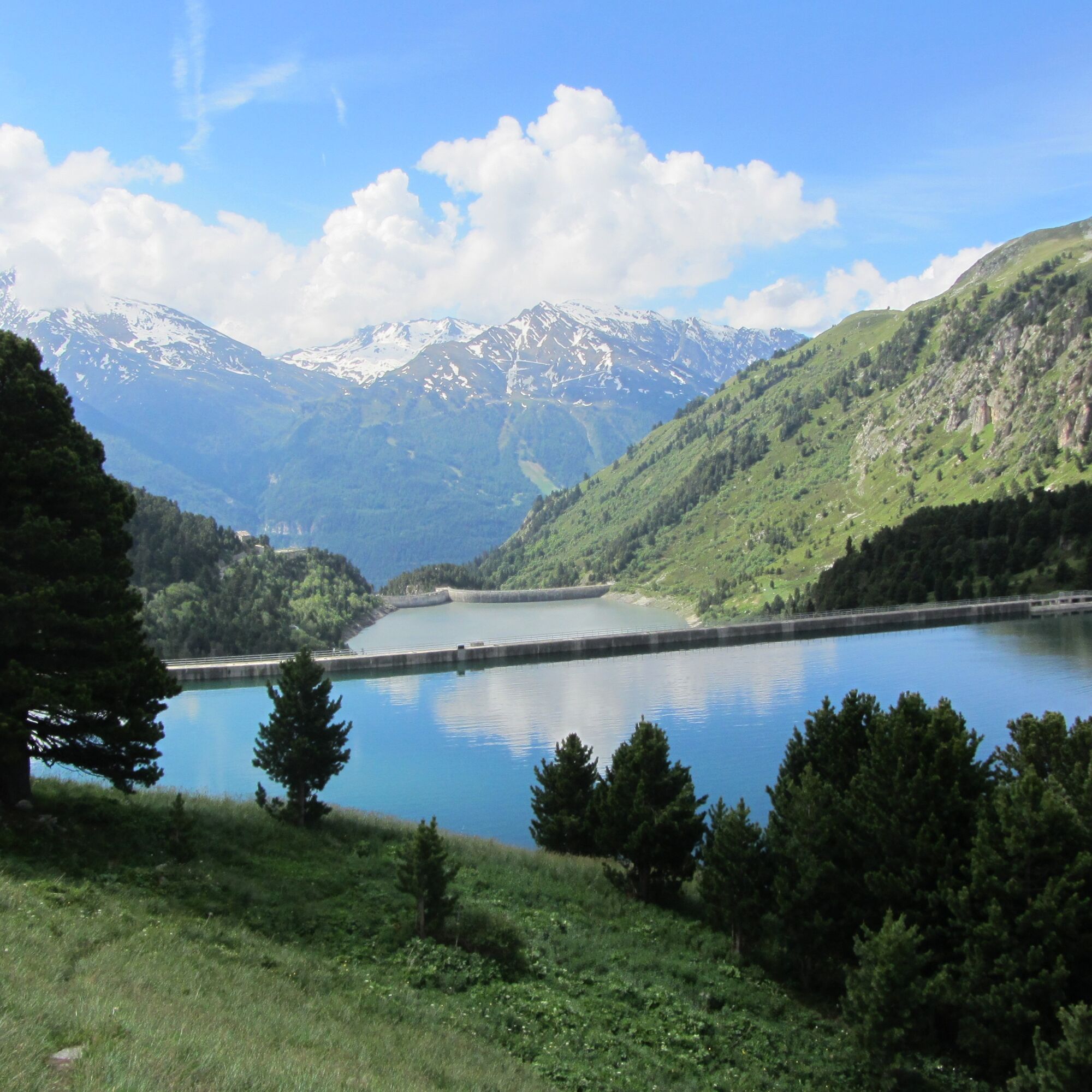
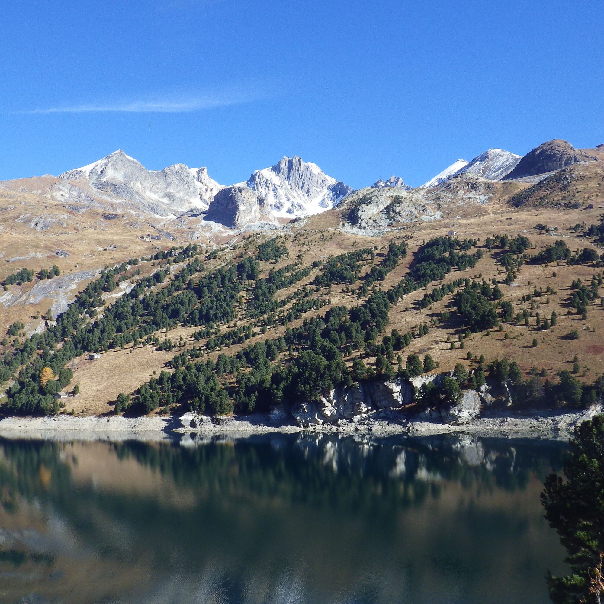
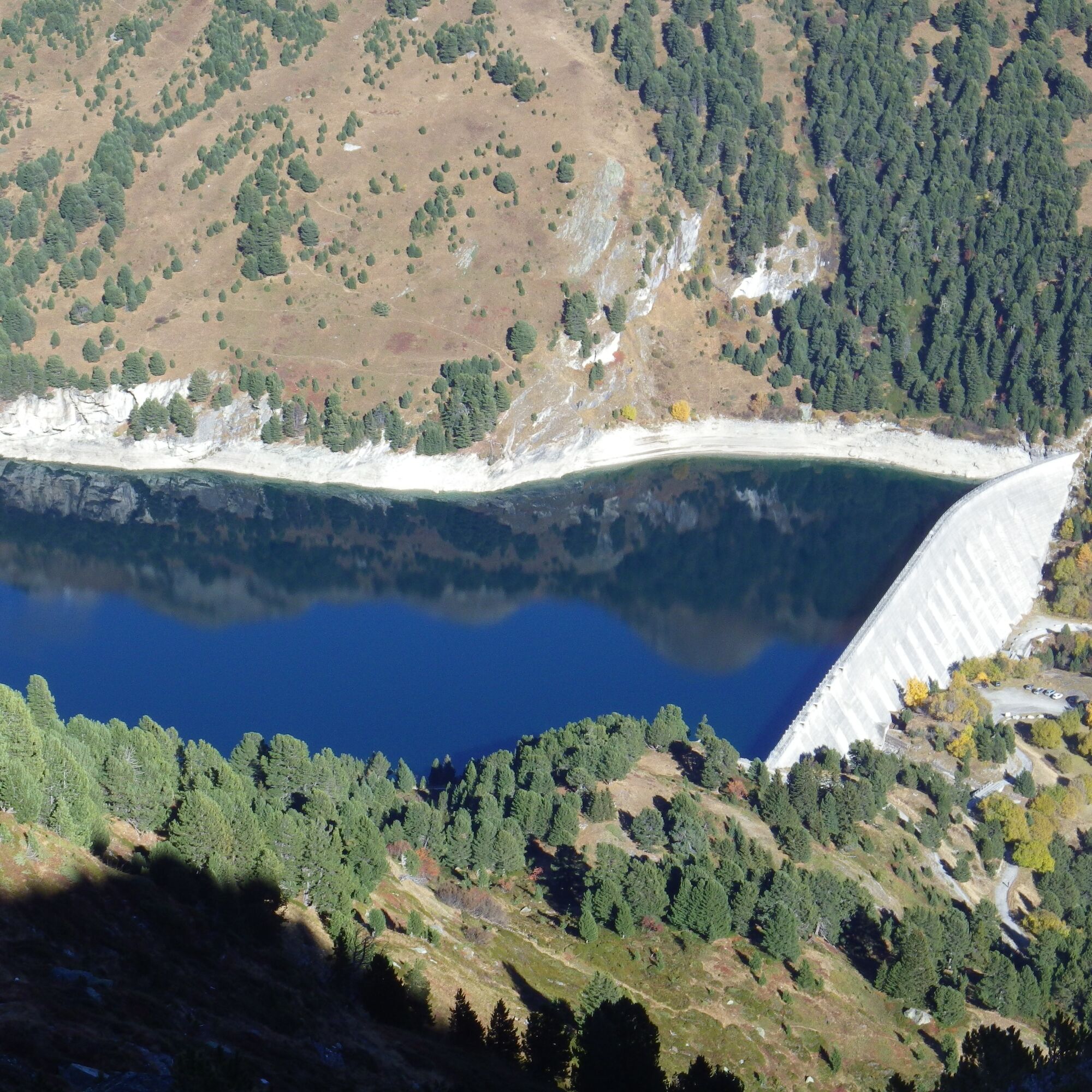
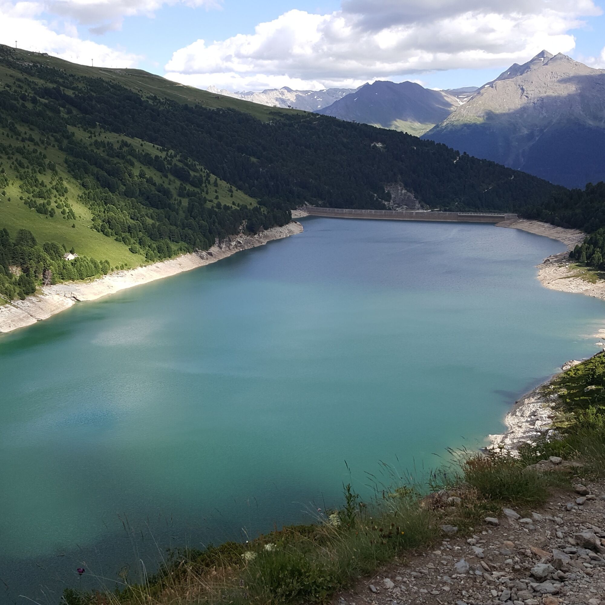
Did you know that the body of water you're walking along and its twin below have a curious function? These hydroelectric dams power an aerospace wind tunnel where model airplanes and rockets are tested.
But...
But you don't need such machines to admire these turquoise waters.
Set off along the path lined with sweet-smelling rhododendrons and stone pines! Many animals inhabit this little paradise: marmots, squirrels, bearded vultures, ibexes... you may even come across one of them.
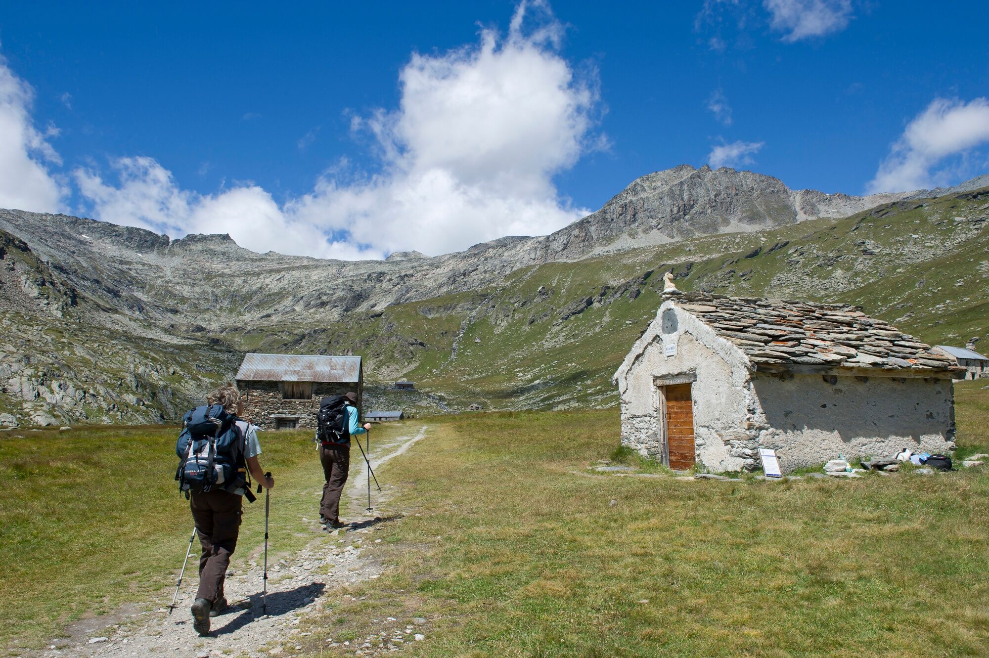
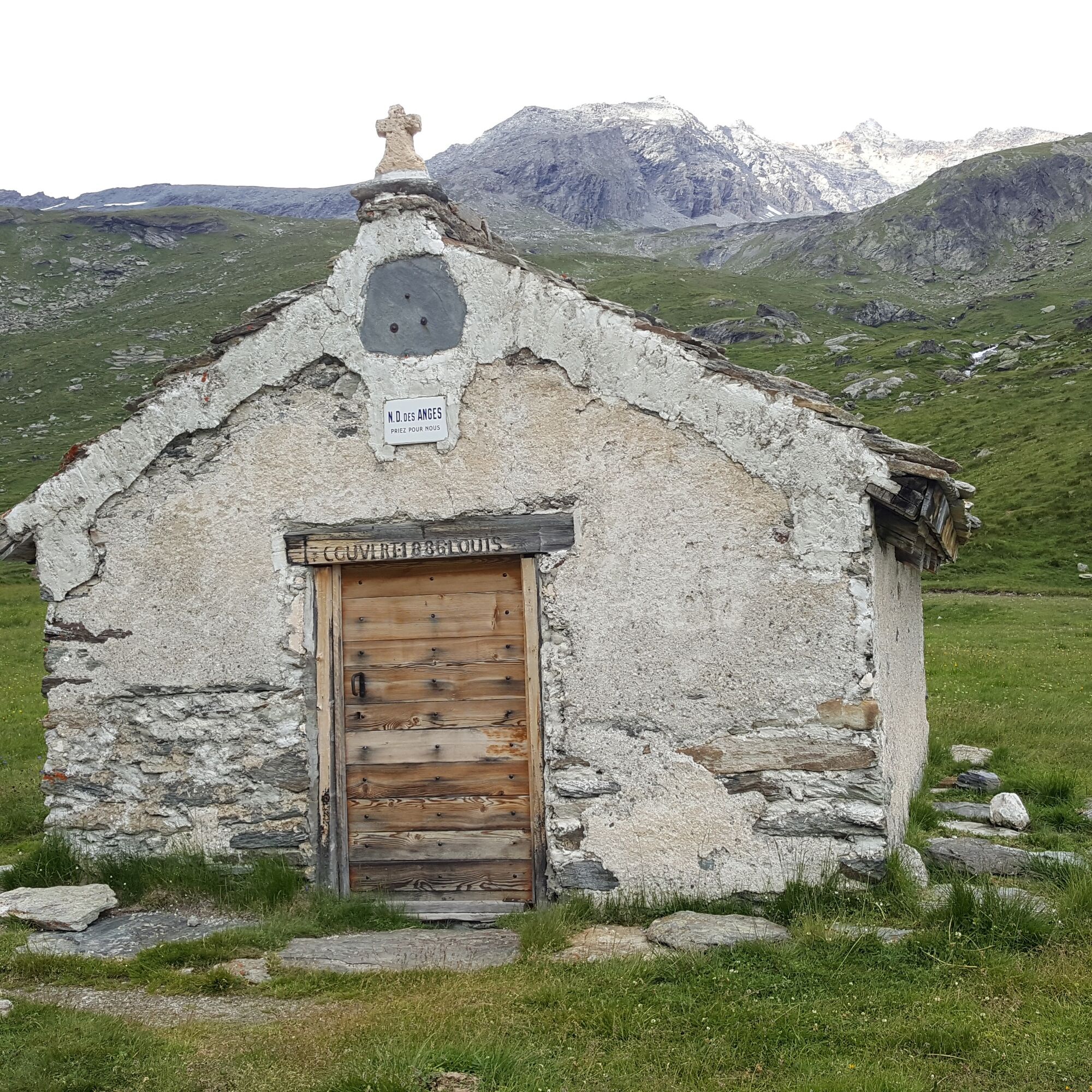
You come to a plain where a peaceful stream meanders. Follow it to the pretty Notre-Dame-des-Anges chapel, where a few fluttering jackdaws seem to stand guard.
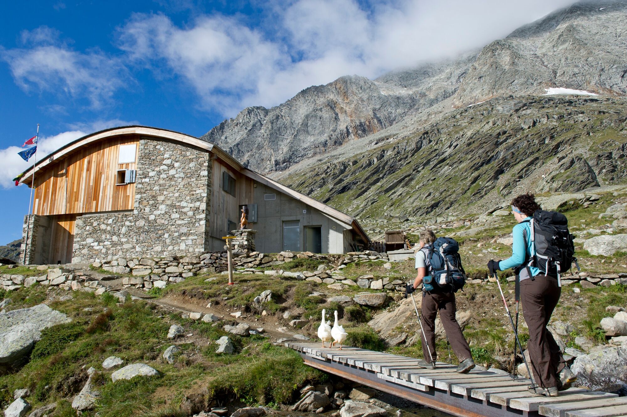
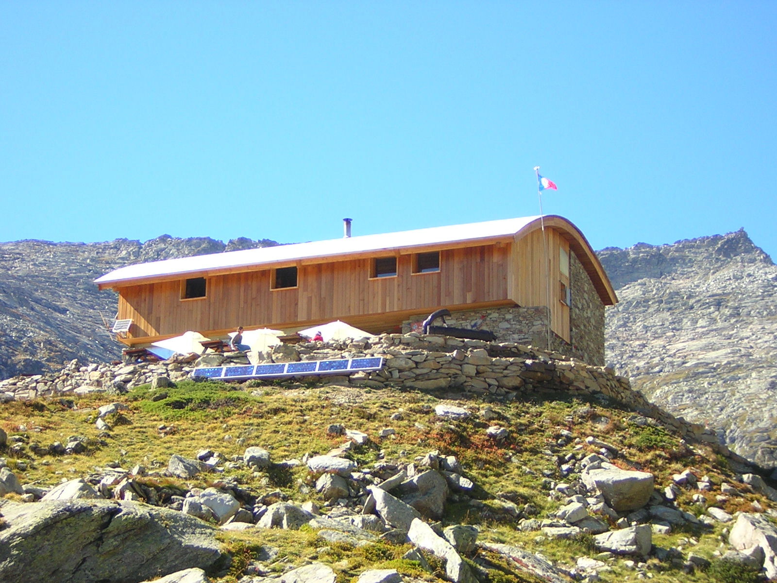
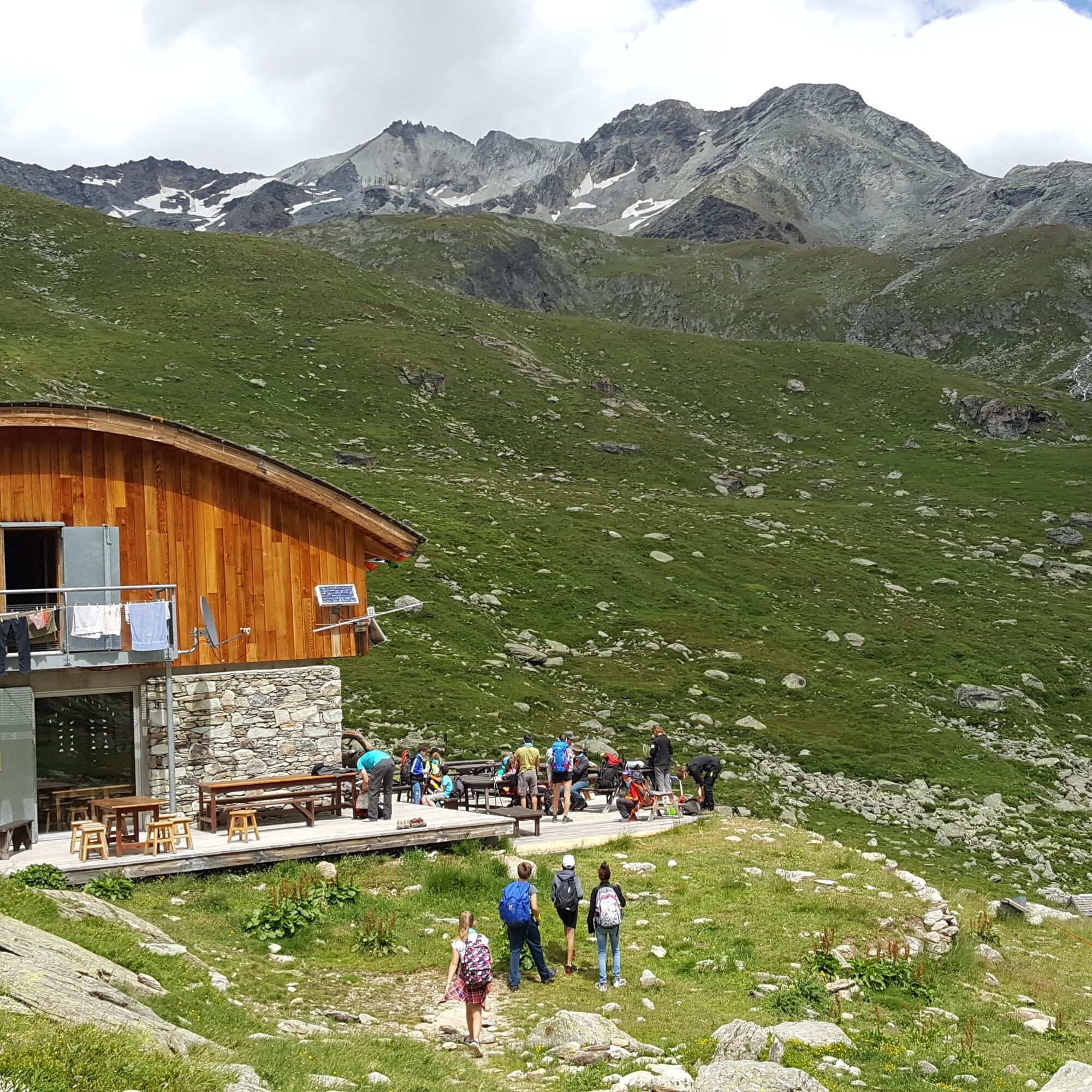
Finally, you arrive at the refuge, overlooking the former "Chalet de la Marie". The warm welcome from Tim and his team, as well as the organic and local catering, are sure to entice you to stop off. This is your base camp for the evening.
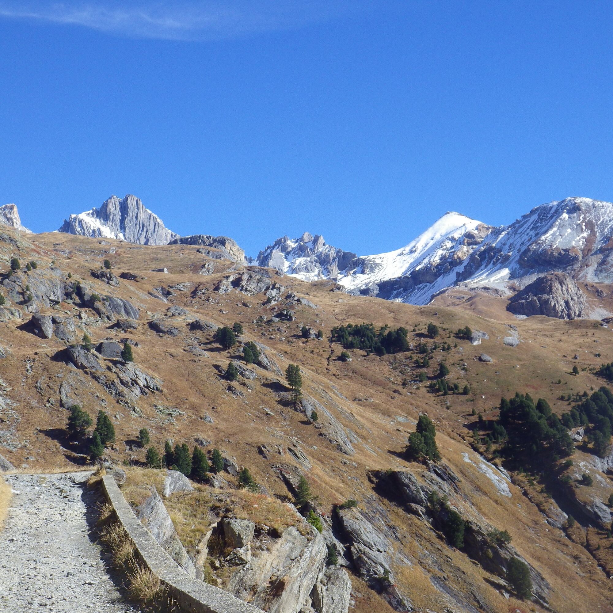
The more daring will be tempted to continue on a slightly steeper slope towards the Col d'Aussois. But their efforts will be amply rewarded by the breathtaking views of the Vanoise and all the surrounding massifs.
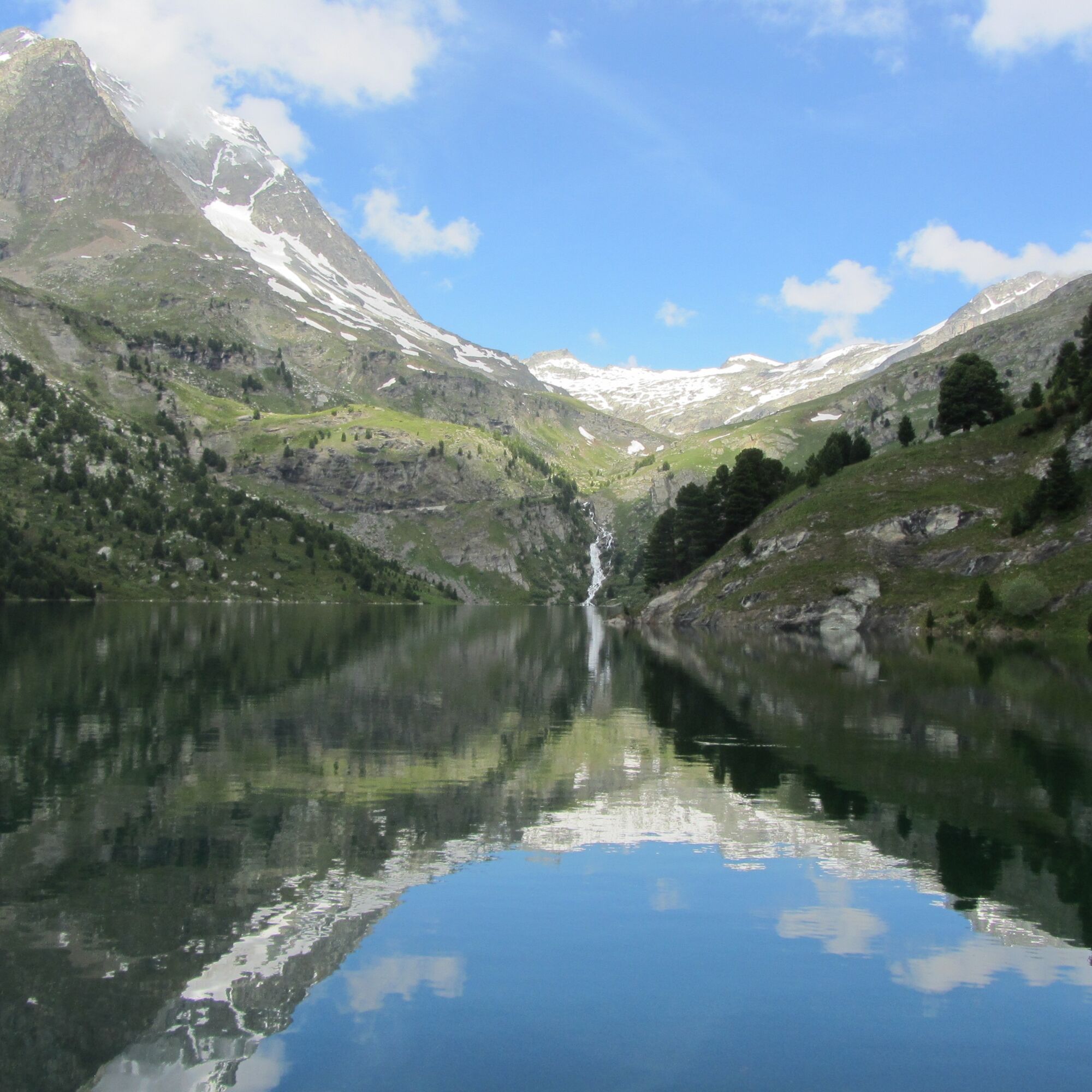
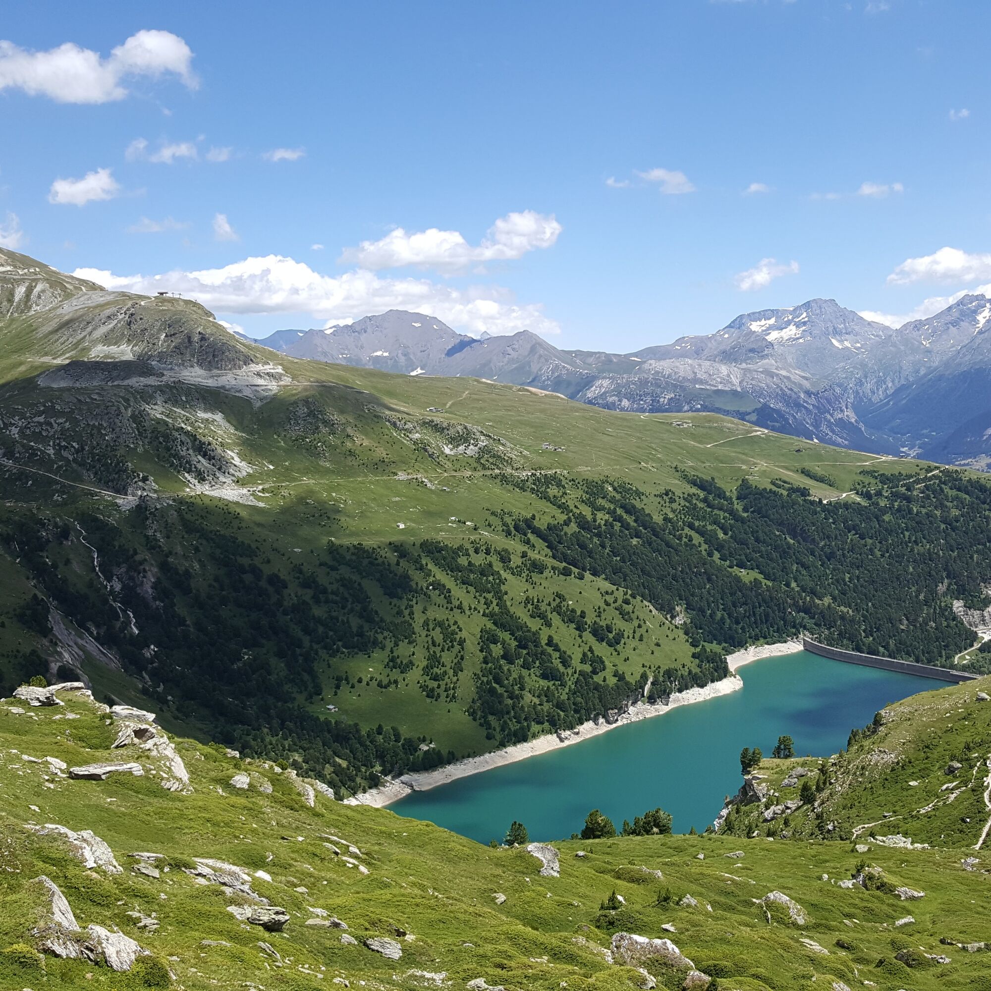
The next day, we return to the other side of the lake, under the watchful eye of the mythical Dent Parrachée, at an altitude of 3687m. Along the way, the Fournache and Plan Sec refuges offer you the opportunity for another gourmet break. There's no doubt you'll be coming back for more.

Start: Free parking lot at the dams, 7 km from Aussois. Road closed to coaches.
1/ DAY 1: from "Parking des Barrages" to "Refuge du Fond d'Aussois" / Duration: 2 h / Ascent: + 349 m / From the "Parking des Barrages", continue on the dirt road overlooking the dam. The trail rises gently along the Lac de Plan d'Amont to the Pont de la Séteria. After crossing the torrent, continue to the crossroads, then leave the GR5 (refuge de la Fournache) to turn left towards Fond d'Aussois and the refuge du Fond d'Aussois. Once on the plateau, pass by the Chapelle Notre-Dame des Anges built in 1886 by Louis Couvert. The route then passes the Chalet de la Marie, which was a refuge until 2003. After a final climb, you arrive at the new Fond d'Aussois refuge (CAF), built in 2004. If you're feeling more sporty, you can venture up to the Col d'Aussois and the Pointe de l'Observatoire at 3015 m (beware, it's much more vertiginous): allow 3h15 round trip.
2/ DAY 2: from "Refuge du Fond d'Aussois" to "Parking des Barrages" / Duration: 1h45 / Ascent: + 144 m and - 463 m / From the refuge, retrace your steps to the crossroads. Turn left towards the Refuge de la Fournache. The route continues gradually downhill to the foot of the dam / Option to return via La Fournache. Access trail to the Grand Jeu chairlift, open all summer except Saturdays, via the Plan Sec refuge.
Refuge en Famille" label. You must book your overnight stay in a refuge in advance. Stay on the trails and follow the signs, and take your garbage with you.


Popularne wycieczki w okolicy
The White Lake
światłoWędrówka 4,42 km- 5,0
The Builder's Trail on foot
światłoTrasa tematyczna 7,23 km Col de l'Iseran from Modane
ciężkiDroga rowerowa 59,5 kmCol du Mont Cenis from Lanslebourg
ciężkiDroga rowerowa 9,84 kmCol du Mont Cenis from Modane
ciężkiDroga rowerowa 34,8 km- 5,0
Goldtoni - Alpenbogen A068 Refuge de la Leisse-Termignon Val Cenis
średnidługodystansowy szlak pieszy 28,7 km - 5,0
Walking tour of the Plan du Lac refuge
światłoWędrówka 4,58 km - 5,0
Girarde footpath
światłoWędrówka 8,10 km Petit Mont-Cenis pass
ciężkiDroga rowerowa 18,0 kmSentier pédestre des Sculptures - Land Art Montagne
światłoTrasa tematyczna 5,16 km
Wędrówki i tropienie


Nie przegap ofert i inspiracji na następne wakacje
Twój adres e-mail została dodana do listy mailingowej.