
Trail to the Avérole refuge via the hamlet
światło
Pobierz tę trasę na swój telefon komórkowy
Trail to the Avérole refuge via the hamlet
światło
Trailrunning
9,36
km
Zeskanuj kod QR i rozpocznij nawigację w aplikacji bergfex.


Wędrówki i tropienie





Trail to the Avérole refuge via the hamlet
światło
Odległość
9,36
km
Czas trwania
01:35
h
Ascent
334
hm
Poziom morza
1 827 -
2 204
m
Ścieżka do pobrania
Trail to the Avérole refuge via the hamlet
światło
Trailrunning
9,36
km
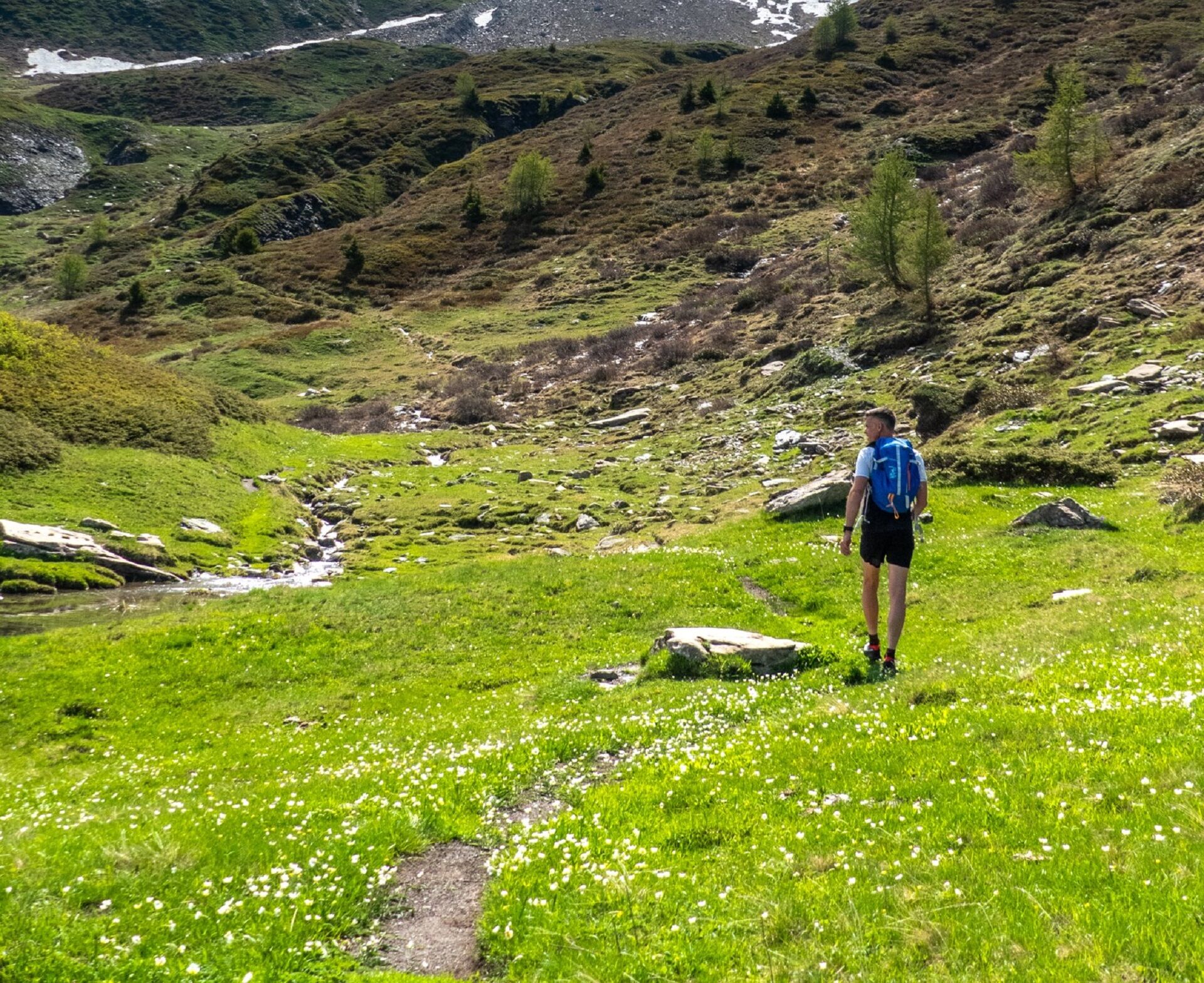
The trail winds through this wild and secluded valley, following the Avérole
torrent. The sound of water flowing through this fold in the mountains
accompanies you throughout your hike, just as it once...
Opis
The trail winds through this wild and secluded valley, following the Avérole
torrent. The sound of water flowing through this fold in the mountains
accompanies you throughout your hike, just as it once accompanied the
peddlers selling their goods door to door as they travelled to Italy. Once upon
a time, this valley was not so sparsely populated. Look around you, there are
traces of the former bustling agricultural life everywhere! Who built this dry
stone wall that safeguard the path between hamlets? Who prayed at these
oratories and chapels dotted along the route? Who lived in these houses
with stone roofs built in the traditional mountain village style? There were
many people living here in bygone days and they've left their footprints.
Follow these footprints to the refuge, a cosy nest where you'll be welcomed
by Virginie, the guardian.
Feast your eyes on the majestic Charbonnel peak, rising to 3,752 metres,
dwarfing its neighbours that still reach 3,000 metres!
torrent. The sound of water flowing through this fold in the mountains
accompanies you throughout your hike, just as it once accompanied the
peddlers selling their goods door to door as they travelled to Italy. Once upon
a time, this valley was not so sparsely populated. Look around you, there are
traces of the former bustling agricultural life everywhere! Who built this dry
stone wall that safeguard the path between hamlets? Who prayed at these
oratories and chapels dotted along the route? Who lived in these houses
with stone roofs built in the traditional mountain village style? There were
many people living here in bygone days and they've left their footprints.
Follow these footprints to the refuge, a cosy nest where you'll be welcomed
by Virginie, the guardian.
Feast your eyes on the majestic Charbonnel peak, rising to 3,752 metres,
dwarfing its neighbours that still reach 3,000 metres!
Trasa
Vincendières
(1 851 m)
Rozliczenie
0,2 km
Chapelle Saint-Pierre
(1 994 m)
Miejsce kultu
2,2 km
Refuge d'Avérole
(2 211 m)
Schronienie
4,6 km
Fenêtre de l'Île
(2 041 m)
Wejście do jaskini
6,3 km
Vincendières
(1 851 m)
Rozliczenie
9,3 km
Trasa
Trail to the Avérole refuge via the hamlet
światło
Trailrunning
9,36
km
Vincendières
(1 851 m)
Rozliczenie
0,2 km
Avérole
(1 986 m)
Rozliczenie
2,1 km
Chapelle Saint-Pierre
(1 994 m)
Miejsce kultu
2,2 km
Refuge d'Avérole
(2 211 m)
Schronienie
4,6 km
Fenêtre de l'Île
(2 041 m)
Wejście do jaskini
6,3 km
Vincendières
(1 851 m)
Rozliczenie
9,3 km
Autor
Dostarczone przez Haute Maurienne Vanoise
Wycieczkę Trail to the Avérole refuge via the hamlet zapewnia outdooractive.com.

Ostatnio śledzony
3 tygodnie temu

Informacje o trasie
Trasa
To guide you in the field, consult the "step-by-step" directional diagram provided in pdf.
Dodatkowe informacje i wskazówki
Dodatkowe informacje
1/ How is trail running time calculated? Trail times are calculated on the basis of reference paces for a regular runner who practices running on average 1 or 2 times a week. 600m/h ascent in altitude 900m/h ascent on descent 9km/h on the flat
2/ Using GPX tracks As hazards may occur at any time on the routes, the GPX tracks provided are not contractual. They are given for information only. Riders use them at their own risk, depending on their level of technological proficiency and their understanding of the terrain.
2/ Using GPX tracks As hazards may occur at any time on the routes, the GPX tracks provided are not contractual. They are given for information only. Riders use them at their own risk, depending on their level of technological proficiency and their understanding of the terrain.
Nie ma jeszcze recenzji
Kamery internetowe z trasy
Uzyskaj wgląd
Zawsze na żywo z ponad 9 500 kamer internetowych. bergfex Jako użytkownik Pro, możesz teraz zobaczyć odpowiednie kamery internetowe dla wielu wycieczek w aplikacji wycieczki od. Pozwala to na bezpośredni podgląd aktualnych warunków.

Popularne wycieczki w okolicy
-
4,5
Rocciamelone partedjo dalla Riposa. Mompantero, Piemont/Italien
średniWędrówka 10,6 km -
5,0
The Grand Méan lake via the Evettes circus
ciężkiWędrówka 13,6 km -
5,0
BALME Green Lakes and Lago Paschiet
średniWędrówka 7,51 km -
4,5
Hiking at Lake Clair
ciężkiWędrówka 6,99 km -
little 'Haute-Maurienne Vanoise' circuit
ciężkiDroga rowerowa 32,0 km -
5,0
BALME Arnas Ring - Pian della Mussa
ciężkiWędrówka 13,6 km -
USSEGLIO Lake Nero from Lake Malciaussia
światłoWędrówka 4,79 km -
5,0
Alta Via delle Valli di Lanzo | Stage 4 Rifugio Citt di Ciri - Rifugio Cibrario
ciężkiWędrówka 12,0 km -
4,7
High Way of the Lanzo Valleys | Stage 6 Tazzetti Refuge - Lake of Malciaussia
średniWędrówka 5,49 km -
USSEGLIO Lake behind the Tower and of the Rossa
ciężkiWędrówka 17,1 km
Wędrówki i tropienie

Ponad 550.000 propozycji wycieczek, szczegółowe mapy i intuicyjny planer tras sprawiają, że aplikacja jest niezbędna dla wszystkich entuzjastów przyrody.

Nie przegap ofert i inspiracji na następne wakacje
Zapisz się do newslettera
Błąd
Wystąpił błąd. Spróbuj ponownie.
Dziękujemy za rejestrację
Twój adres e-mail została dodana do listy mailingowej.
Wycieczki po całej Europie
Austria
Szwajcaria
Niemcy
Włochy
Słowenię
Francja
Holandia
Belgia
Polska
Liechtenstein
Czechy
Słowacja
Hiszpania
Chorwacja
Bośnia i Hercegowina
Luksemburg
Andorra
Portugalia
Islandia
Wielka Brytania
Irlandia
Grecja
Albania
Macedonia Północna
Malta
Norwegia
Czarnogóra
Mołdawia
Kosowo
Węgry
San Marino
Rumunia
Estonia
Łotwa
Białoruś
Cypr
Litwa
Serbia
Bułgaria
Monako
Dania
Szwecja
Finlandia





