


Chemin des Contrées
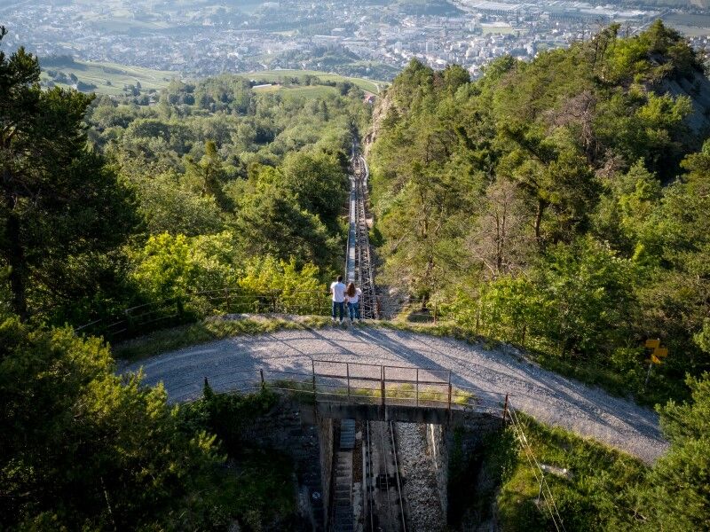
Connecting the Noble and Louable Contrée (territory joining Sierre to the Plaine Morte) by an unprecedented route, here is the adventure of the "Chemin des Contrées." The inhospitable area of the Boup...
Connecting the Noble and Louable Contrée (territory joining Sierre to the Plaine Morte) by an unprecedented route, here is the adventure of the "Chemin des Contrées." The inhospitable area of the Boup chasm, the forests of Echerts and those of Chertines were previously impassable.
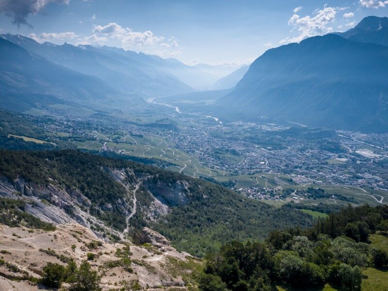
To the east, Mollens forms the starting point for this hike, accessible most of the year, in a bucolic setting. The territory of the former municipality is vast – more than 3000 hectares – stretching from the Planige plateau above Miège to the Faverges, at the border with the canton of Bern.
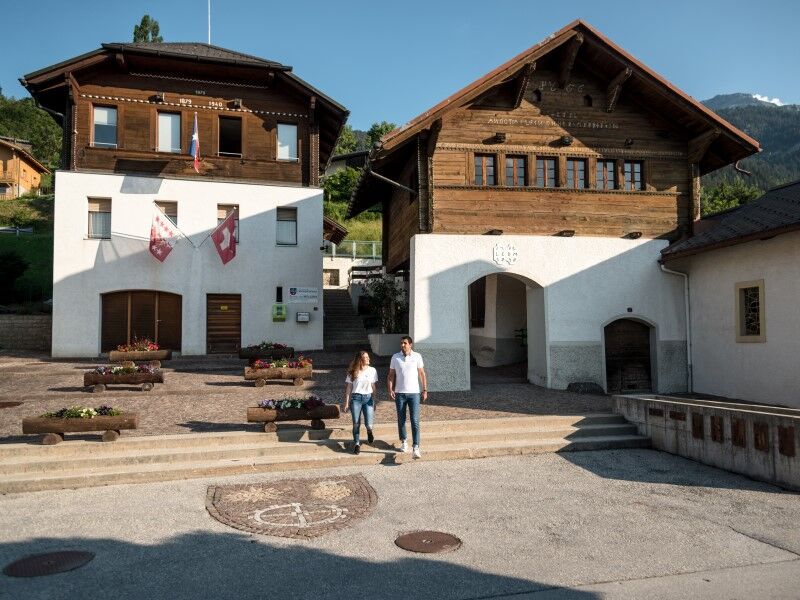
Along the route, different historical buildings such as the chapel, the bourgeois house, or the municipal building of Mollens allow walkers to learn about the richness of the regional heritage. The parish church of St-Maurice de Laques, of medieval origin, was a high place of worship for the Contrée. So, hikers contemplate 750 years of history.
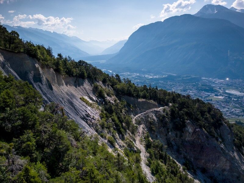
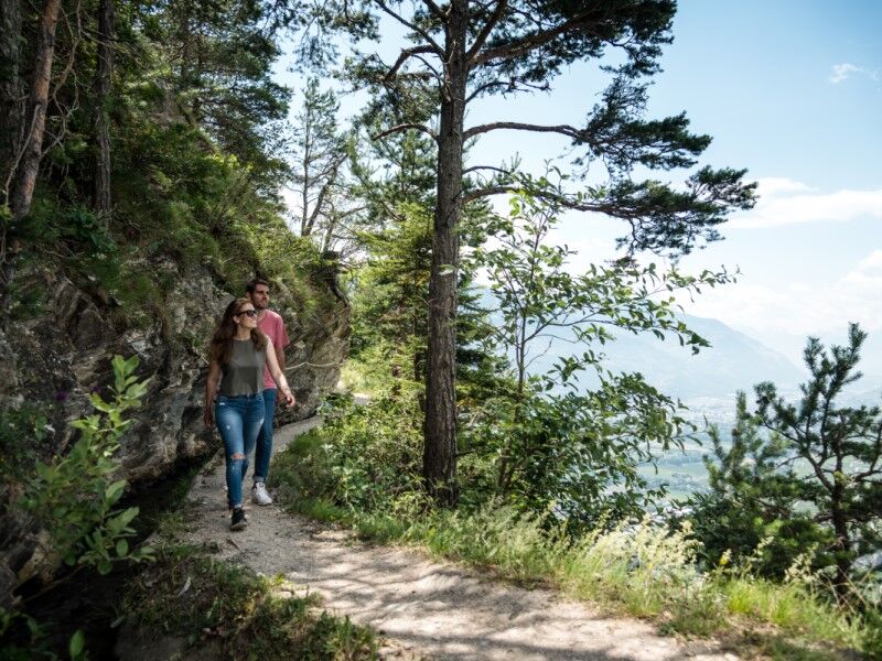
Further on, the locality known as "Le Boup" (a patois name meaning "hole" or "chasm") is a legacy of glacial retreat. This incredible natural arena will delight geology lovers. This mineral space transforms into a true Amazonian forest when vegetation starts in spring.

Mollens - Departure from the Carrefour de la Poste - Cross the Route Cantonale (Rue de Montana) - Take Rue de la Ciblette - Then Route de Tsampriman (ON YOUR LEFT) - Then Route de la Gare - St-Maurice-de-Laques - Diogne - Chermignon-d'en-Bas - Icogne
Tak
Tak
Good walking shoes.
Certain sections are not recommended for people prone to vertigo.
Follow the marked trails. Please respect the fauna, flora: nature.
Check the weather conditions before your departure.
Crans-Montana Tourism & Congress declines all responsibility in case of an accident.
To reach Mollens by car, take the exit from the A9 motorway (Rhône motorway) named "Sierre East." At the motorway exit, continue straight ahead. At the roundabout, continue straight and follow the signs indicating "Crans-Montana" until the village of Mollens. The travel time is about 20 minutes.
The village of Mollens is accessible from Sierre station and from the Crans-Montana station with the SMC bus company.
The stop closest to the start of the hike is: Mollens VS.
Free parking spaces are available in front of the multipurpose hall, at Rue de l'Ancienne Laiterie 1.
Evaluate your physical condition and capacities well. The use of the different routes is always at your own risk.

Popularne wycieczki w okolicy
-
5,0
Bella-Tola
średniWycieczka wysokogórska 6,72 km -
4,0
Grand Bisse de Lens
światłoWędrówka 8,73 km -
4,0
Tripon - Brac – Ancien Bisse du Torrent Neuf – St. Marguerite – Torrent Neuf – Prafirmin - St. Germain
światłoWędrówka 12,9 km -
4,0
Belvédère via ferrata
średniVia ferrata 1,81 km -
5,0
Wildstrubel Umrundung 4-Tage
średniWędrówka 79,1 km -
Alpweg (Albinen- Torrentalp)
Wędrówka 3,97 km -
Grand bisse d’Ayent
średniWędrówka 11,7 km -
4,5
Sentier viticole / Wine trail
światłoWędrówka 7,49 km -
Bisse du Tsittoret
średniWędrówka 10,6 km -
5,0
Wine route: Venthône – Leuk (Stage 4)
średniWędrówka 12,8 km

Wędrówki i tropienie


Nie przegap ofert i inspiracji na następne wakacje
Twój adres e-mail została dodana do listy mailingowej.