


Sentier des Chamois


The chamois is the emblem of the second largest nature reserve in Switzerland. This light-footed alpine animal conquers even the steepest slopes effortlessly and is perfectly adapted to the alpine terrain...
The chamois is the emblem of the second largest nature reserve in Switzerland. This light-footed alpine animal conquers even the steepest slopes effortlessly and is perfectly adapted to the alpine terrain of the region.
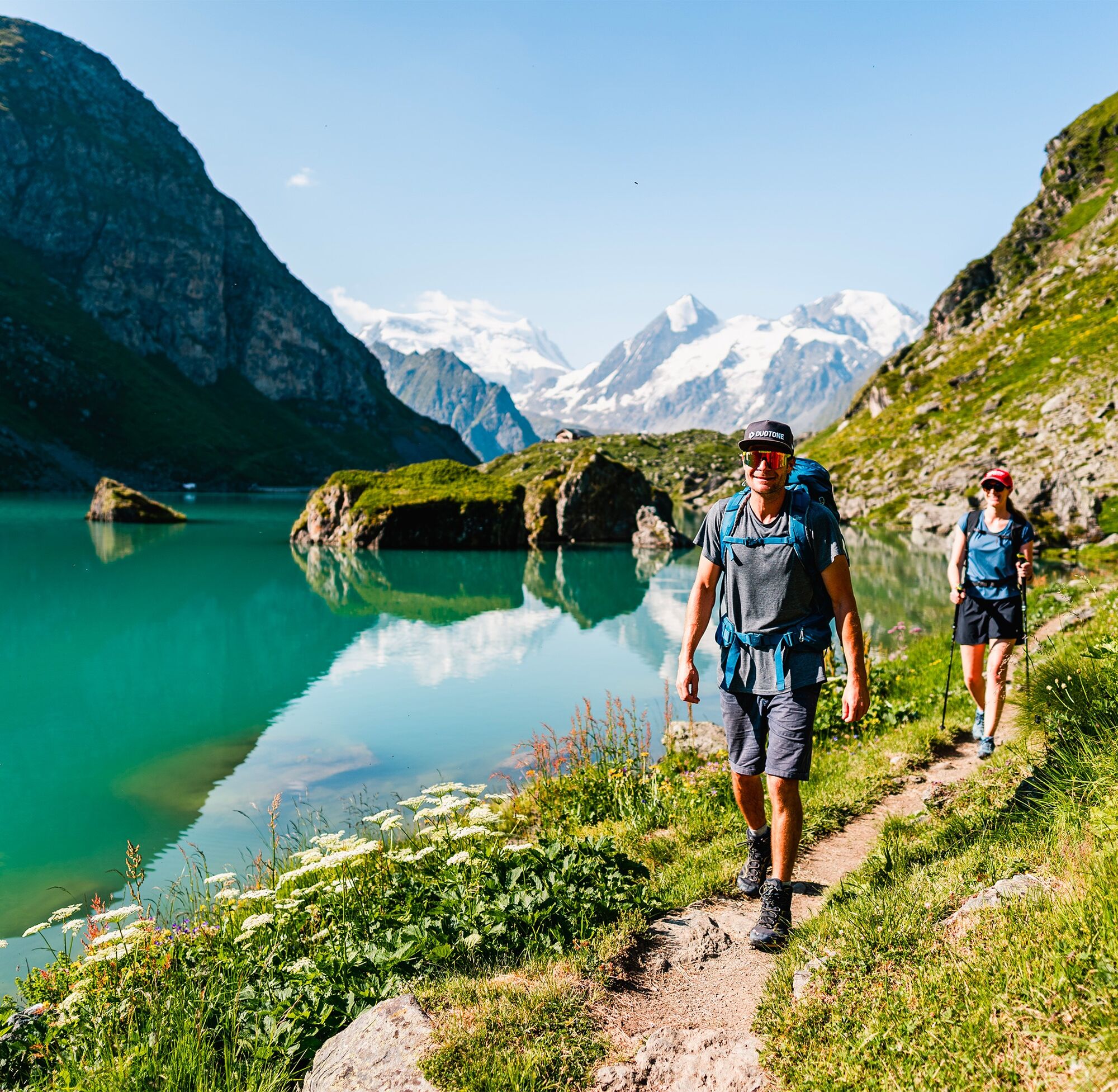
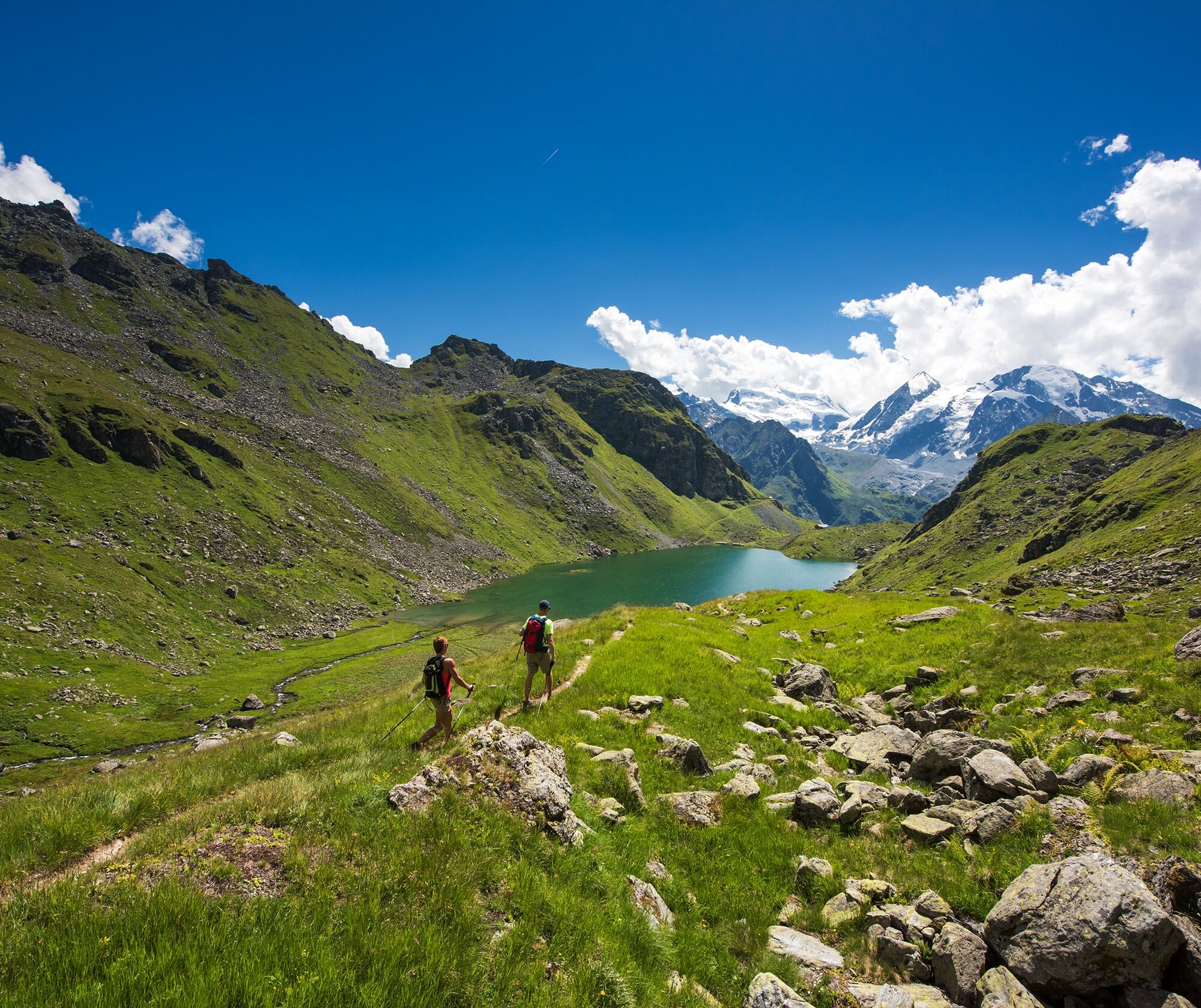
This hike will captivate you with its wild landscape: from high alpine pastures along steep slopes to the idyllic Lac de Louvie with its charming mountain hut and then down to the village of Fionnay in the valley floor. The path starts in La Chaux, but you can also start in Les Ruinettes and pay a visit to the 3D sculpture park, where sculptures are displayed in open nature.
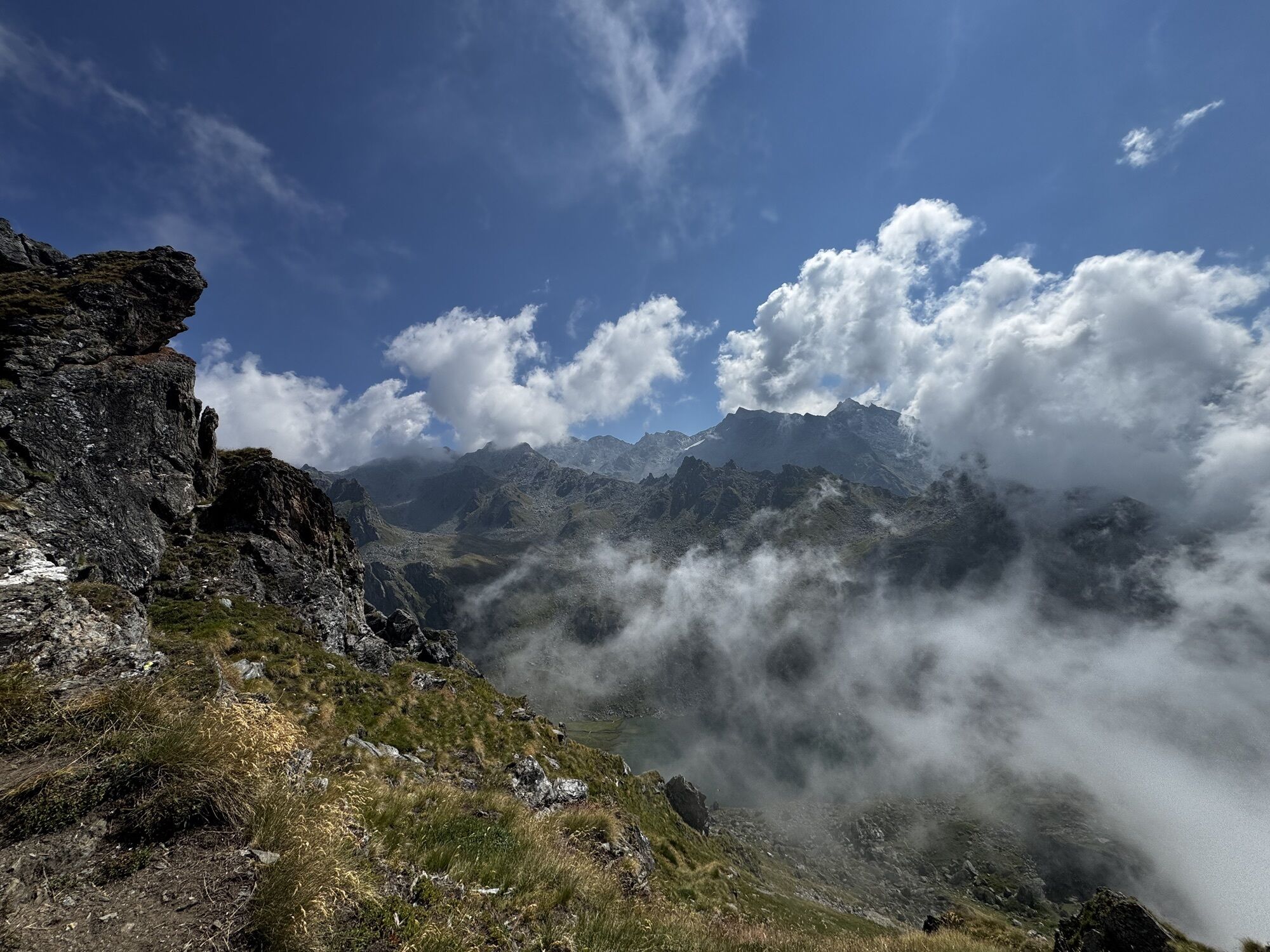
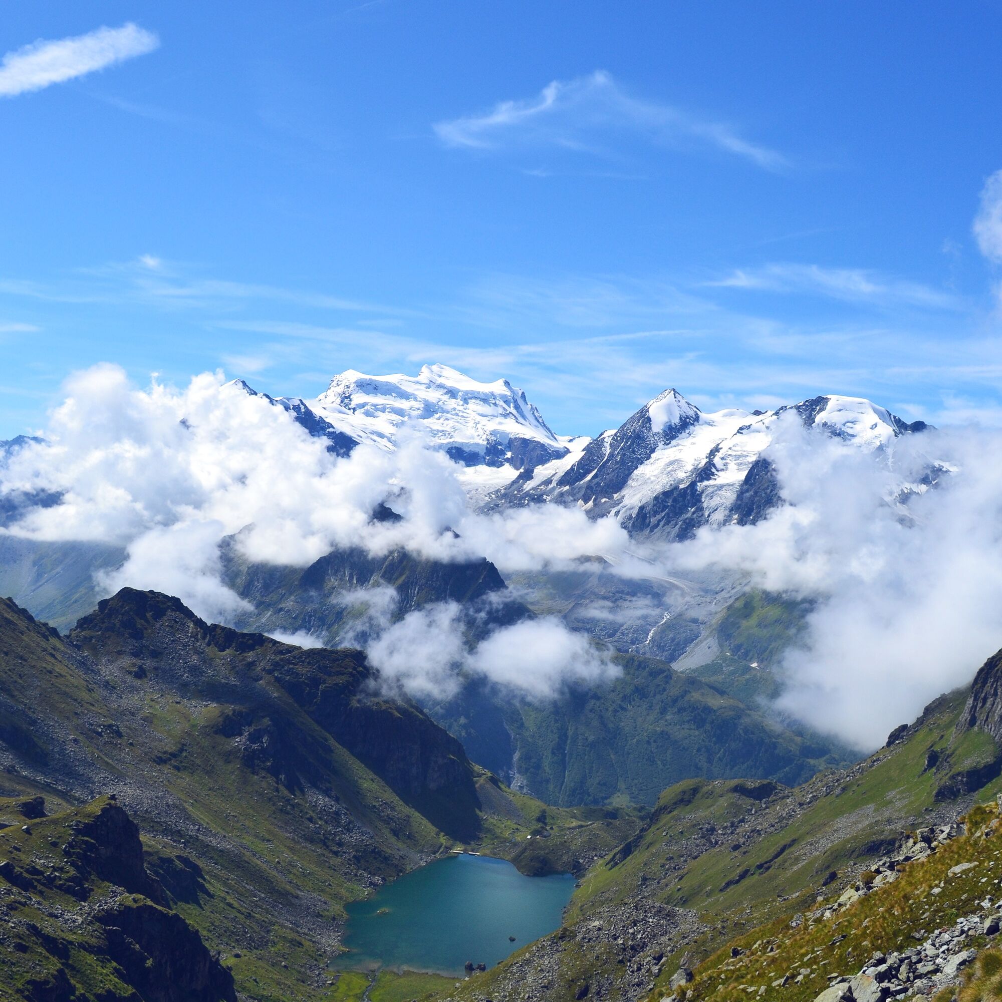
At the beginning of the hike, the path leads over pastures where Eringer cows often graze before it becomes rockier and the landscape gradually wilder. As the steepness increases, the view becomes breathtaking and sure footing as well as a head for heights are required, especially at the highest point of the tour, Col Termin.
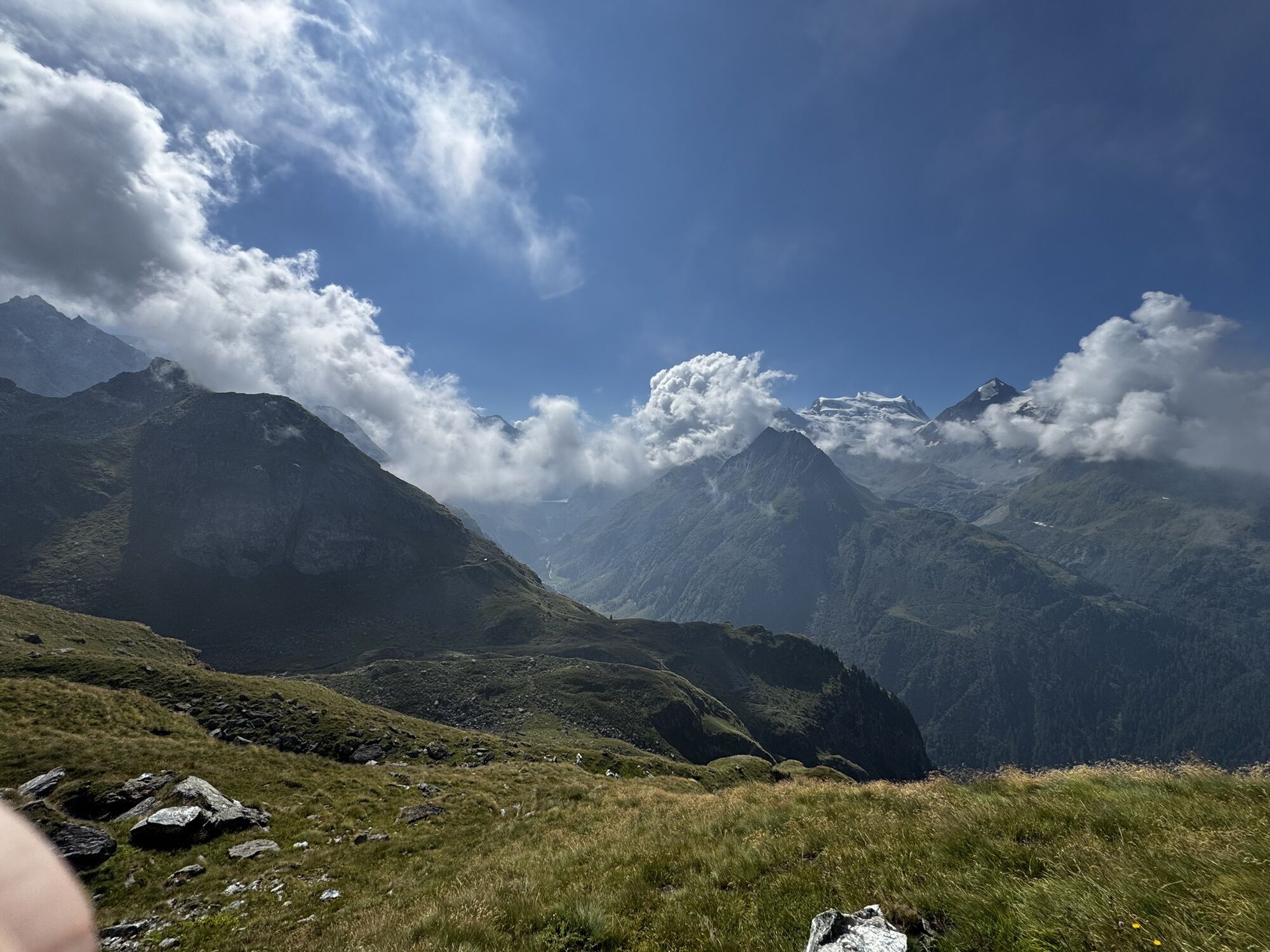
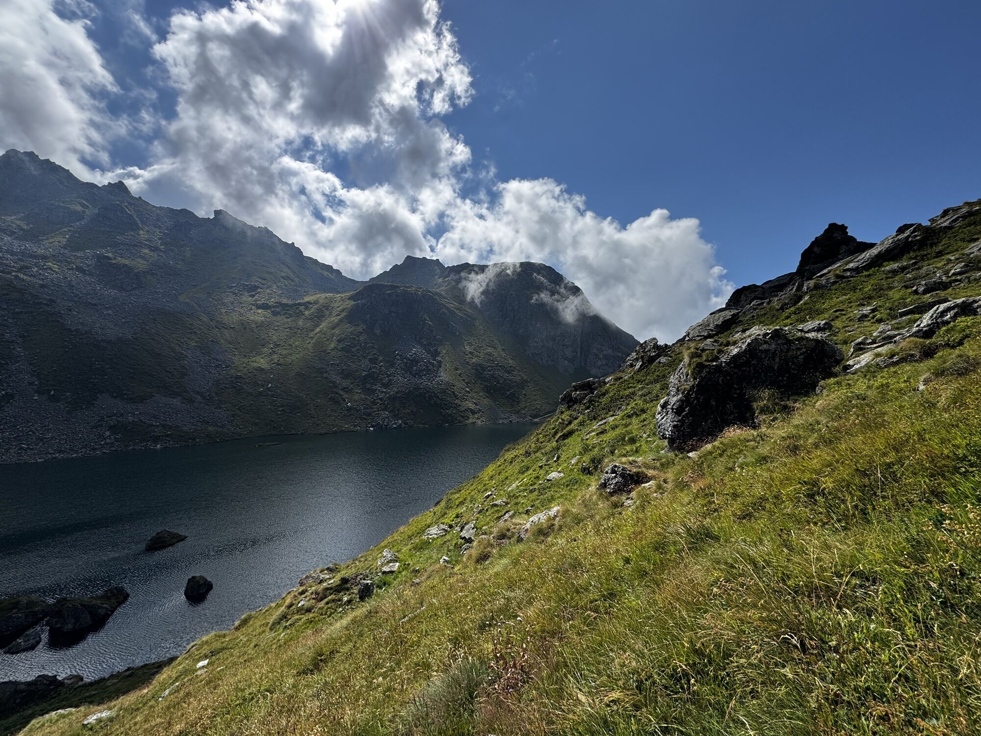
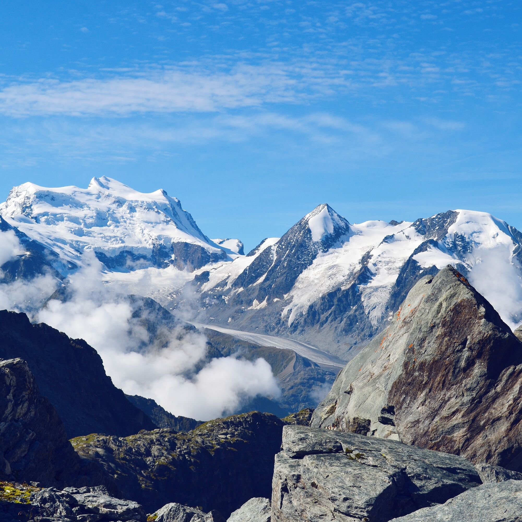
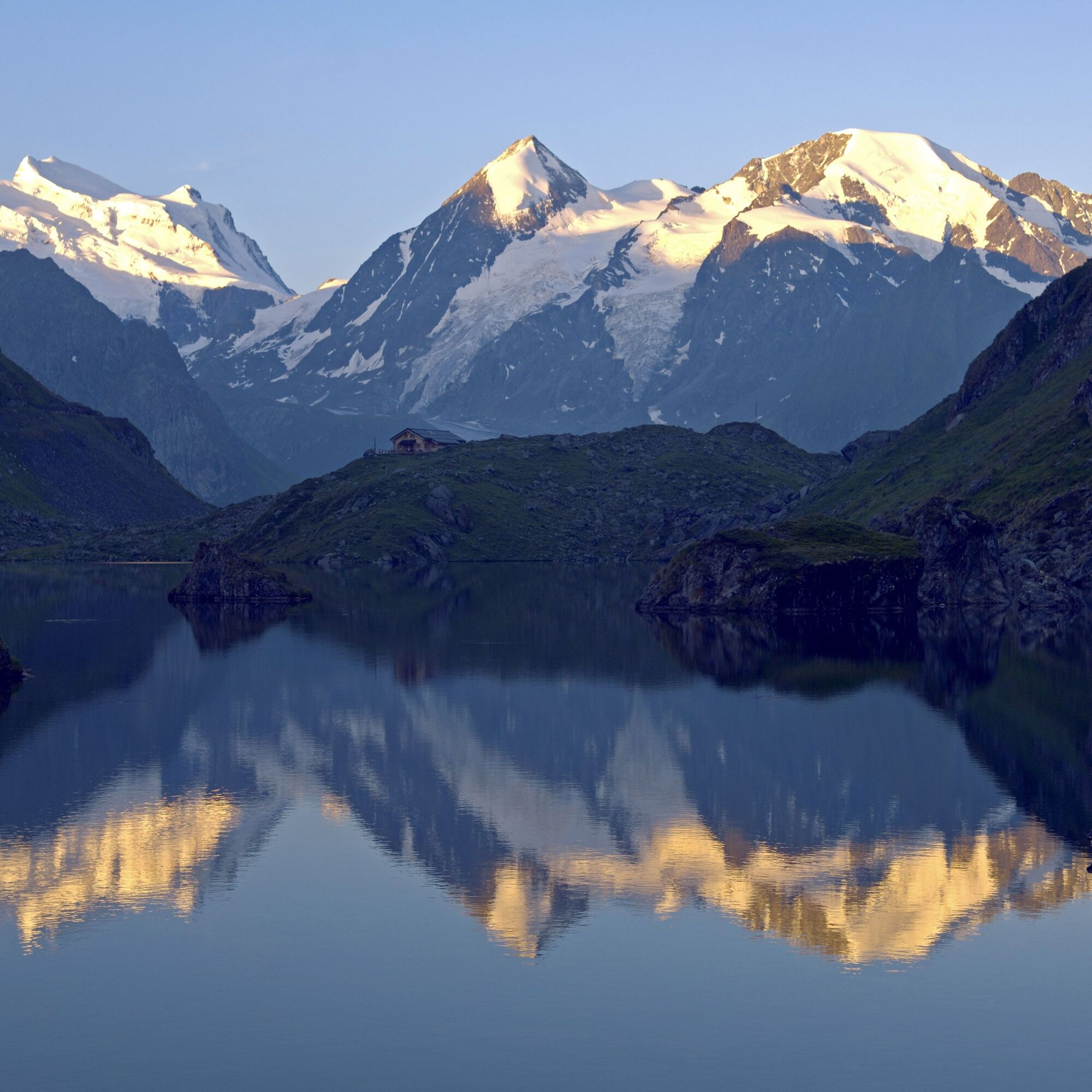
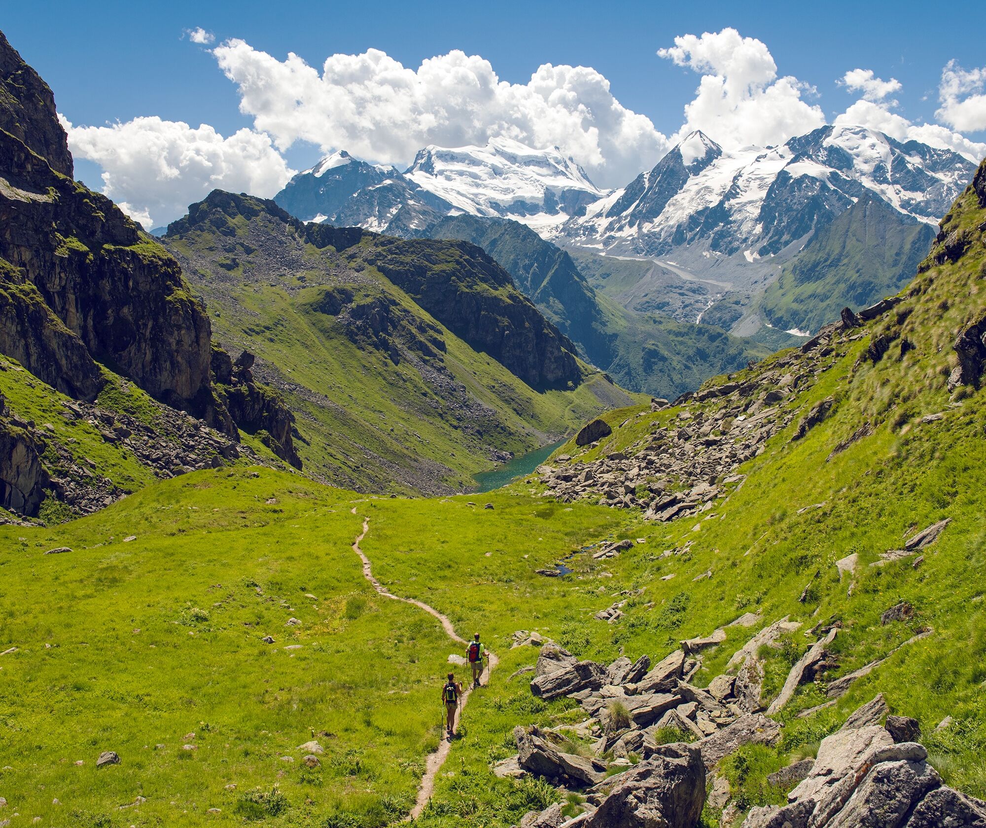
From here you enjoy views of the upper Val de Bagnes, crowned by the glaciers of the Combin massif. The steep descent to Lac de Louvie with stone-built stalls overcomes almost 400 meters of elevation in 1.5 kilometers. From the hut, the path zigzags down to the village of Fionnay.
Highlights of the hike:
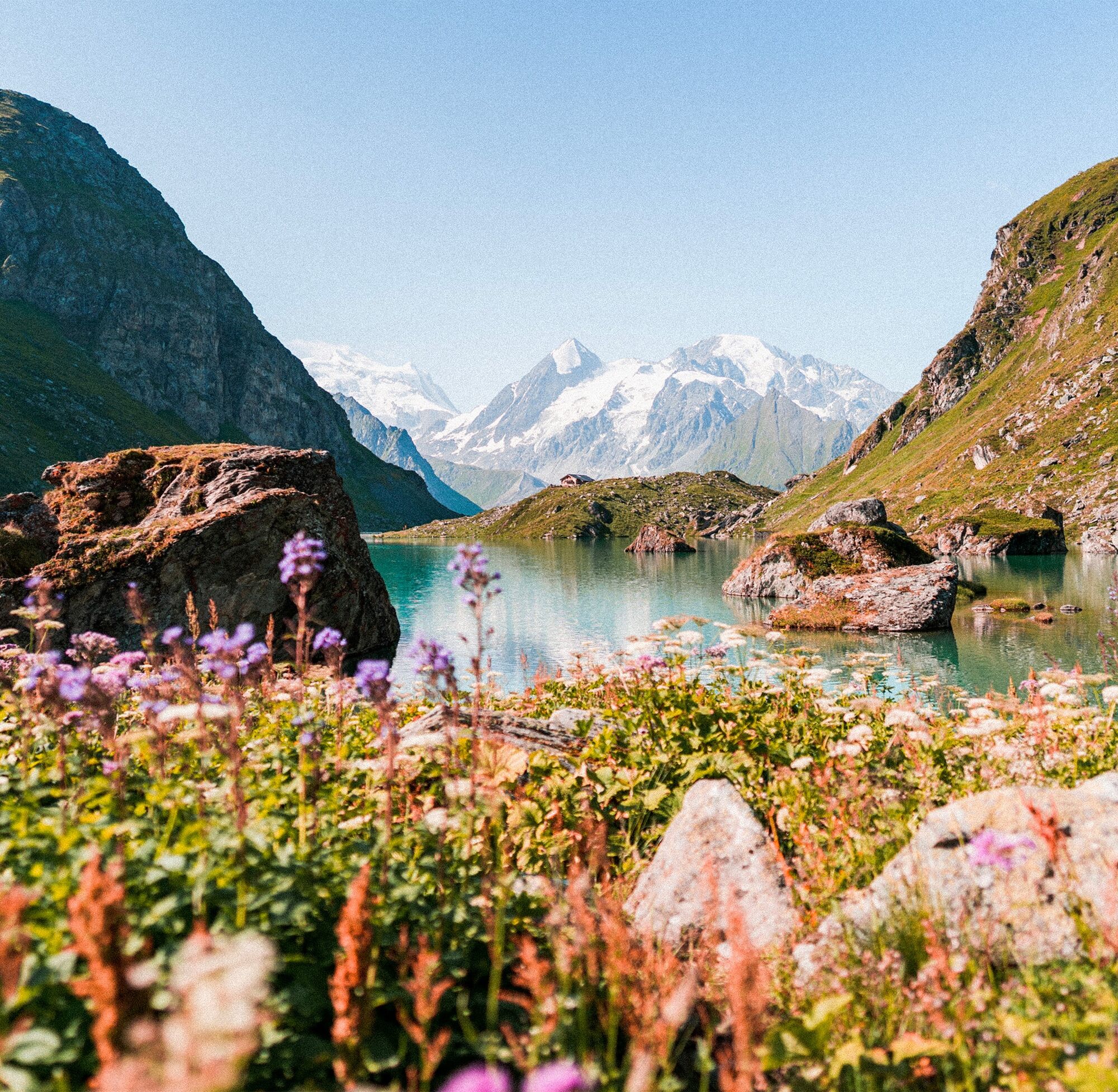
3D sculpture park in Les Ruinettes. The Haut Val de Bagnes nature reserve offers numerous opportunities to observe wildlife. The dramatic and steep landscape as well as the breathtaking views of peaks, glaciers, and valleys. The idyllic huts Cabane de Louvie by the sparkling mountain lake Lac de Louvie.

Option 1: Start the hike at the mountain station Les Ruinettes and follow the flat 3D sculpture park to La Chaux.
Option 2: Take the La Chaux Express from Les Ruinettes to La Chaux and start the hike there.
From La Chaux the path leads towards Mintset until it turns left at the ridge and ascends increasingly steeply to the east. Special caution is required especially at Col Termin. The descent to Lac de Louvie and then onwards to Fionnay is also very steep.
Tak
Tak
We recommend:
Good footwear Weather-dependent clothing: always carry a waterproof vest Headwear Sunscreen Water bottle Picnic Camera Binoculars (optional) Trekking poles (optional) Printout of the hiking trail (click “Print” to download)For certain hikes:
SwimsuitUse of the hiking trails and information on this website is at your own risk. Conditions on site may cause changes to the route. Valais/Wallis Promotion assumes no responsibility for the accuracy or completeness of the information on this website.
Assess your own abilities and fitness well. Hiking the various routes is fundamentally at your own responsibility.
For all hikes:
Carry a map with you. Download the complete description of the hiking trail with a large-scale map by clicking “Print” at the top right of the page. Use only marked hiking trails and observe all signposts and instructions – for your own safety, to protect grazing animals, and out of respect for wildlife. Close gates after passing through. Behave considerately towards other trail users, plants, and animals.For mountain hikes:
Carry additional sun protection. UV rays can be very strong at high altitudes, even in cloudy weather. Plan your hike carefully: take into account the required fitness level of all participants, weather forecasts, and seasonal conditions. Weather conditions in the mountains can change very quickly and without warning. Appropriate clothing and sufficient provisions (food and drink) are very important. In unstable weather, it is better to turn back early.For high alpine hikes:
Inform your family about your hiking route. If possible, avoid going alone. Do not go onto glaciers without a mountain guide. Observe warning signs indicating dangers at riverbanks, along waterways below dams and reservoirs: water levels can rise quickly and without warning.A9 motorway, exit 22 (Grand St-Bernard). Follow signs to Verbier and drive to Le Châble, where you can take the gondola directly to Les Ruinettes.
Regular train connections to Martigny, where you must change to the regional train to Le Châble. The gondola takes you from Le Châble via Verbier to La Chaux.
At the end of the hike, the postbus takes you from Fionnay back to Le Châble. Timetables for trains and postbuses can be found at www.sbb.ch
Free parking at the cable cars in Le Châble. Parking in Verbier is subject to a fee. Follow the local parking guidance system in Le Châble or Verbier.
View this route on SwitzerlandMobility:
No. 160 Sentier des ChamoisMore information about the destination can be found here:
Verbier Val de BagnesTake a short detour to the northern shore at Lac de Louvie to visit the traditional, arched stone stalls.

Popularne wycieczki w okolicy
From Savoleyres to the mountain lake Lac des Vaux
średniWędrówka 14,0 km- 5,0
Sentier des bouquetins
średniWędrówka 8,73 km - 4,5
Cleuson Dam
średniWędrówka 11,5 km - 4,5
The Larches of Balavaux
światłoWędrówka 11,0 km Arolla - Vignettes
średniWycieczka narciarska 5,04 km- 3,0
Via ferrata in the Mauvoisin Gorge
średniVia ferrata 1,77 km - 3,5
The Ahornweg « La Voie des Erables »
ciężkiWędrówka 9,66 km - 4,0
Six blanc depuis Cabine
średniWycieczka narciarska 5,85 km Sentier des Sens La Tzoumaz (Path of the Senses)
światłoWędrówka 5,42 kmFrom Cabane Brunet to Cabane FXB Panossière
średniWędrówka 6,87 km

Wędrówki i tropienie


Nie przegap ofert i inspiracji na następne wakacje
Twój adres e-mail została dodana do listy mailingowej.