







Climbing route Zimba west ridge - summit ascent in the Rätikon
A real challenge in the Rätikon is the ascent of the Zimba. For generations, the 2,643-meter-high mountain has fascinated alpinists across the country. Due to its extraordinary shape, the Zimba is often...
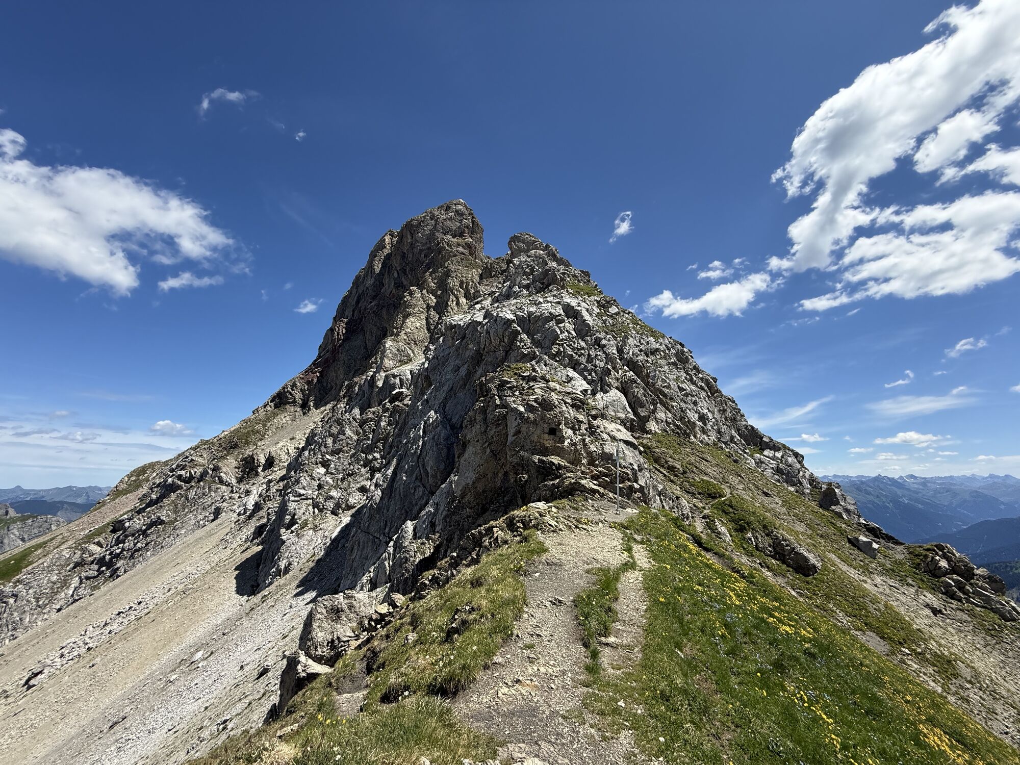
A real challenge in the Rätikon is the ascent of the Zimba. For generations, the 2,643-meter-high mountain has fascinated alpinists across the country. Due to its extraordinary shape, the Zimba is often described as the Montafon Matterhorn. Neither a hiking trail nor a via ferrata leads to the summit, and it takes courage, a good head for heights, and stamina to master the demanding rock tour of difficulty grade III.

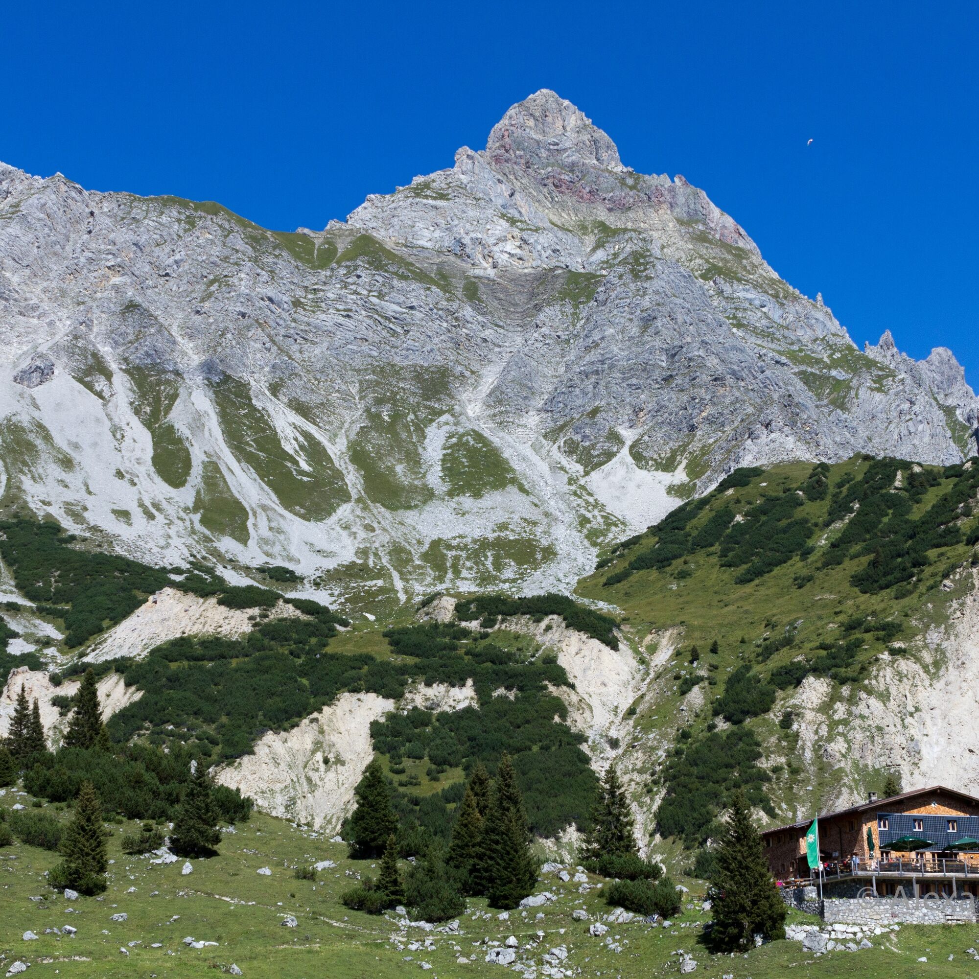

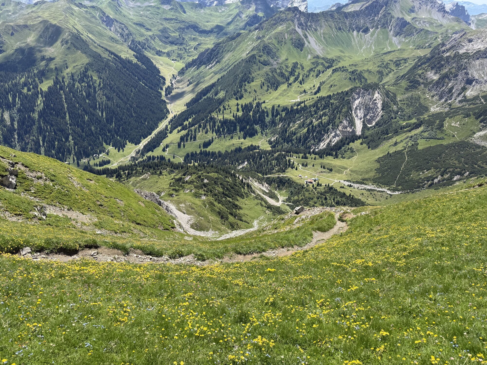
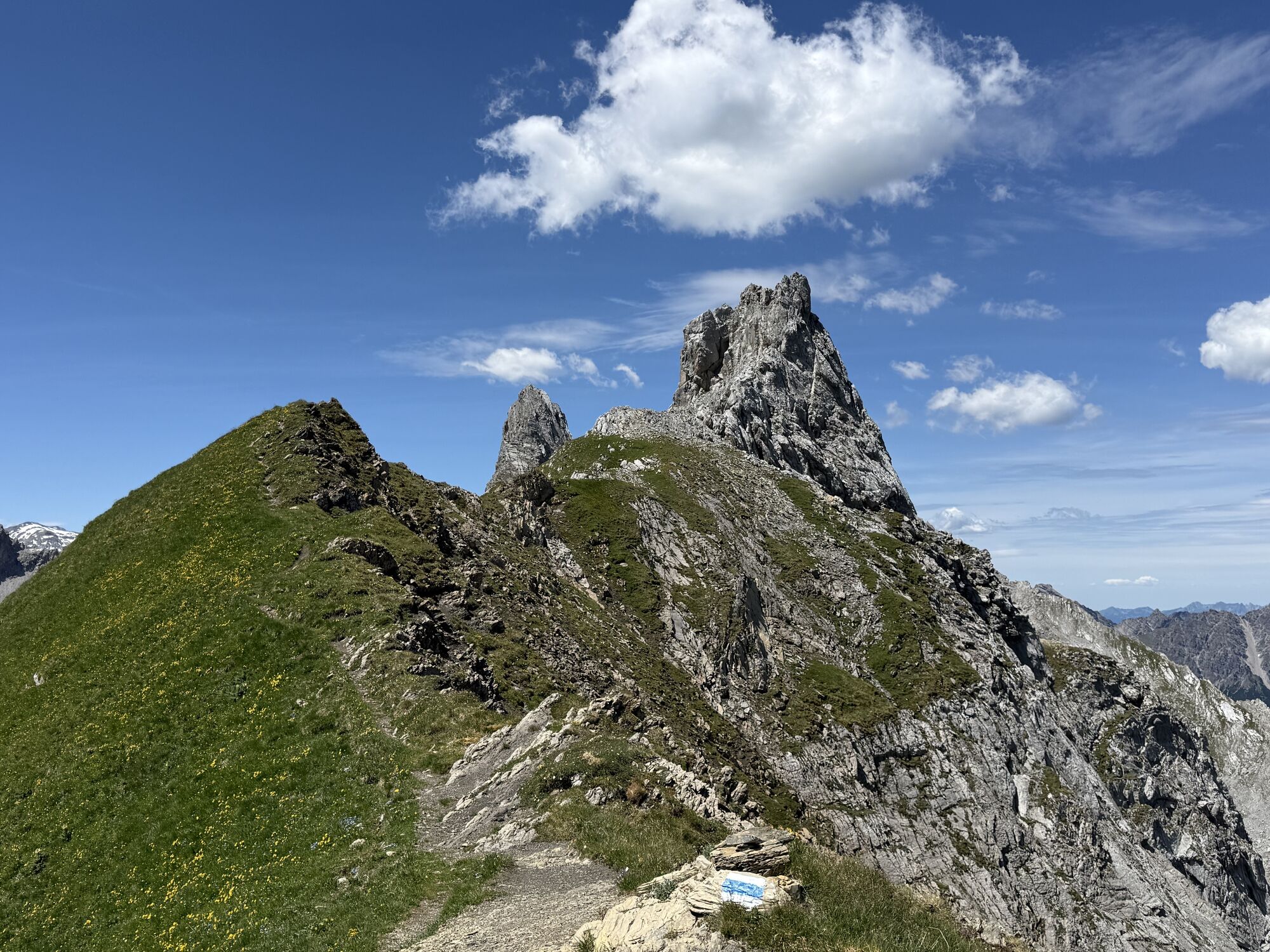
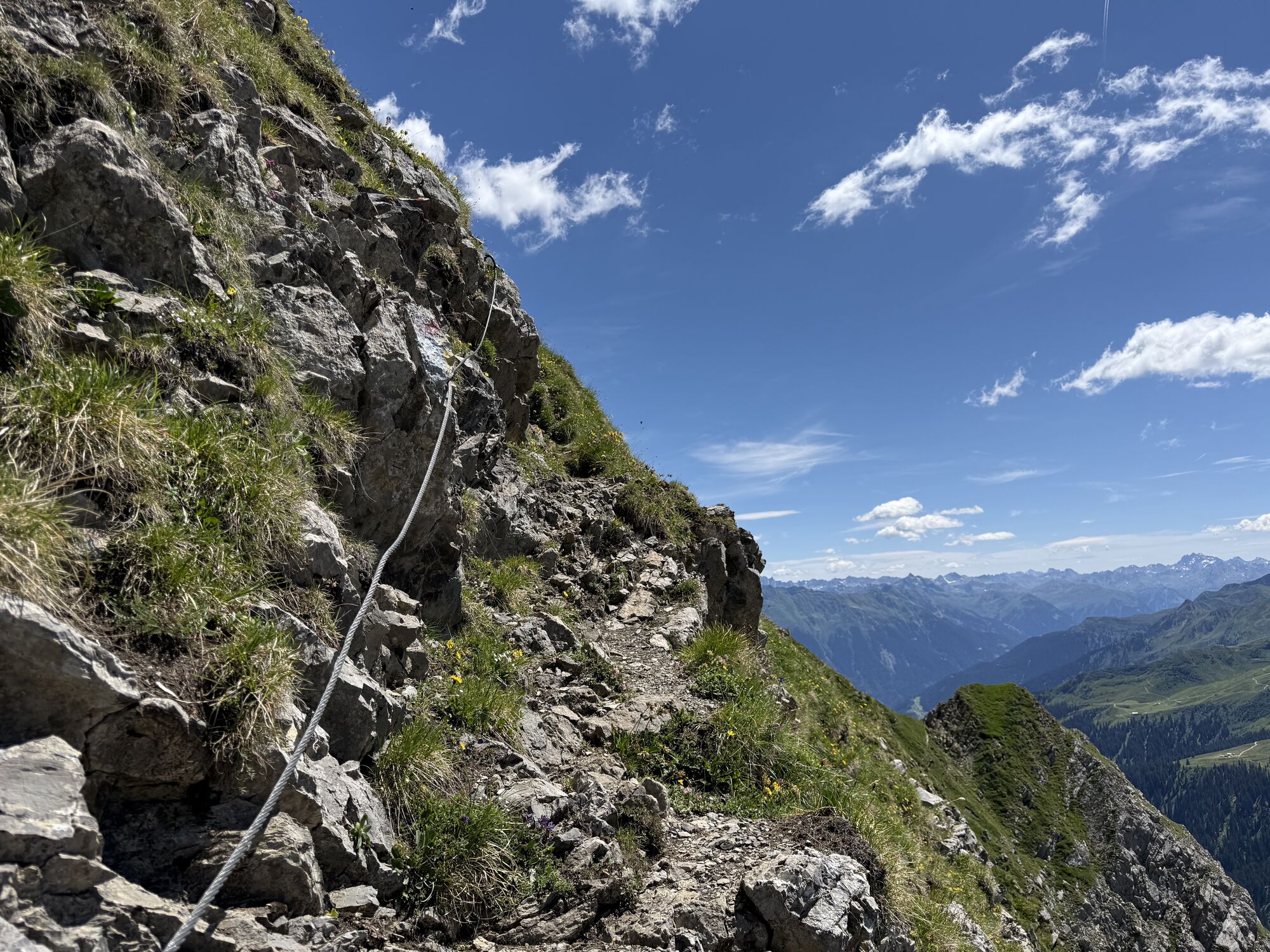
The route to the Zimba, the Matterhorn of Montafon, is one of the most beautiful climbing routes in the valley. From the Heinrich Hueter Hut (1,766 m), the normal route of the west ridge leads on a red-marked path in steep zigzags to the Zimba col. This 260-meter-high, partly brittle wall must be overcome already in easy climbing (difficulty level I-II). From the Zimba col, it goes over the west ridge to the summit cross of the Zimba. Here begins the actual climbing over the partly very exposed west ridge. The route continues over the so-called "Sohmplatte" and offers beautiful climbing up to difficulty level III. Pitons are partially available.
Tak
Tak
Carry a backpack with provisions and drinks as well as rain and sun protection
Equipment: ankle-high mountain boots with profiled soles and mountain-appropriate clothing as well as climbing equipment
EMERGENCY CALL: 144
European emergency number: 112 (works with any mobile phone/network)
Coming from Bludenz, take the Bludenz/Montafon motorway exit and follow the road into Montafon until you reach Vandans. At Vandans station and at the Golmerbahn in Vandans, parking spaces are available. At the Golmerbahn there is also a boarding point for the Rellstal hiking bus. www.google.at/maps
Just leave your car standing
The Montafonerbahn regional buses operate throughout Montafon. The main lines run hourly from Schruns station.
From Schruns station you reach Vandans station via the Montafonerbahn. From Vandans station, you continue by hiking bus into the Rellstal. The stop is: "Alpengasthof Rellstal".
For the return trip
By hiking bus you return from Alpengasthof Rellstal to Vandans station. From Vandans station you travel back with the Montafonerbahn to Schruns station.
Arrival by train
From Bludenz station, the Montafonerbahn runs hourly (sometimes every half hour). There are also direct connections from Lindau (D) and from Bregenz.
free parking is available at Vandans station and at the Golmerbahn in Vandans.
September 7, 1848 has special significance in alpinism: On that day Anton Neyer from Bludenz – known as “Bücheltonis Toni” – first climbed the Zimba. The following year will mark the 175th anniversary of this early alpine feat.
You can reach the Heinrich Hueter Hut either by the Rellstal hiking bus from Vandans or from the Lünersee.
Overnight stay at the Heinrich Hueter Hut is recommended; reserve your bed at the hut early.
 Uzyskaj wgląd
Zawsze na żywo z ponad 9 500 kamer internetowych. bergfex Jako użytkownik Pro, możesz teraz zobaczyć odpowiednie kamery internetowe dla wielu wycieczek w aplikacji wycieczki od. Pozwala to na bezpośredni podgląd aktualnych warunków.
Uzyskaj wgląd
Zawsze na żywo z ponad 9 500 kamer internetowych. bergfex Jako użytkownik Pro, możesz teraz zobaczyć odpowiednie kamery internetowe dla wielu wycieczek w aplikacji wycieczki od. Pozwala to na bezpośredni podgląd aktualnych warunków.
Popularne wycieczki w okolicy
-
5,0
Ski tour to the Lindauer Hut (1,744 m)
światłoWycieczka narciarska 14,0 km -
5,0
Bürs, Bürserschlucht Bürs, Vorarlberg
średniWędrówka 5,31 km -
4,4
Golm-Rundwanderweg im Rätikon
średniTrasa tematyczna 7,28 km -
4,9
Douglasshütte, Lünersee, Gafalljoch Brand bei Bludenz, Vorarlberg
światłoWędrówka 9,16 km -
4,6
Over the historic mine and Fritzensee to Rellseck
średniWędrówka 7,25 km -
4,3
Golmerbahn Bergstaion Grüneck - Golmer Höhenweg - Geißspitze - Lindauer Hütte - Latschau
średniWędrówka 11,5 km -
4,2
Mondspitze (Montspitze)
średniWędrówka 7,97 km -
3,7
Fürstin-Gina-Weg
Wędrówka 10,7 km -
3,8
Sassweg - von Malbun zum Sass-Seelein
Wędrówka 4,14 km -
4,9
From Malbun to the Schönberg
średniWędrówka 12,4 km
Wędrówki i tropienie


Nie przegap ofert i inspiracji na następne wakacje
Twój adres e-mail została dodana do listy mailingowej.





