


Teufelsbach Waterfall Loop
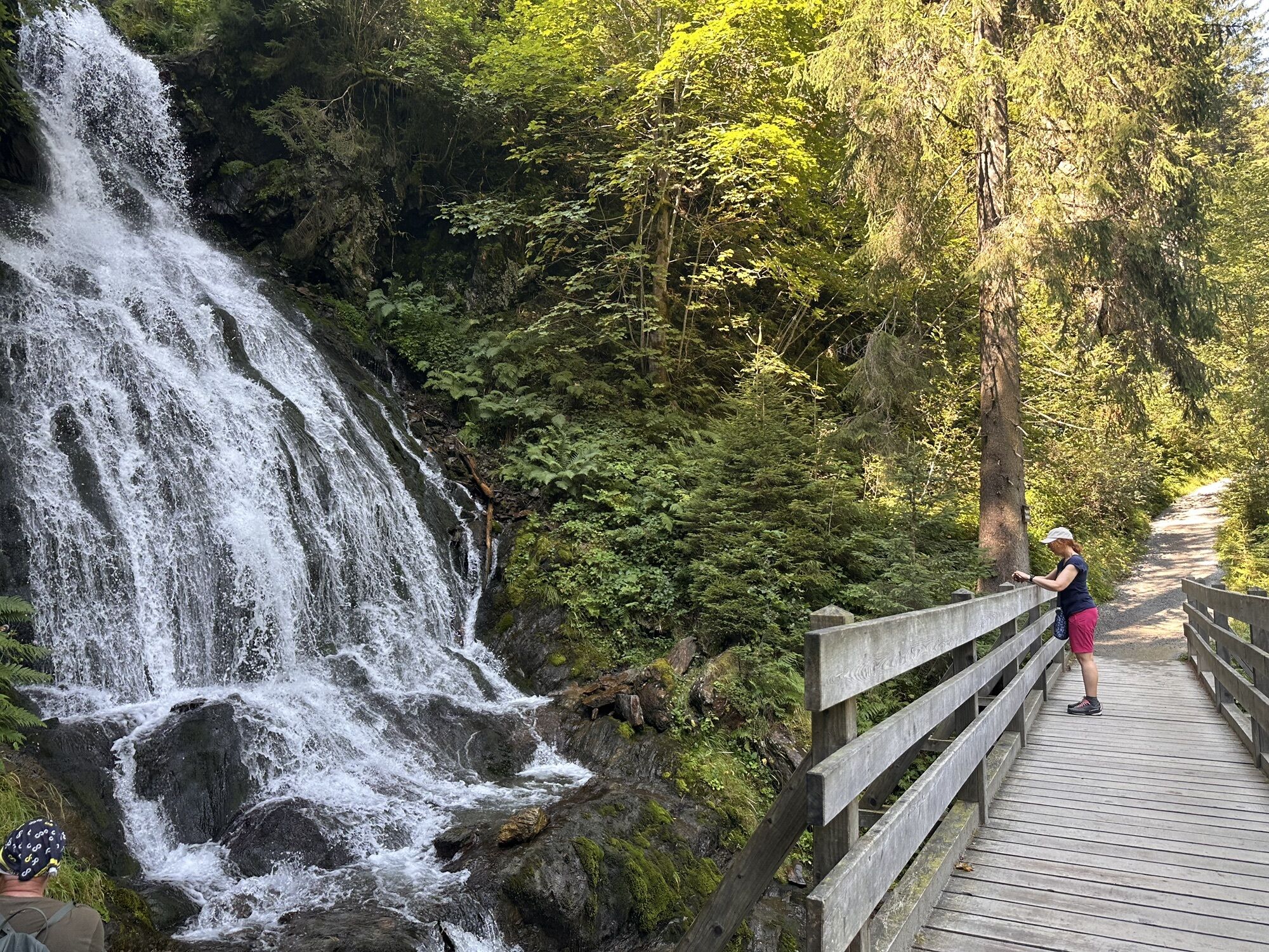
This easy route leads through shady and mossy forests as well as past an impressive waterfall.

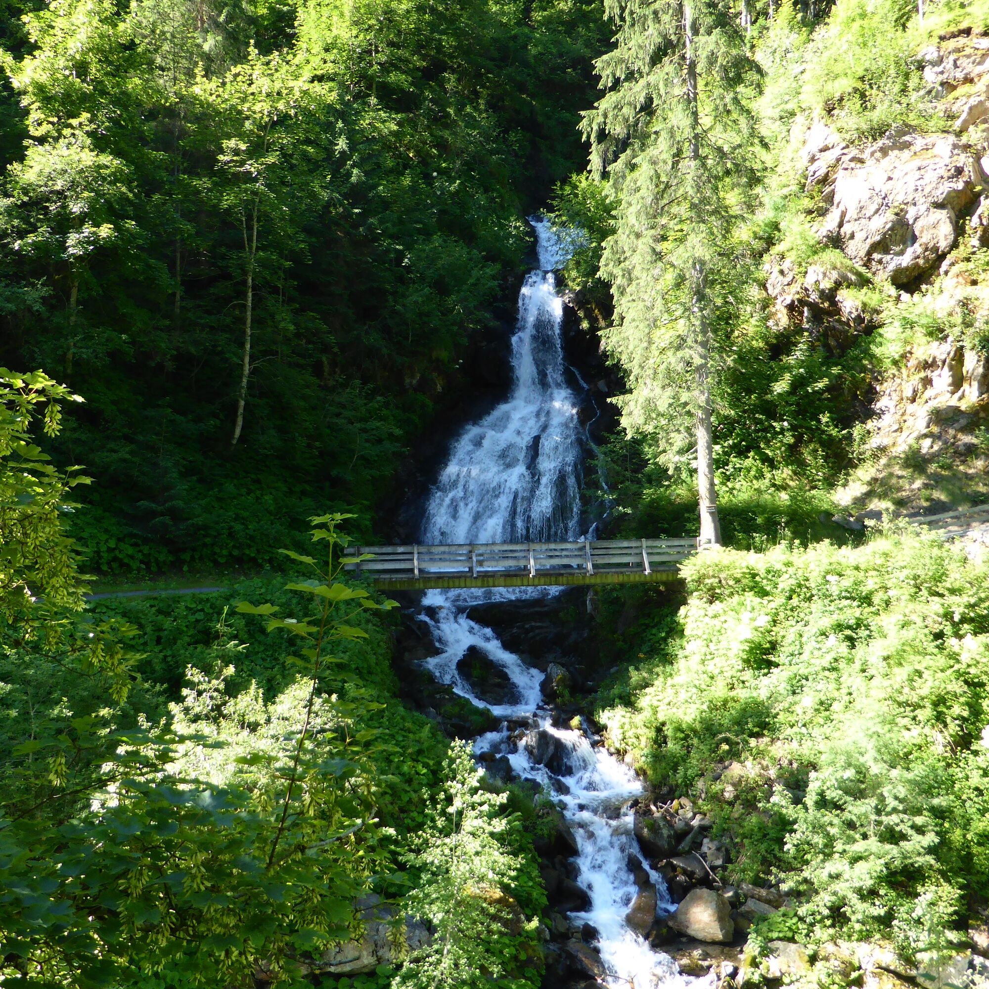

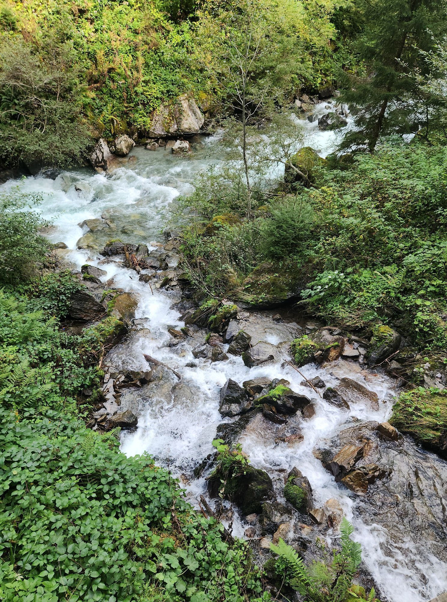
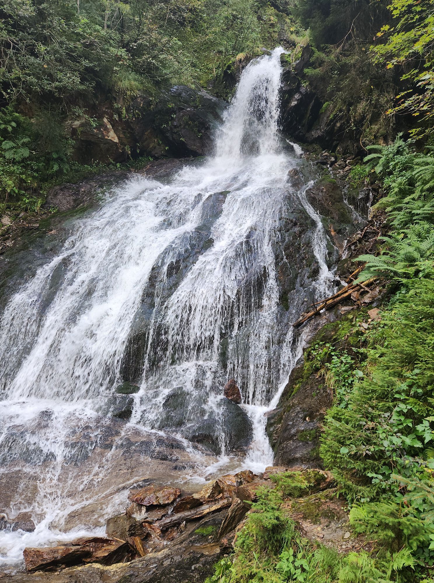
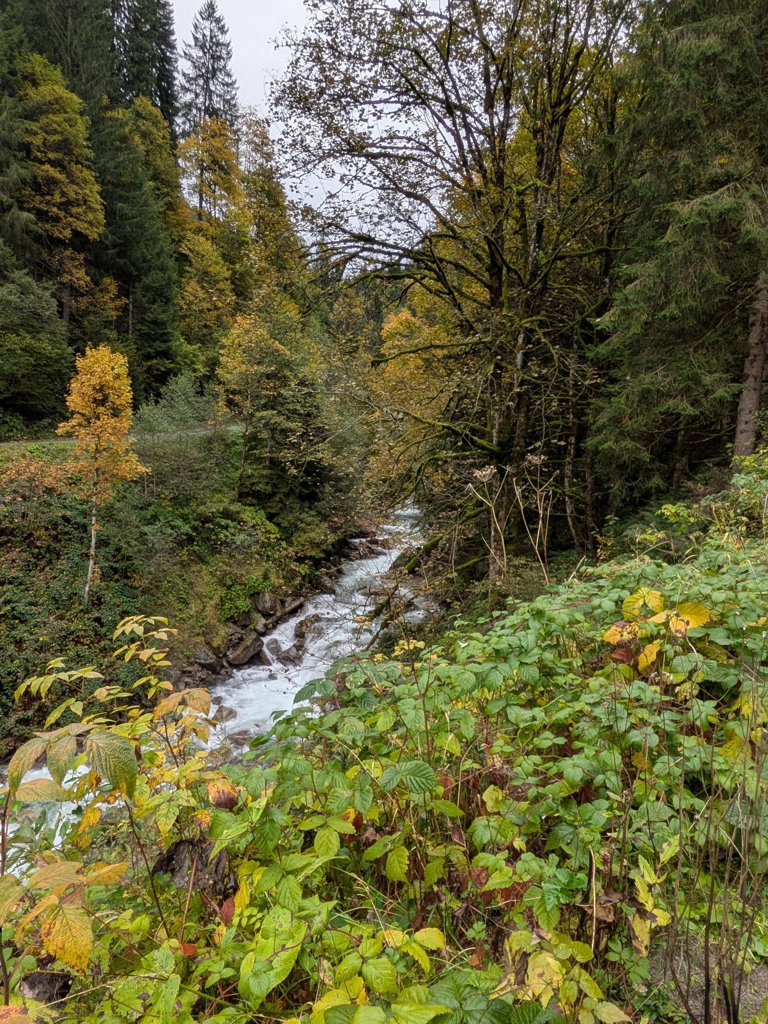
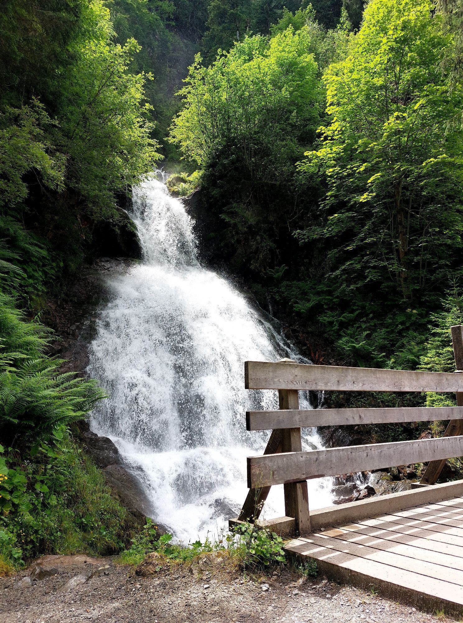
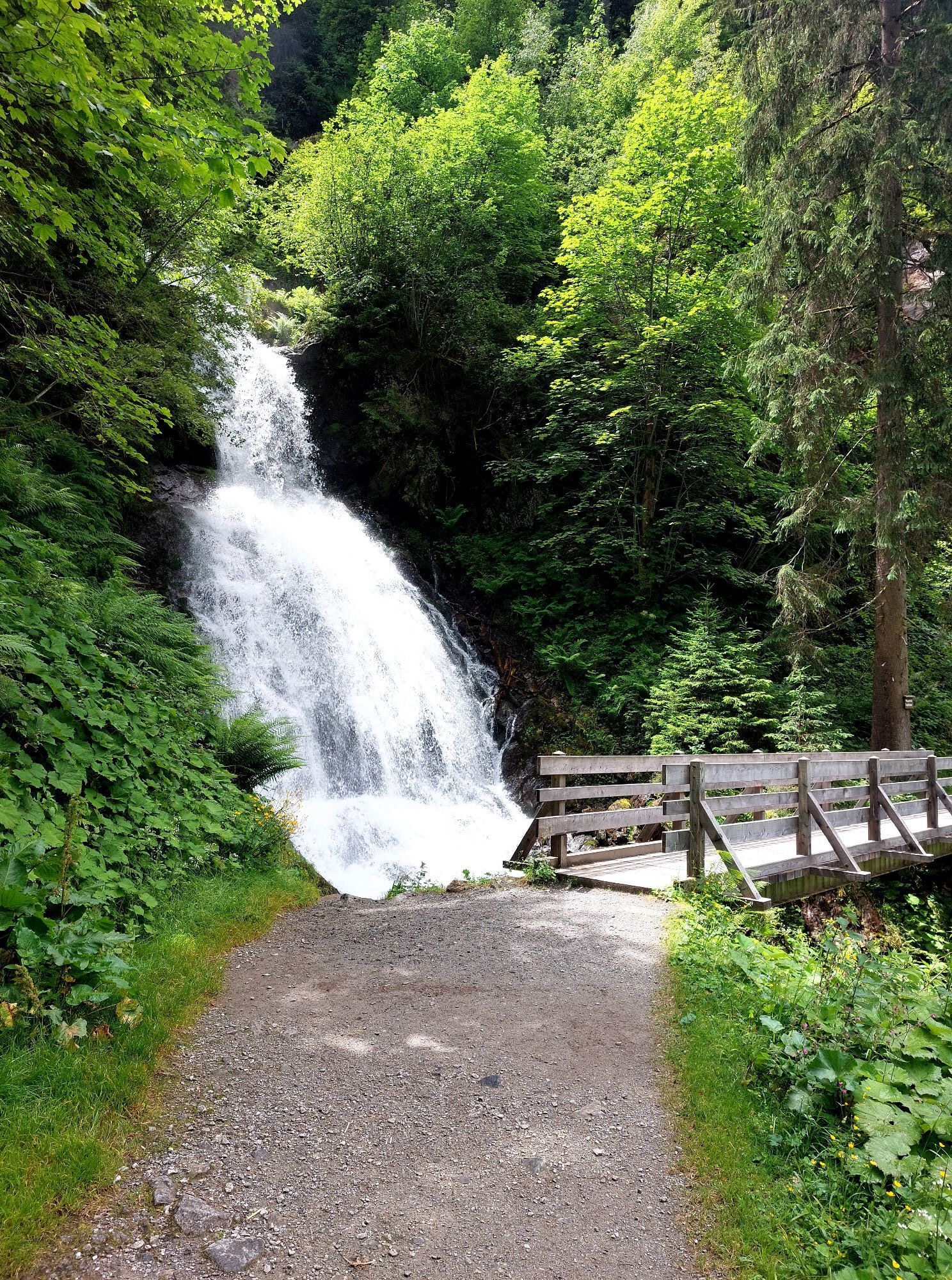
You walk downstream and turn right immediately after the sports field. It goes uphill over the slope to the intersection (Wißli). Follow the path to the right and you reach Burgkopf. It continues straight through the forest. A little later you reach the hiking trail that comes up from the open-air stage of the Montafon Saga Festival. Turn right and follow the hiking trail further downstream. After a short, slightly steeper section, you reach the Teufelsbach waterfall a few minutes later. The loop continues downstream to the bridge. Cross the gravel road on the other side back to the "Felsa parking lot" at the height of the open-air stage of the Montafon Saga Festival. Once there, you cross the bridge again and follow the same path along the Litz back to the starting point.
EMERGENCY CALL:
144 emergencies Vorarlberg
112 European emergency call (works with any phone/network)
Coming from Bludenz, take the Bludenz/Montafon highway exit and follow the L188 into Montafon until Schruns. Then continue via Silbertalerstraße to Silbertal. www.google.at/maps
Just leave your car standing
The regional buses of the Montafonerbahn run throughout the Montafon. The main lines depart hourly from Schruns train station.
From Schruns train station you reach Silbertal with bus line 88. The stop is: "Kristbergbahn"
For the way back
With bus line 88 you return from Silbertal to Schruns train station.
Arrival by train
From Bludenz station the Montafonerbahn runs hourly (partly half-hourly). There are also direct connections from Lindau (D) or from Bregenz.
Parking spaces are located at the Kristbergbahn. (free in winter)
Kamery internetowe z trasy
-
Bergstation Sonnenkopf
-
Hochjoch Bahn Bergstation
-
Montafoner Kristbergbahn Bergstation
-
Panoramagasthof Kristberg
-
Panoramagasthof Kristberg
-
Kristberglift mit St. Agatha Kirche
-
Kinderland Skischule Silbertal
-
Bergstation Hochalpila Bahn
-
Silbertal Dorf
-
Innerberg
-
Bergstation Sonnenkopf
-
Bergstation Sonnenkopf
-
Bergstation Sonnenkopf
-
Bergstation Sonnenkopf
-
Schruns
-
Bartholomäberg - Ferienhotel Fernblick
-
Kapellbahn
-
Bartholomäberg - Ferienhotel Fernblick
-
Bartholomäberg - Ferienhotel Fernblick
-
Bartholomäberg - Ferienhotel Fernblick
Popularne wycieczki w okolicy
-
4,4
Golm-Rundwanderweg im Rätikon
średniTrasa tematyczna 7,28 km -
5,0
Ski tour to the Lindauer Hut (1,744 m)
światłoWycieczka narciarska 14,0 km -
4,0
Stuben - Stubner See - Kaltenberghütte - Stuben
średniWędrówka 9,90 km -
4,8
Kristberg - Wasserstubental - Silbertal
światłoWędrówka 13,8 km -
3,5
Golmer Höhenweg
średniWędrówka 13,8 km -
4,8
Heilbronner lodge
średniWędrówka 13,0 km -
4,7
Alpgues circular route
średniTrasa tematyczna 9,36 km -
4,7
Muttjöchle summit trail
średniTrasa tematyczna 7,50 km -
4,5
Zamangspitze summit path
średniTrasa tematyczna 7,07 km -
4,4
Madrisella summit path
średniTrasa tematyczna 10,8 km
Wędrówki i tropienie


Nie przegap ofert i inspiracji na następne wakacje
Twój adres e-mail została dodana do listy mailingowej.