


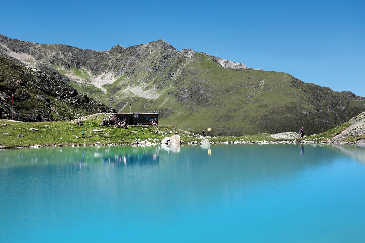
Hauersee Hut 2383m - Längenfeld


The start of this wonderful hike is in the Längenfeld district of Lehn. The ascent takes place via a trail that leads steadily uphill through dense forest. From time to time, you can catch a glimpse of...
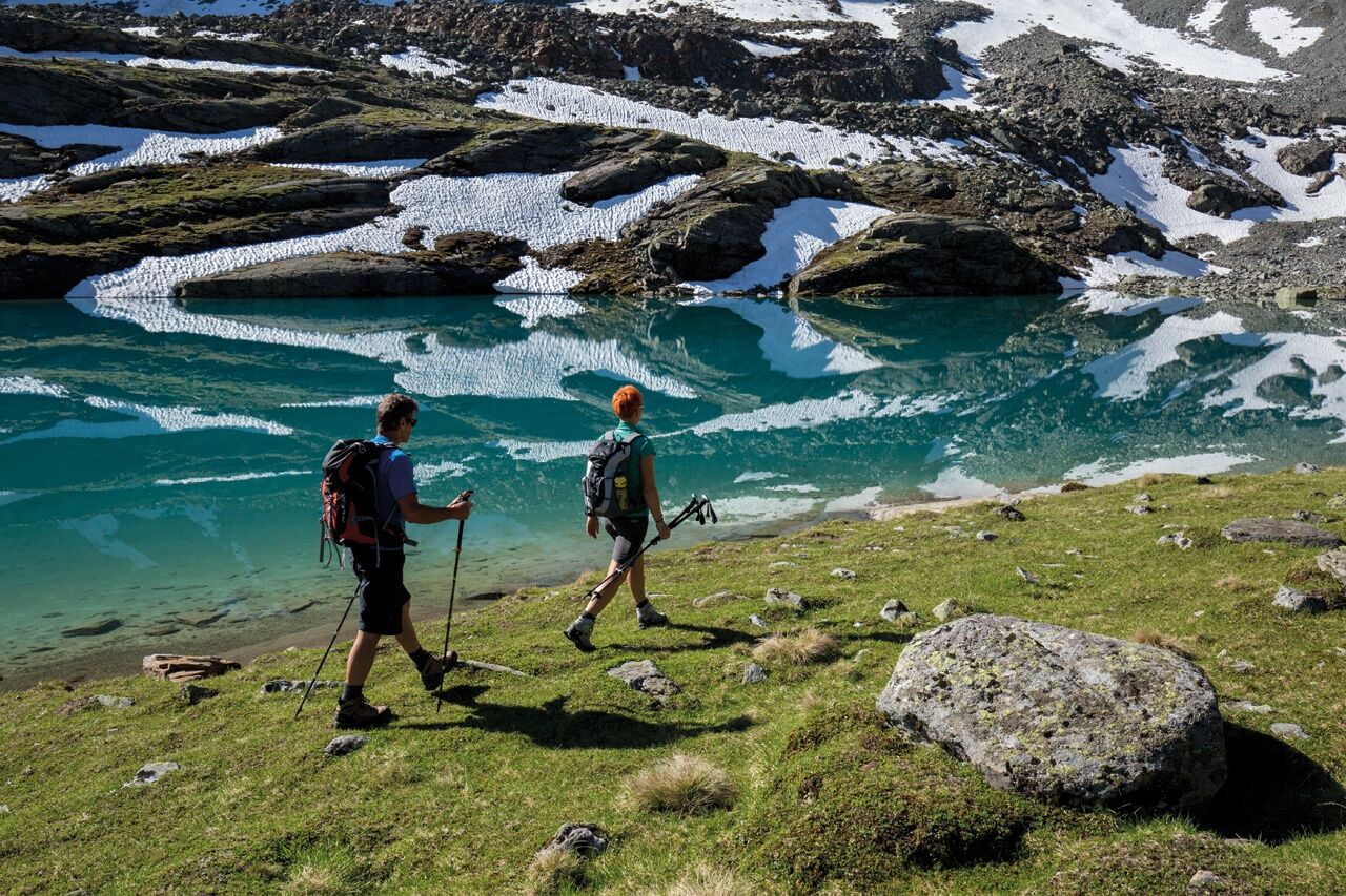
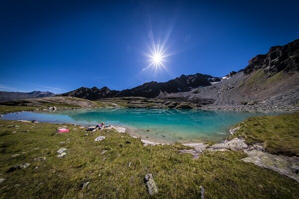
The start of this wonderful hike is in the Längenfeld district of Lehn. The ascent takes place via a trail that leads steadily uphill through dense forest. From time to time, you can catch a glimpse of the Lehner Waterfall. Except for a section of the path that goes over a well-secured stone slab, you walk on forest ground. After about 2 hours of walking you reach the tree line and Stabelealm comes into view. You leave the turn-off to this hut on the right and continue walking through lush green meadows towards Innerbergalm. After a short break, you continue over the Hauer ridge towards Hauersee. After some flatter and steeper sections in this cirque, you reach Hauersee which shimmers milky green to turquoise blue depending on the season. Surrounded by the so-called Fünffingerspitzen, you can enjoy once again the pleasant calm at 2300 meters altitude before you start the descent.

The hike, which starts in the district of Lehn, poses no difficulties, but some fitness is required as over 1,000 meters of altitude must be overcome.
The ascent takes about 2 hours via a hiking trail that goes through the forest towards Stabelealm. From the forest boundary, the path proceeds on grassy ground to Innerbergalm. After some flatter and steeper sections in this cirque, you reach Hauersee.
Appropriate equipment such as breathable and weather-appropriate outdoor clothing,
ankle-high hiking boots, wind, rain and sun protection, hat, possibly gloves, is required for all
hikes and routes. Bringing a first aid kit, a mobile phone and possibly
a hiking map, as well as enough provisions for hikes without refreshment options, is necessary
Appropriate equipment such as breathable and weather-appropriate outdoor clothing is required for all hikes and routes. Bringing a first aid kit, a mobile phone and possibly a hiking map, as well as sufficient provisions on hikes without refreshment options, is necessary.
The drive into ÖTZTAL
Traveling by car leads visitors through the Inn valley to the valley entrance and further along Ötztal. In addition to the toll motorway, country roads can also be used. The route planner allows you to quickly and conveniently plan your trip. To the route planner: https://www.google.at/maps
Public transport
Travel comfortably and safely by train. The final station or exit point is ÖTZTAL station. Afterwards, you travel conveniently and quickly with public bus lines or local taxi companies through the entire valley to your desired destination. The current bus timetable is available at: http://fahrplan.vvt.at
The following parking options are available in Längenfeld:
directly at the starting point in Längenfeld/Lehn - subject to fees
The hut taxi runs once a week to Innerbergalm during the summer season. (2-hour ascent is saved)
Reservation is required. Ötztal Tourism - Längenfeld information +43 (0)57200 300
More information about hiking in Ötztal can be found here.
The Hauersee Hut is a self-catering hut. The hut warden is on site during the summer months.
The hut taxi runs once a week in the summer season. Reservation is required.
Ötztal Tourism - Längenfeld information
+43 (0)57200 300
The hut taxi saves you a 2-hour ascent to Stabele Alm
Kamery internetowe z trasy
Popularne wycieczki w okolicy
-
4,7
Winnebachsee Hut – Längenfeld/Gries
średniWędrówka 4,74 km -
4,4
Oetz - Lake Piburger See - Oetz
średniWędrówka 7,16 km -
4,2
Hike Stuibenfall - Umhausen
światłoWędrówka 2,95 km -
4,4
Stuibenfall Umhausen circular hike
światłoWędrówka 9,32 km -
5,0
Larstigalm - Niederthai
światłoWędrówka 3,24 km -
4,5
Amberger Hut - Längenfeld/Gries
średniWędrówka 5,60 km -
4,7
Umhausen - Stuibenfall - Umhausen
średniWędrówka 7,94 km -
4,6
Summit route Weather Cross from Hochoetz
średniWędrówka 3,06 km -
5,0
Nissl Alm - Längenfeld/Gries
światłoWędrówka 5,17 km -
4,4
Rundwanderung Hängebrück3
światłoWędrówka 6,32 km
Wędrówki i tropienie


Nie przegap ofert i inspiracji na następne wakacje
Twój adres e-mail została dodana do listy mailingowej.