


To the healing water of the Maria Larch Chapel
Poziom trudności: T1
This easy hike leads us with a wonderful view of the surrounding mountain scenery to the healing spring at the Maria Larch Chapel. Always along the sunny side of the Inn Valley, it goes up to the Gnadenwalder...
This easy hike leads us with a wonderful view of the surrounding mountain scenery to the healing spring at the Maria Larch Chapel. Always along the sunny side of the Inn Valley, it goes up to the Gnadenwalder Plateau. Along old farmhouses and wayside shrines along the path.

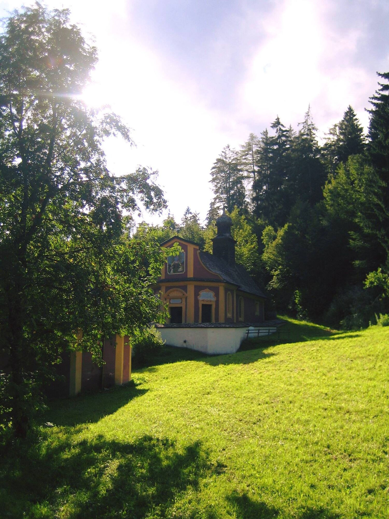
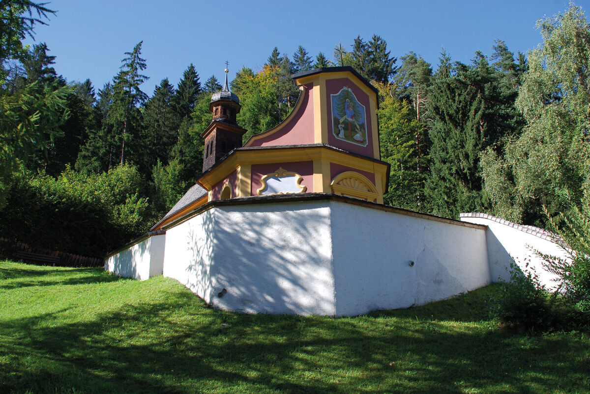
Walk from the village center of Fritzens up to the Gnadenwalder Plateau. South of the Thierburg to the farms Voreggen and Eggen and down to Maria Larch. There we taste from the healing spring, well known far and wide!
Return: The same way or via Terfens–Neu-Terfens back to Fritzens. For this, follow the contemplation path down to Terfens and from there over to Fritzens.
Tak
By car, the best way to reach the destination is via the Inntal motorway A12 and exit 61-Wattens - follow the signs until you reach your destination.
Plenty of parking options are located directly at the starting point.
T1
Fill your water bottle with the healing water at the Maria Larch Chapel!
Kamery internetowe z trasy
-
Wattens - Swarovski Kristallwelten
-
Schiestlhof
-
Hüttegglift
-
Swarovski Kristallwelten
-
Swarovski Kristallwelten
-
Swarovski Kristallwelten
-
Swarovski Kristallwelten
-
Schiestlhof
-
Schiestlhof
-
Schiestlhof
-
Hüttegglift
-
Hüttegglift
-
Jägerhof
-
Jägerhof
-
Jägerhof
-
Jägerhof
-
Jägerhof
-
Modellsportgruppe Unterland 6130 Schwaz (MSGU)
Popularne wycieczki w okolicy
-
4,6
Hinterriss - Eng - Falkenhütte
średniWędrówka 6,88 km -
4,7
Felix-Kuen via ferrata on the Hundskopf
ciężkiVia ferrata 2,18 km -
4,6
Gütenberg und Feilkopf
światłoWędrówka 10,4 km -
4,5
Sonnjoch
średniWędrówka 11,2 km -
4,5
Wolfsklamm über Maria Tax
średniWędrówka 5,50 km -
4,5
Wandern zum Bärenkopf
średniWędrówka 10,9 km -
4,6
To the scenic Hochmahdkopf
średniWędrówka 8,31 km -
3,4
Wolfsklamm-Stans
średniWędrówka 2,66 km -
4,5
Up to the Largoz
średniWędrówka 7,01 km -
4,3
Wanderung zur Binsalm
światłoWędrówka 8,54 km
Wędrówki i tropienie


Nie przegap ofert i inspiracji na następne wakacje
Twój adres e-mail została dodana do listy mailingowej.