


Werra Burgen Steig X5 Dietlas to Gerstungen
The hike starts in Dietlas via Vacha, Heringen, Dankmarshausen, Gerstungen. The municipalities of Philippsthal, Obersuhl, and Berka are only passed on the outskirts. The trail has the marking X5 and a...
The hike starts in Dietlas via Vacha, Heringen, Dankmarshausen, Gerstungen. The municipalities of Philippsthal, Obersuhl, and Berka are only passed on the outskirts. The trail has the marking X5 and a blue square on a white background. This hike is a segment of the Werra Burgen Steig trail, which is almost 500 km long. It is advisable to follow the route according to GPS data.

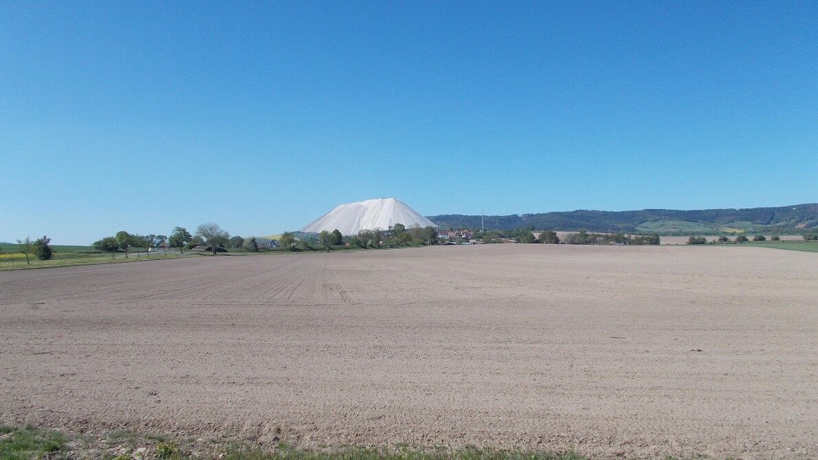
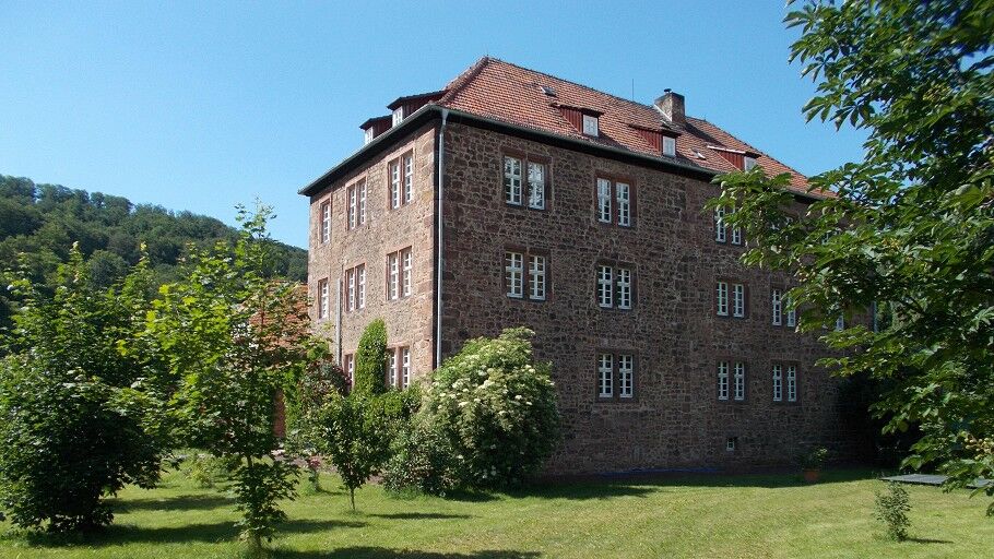

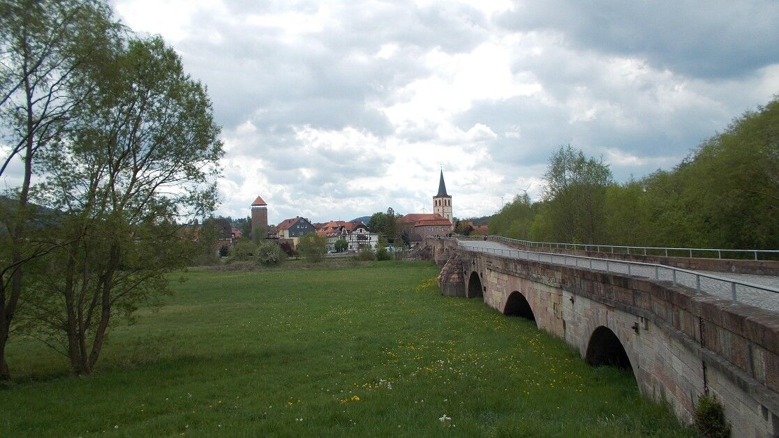
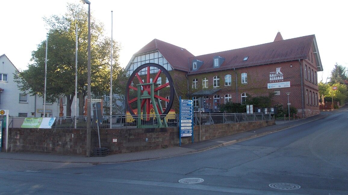
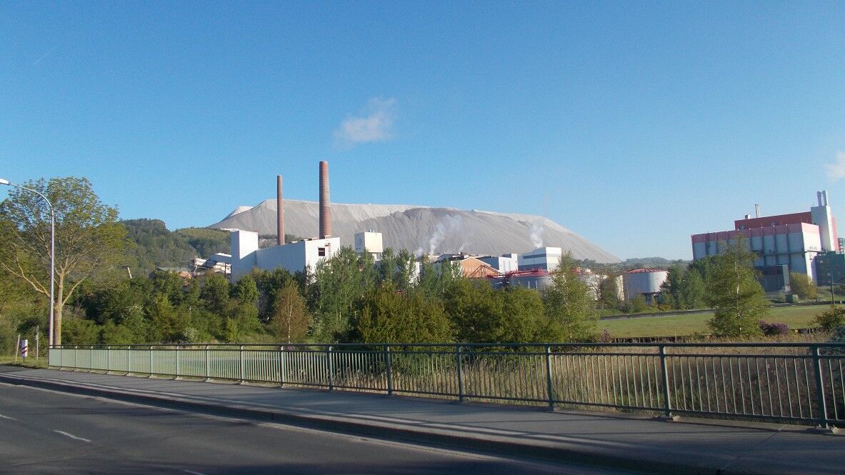

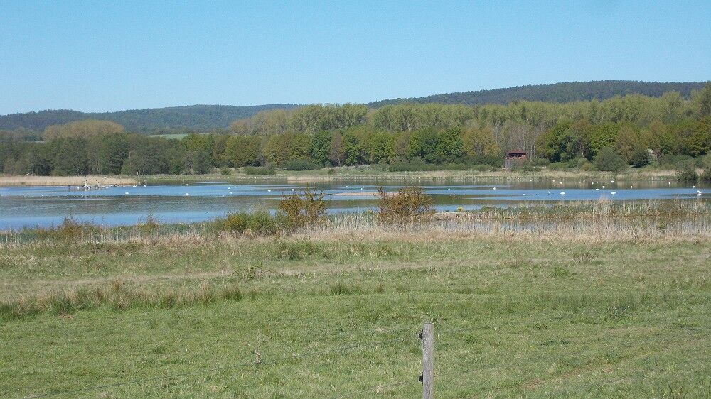
The hike starts in the village center at the linden tree. From here, it goes uphill to Steinernen Gasse and turns there. This hike is a stage of the Werra Burgen Steig, which is about 500 km long. Therefore, there is the trail marking X5 or a blue square on a white background. You follow this trail marking to the destination point, though the signs are not always clear. The path from Dietlas goes through the forest to Martinrodaer Eck, where you reach a paved road; it goes about 300 m to the left before turning right back into the forest. From here, the path leads directly to Vacha. In Vacha, you pass the historic market by Wendelstein Castle (which has a museum with an observation tower), then cross the historic bridge (Bridge of Unity). After crossing the Werra River, you are in Hesse. Here, the path immediately crosses the street and goes uphill to Thüringer Hütte, leading directly to Heringen. In Heringen, the path passes the Kali Museum (where visitor tickets for the Monte Kali visitor site “Kali spoil heap pit” are available). The path crosses the Werra, goes directly to Monte Kali, and around the mountain. Afterward, it leads to Dankmarshausen; when you leave the town, you pass a large gravel lake with a bird sanctuary. There are also observation points where birdlife can be watched. Then the route goes toward the Werra River and along it to Gerstungen. From here, you can start the return trip, first by train to Bad Salzungen and then by bus to the starting point.
Tak
Sturdy footwear, preferably hiking boots.
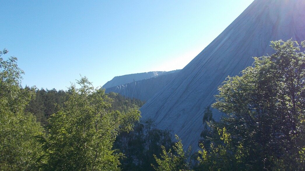
There is a steep section on the Kaliberg that is very slippery when wet. Good surefootedness is important.
Parking at the linden tree in Dietlas
There are inns open in the morning or afternoon in Vacha, Heringen, and Gerstungen. However, it is advisable to get information in advance.
A trip tip is a visit to the Kaliberg (Monte Kali) with a magnificent view. Unfortunately, the tour is only possible on Sundays and public holidays at 3:00 p.m., and tickets can be obtained in the town of Heringen at the Kali Museum. The route itself takes about 1.5 hours. It is recommended to plan this excursion separately.
Popularne wycieczki w okolicy
-
4,0
Thuringian long-distance cycle routes - 02 - Werra Valley Cycle Path - Stage 4: Bad Salzungen → Eisenach
średniKolarstwo długodystansowe 77,0 km -
Premium route P18 Tannenburg
średniWędrówka 8,34 km -
Circular hike - Frauensee - Thuringian Forest
światłoWędrówka 8,90 km -
Hike - The freedom of the storks - Thuringia/Hesse
światłoWędrówka 16,8 km -
Werra Wasser Wandern 4: Bad Salzungen - Vacha
średniKajak / Canoe 21,5 km -
Werra Water Hiking 5: Vacha - Berka/Werra
średniKajak / Canoe 23,5 km -
11th section Werra-Burgen-Steig Hessen
Wędrówka 16,0 km -
Werra Water Hiking 6: Berka/Werra - Hörschel
średniKajak / Canoe 26,1 km -
Thuringian long-distance cycle routes - 02 - Werra Valley Cycle Path
ciężkiKolarstwo długodystansowe 472,9 km -
Hike - Sallmannshäuser Rennsteig - from Ruhla to Sallmannshausen
średniWędrówka 28,1 km
Wędrówki i tropienie


Nie przegap ofert i inspiracji na następne wakacje
Twój adres e-mail została dodana do listy mailingowej.