


Circular hiking trail - Pearls of the lower Schwarzatal - Bad Blankenburg
The first and also most challenging part of the hike takes you uphill on a beautiful nature trail to the Griesbachfelsen, a well-known and popular viewpoint in the lower Schwarzatal. On the way, you will...
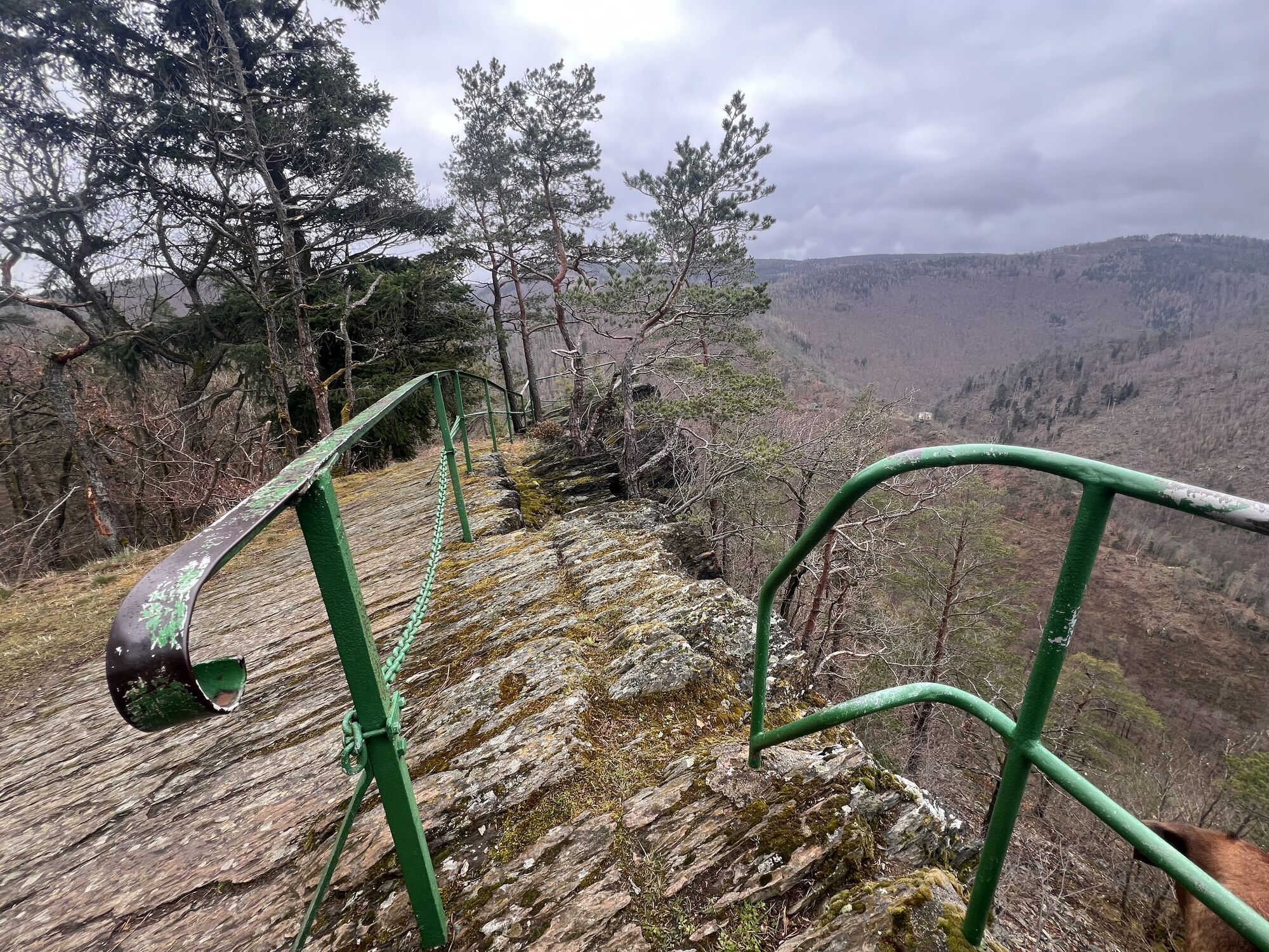
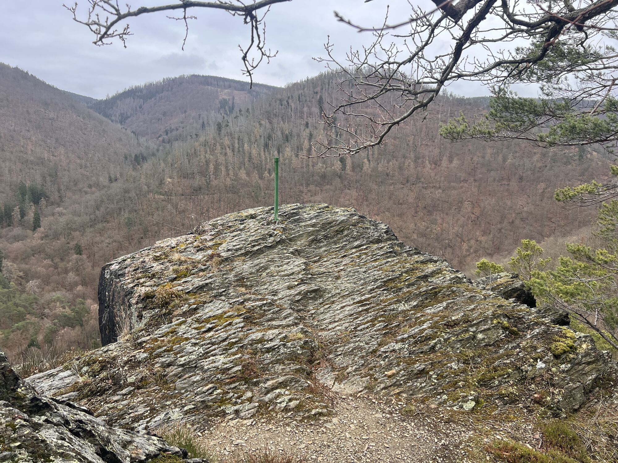
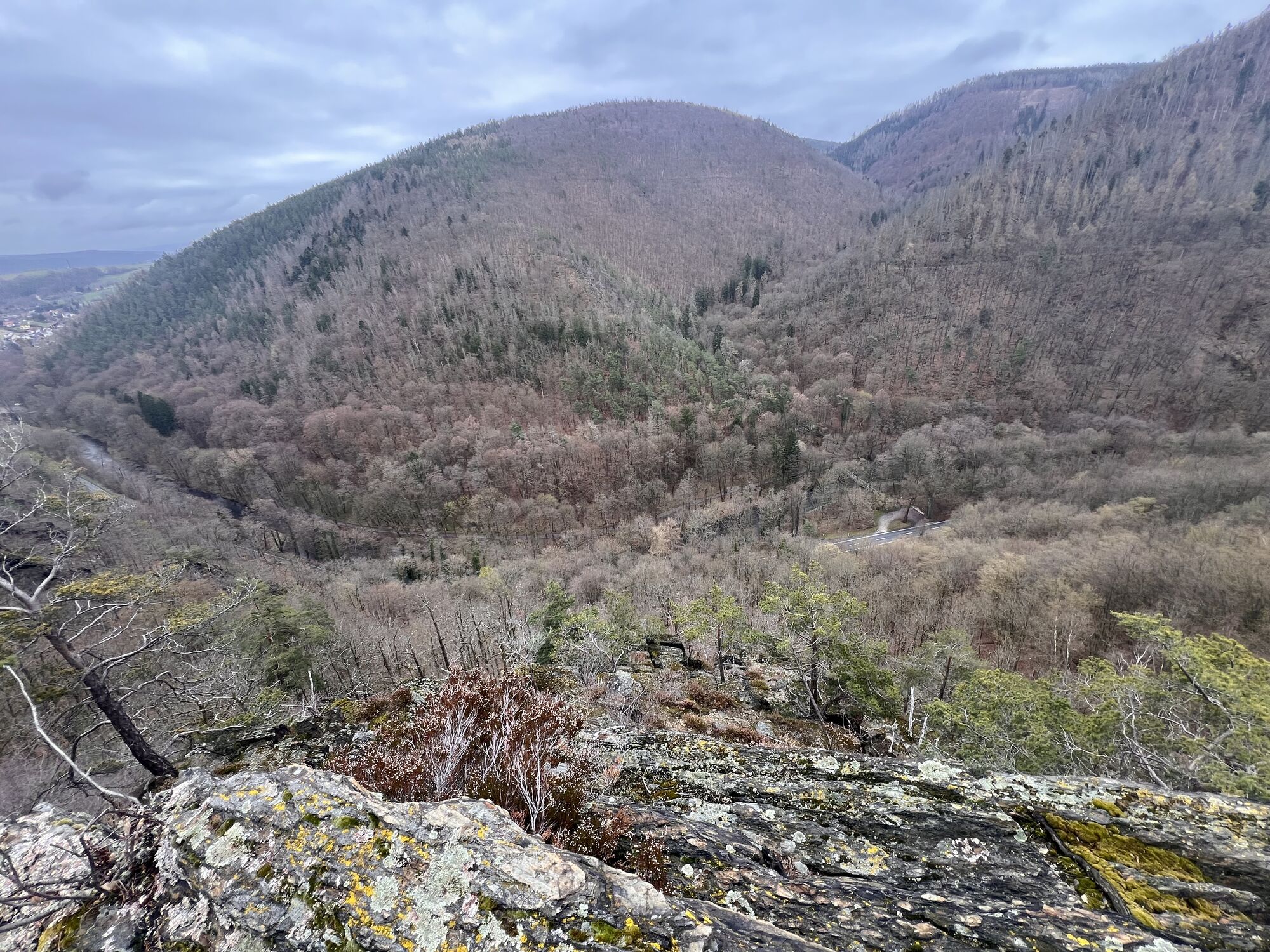
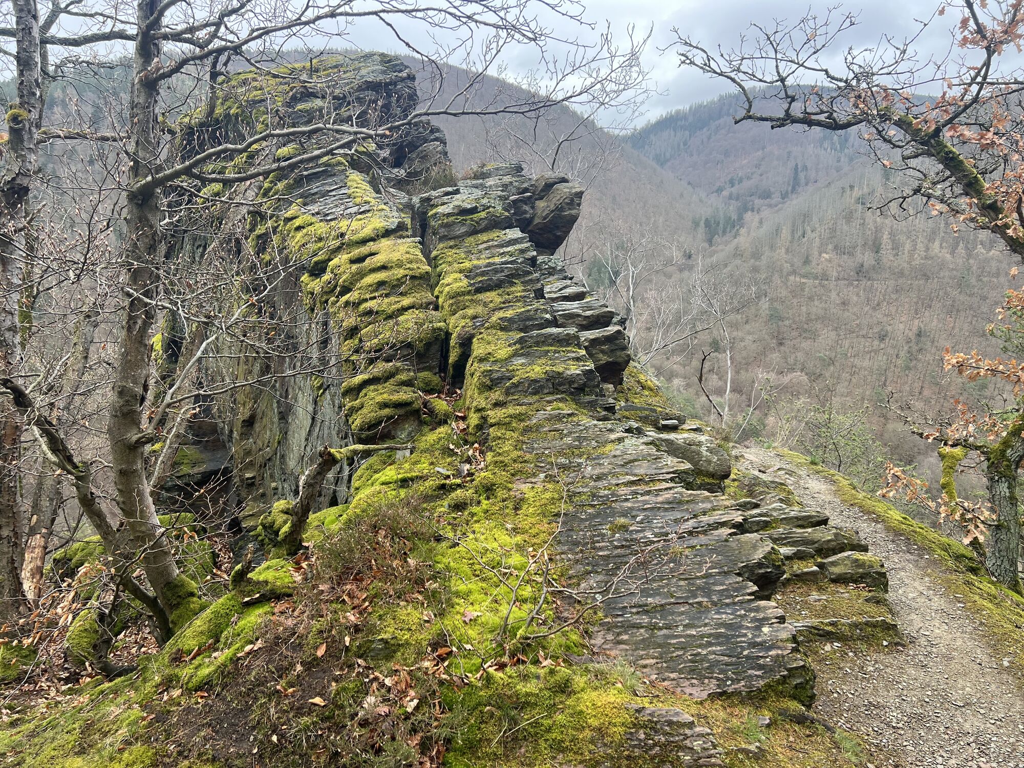
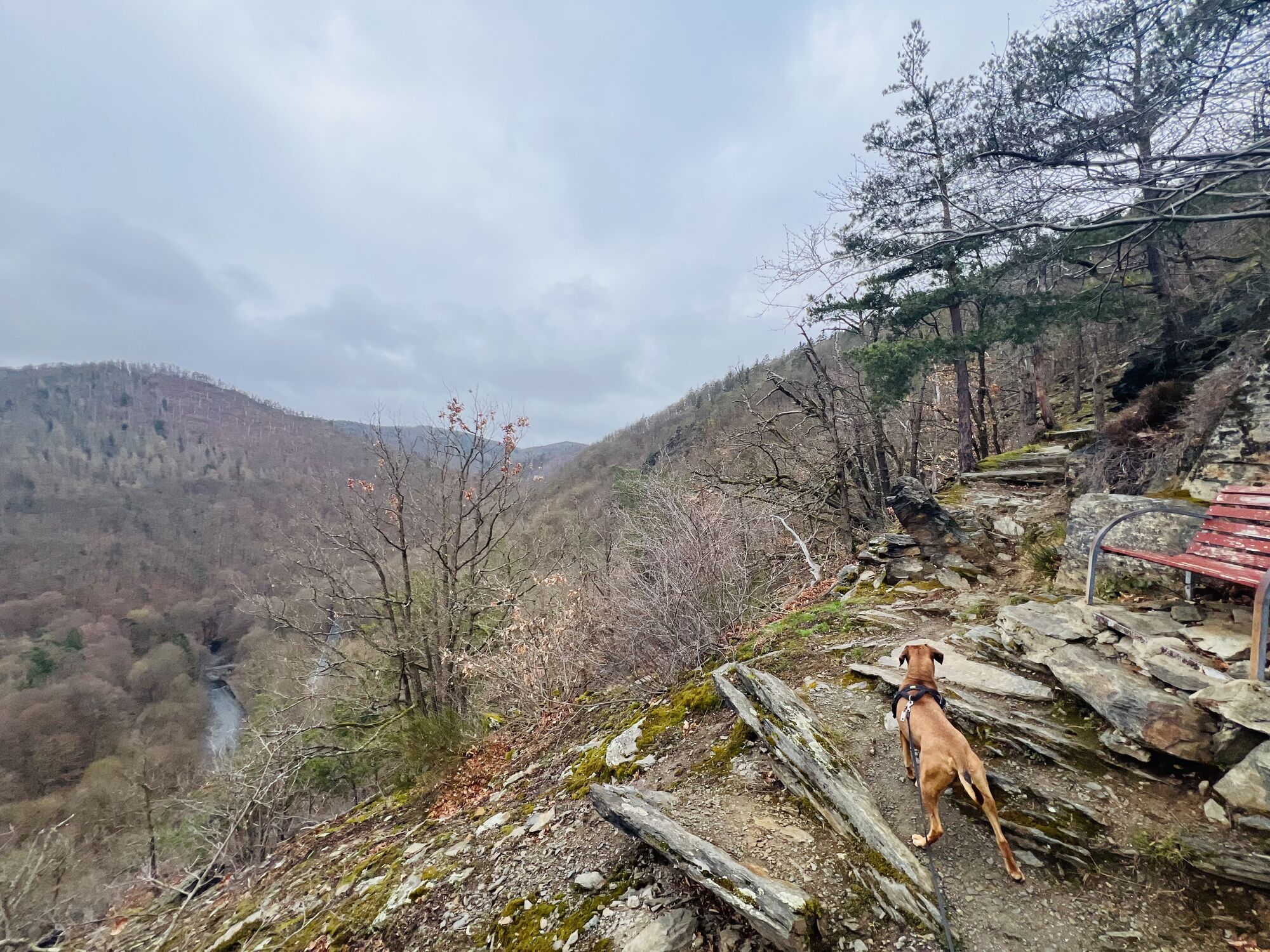
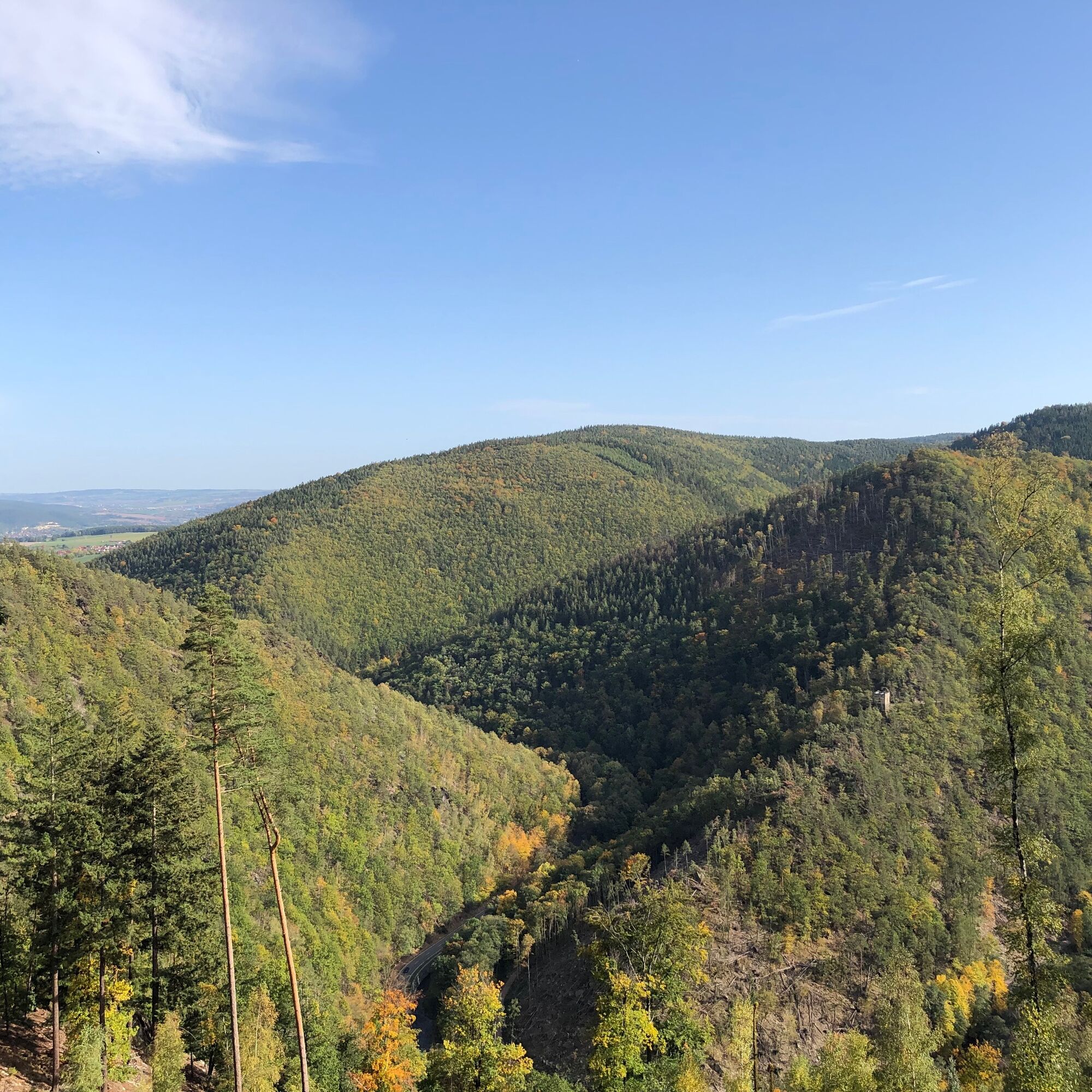
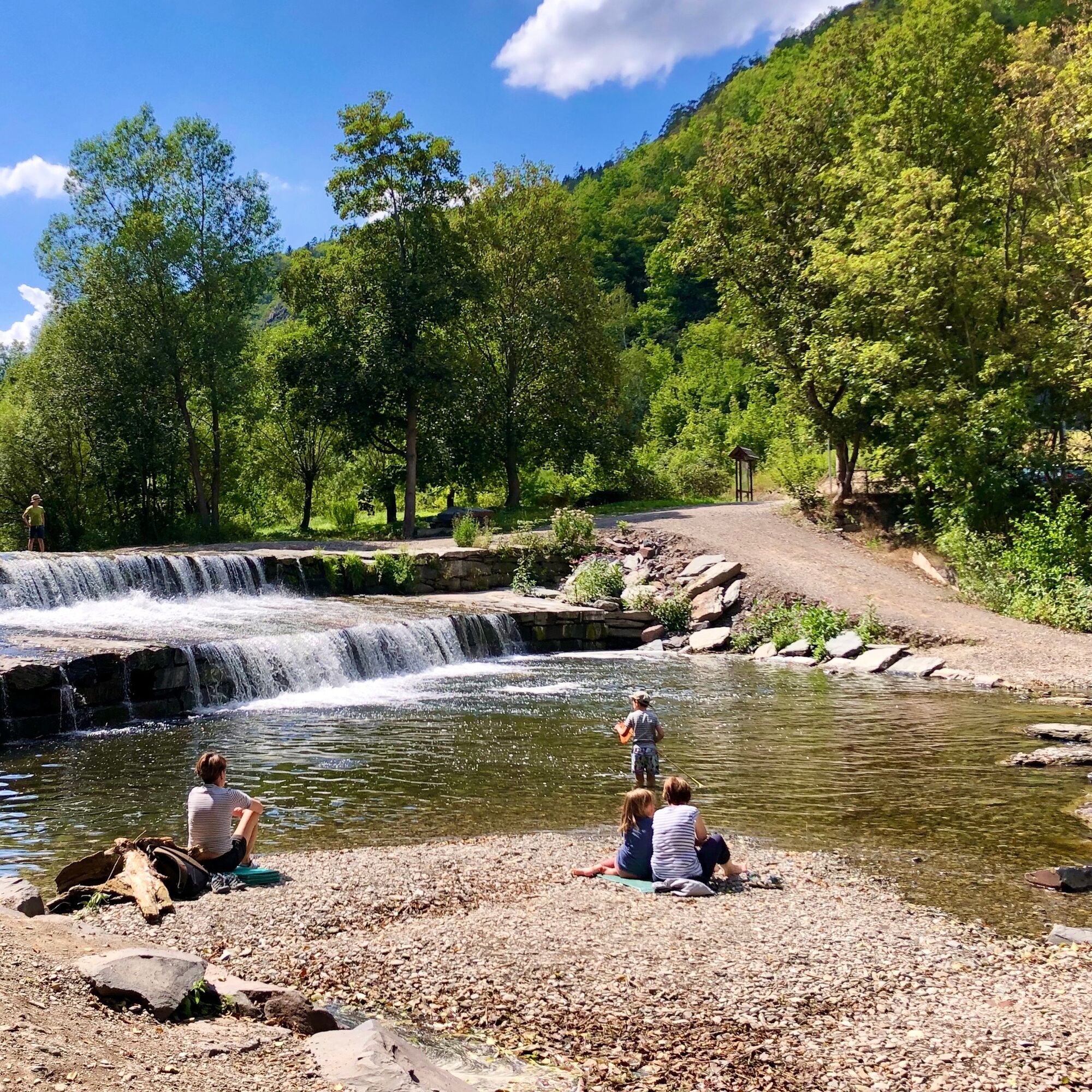
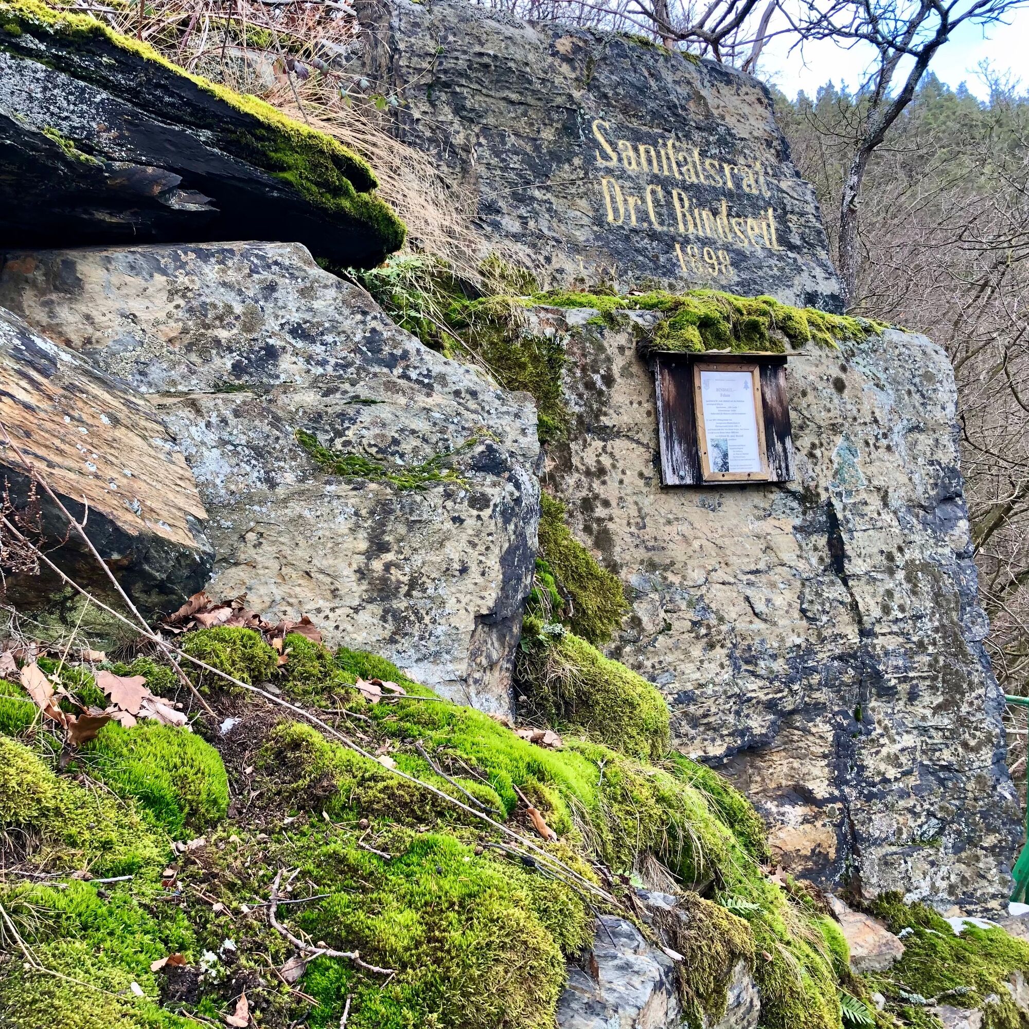
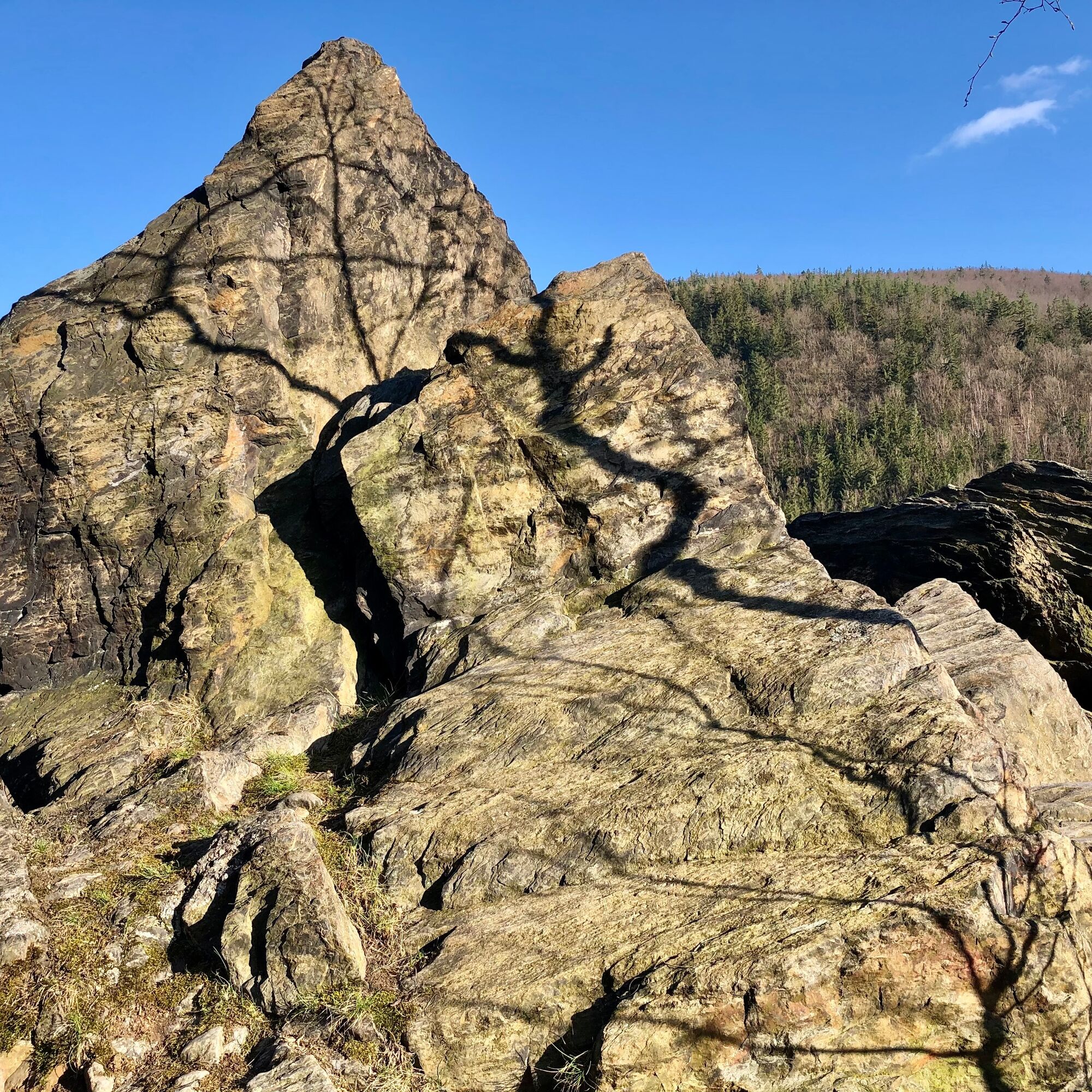
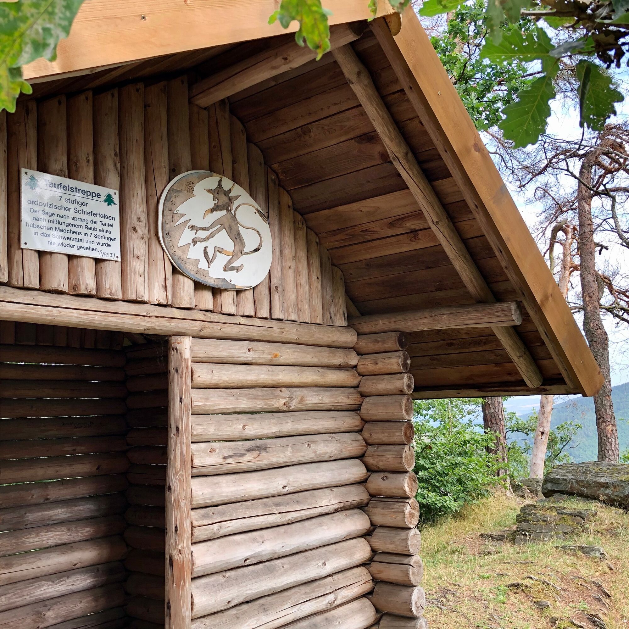
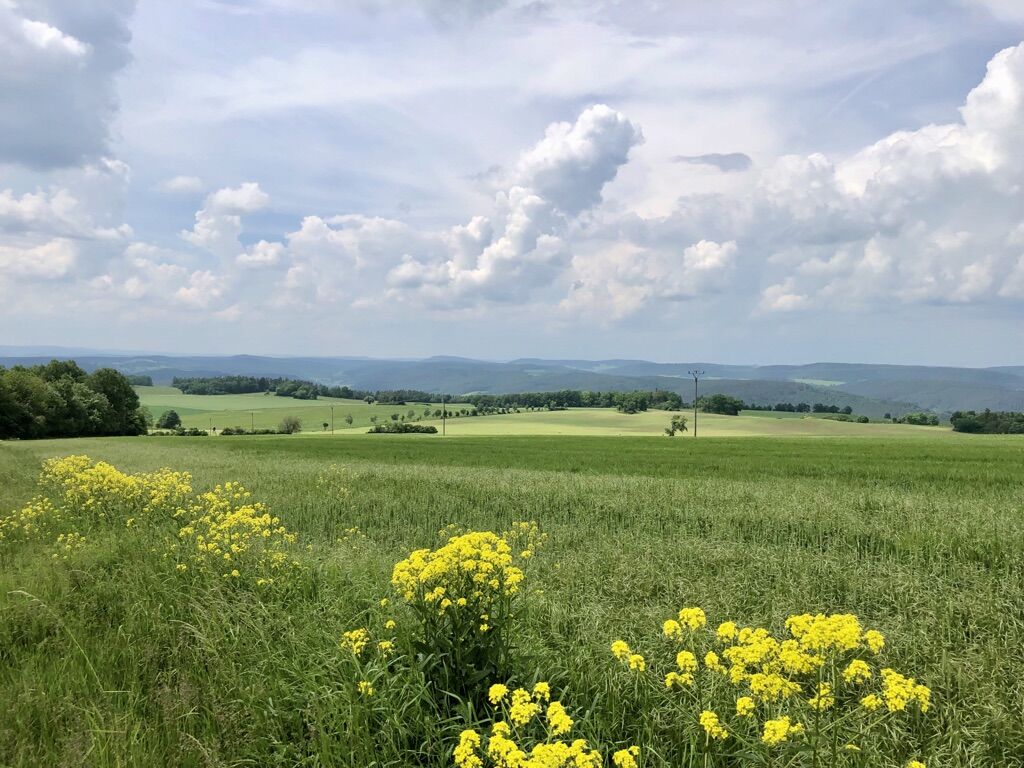
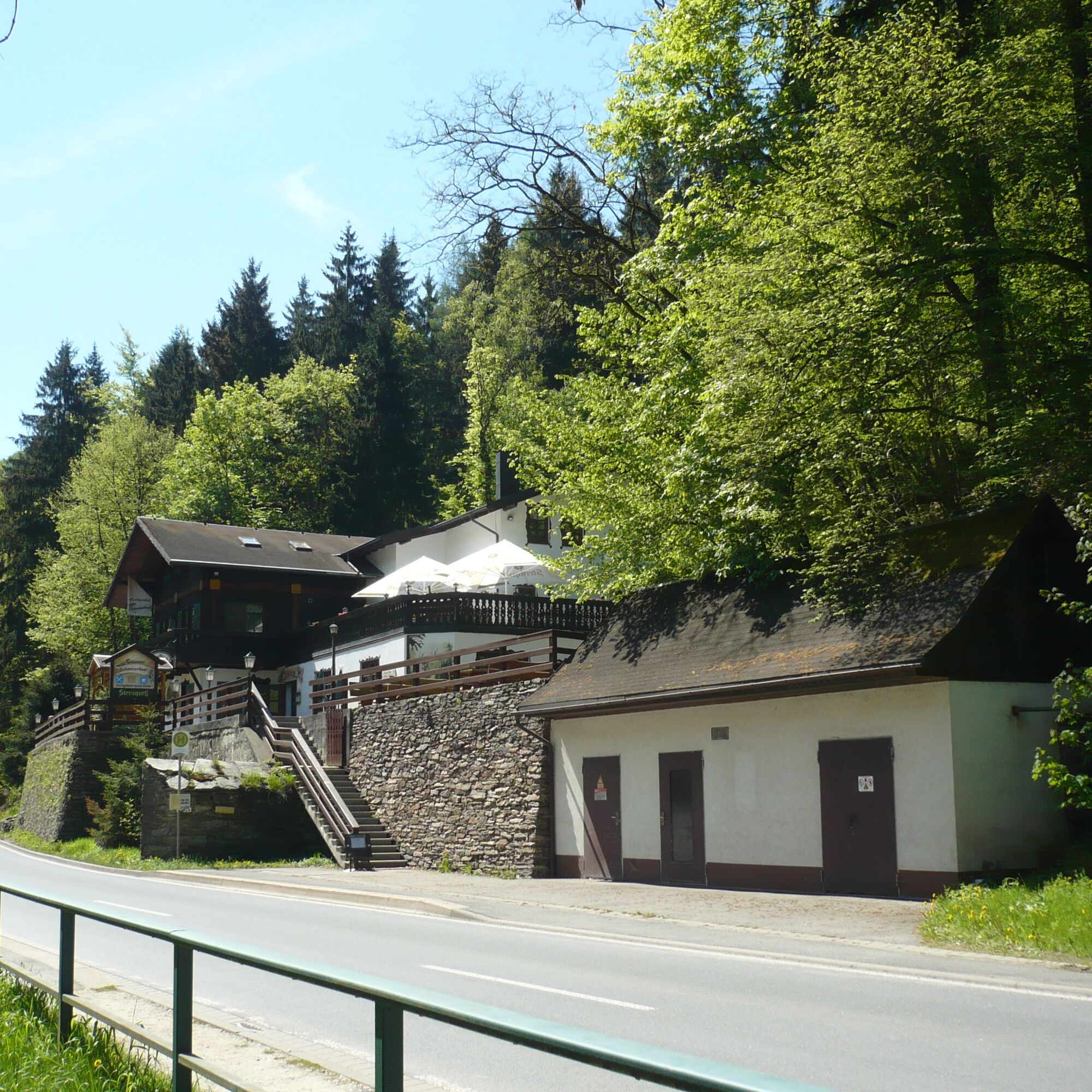
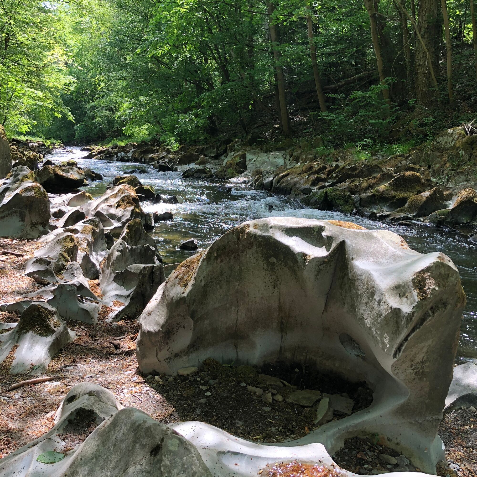
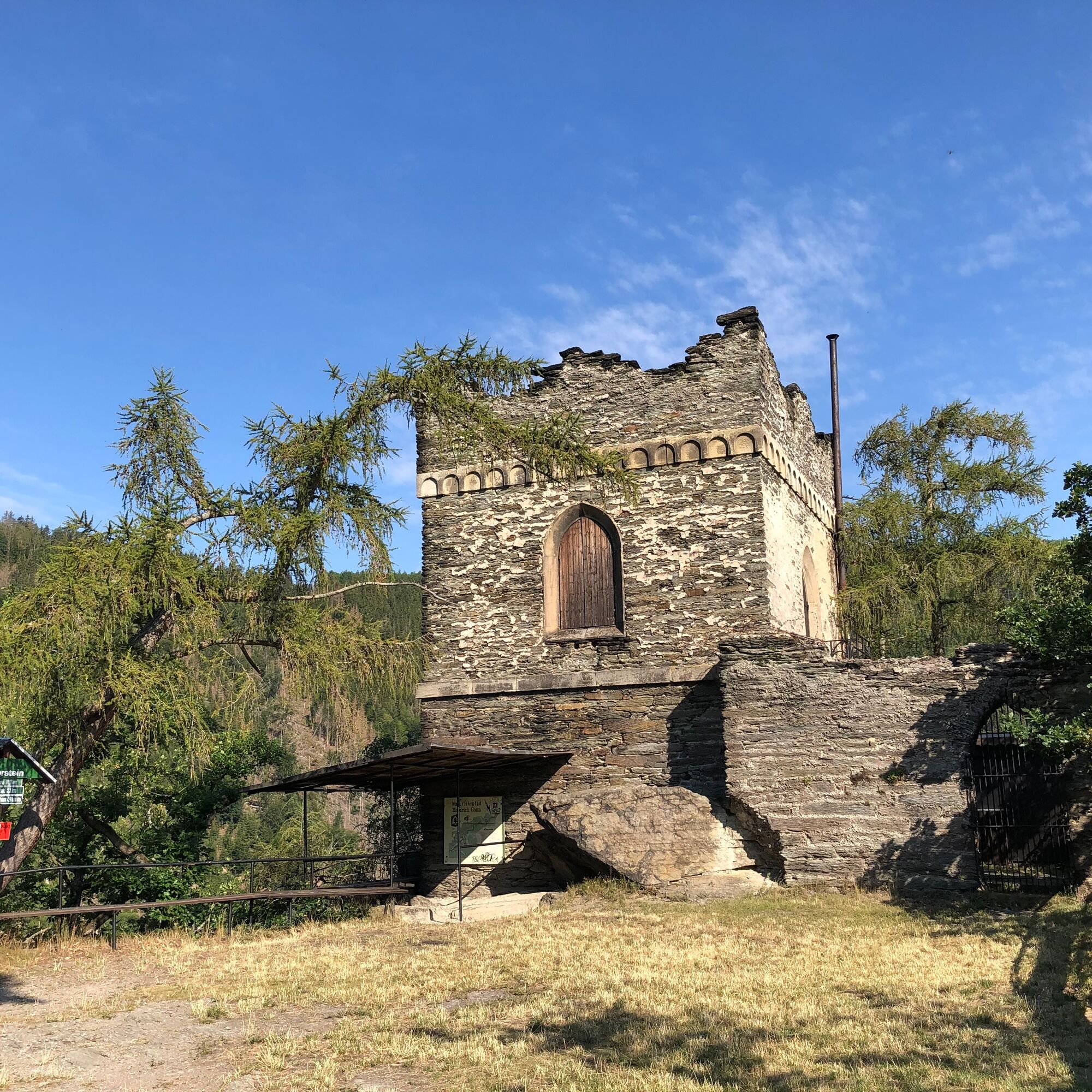
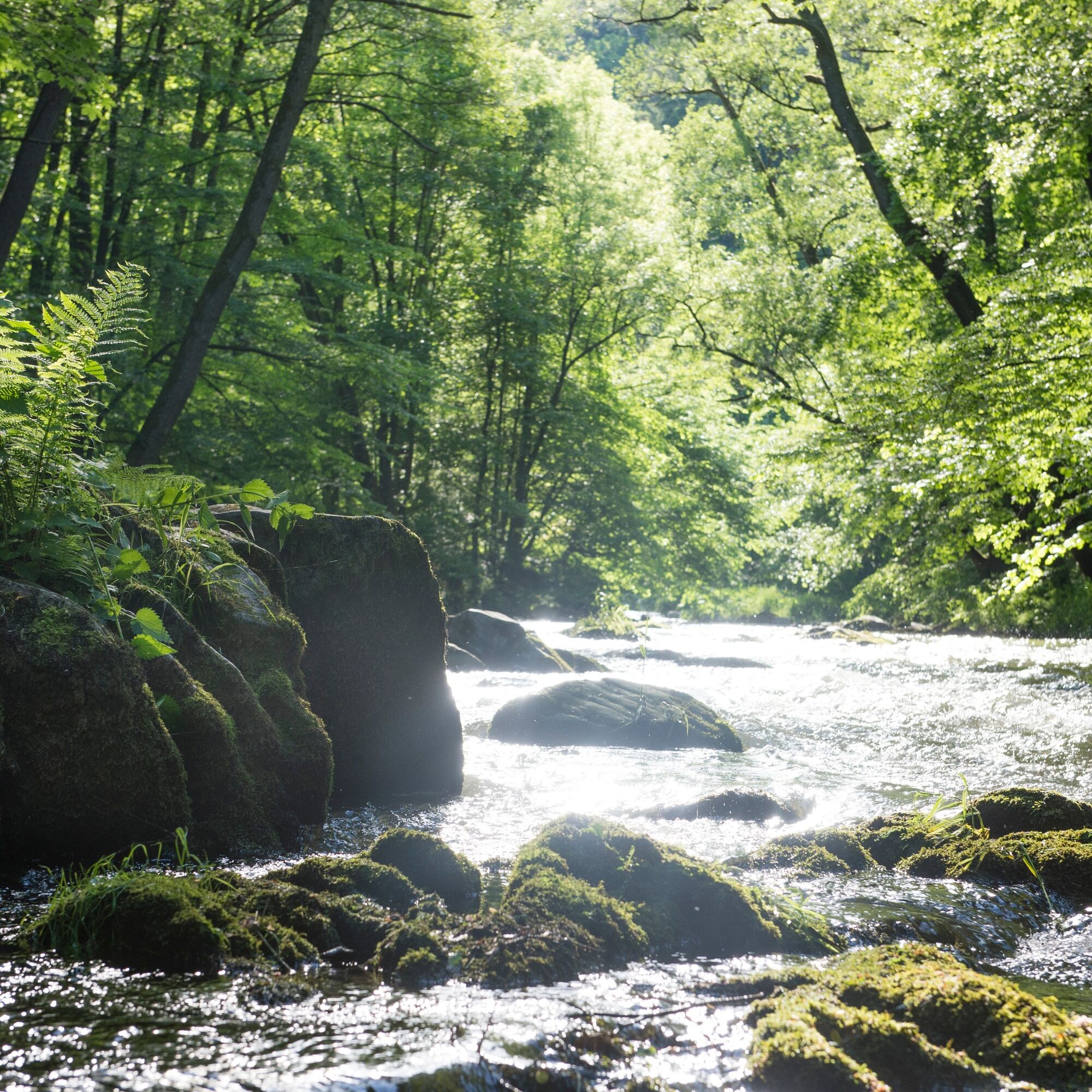
The first and also most challenging part of the hike takes you uphill on a beautiful nature trail to the Griesbachfelsen, a well-known and popular viewpoint in the lower Schwarzatal. On the way, you will already see some distinctive rocks, such as the Bindseil and Siegfried rocks, as well as the Ingoklippe. At Griesbachfelsen, a steep rock cliff at 440 m above sea level, there is a breathtaking view into the deeply incised Schwarzatal, the opposite Hünenkuppe, and the former hunting lodge Eberstein. Passing Teufelstreppe and Fürstenstand, continue to the high-altitude villages Böhlscheiben and Cordobang. Enjoy the fantastic panoramic views on this section before descending towards Schweizerhaus. From Schweizerhaus, follow the downstream path along the Schwarza river to the Strudeltöpfe. Over thousands of years, the Schwarza has ground round depressions into the stones here. After a gentle ascent, you will reach the last highlight of this route - the Eberstein.


Parking lot at Chrysopraswehr - Griesbachfelsen - Teufelstreppe - Böhlscheiben - Cordobang - Schweizerhaus - Strudeltöpfe - Eberstein - Fish breeding - Parking lot at Chrysopraswehr
Marking:
From the parking lot at Chrysopraswehr to Schweizerhaus and then further towards Bad Blankenburg, follow the marking of the Heinrich-Cotta nature trail (green diagonal or green fir on white background) until you reach the Strudeltöpfe of the Schwarza. From the Strudeltöpfe, follow the marking of the Schwarzatal panorama trail (red triangle on white background) towards Eberstein and further to the end of the hike, the parking lot at Chrysopraswehr.
Tak
Sturdy footwear
Rainwear
First aid kit
GPS device or smartphone
Drinks, packed lunch
Always stay on the designated hiking trails and be aware of typical forest hazards.
Coming from the A71, take exit 14b (Stadtilm) and then continue on the B90n towards Rudolstadt. In Rudolstadt change to the B85 / B88 and drive south towards Saalfeld / Bad Blankenburg. Directly at the Schwarzamündung, the B88 turns right towards Bad Blankenburg. At Bad Blankenburg station, turn left into Wirbacher Straße and from the outdoor pool follow Dittersdorfer Weg.
You can reach Bad Blankenburg conveniently by trains of the Erfurt railway. Simply use this link for travel planning:
Travel to Bad Blankenburg in the DB travel planner
The hiking parking lot can be reached from the station in about 15 minutes on foot, along the Schwarza past the outdoor pool through the spa park.
The hiking parking lot is located at the entrance to the Schwarzatal, more precisely at the Chrysopraswehr (Google NAV point).
Bahnhofstr. 23
07422 Bad Blankenburg
Tel.: 03 67 41 - 26 67
Popularne wycieczki w okolicy
-
5,0
Circular hiking trail - "To the most beautiful viewpoints" - Thuringian Forest
średniWędrówka 12,8 km -
Circular hiking trail - "Sculpture Trail" - Hiking start Unterweißbach - Thuringian Forest
średniWędrówka 24,4 km -
4,0
Circular route - “To the Strudel pots of the Schwarza” - Starting point at the Chrysopras weir - Bad Blankenburg
średniWędrówka 9,01 km -
Circular hike - "Friedrich Fröbel" - Bad Blankenburg
ciężkiWędrówka 14,4 km -
Circular trail - Saugartenpfad - Hiking start at Chrysopraswehr - Bad Blankenburg
średniWędrówka 8,39 km -
5,0
Kulm route
średniWędrówka 9,39 km -
3,0
Circular route - "On archaeological trail of King Otto I." - Saale region
światłoWędrówka 6,55 km -
Panoramaweg Schwarzatal - Stage 1 Schwarza to Schwarzburg - Thuringian Forest
ciężkiWędrówka 15,4 km -
4,0
Circular hike - "Round route 3" - start and finish country hotel Edelhof Kolkwitz - Thuringia
średniWędrówka 9,42 km -
5,0
Circular hiking trail - Nature educational path Lichtenhain - Hiking start Lichtenhain
średniWędrówka 8,08 km
Wędrówki i tropienie


Nie przegap ofert i inspiracji na następne wakacje
Twój adres e-mail została dodana do listy mailingowej.