


Circular hiking trail - Nature educational path Lichtenhain - Hiking start Lichtenhain
Around the small high-altitude village of Lichtenhain, a district of the town Oberweißbach and located at the steep section of the Oberweißbacher Berg- und Schwarzatalbahn, the local heritage association...
Around the small high-altitude village of Lichtenhain, a district of the town Oberweißbach and located at the steep section of the Oberweißbacher Berg- und Schwarzatalbahn, the local heritage association of Lichtenhain has created a circular hiking trail that allows hikers to fully enjoy nature and landscape in different seasons.
Hiking stamps On these circular trails, you can collect digital hiking stamps for your personal hiking certificate. At the marked stamp stations, scan the respective QR code with your smartphone and add the location to your stamp account via the generated link. You can also collect hiking stamps without a smartphone. Information about this is available onsite on the QR code signs. All stamp stations are located directly on the trail!
And the special thing:
The KomBus hiking buses take you quickly and comfortably to the starting point of your hike!

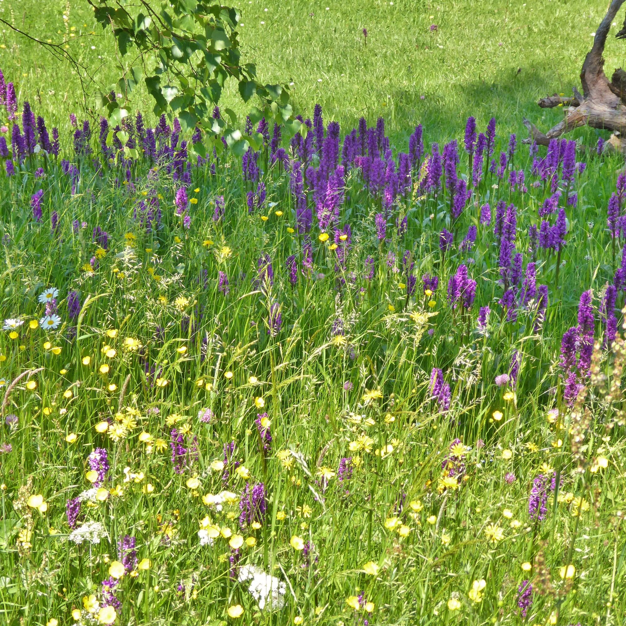
The circular hiking trail, consistently marked with the green diagonal stripe, the sign for theme trails and educational paths in Thuringia, begins at the hiking start point in Lichtenhain, directly at the mountain station of the Oberweißbacher Bergbahn. First, it goes through the small village of Lichtenhain, then after passing under the tracks of the steep section of the mountain railway, the path leads down through the high forest dominated by spruces and pines to the watering place. As the name "watering place" suggests, a spring emerges from the mountainside here, which was used as a watering spot for cattle kept on the pastures of the highlands (until the mid-20th century). Benches now invite you to rest at this forest-surrounded spot.
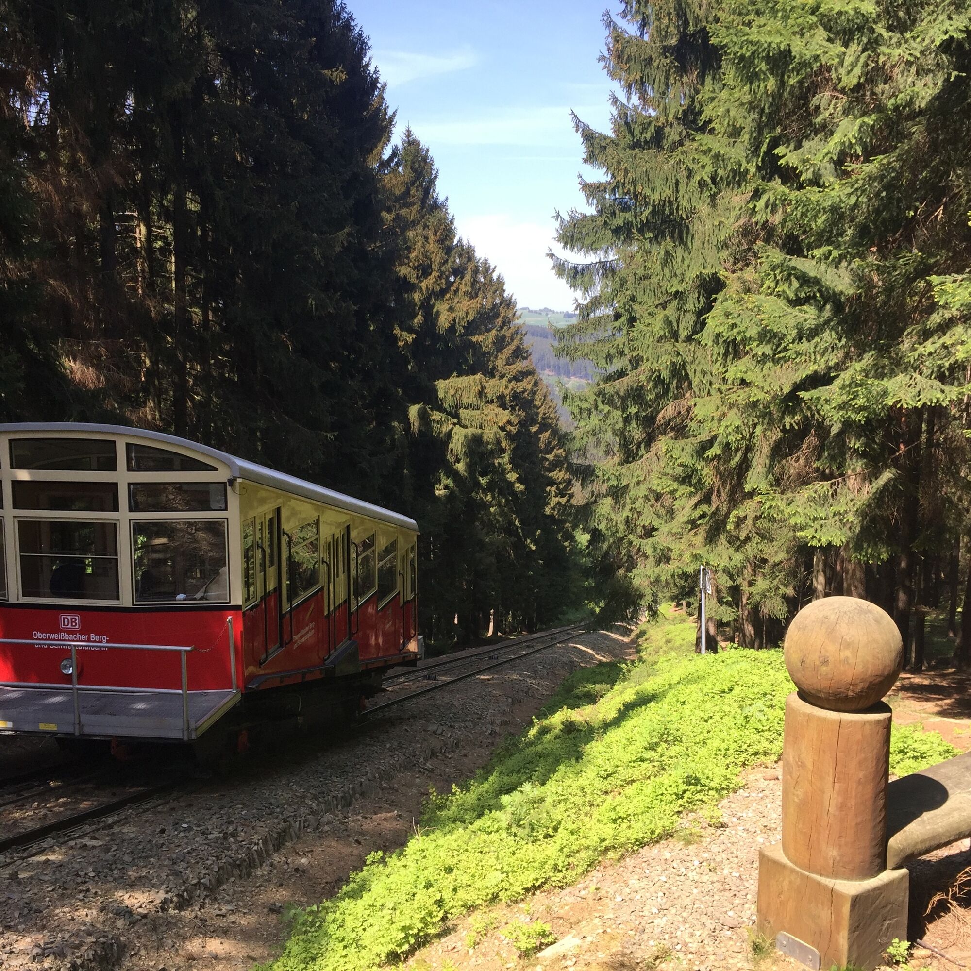
Now, the path leads slightly uphill to the tracks of the steep section of the mountain railway. Here, there is an opportunity to watch the different cars of the railway going up and down and to take special souvenir photos.
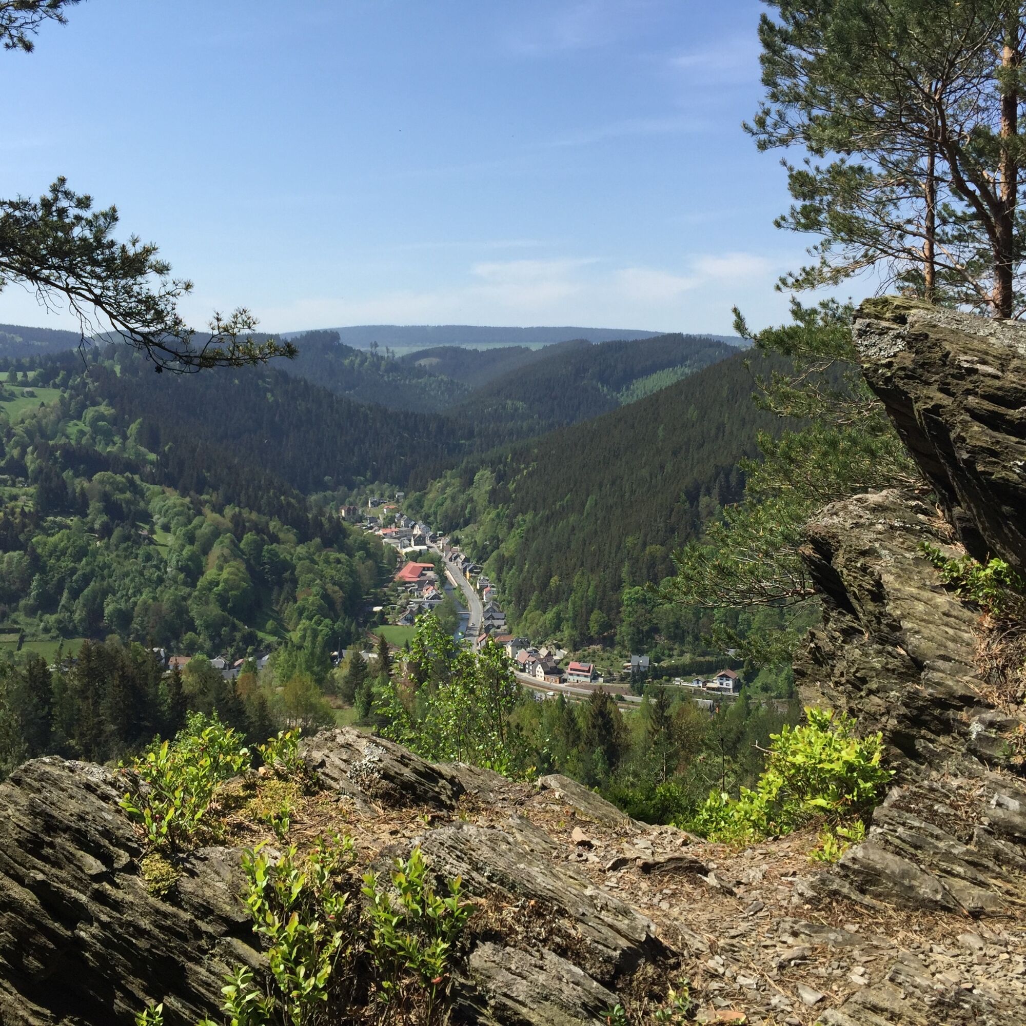
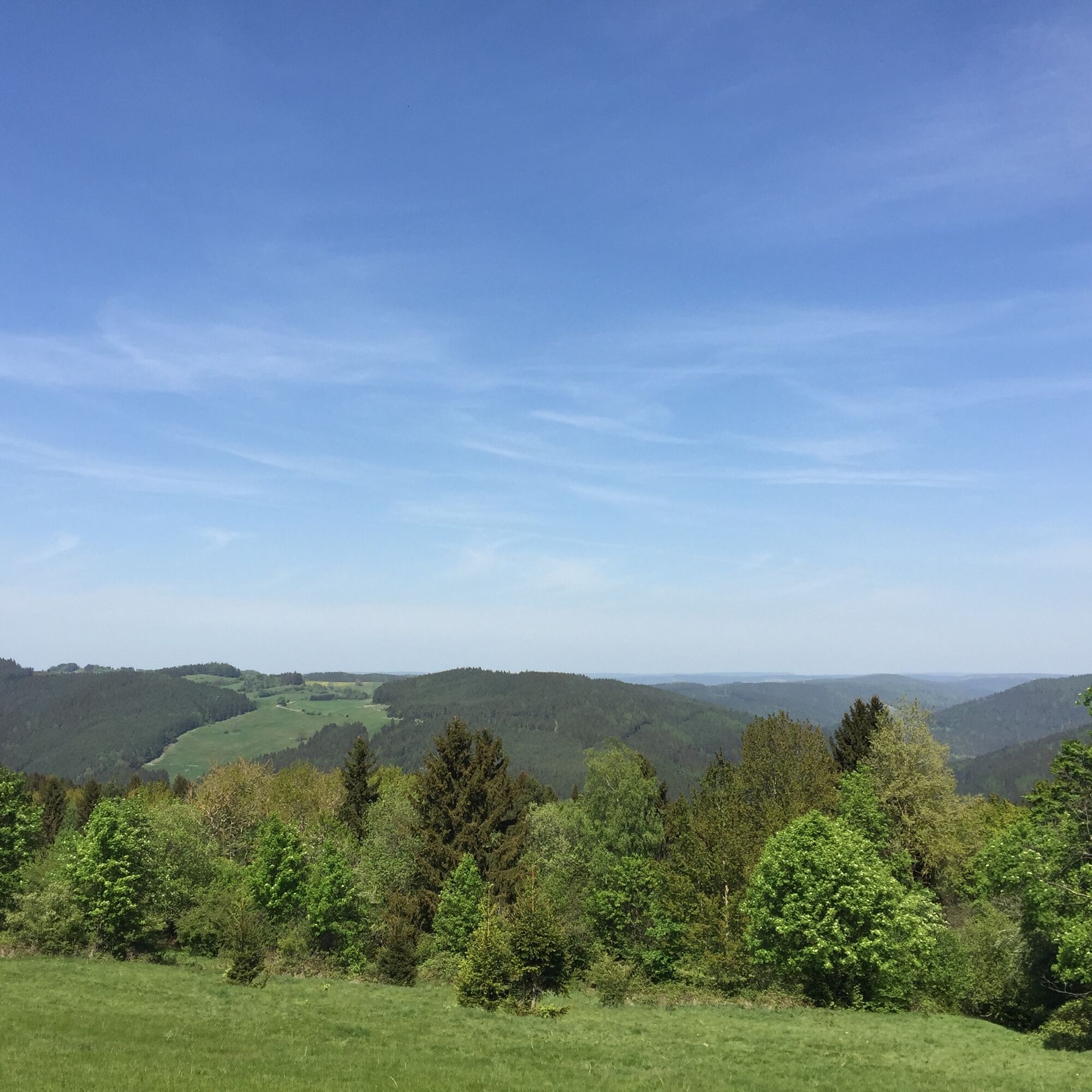
After passing under the tracks, the path goes through the pasturelands that stretch around the small village of Lichtenhain. From almost 600 m above sea level, wonderful views of the mountains can be enjoyed here, which frame the Schwarza valley in the northeast direction.
Via "den Anspann" – a place located on an old trade route where the cart drivers changed horses or took a rest after the climb from the Schwarzatal – we reach the forest again and now follow the old trade route past the cemetery of Lichtenhain, downhill. We reach the junction to the Sachsensteine but stay another 100 m on the trade route to reach the quarry viewpoint. Here, from the height of the Mellenbach quarry, there is an unobstructed view into the Schwarza valley, the village of Mellenbach-Glasbach, and on the horizon, the Lang Berg over 800 m high.
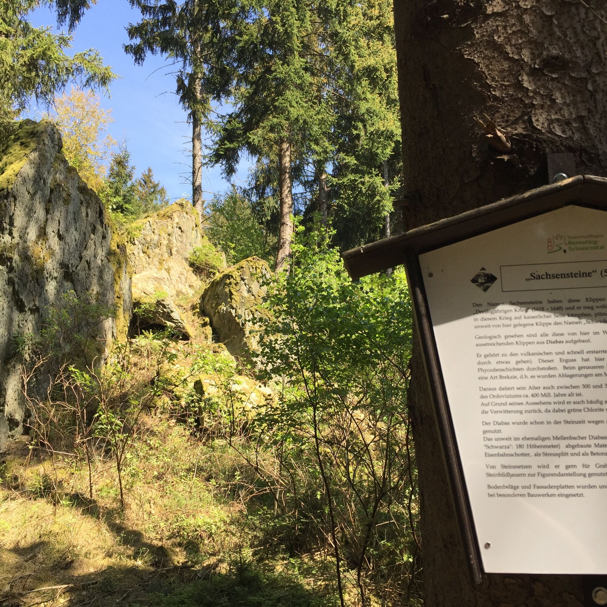
Back at the junction to Sachsenstein, the path goes slightly uphill before, almost hidden by trees, the Sachsensteine are reached. On an information board, you can learn interesting facts about the geology of the region here. Shortly after, the Schweden- or Totenstein is reached. Why it is called so can be read onsite with the legend of the Schweden- or Totenstein on an information board.
Further uphill through the forest, you again reach the pasturelands of Lichtenhain and the so-called "Vogelherd". Here, songbirds were previously caught, which were then kept in small cages for the pleasure of the catchers or buyers or, in times of need, even eaten.
From here, the path returns to Lichtenhain, passing through the village, up to a small hill with a shelter and barbecue area called "Schau ins Land". Indeed, the open view from here invites a longer rest. Continuing through Lichtenhain, you reach the flat section of the mountain railway that connects Lichtenhain with the recreational resort Cursdorf. Through the Fröbelwald forest with its interesting stations on important topics from the history of the region, the nature educational path leads back to the hiking start.
Route:
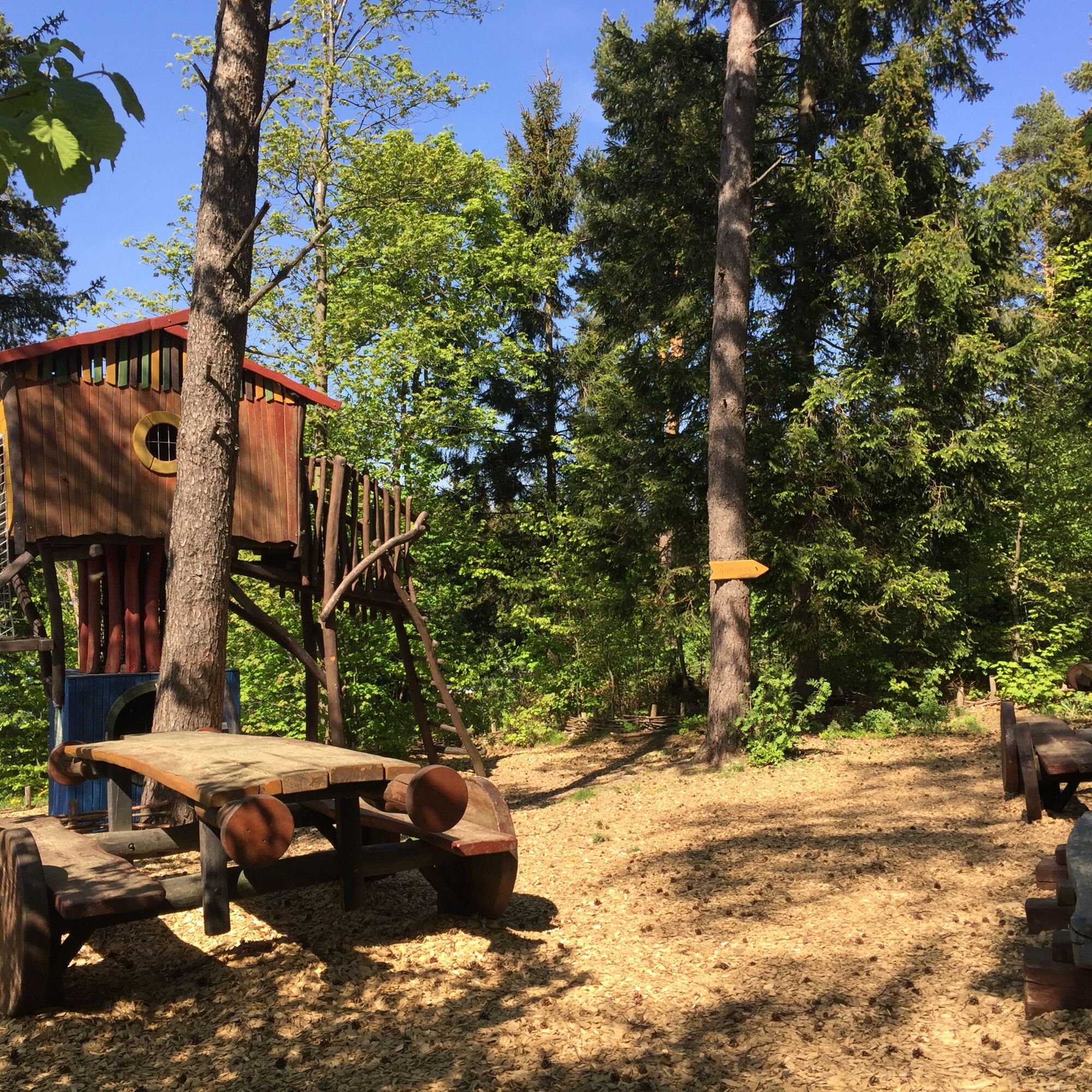
Hiking start – Underpass mountain railway – Sandmännchen's fairy tale hut – Watering place – Underpass mountain railway – Am Anspann – Quarry viewpoint – Sachsenstein – Schwedenstein – Vogelherd – Am Anspann – in the alley – Lichtenhain – Schau ins Land – Fröbelwald – Hiking start
Tak
Sturdy footwear
Rainwear
First aid kit
GPS device or smartphone
Drinks
The circular hiking trail is easy to hike during snow- and ice-free periods without special safety precautions. However, at the mountain railway, you should keep a safe distance from the tracks, and at the quarry viewpoint, special care should be taken to prevent children from entering dangerous edge areas.
Coming from the A73, take exit 5 (Eisfeld-Nord) and continue on B281 towards Neuhaus am Rennweg. After passing through Neuhaus am Rennweg, take the third exit at the roundabout to the left towards Oberweißbach / Lichtenhain.
You can travel to Lichtenhain with the trains of the Oberweissbacher Berg- und Schwarzatalbahn. From Obstfelderschmiede (Schwarzatal), first take the funicular railway to Lichtenhain.
You can also conveniently use the Deutsche Bahn travel information. Enter Lichtenhain as the destination.
Alternatively, Lichtenhain is also accessible by bus. The KomBus GmbH serves the village with line 313. These connections are also included in the Deutsche Bahn search results.
Use the parking facilities at the train stop (Google-NAV point)
Local contact:
Tourist Information / Memorial Museum
Markt 10 / 98744 Oberweißbach
Tel.: 036705 - 62123
Central contact:
Tourist and Service Center
(Main entrance town hall)
Bahnhofstr. 23 | 07422 Bad Blankenburg
Tel. 03 67 41 - 26 67
Anyone who wishes to use the beautiful barbecue area "Schau ins Land" for grilling should have everything necessary for it in their backpack.
Popularne wycieczki w okolicy
- 3,0
Circular hike - "4 ponds hike" Neustadt am Rennsteig - Thuringian Forest
ciężkiWędrówka 12,6 km - 5,0
Circular hiking route - TOP 1 - Werra Source - Masserberg - Thuringian Forest
średniWędrówka 5,94 km Circular hiking trail - "Sculpture Trail" - Hiking start Unterweißbach - Thuringian Forest
średniWędrówka 24,4 kmCircular route - "When Rennsteig meets the Schwarzatal panorama path" - Limbach
średniWędrówka 9,68 km- 4,0
Circular route - “To the Strudel pots of the Schwarza” - Starting point at the Chrysopras weir - Bad Blankenburg
średniWędrówka 9,01 km - 5,0
Circular route 5 - Neustadt am Rennsteig - Thuringian Forest
średniWędrówka 8,50 km Circular hike - "Friedrich Fröbel" - Bad Blankenburg
ciężkiWędrówka 14,4 kmCircular trail - Saugartenpfad - Hiking start at Chrysopraswehr - Bad Blankenburg
średniWędrówka 8,39 kmPanoramaweg Schwarzatal - Stage 1 Schwarza to Schwarzburg - Thuringian Forest
ciężkiWędrówka 15,4 kmHike - “Ochsenbacher Pond” - Neustadt am Rennsteig - Thuringian Forest
średniWędrówka 14,0 km
Wędrówki i tropienie


Nie przegap ofert i inspiracji na następne wakacje
Twój adres e-mail została dodana do listy mailingowej.