


Circular route - "When Rennsteig meets the Schwarzatal panorama path" - Limbach
Zdjęcia naszych użytkowników

This hike connects a typical Rennsteig section with the source area of the Schwarza. Further regional and supraregional hiking trails intersect this route, e.g. E3, EB, Goldpfad and 6 Kuppensteig.
From...
This hike connects a typical Rennsteig section with the source area of the Schwarza. Further regional and supraregional hiking trails intersect this route, e.g. E3, EB, Goldpfad and 6 Kuppensteig.
From the parking lot, go to the Rennsteig and keep right towards Neuhaus/Blankenstein. It goes uphill! Soon, the old "Free Mining Town" Steinheid lies to your right. This community was once founded by gold prospectors. Today, thousands of shimmering Christmas ornaments give the place its economic character. Soon, the stone "Free is the ridge path" stands to your left. Anyone wanting to know more can use the "Rennsteig audio experience".
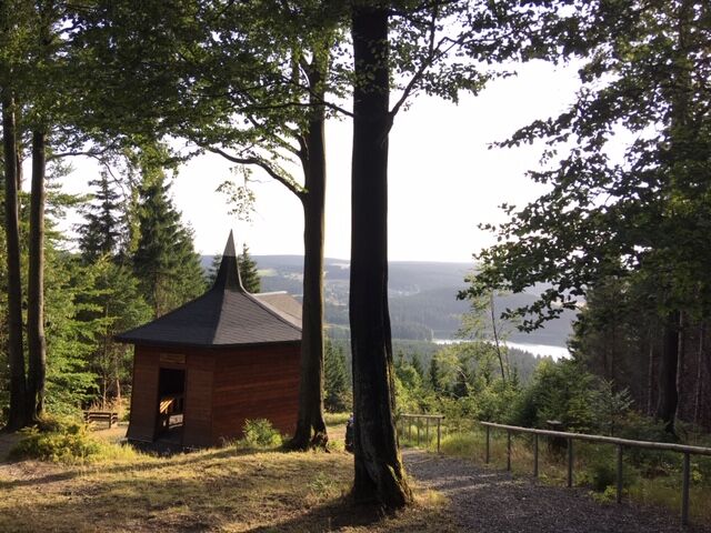
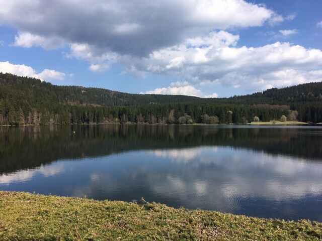
Under your feet it’s now bright – kaolin! This was the raw material for the many glassworks and porcelain factories. After a short descent, the "Steinheider hut" lies to your right. The path climbs again. At the "R seating group" you leave the ridge path and turn left. A wide forest path without inclines lets your circulation calm down. It’s about 500 m now to "Weidmannsheil". The hiking hut with its dream view invites you to rest. In front of you stretches the Schwarzastausee and on the horizon, the Rennsteig runs towards Masserberg. To the left greets the Bleßberg with its transmission mast.
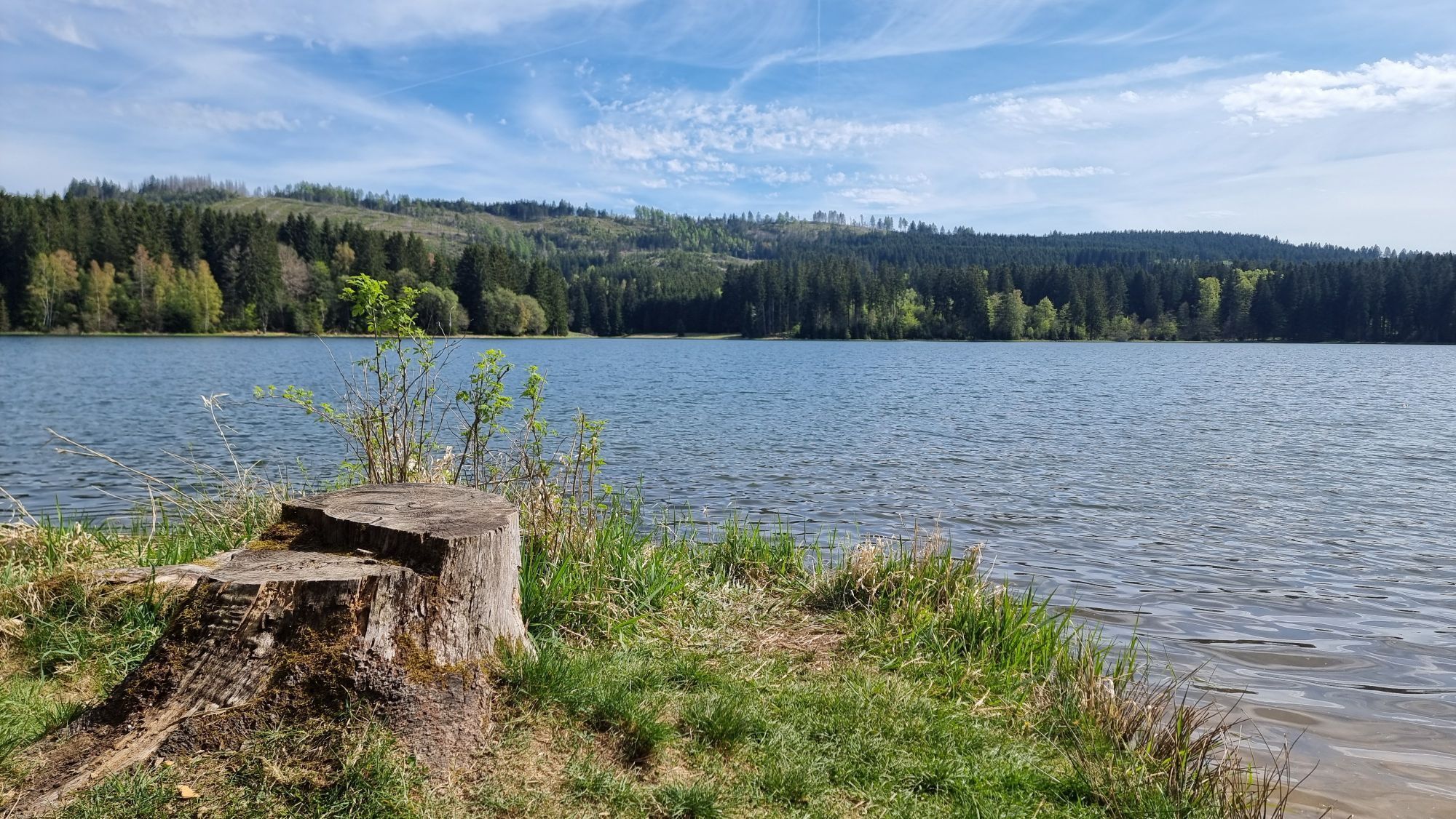
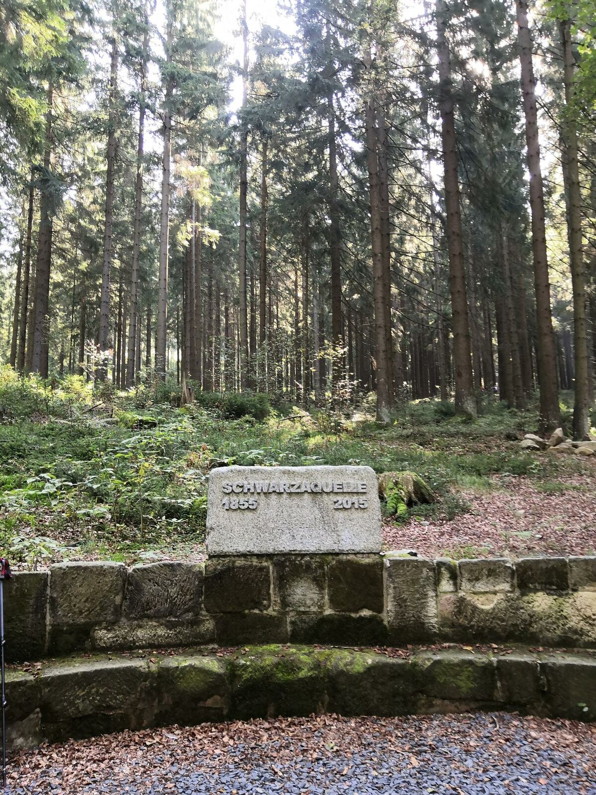
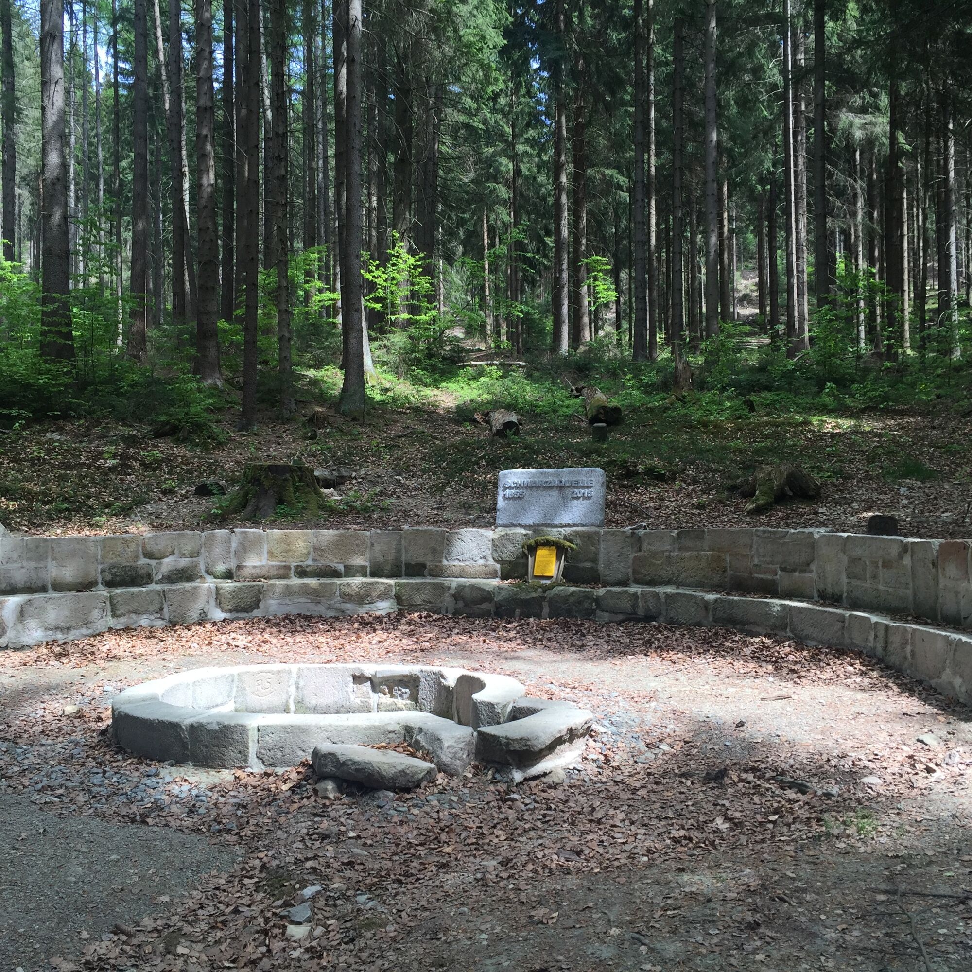
The route now follows the sign "red triangle on white square". The entrance is on the left below the hut. Slightly downhill, you hike to the Schwarza spring and the Schwarzastausee. At the end of the dam, turn right and follow the paved path to Scheibe-Alsbach. Directly at the sports ground, the path turns left into the Gläser valley. You cross this very beautiful valley to the end. Here, the path meets a paved road. Follow it to the left to the forest edge. Now you meet the "Goldpfad" which you follow back to Limbach.
A visit to the ice cream café in the village rounds off the small circular hike "tastefully".

Limbach - Steinheid - Weidmannsheil - Schwarza Spring - Schwarzastausee - Scheibe-Alsbach - Limbach
Tak
Sturdy footwear is important
Rainwear
First aid kit
Drink reserve
GPS navigation device or smartphone
Part of your hike is a training route for junior athletes of a winter sports performance center, so be careful!
Coming from the A73, take exit 5 (Eisfeld North) and follow the B281 towards Neuhaus am Rennweg / Saalfeld to Limbach.
Arrival can be by car or by bus line 508 or via Neuhaus. For travel planning, simply use the Deutsche Bahn travel portal at the following prepared link:
Arrival at Limbach
Just enter your starting point and the desired travel period.
Parking lot Limbach (Google NAV point)
At the beginning of the hike, a visit to the "Room of Silence" should take place. Here, the Greiner porcelain family is commemorated. The "Rennsteig audio experience" explains some points of the route.
Popularne wycieczki w okolicy
-
5,0
Naturlehrpfad Gießübler Schweiz
średniWędrówka 7,99 km -
5,0
Circular hiking route - TOP 1 - Werra Source - Masserberg - Thuringian Forest
średniWędrówka 5,94 km -
4,0
Circular hiking trail - TOP 4 - Masserberg - Fehrenbach Switzerland - Thuringian Forest
średniWędrówka 11,5 km -
Circular hiking trail - "Sculpture Trail" - Hiking start Unterweißbach - Thuringian Forest
średniWędrówka 24,4 km -
5,0
Circular hiking route - "Panorama View" - Schönbrunn - Thuringian Forest
średniWędrówka 9,65 km -
5,0
Circular route 5 - Neustadt am Rennsteig - Thuringian Forest
średniWędrówka 8,50 km -
Circular route - TOP 3 - hike with a view - Masserberg - Thuringian Forest
średniWędrówka 17,3 km -
4,0
Circular hiking trail - TOP 2 - Masserberg - "Cultural Experience" - Friedrichshöhe - Thuringian Forest
średniWędrówka 15,2 km -
Circular hike - Around the pumped-storage power plant - Goldisthal
średniWędrówka 19,5 km -
hiking - Rennsteig - stage 5 - from Allzunah to Friedrichshöhe
ciężkiWędrówka 24,5 km

Wędrówki i tropienie


Nie przegap ofert i inspiracji na następne wakacje
Twój adres e-mail została dodana do listy mailingowej.