


Werra Water Hiking 11: Wahlhausen - Witzenhausen
Poziom trudności: 2
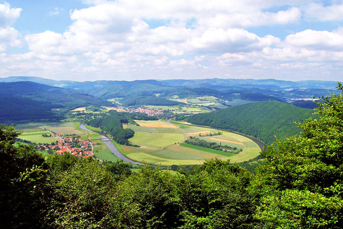
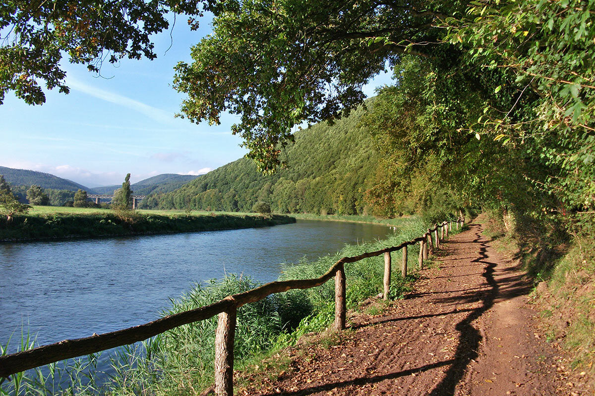
This is a real border experience, as the middle of the Werra river forms the border between Hesse and Thuringia between Wahlhausen and Lindewerra. The Werra winds in large meanders between the opposite...
This is a real border experience, as the middle of the Werra river forms the border between Hesse and Thuringia between Wahlhausen and Lindewerra. The Werra winds in large meanders between the opposite mountain slopes of the Meißner-Kaufunger Forest and the Eichsfeld.
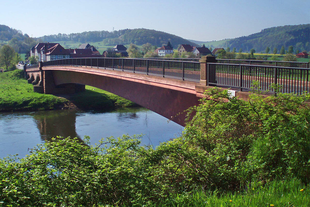
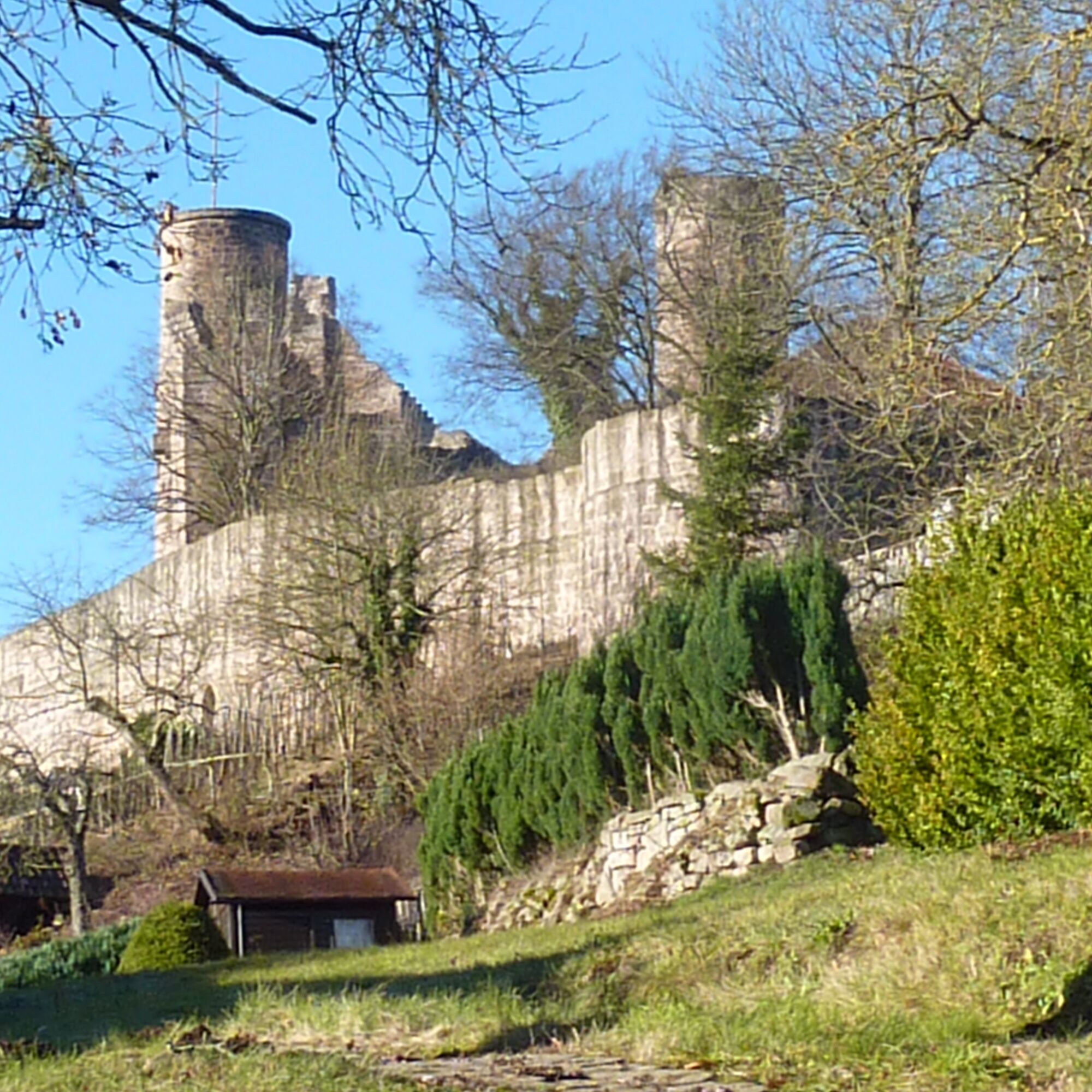
After about 5.5 km, you reach Lindewerra, the "stick maker village of Germany." Hiking and walking sticks from Lindewerra were traded worldwide. Below the Devil's Pulpit on the nearby mountain ridge, the Werra is forced into a large loop in the valley basin. After Lindewerra, the Werra definitively leaves the Thuringian area. At Oberrieden, the Werra Valley widens and presents the famous two-castle view of the Ludwigstein Youth Castle and the Hanstein castle ruins. At Werleshausen, the Werra squeezes once more through a narrow valley between Halbesberg and Ludwigstein.
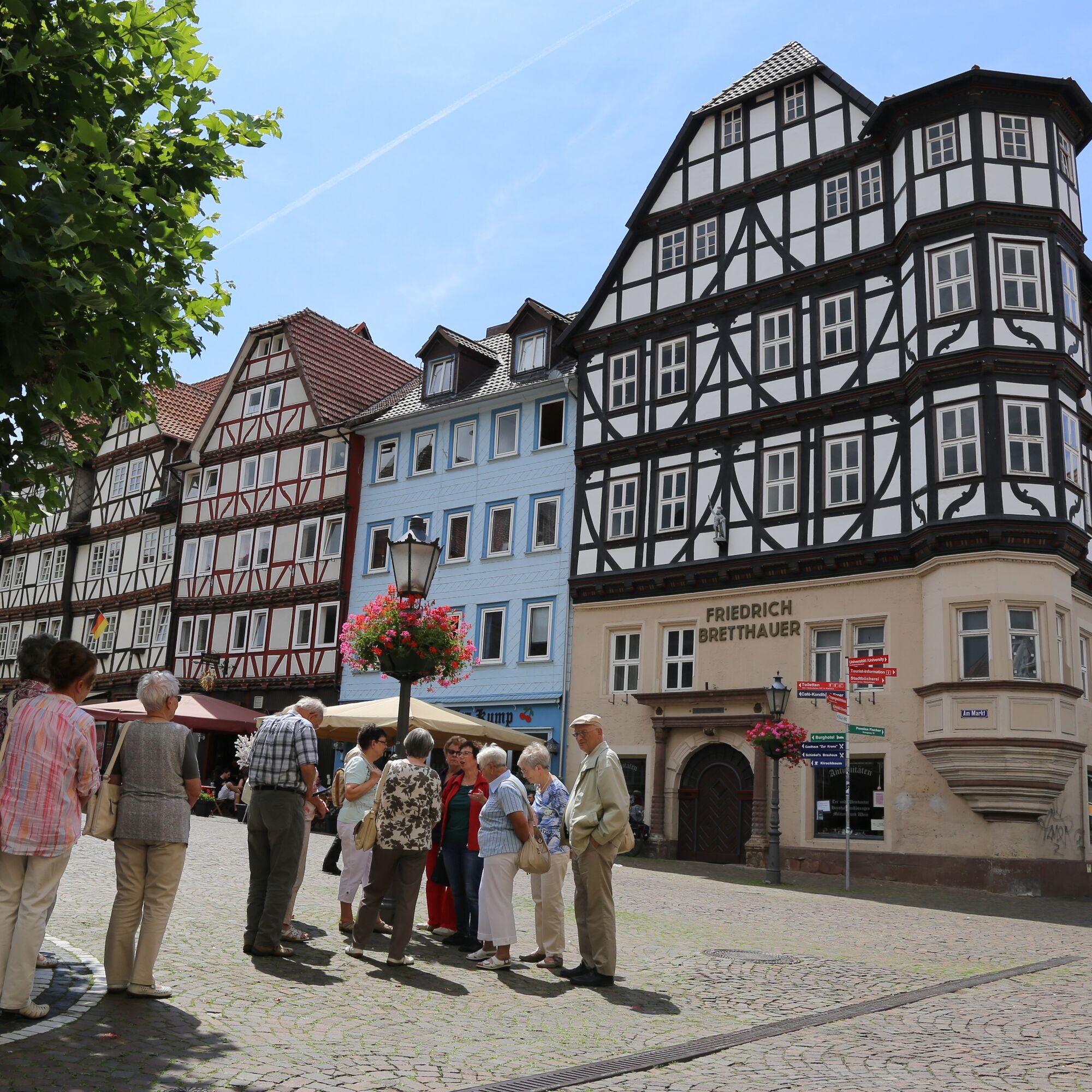
Afterwards, the Werra Valley opens widely into one of the largest and oldest cherry growing areas in Germany. In the cherry land near Witzenhausen, about 150,000 cherry trees transform the slopes into a white sea of blossoms in spring. At the outskirts of Witzenhausen, you reach the stage destination at the boathouse of the Witzenhausen canoe club or at the private boat dock of the Werratal campsite. The historic half-timbered old town of Witzenhausen is definitely worth seeing.

2
Tourist Information
Witzenhausen Tourist InformationAttractions
Asbach-Sickenberg: Schifflersgrund Border Museum Lindewerra: half-timbered houses, Stick Maker Museum, hike to the Devil's Pulpit (mountain hut & inn) Bornhagen: Hanstein Castle ruins, St. Marien Church Rimbach, historic inn & sausage museum "Klausenhof" Ludwigstein Youth Castle: medieval castle, hostel, camping, castle kitchen, event halls, weddings, swimming pool, sauna Witzenhausen: historic old town, open-air pool, cherry blossomsWater hiking tours, boat rental
Werra Canoe Creuzburg & Eschwege, Active Station Creuzburg, Active Station Eschwege Werratalsee Nature Camp Meinhard Kanurado Eschwege Hunter Oak Adventure Ranch and canoe rental Bad Sooden-Allendorf Werratal Campsite WitzenhausenActive tourism
Werra Valley Cycle Path: The Werra Valley Cycle Path runs over 300 km from the Rennsteig near Neuhaus am Rennweg to the Werra mouth in the Weser near Hann. Münden. Werra Burgen Steig / Werra Burgen Steig Hesse: The nearly 500 km long long-distance hiking trail Werra Burgen Steig follows the Werra in the valley and the surrounding heights and leads to culturally and historically interesting castles, palaces, and ruins. From Lindewerra, a side trail leads to the Devil's Pulpit and Hanstein ruins. At Werleshausen, the WBS / X5H (section between Hanstein ruins and Ludwigstein Youth Castle) crosses the Werra. Hiking trails: P7: Söder Forest, P16: Asbach-Sickenberg, Cherry hiking trails near WitzenhausenFrom the stick maker village Lindewerra, a hike to the Devil's Pulpit (approx. 2.5 km, viewpoint, mountain hut & inn) and to the Hanstein Castle ruins (approx. 5.3 km) is worthwhile.
From Werleshausen, you can hike to the Ludwigstein Youth Castle (approx. 2 km) and to the Hanstein ruins (approx. 3.5 km).
The cherry land near Witzenhausen shows itself as a white sea of blossoms in springtime during cherry blossom season.
The historic old town of Witzenhausen with half-timbered houses is worth seeing.
Kamery internetowe z trasy
Popularne wycieczki w okolicy
-
4,0
Premium route P1 Hoher Meißner
ciężkiWędrówka 13,8 km -
5,0
Premium trail P16 Asbach-Sickenberg - Walkable Green Belt
ciężkiWędrówka 13,6 km -
5,0
Premium trail P14 Bilstein
średniWędrówka 9,96 km -
5,0
Premium route P2 Frankershäuser Karst
ciężkiWędrówka 10,2 km -
3,5
Premium route P27 Ludwigstein
średniWędrówka 11,2 km -
Premium route P4 Hessische Schweiz - Walkable Green Belt
ciężkiWędrówka 15,7 km -
Premium route P9 Wacholderpfad Roßbach
średniWędrówka 11,1 km -
5,0
Premium route P25 Kleinalmerode
średniWędrówka 13,4 km -
Premium route P23 Höllental
średniWędrówka 9,89 km -
4,0
5th section Werra-Burgen-Steig Hessen
ciężkiWędrówka 17,5 km
Wędrówki i tropienie


Nie przegap ofert i inspiracji na następne wakacje
Twój adres e-mail została dodana do listy mailingowej.