


Monte Gambarogno trail (SvizzeraMobile 613)
Poziom trudności: T2
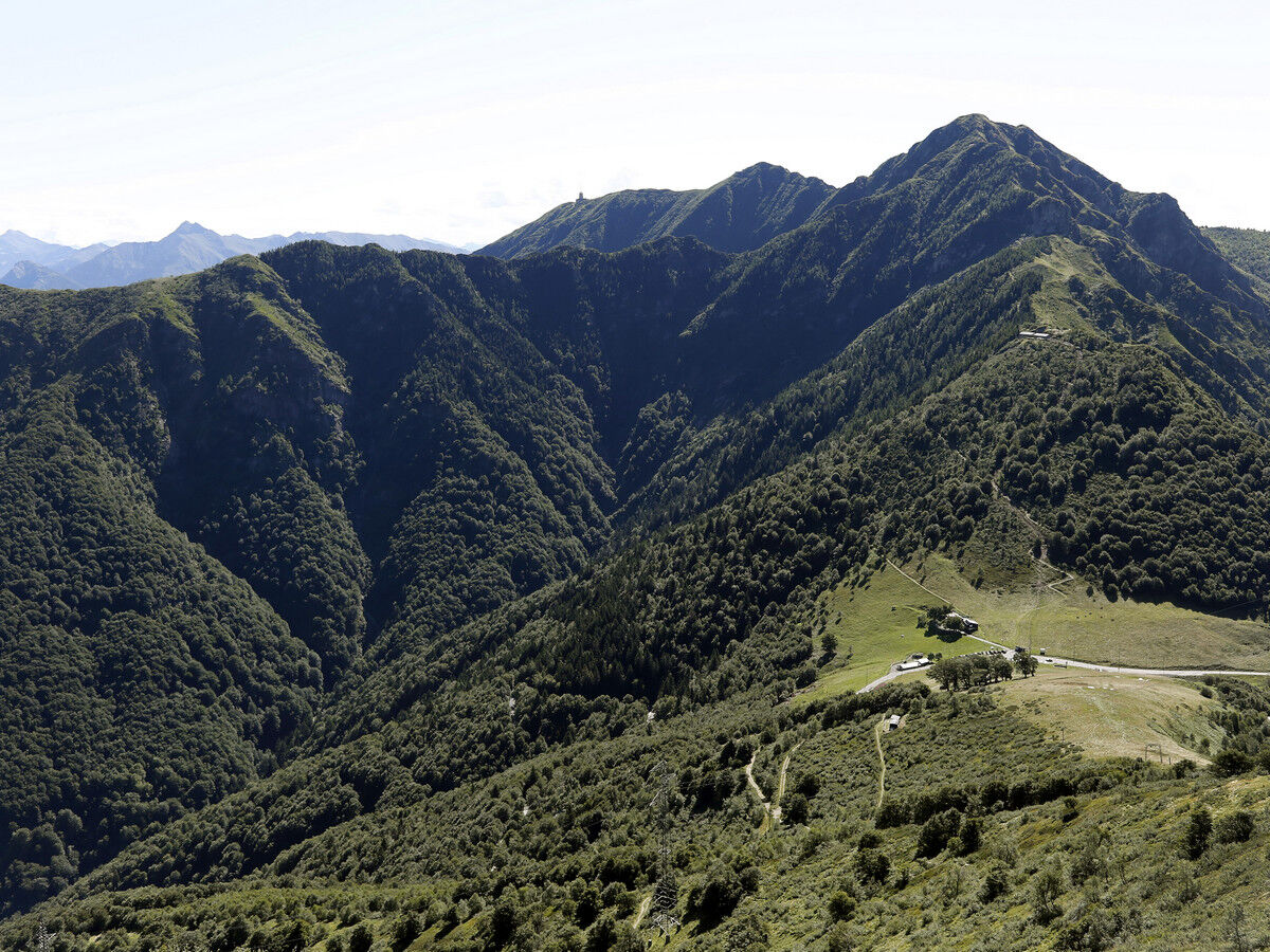
At Alpe di Neggia, reachable by post bus, right at the top of the pass, begins the pleasant mule track that leads to the summit of Monte Gambarogno. From the summit, you can enjoy a unique view over Lake...
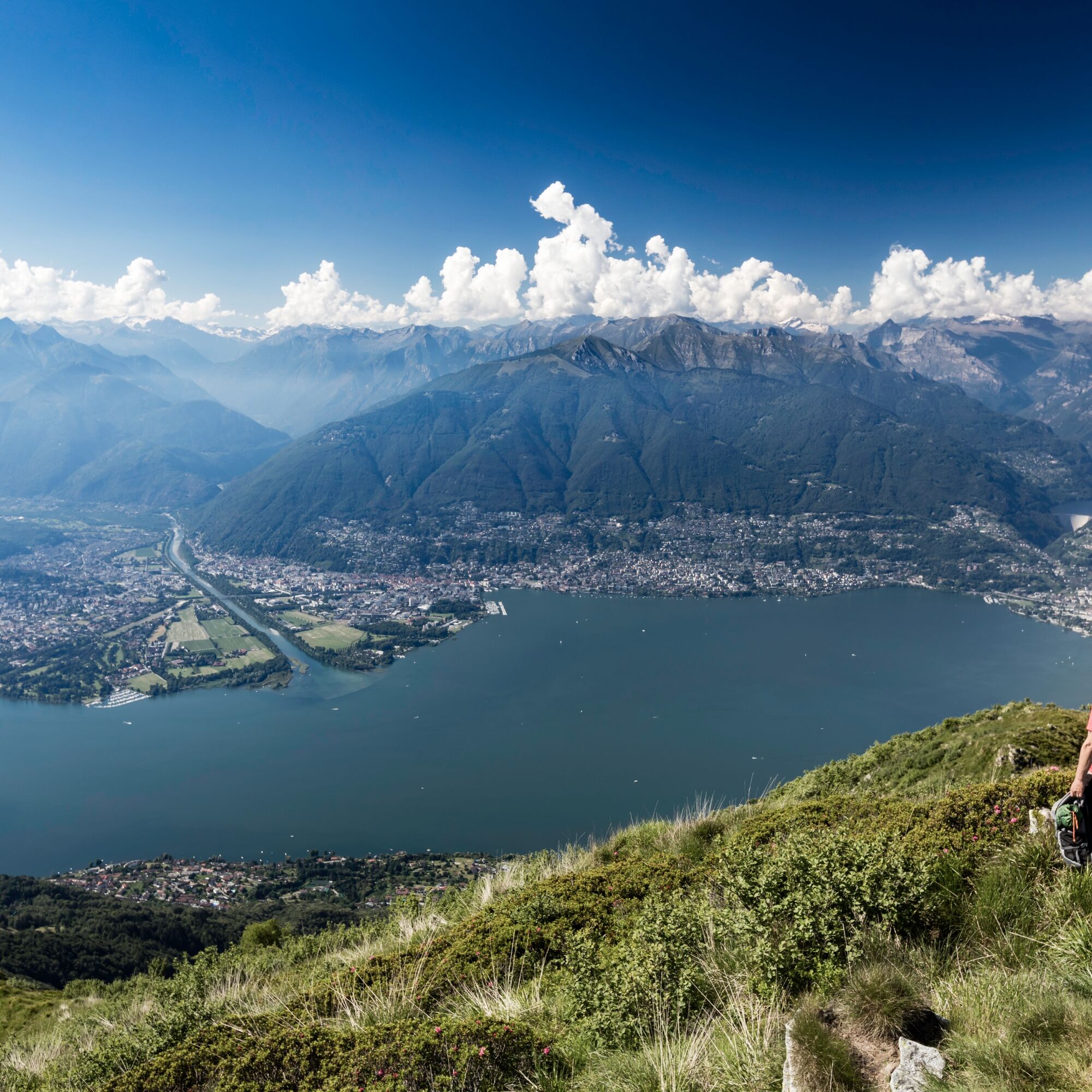
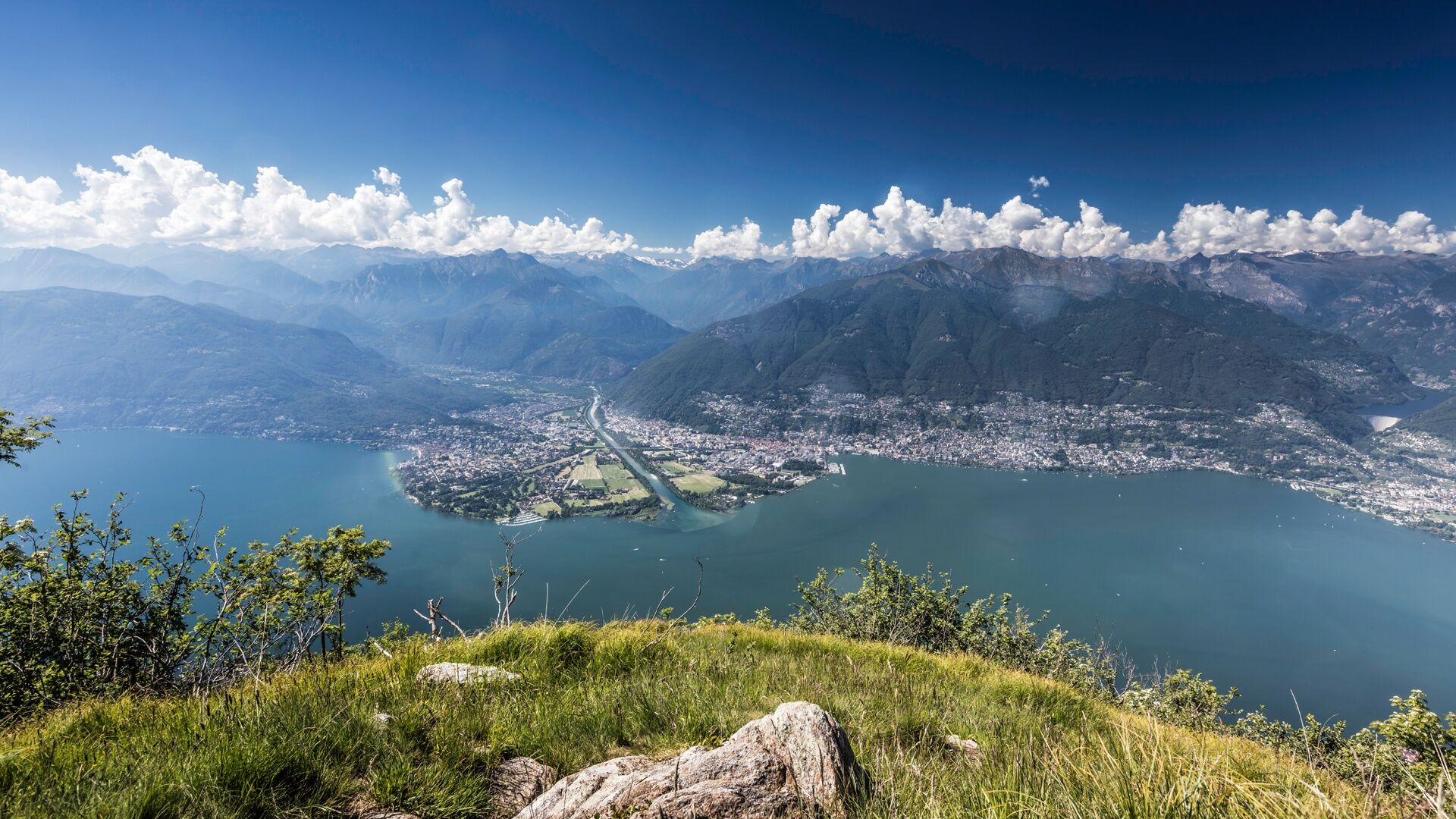
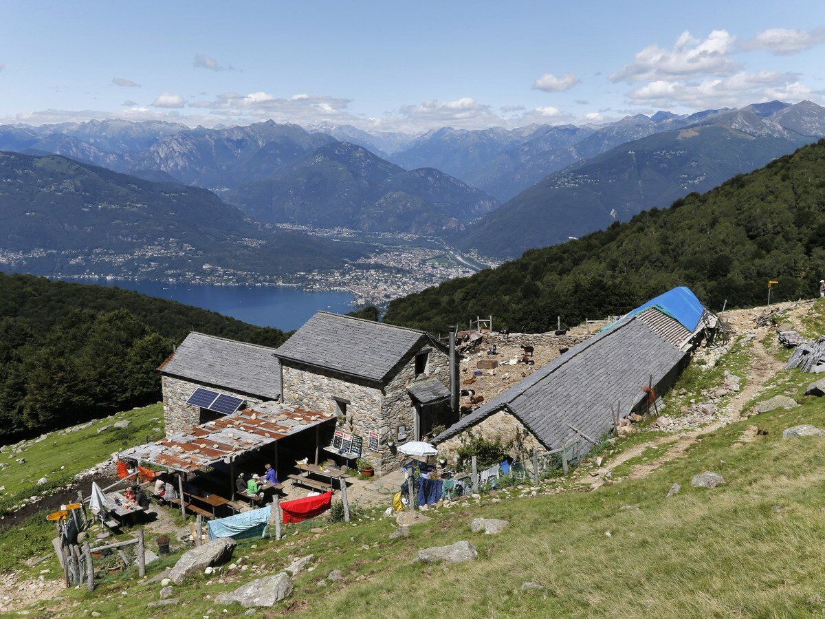
At Alpe di Neggia, reachable by post bus, right at the top of the pass, begins the pleasant mule track that leads to the summit of Monte Gambarogno. From the summit, you can enjoy a unique view over Lake Maggiore and the entire Alpine chain. The panorama includes the Monte Rosa massif, the Mischabel mountain group, and the Basòdino, which at 3,272 meters is the second highest mountain in the Ticino Alps. Here is also the Capanna Gambarögn (open from May to October), recently renovated, where it is possible to eat or stay overnight.
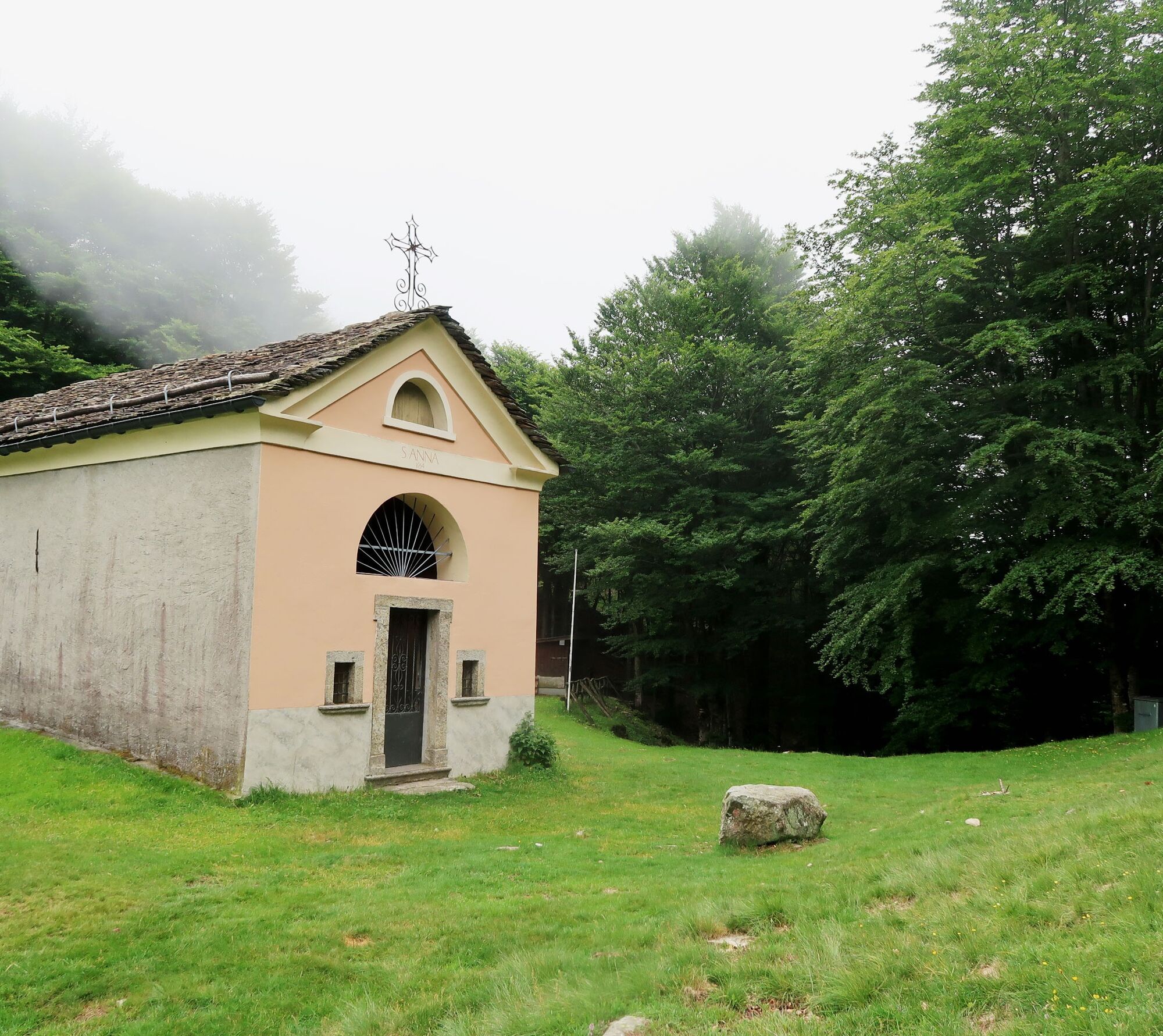
The descent then follows wide curves along the western slope down to Alpe Cedullo: here it is possible to taste locally produced cheese. The route continues with a slight ascent, and a few minutes later, you reach the pass summit where the oratory of Sant'Anna is located. This isolated small church marks the border with Italy. The valuable frescoes inside depicting a Madonna Lactans are of particular interest and are attributed to the circle of artists around Antonio da Tradate (14th/15th centuries). The ancient hermitage behind the chapel is now used as a refuge.
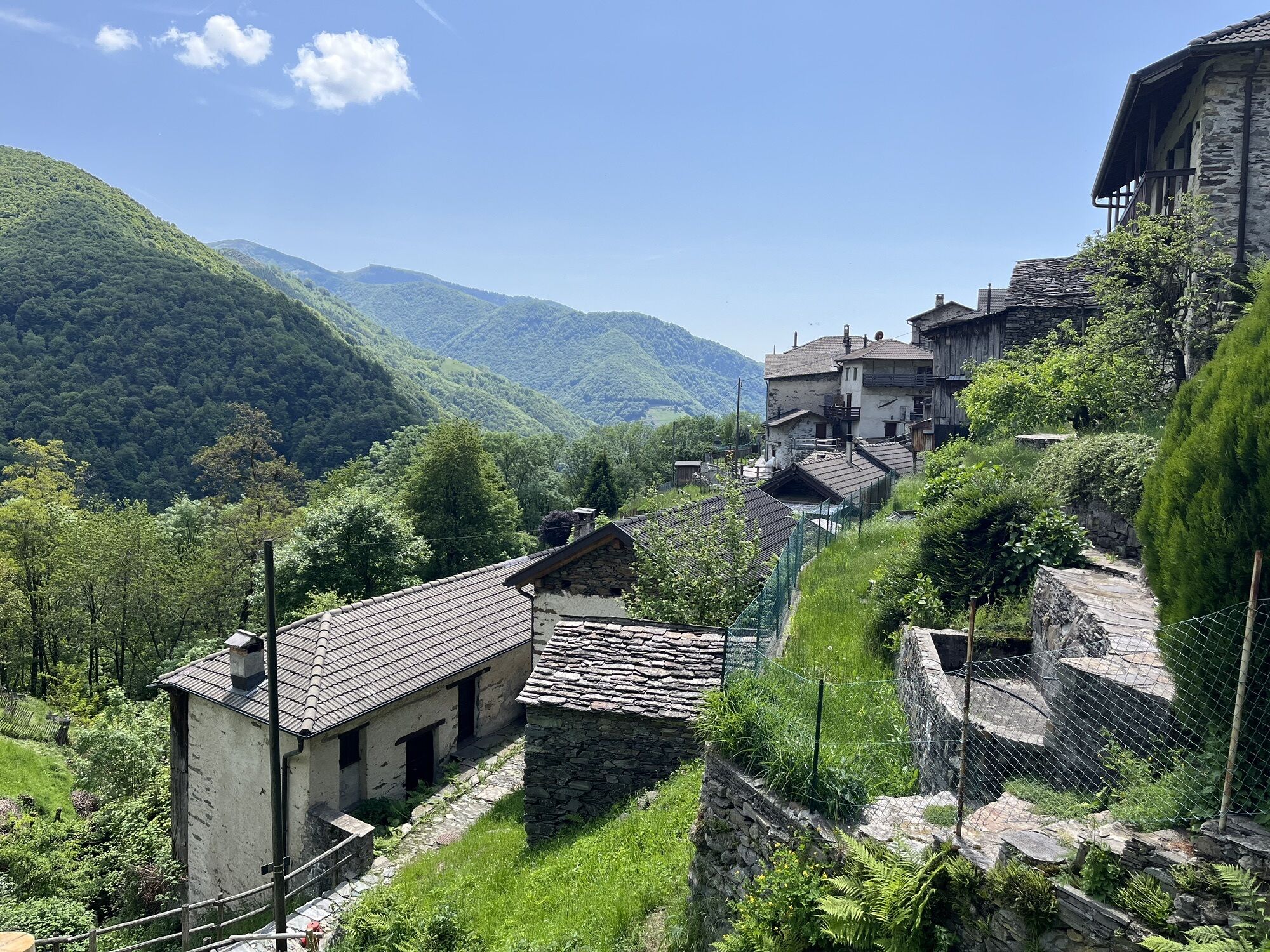
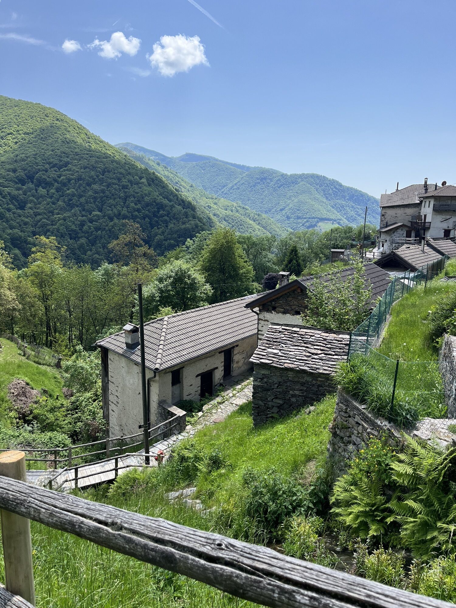
The last part to return to the village of Indemini follows a comfortable path along the slope of the Sassi Gialli. After the Val Crosa, among the treetops of the birch forest, the first glimmers of the stone roofs of the small village quickly become visible. Indemini is the only typical Ticino village entirely built with gneiss quarried locally and has managed to maintain its mountain village character with its aligned houses, stone roofs, alleys, and steps.
(Source: SvizzeraMobile)

Alpe di Neggia-Monte Gambarogno-Alpe Cedullo-Oratory of Sant'Anna-Indemini
Tak
Hiking backpack (approx. 20 liters) with rain cover
Sturdy and comfortable shoes
Clothing suitable for weather conditions and durable, layering principle, and possibly trekking poles
Protection from sun and rain
Provisions and drinking water
First aid kit
Pocket knife
Mobile phone, possibly headlamp
Map material
T2
Popularne wycieczki w okolicy
- 4,9
Verzasca Dam-Mergoscia-Corippo-Lavertezzo
średniWędrówka 13,0 km - 4,8
Avegno-Ponte Brolla-Avegno
średniWędrówka 8,56 km - 3,8
Cannobio zu Sant’Aagata
światłoWędrówka 5,85 km - 4,0
Cardada Bike (SwitzerlandMobility 397)
ciężkiMountainbike 30,6 km - 5,0
Verzasca Dam-Monti di Motti-Verzasca Dam
średniWędrówka 9,31 km Cardada-Cimetta-Alpe Vegnasca-Cardada
średniWędrówka 6,86 km- 4,0
Vogorno-Alpe Bardughè-Vogorno
średniWędrówka 12,2 km Via Alta Vallemaggia - 1st stage: Cimetta-Capanna Alpe Nimi
ciężkiWędrówka 10,2 kmSentiero Verzasca (SvizzeraMobile 74)
średnidługodystansowy szlak pieszy 34,4 km- 4,5
Sculpture Trail
światłoTrasa tematyczna 2,49 km
Wędrówki i tropienie


Nie przegap ofert i inspiracji na następne wakacje
Twój adres e-mail została dodana do listy mailingowej.