


Over the Kugelberg and the Felsenbad to the Plaik circular hiking trail

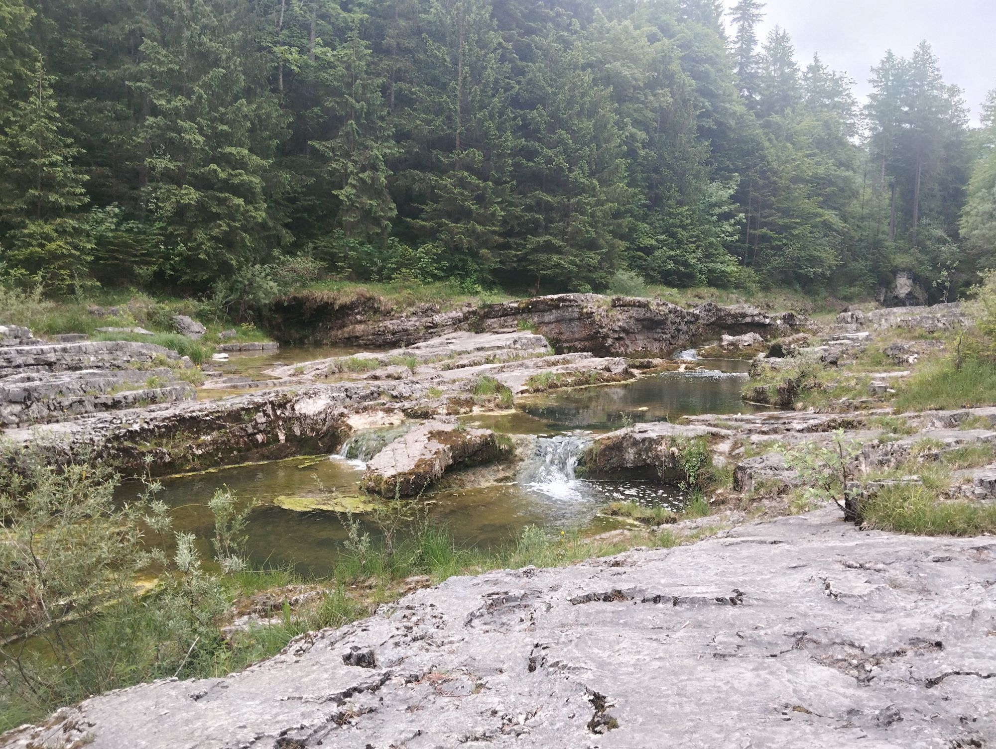
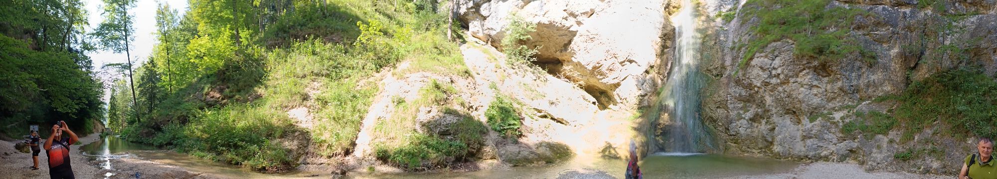
The Plaik circular hiking trail offers numerous noteworthy spots in a very short time. The Felsenbad, a natural swimming spot with small, natural rock pools, invites you to take a break and cool off in...
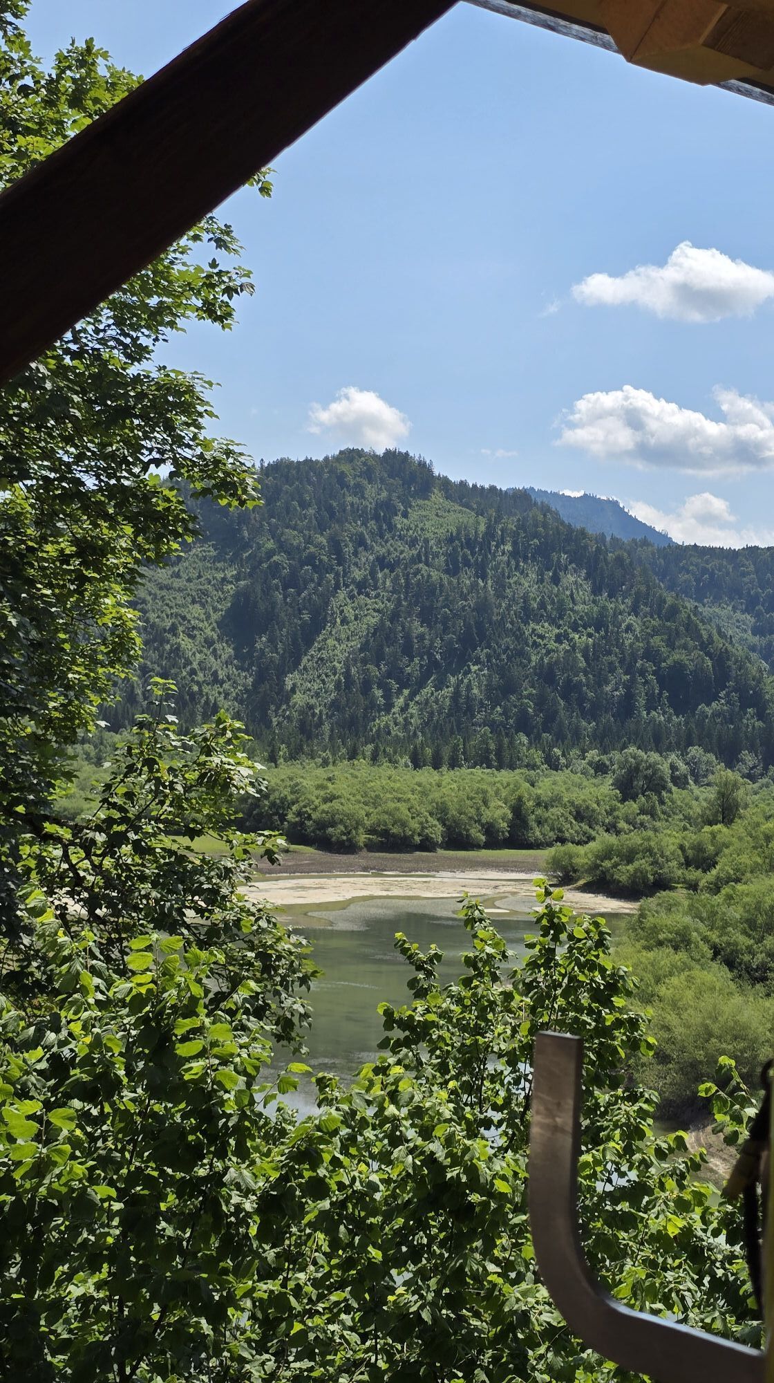
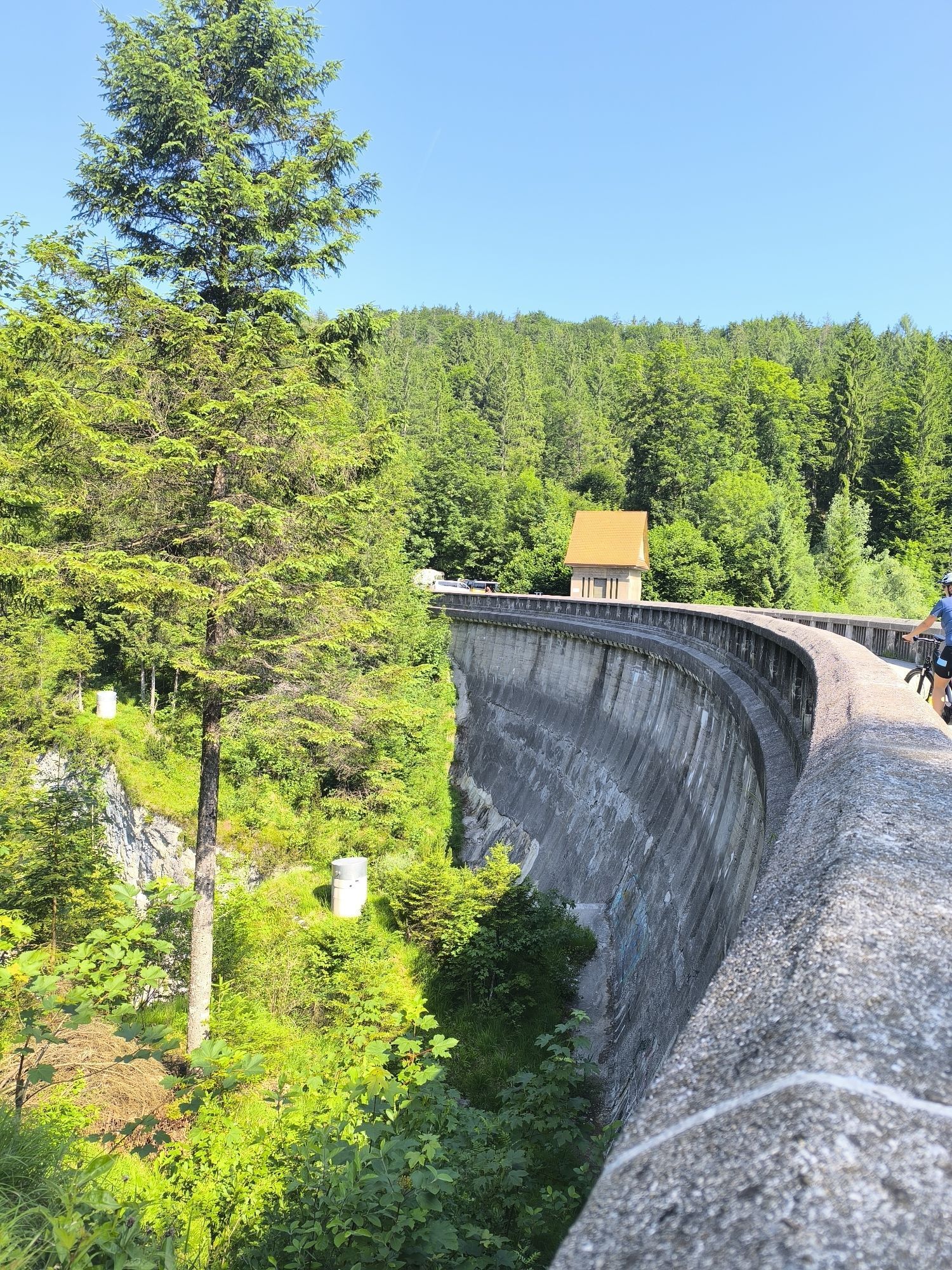
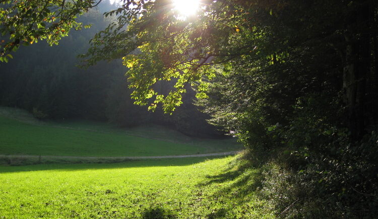
The Plaik circular hiking trail offers numerous noteworthy spots in a very short time. The Felsenbad, a natural swimming spot with small, natural rock pools, invites you to take a break and cool off in summer. At the entrance to the Metzgersteig you can look into the impressive Strubklamm from the dam.
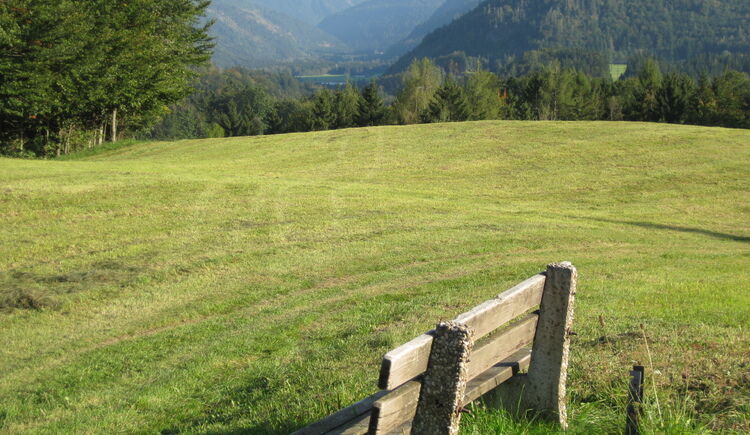
We start the circular hike at the public parking lot in the center of Faistenau. We walk along Bramsaustraße to the former Bramsau Bräu on the asphalt road. Between the main and the annex building, an asphalted street leads about 50 m uphill to the forest edge and the actual Kugelberg circular hiking trail. We pass the wayside shrine on the right side of the path and, after a short climb, walk 200 m downhill counterclockwise on the path. At the fork, we keep right, and the path becomes increasingly steeper and rougher. We cross Almbachstraße and go over the bridge to the other side of the Almbach, where we immediately turn left onto the street. After about 300 meters, the Felsenbad lies on our left. Before the next bridge, we follow hiking trail no. 48 over Strübl Bach Plaik. Along the way, we pass some farms. After the third farm, watch for the turnoff! Before the trail leads back into the forest, we must turn sharply right and follow a small path along the forest edge until we reach a farm again across an alpine meadow. From here, we walk along the not very busy street to the dam of Vordersee. From there, the Metzgersteig through Strubklamm to Ebenau starts. We stay on the street and return on hiking trail no. 60 to our starting point in Faistenau.
Sturdy footwear, otherwise no special equipment necessary
Information from the Faistenau Riding and Horse Breeding Association
From the lowest point of the circular hike (turnoff to Hintersee) the path is also used by riders. A great concern of the Faistenau Riding Association is harmonious interaction between riders and hikers. Mutual respectful behavior is especially important for this. Therefore, please observe the leash requirement, keep a safe distance from the horses, and avoid loud noises as well as hasty/quick movements.
Leash requirement for dogs
The entire municipality of Faistenau has had a dog leash and dog waste disposal ordinance in effect since 2009. This also applies on all hiking trails.
Arrival via the A1 West Motorway – Thalgau exit
Follow the federal road (B 158) in Hof near Salzburg to the Baderluck roundabout. Take the 1st exit into Hinterseestraße and after a few kilometers you will reach your holiday destination Faistenau.
There are sufficient parking spaces at the starting point.
By bus
From Salzburg main station there are excellent Postbus connections to the Fuschlsee region or to Faistenau. All bus connections are available online at www.svv-info.at.
By train
Information on train connections can be found at www.oebb.at and www.bahn.de
By plane
Salzburg Airport W.A. Mozart is located very close to the city of Salzburg. Bus lines 2 or 27 will take you to the main station, where you can transfer to the Postbus.
Free parking in the village center opposite the new middle school
Popularne wycieczki w okolicy
-
4,8
Fuschl: Ruine Wartenfels - Schober - Frauenkopf
średniWędrówka 7,62 km -
4,4
Fuschlseewanderung
światłoWędrówka 11 km -
4,2
Pillstein Panorama Rundweg
światłoWędrówka 3,40 km -
4,7
Pleasure hike over the Falkenstein
średniWędrówka 9,81 km -
3,6
Mondsee: Rund um den Mondsee
światłoJazda na rowerze 26,3 km -
4,6
The Plombergstein: Adventure and summit panorama
światłoWędrówka 4,12 km -
4,0
Bärenweg am Lidaun
światłoWędrówka 9,05 km -
4,4
From Koppl to the Gaisberg summit
średniWędrówka 9,86 km -
4,8
Salzkammergut: Die Drachenwand
ciężkiVia ferrata 4,32 km -
4,8
Schober -Aussichtsplattform mit Seensicht
ciężkiWędrówka 2,65 km
Wędrówki i tropienie


Nie przegap ofert i inspiracji na następne wakacje
Twój adres e-mail została dodana do listy mailingowej.