


Grossarl: Frauenkogel
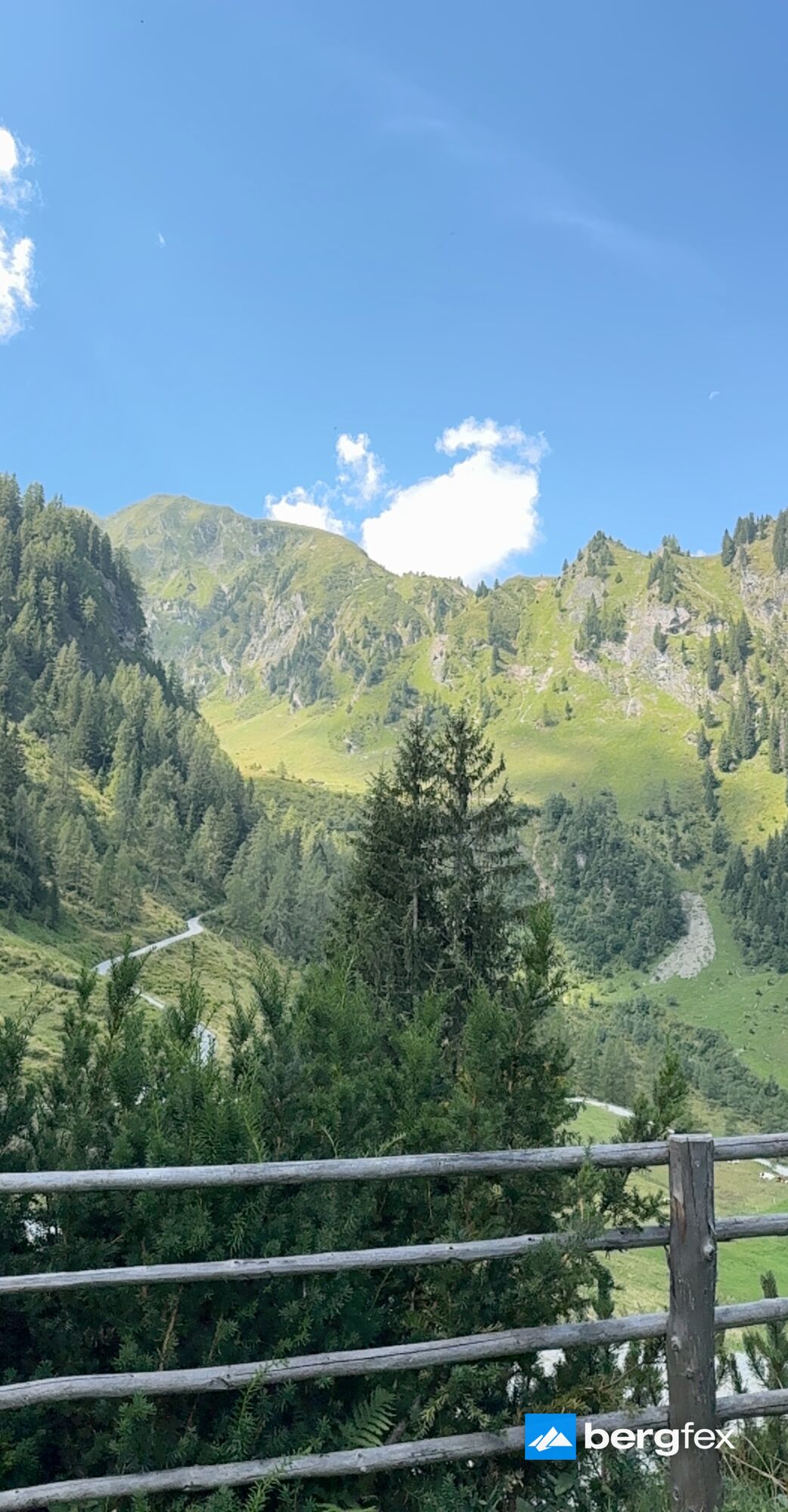
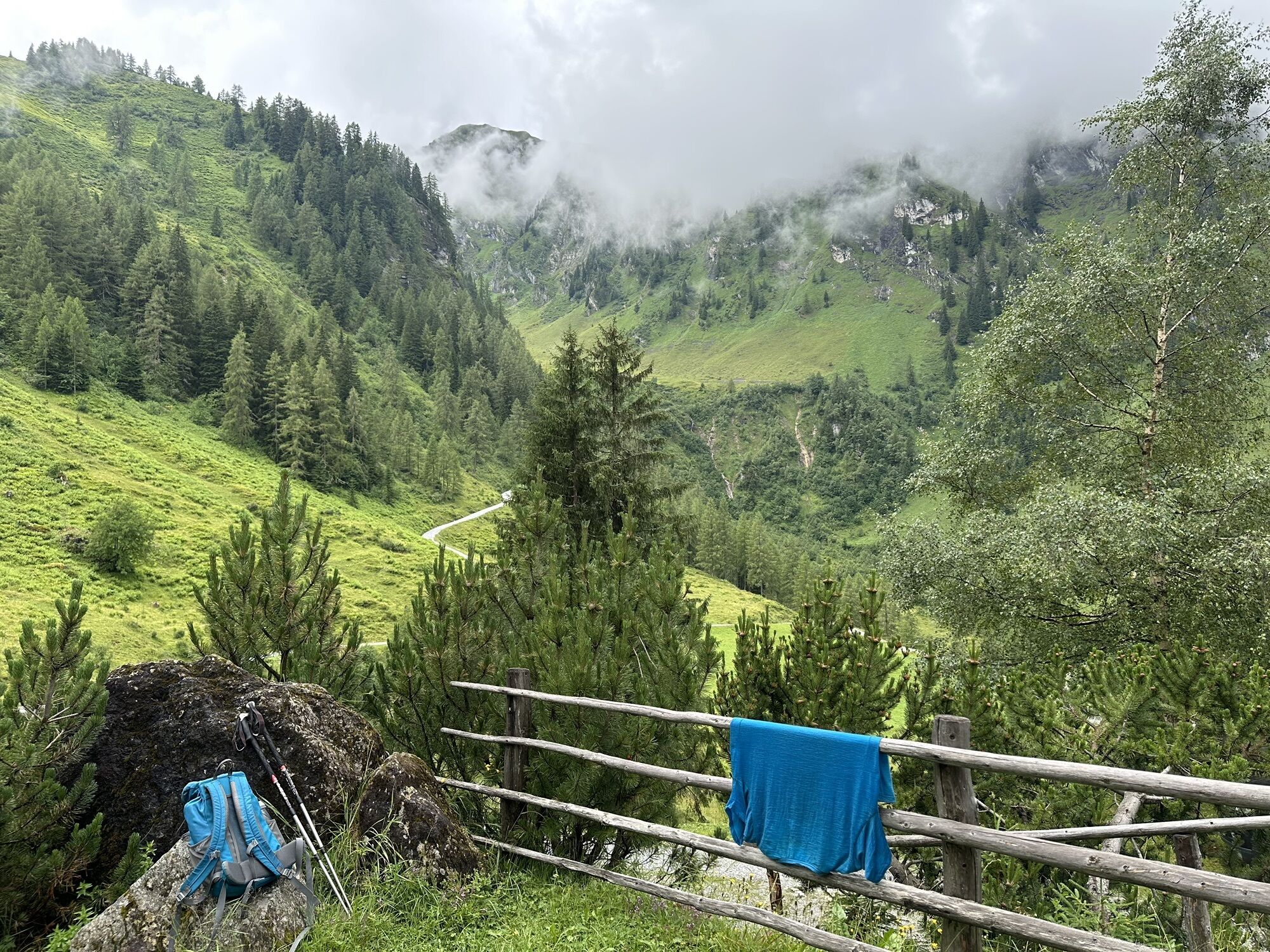
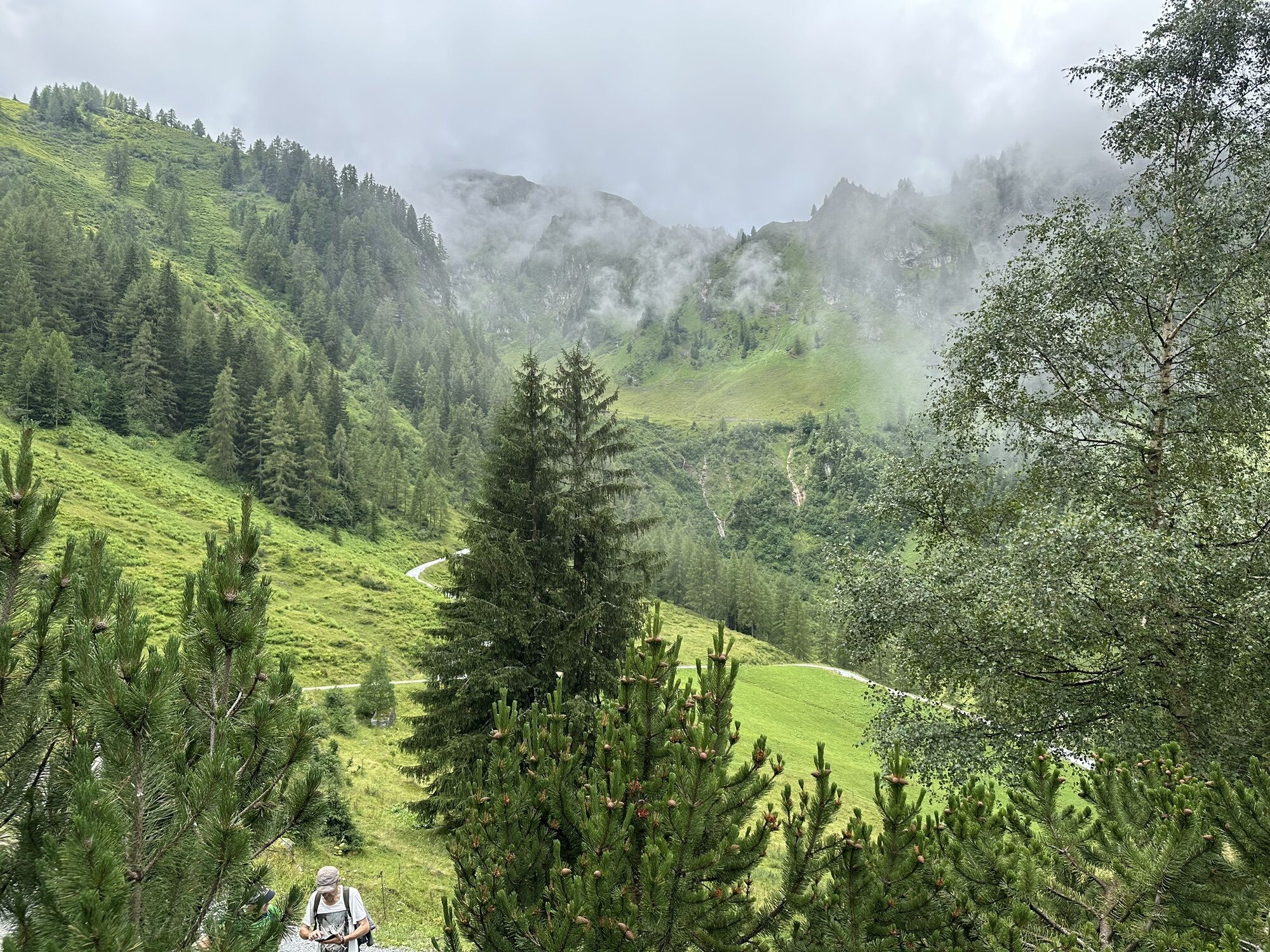

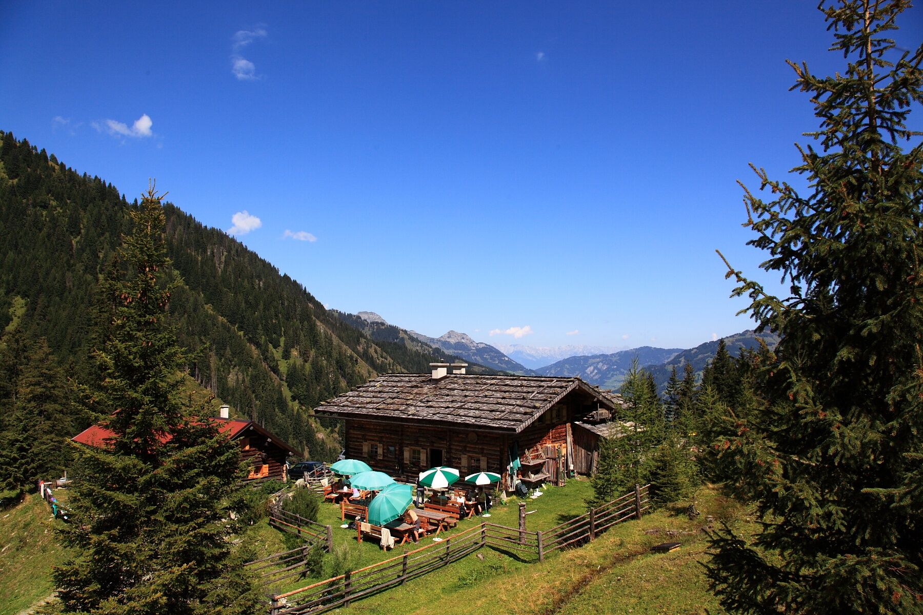
From farm Untereben (direction of Hüttschlag), you hike along the forestry road to the Bachalm. After your break, you hike upwards through the forest. Then you hike through alpine meadows where you pass...
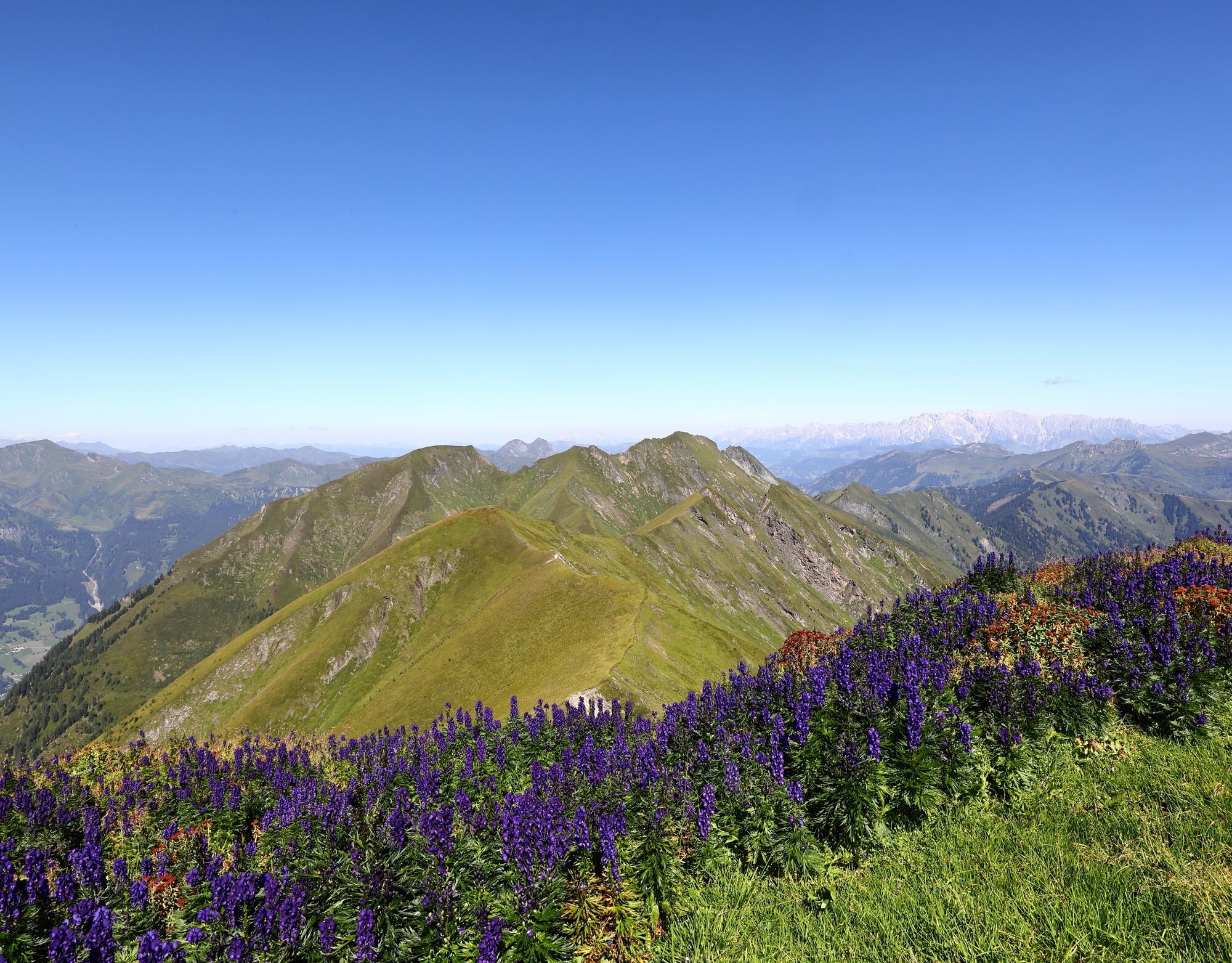
From farm Untereben (direction of Hüttschlag), you hike along the forestry road to the Bachalm. After your break, you hike upwards through the forest. Then you hike through alpine meadows where you pass lots of small mountain lakes. Finally, you reach the Frauenkogel. This mountain is like a pyramid, watching over the valley.
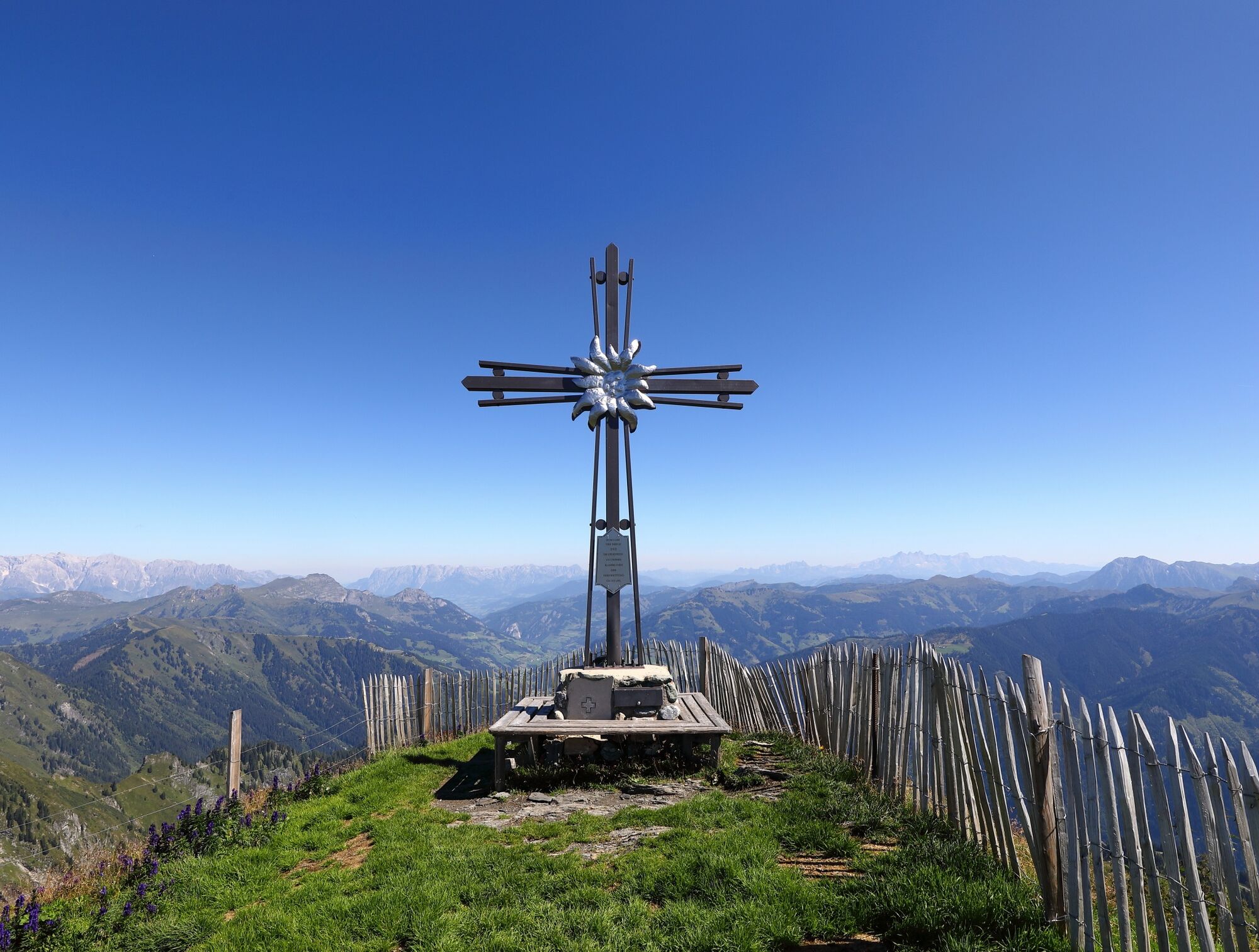
On the Frauenkogel, there is particularly beautiful summit cross and the view is magnificient.
Back on the same route or to the Aigenalmen.
You go by car or public bus towards Hüttschlag and turn right into the Ebengasse. Parking at the farm Untereben. You hike up on the forestry road no. 42 to the Bachalm, 1,535 m (approx. 2 h). Then you ascend on the path no. 42 to the "Frauenkar" and turn left to the trail no. 41 to the Frauenkogel, 2,424 m (about 2 1/2 h).
You descend on the same route or as an OPTION: You hike to the Schmalzscharte, 2,159 m to the Pucher and further to the two Aigenalmen (Mandlhütte, 1,342 m and Paulhütte, 1,280 m approx. 2 1/2 h). Descent into the valley to the Mandldörfl (about 1 h - route no. 41).
Tak
Tak
Tak
hiking boots with grip sole, hiking map
You go by car or public bus no. 540 in direction to Hüttschlag. After approx. 3 km you turn right into the Ebengasse. Then you turn left to the Untereben farm.
parking possibility at the Untereben farm
If you hike down to the Aigenalmen, you have a great round trip.
Kamery internetowe z trasy
-
Kreuzkogel
-
Fulseck
-
Hotel Lammwirt im Großarltal/Ellmautal
-
Dorfgastein - Spiegelsee
-
Bergstation 6er Sesselbahn Harbach
-
Ellmautal - Palfenhof
-
Kühhagerbahn Bergstation
-
Großarl - Ort
-
Dorfgastein - Spiegelsee
-
Dorfgastein - Spiegelsee
-
Dorfgastein - Spiegelsee
-
Dorfgastein - Spiegelsee
-
Großarl - Kieserlbahn
-
Grossarl - Hotel Gasthof Schützenhof
-
Großarl - Hotel Kristall Übungslift
-
Bergstation Kieserl
-
Fulseck
-
Fulseck
-
Fulseck
-
Fulseck
-
Fulseck
-
Fulseck
-
Fulseck
-
Hüttschlag - Grossarltal
-
Großarl
Popularne wycieczki w okolicy
-
4,9
Großarl: Aualm - Liechtensteinkopf - Aukopf - Schuhflicker - Schuhflickersee
średniWędrówka 5,84 km -
5,0
Großarl: Alpine pasture circuit in Ellmautal
średniWędrówka 9,69 km -
4,1
Tappenkarsee Kleinarl
średniWędrówka 9,11 km -
4,9
Höhenweg vom Grünen Baum bis Bad Hofgastein
światłoWędrówka 7,92 km -
4,8
Großarl: Mooslehenalm – Niggeltalalm – Viehhausalm
średniWędrówka 5,44 km -
4,8
Hüttenkogel - Graukogel von der Bergstation
średniWycieczki górskie 4,68 km -
4,5
Mountain route from the Kötschachtal to the natural jewel Reedsee
średniWędrówka 12,5 km -
4,6
Bahnhof Bad Hofgastein nach Bahnhof Bad Gastein
średniWędrówka 13,0 km -
4,5
Großarl: Saukaralm - Saukarkopf - Gerstreitalm
średniWędrówka 9,11 km -
4,2
Großarl: Unterwandalm - Karseggalm - Breitenebenalm
średniWędrówka 5,93 km
Wędrówki i tropienie


Nie przegap ofert i inspiracji na następne wakacje
Twój adres e-mail została dodana do listy mailingowej.