


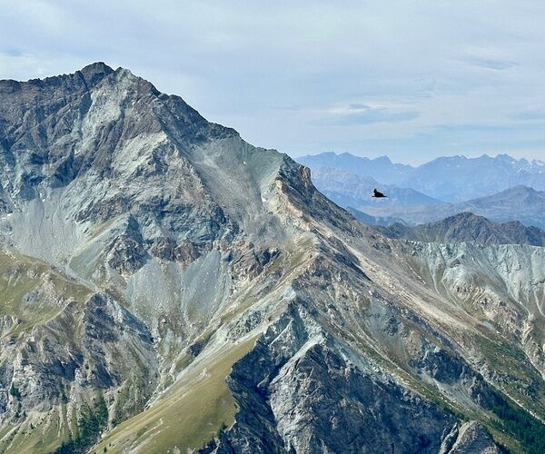
Beth Lakes and Arcane Hill: between rock, sky and water, a dreamy, nature hike
Poziom trudności: T2
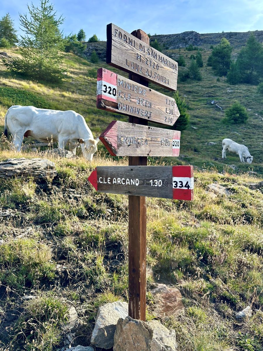
You start from the Bivio Seytes parking lot, which is usually paid for. You reach the hamlet Troncea and take the path in the direction of Colle del Beth. The first part of the trail is in a larch forest,...
It continues in the direction of Bric di Mezzogiorno (2986 m), then Colle dell'Arcano (2781 m) and then closes a wonderful dream trail, partly looped, returning to Troncea.

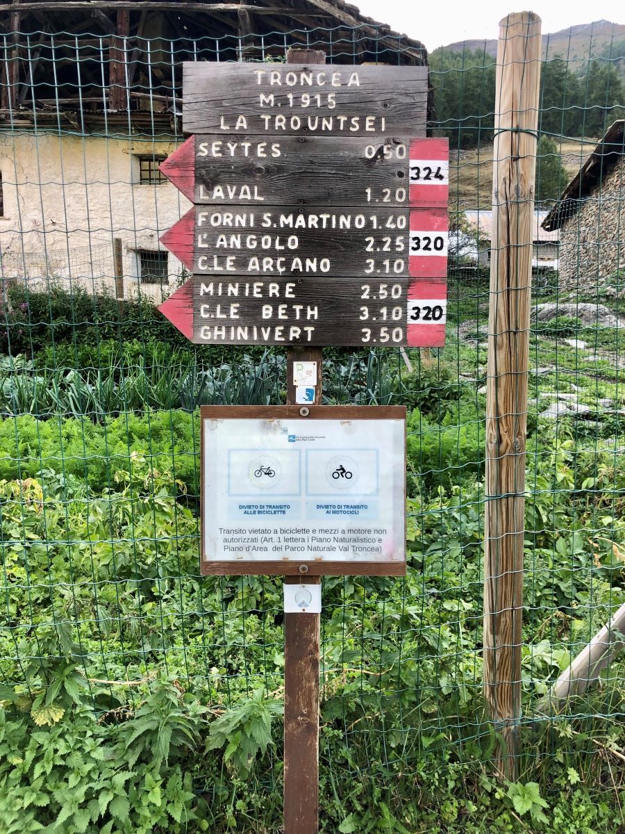
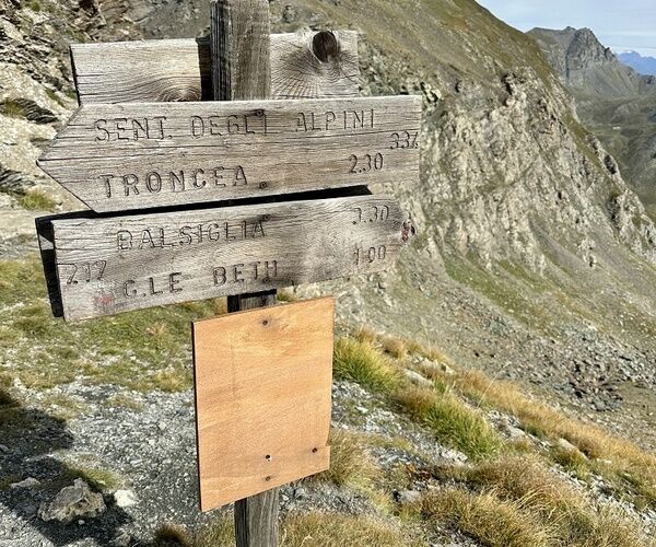
Leaving the parking lot and wearing your backpack, take the valley floor road to the Bivio per Troncea. Once you reach the hamlet that still houses a family of shepherds during the summer season and a hiking hut (Rifugio di Troncea), it will be easy to follow the signposts, which are very clear and visible along the way.
Tak
Tak
Summer hiking only, warm clothing and a jacket are recommended.
Challenging for physical commitment but no technical difficulty.
You can, in addition, continue on the dirt road, after the Pont-daz-Itrèi, for about two kilometers and you will reach the last permitted parking lot before the entrance to Val Troncea Park: Parking Bivio Seytes.
Bus line ARRIVES from Turin, "Plan traffic circle" stop. From the traffic circle walk along Via Rohrbach and reach the hamlets of Plan and then Pattemouche, after about 600 m. walk. After the snow basin and the large attestation parking lot, you will come across a bridge crossing the Chisone stream: you can choose to cross the bridge and continue on the dirt road at the bottom of the valley or take the path on the orographic left until you reach the Bivio Seytes parking lot, just after the Park Information Point.
Parking at Laval, continuing from Pattemouche, over the "Pount daz Itrèi" bridge for two more kilometers.
Usually these summer parking lots are paid for, and the last of these parking lots (Parking Bivio Seytes) actually allows the route to be shortened by 2 kilometers.
During the summer period, a shuttle service may be established to Troncea or Alpe Meys (it is good to inquire at the Tourist Office, however).
T2
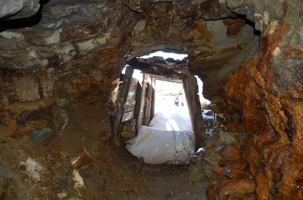
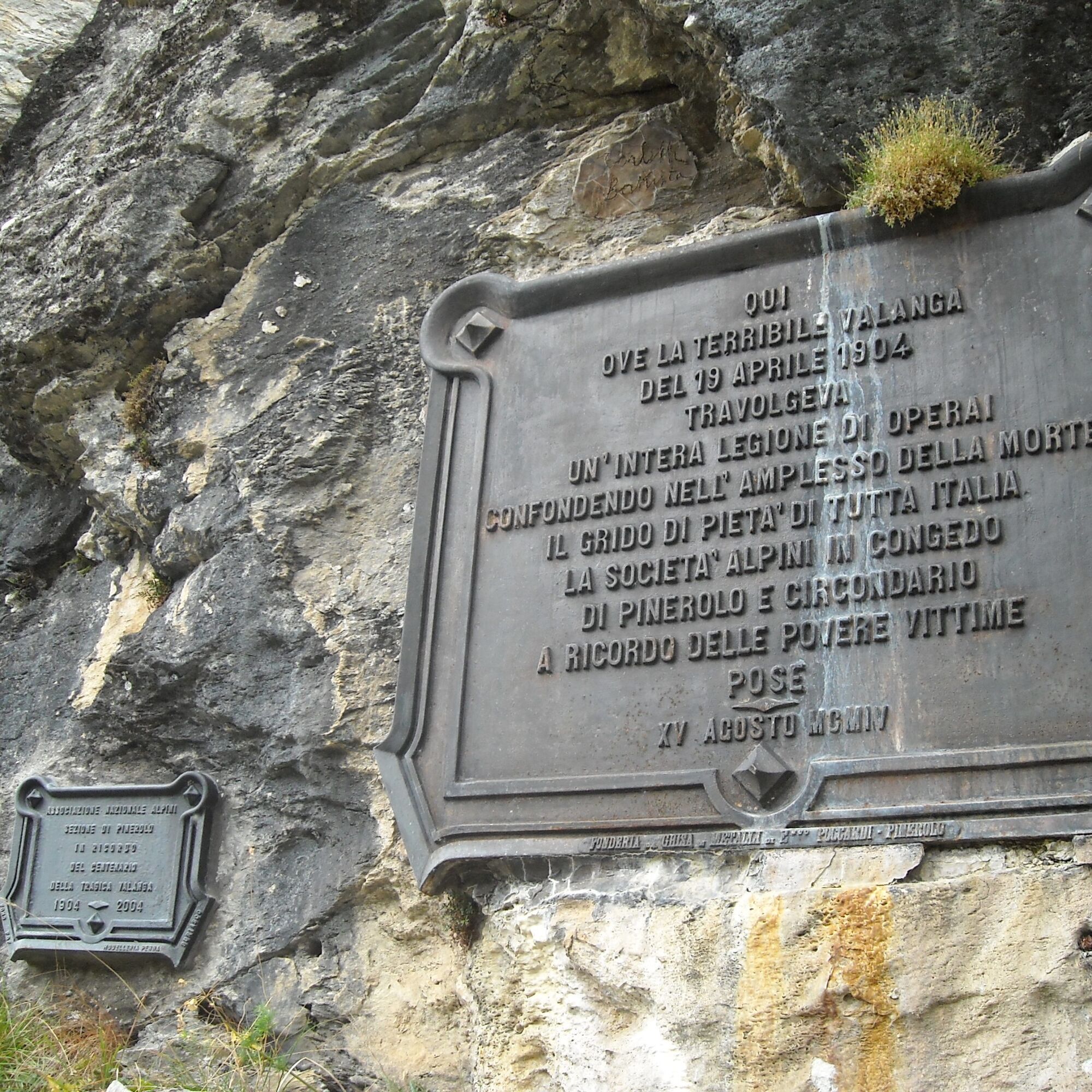
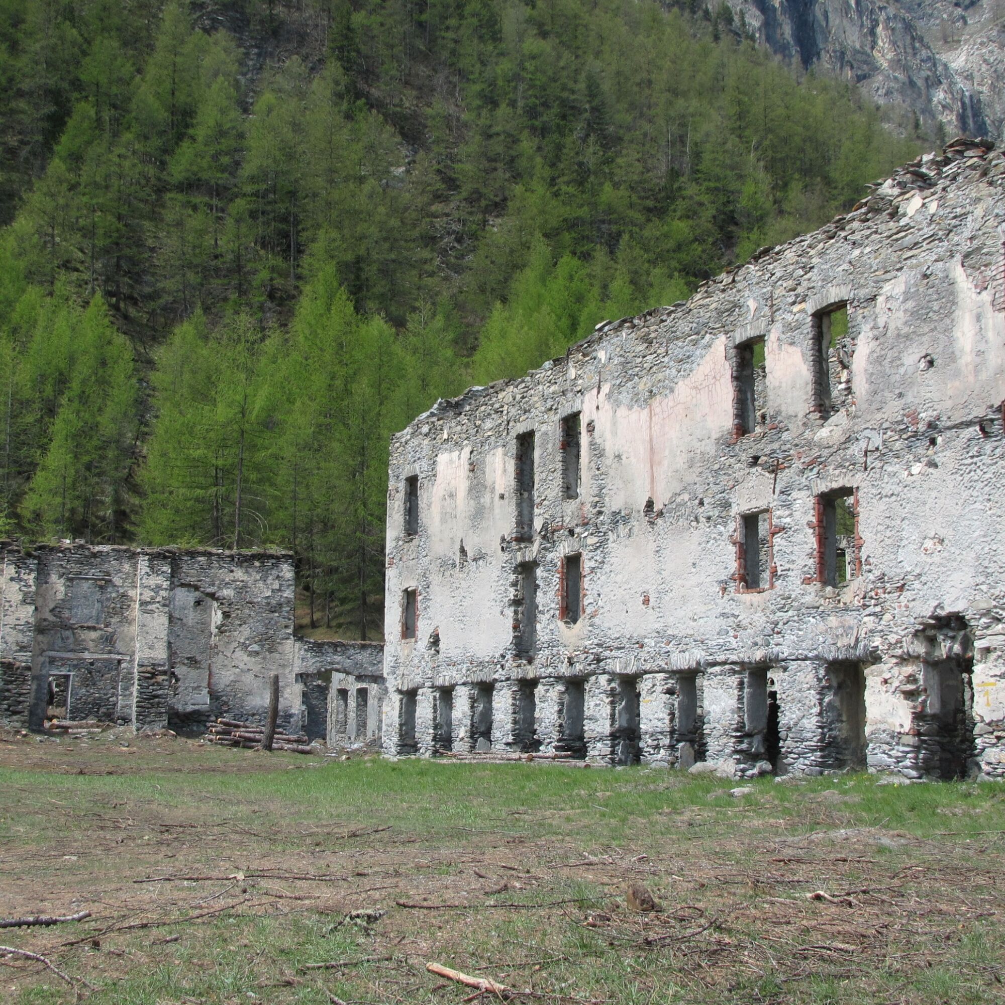
Connected with the hike and completing the industrial history of the Troncea Valley: the tombstone of the 81 miners killed by the avalanche that tragically swept them away on April 19, 1904, and the laTuccia Foundry, an important site of mining archaeology, on the valley floor and on the orographic left of the Chisone stream, which documents the reality mining carried out in the late 1800s and early 1900s by offering a didactic-tourist route, connected to the Beth mine circuit, arranged with attention to accessibility and equipped with observation points and information panels.
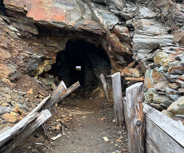
The history of the Beth mines, Copper.
The origin of the history of the Beth copper mines dates back to 1739 when Mr. Matthew Allamand, on Oct. 12, 1739, presented himself to the Pragelato City Council alleging that he had found copper ore in the Mendie valley and asked to be authorized to continue the searchThe pioneering history of the Bet mines starts from that day and goes up to 1863, when the most important deposit in the area, at an elevation of 2775 meters, is given in concession to Pietro Giani, with the official name of "Mines of Vallon Cros and Glacières "From that moment it is possible to speak of industrial exploitation of the depositsBetween 1863 and 1872 Giani and his new French partner Giacomo Guilmin, build for the treatment of the ore a small building, called "Fonderia della Tuccia" in the locality Clot des Touches, at the bottom of the Val Troncea and of the furnaces, known as the San Martino furnaces, at an altitude of 2320 meters, where the extracted material was lightened by firing the slag to facilitate its transport downstreamThe considerable investments incurred in the face of meager revenues, led to the bankruptcy of the Giani and the suspension of activitiesExploitation was resumed in 1887, with little success, by the Guilmin's heir, who in 1890 was forced to cede the mines to an Italian-French company, the Compagnia Rami e Zolfi of PineroloThe company organized the work using industrial methods. Work begins on the excavation of the "New" tunnel to directly connect the tunnels opening in Val Germanasca to the tunnels in Val Troncea, avoiding the need to pass the mined ore through the Bet Pass, thus allowing work even in thewinterA 4,000-meter-long cableway is built, from the Angolo starting station located at 2435 meters, in Vaiolet, to the Tuccia, at 1730 metersThe Tuccia facilities and installations are expanded and modernized with the construction of a power plant. The energy produced, about 150 kwh, is used for the processing of material and the use of electric drills in the tunnelIn order to be able to work in the winter season, barracks are built near the mouth of the constituted New Tunnel at an altitude of 2540 meters, intended as housing for minersIn 1899 the mining complex changes ownership, passing to the Italian Mining Company. Work reached maximum intensity in the early 1900s; 150 miners worked there full-timeThe winter of 1904 was very snowy, and after days of heavy snowfall on the morning of Tuesday, April 19, 1904the 120 miners in the barracks below the Bet pass, isolated and frightened, set out for the valley floorTwo avalanches, which broke off simultaneously from opposite sides, swept away men, barracks, avalanche barriers and mining installationsThe dead numbered 81, almost all of them very young. Work, resumed with many difficulties and finally closed in 1914

Popularne wycieczki w okolicy
- 5,0
SESTRIERE Monte Rognosa
ciężkiWędrówka 6,42 km - 5,0
CESANA T.SE Thures - Cima Bosco
ciężkiRakieta do chodzenia po śniegu 3,94 km - 5,0
CESANA T.SE Cesana - Fenils
światłoWędrówka 4,60 km SAUZE D'OULX Richardette - Montagne Seu )
średniMountainbike 19,9 kmOULX Borgata Seu (Gran Bosco Natural Park)
światłoRakieta do chodzenia po śniegu 5,93 kmPRAGELATO Colle dell'Assietta
ciężkiMountainbike 53,3 kmCESANA T.SE Val Thuras
średniWędrówka 7,58 kmCESANA T.SE The Lakes Route
średniWędrówka 10,2 kmCESANA T.SE Bousson - Lago Nero
średniRakieta do chodzenia po śniegu 4,68 kmPRAGELATO The winter charm of the Val Troncea Natural Park
światłoRakieta do chodzenia po śniegu 4,62 km

Wędrówki i tropienie


Nie przegap ofert i inspiracji na następne wakacje
Twój adres e-mail została dodana do listy mailingowej.