


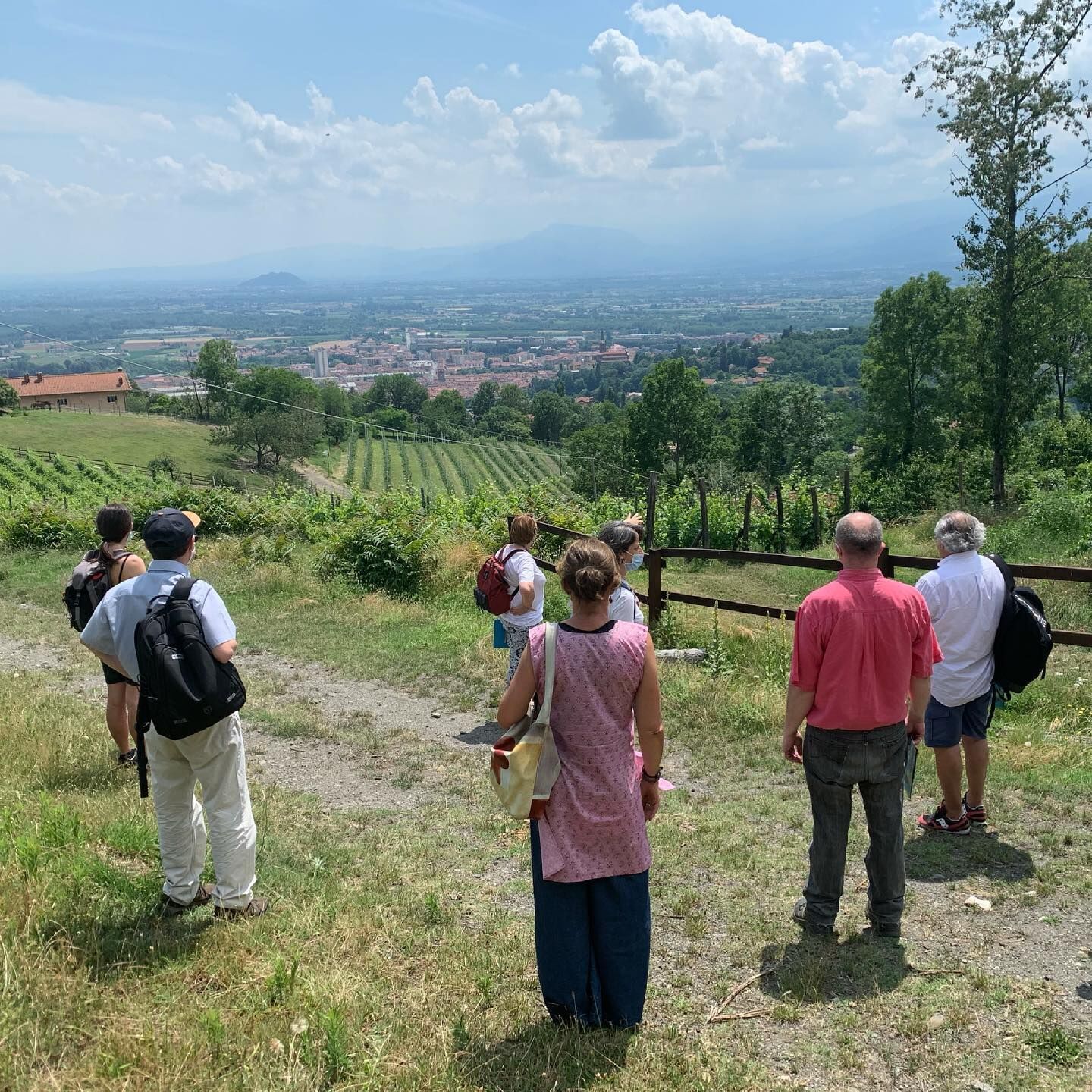
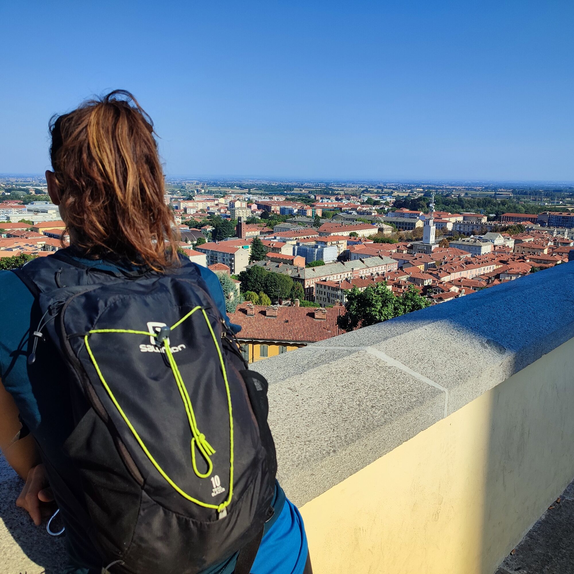
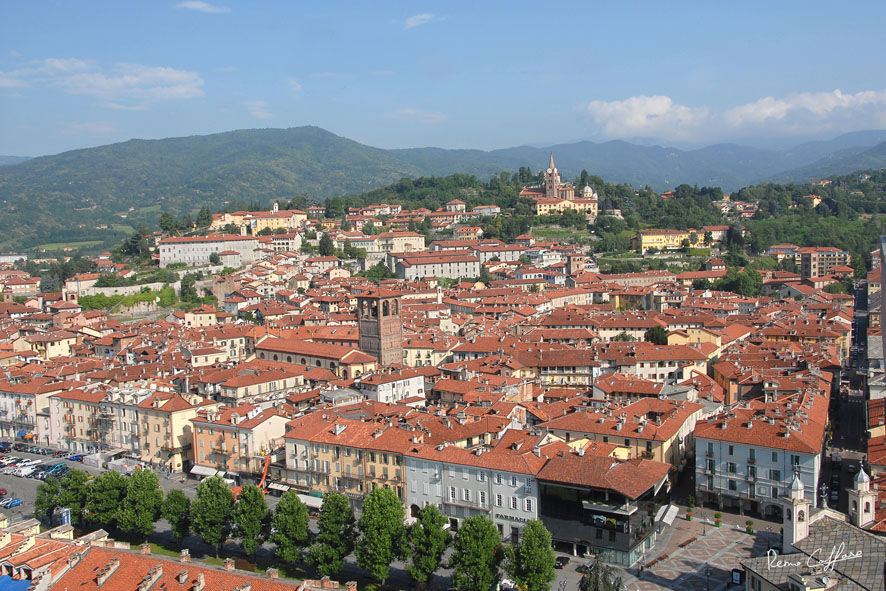
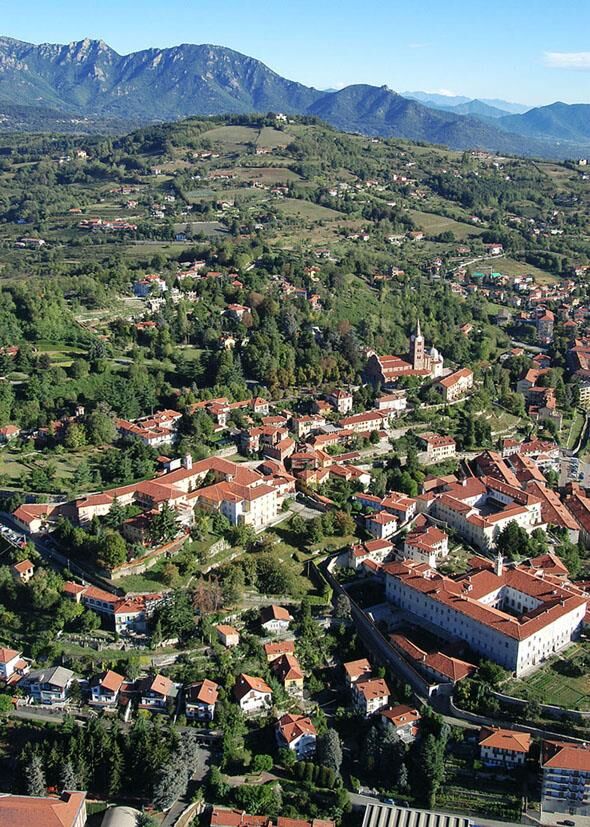
PINEROLO Scopricollina
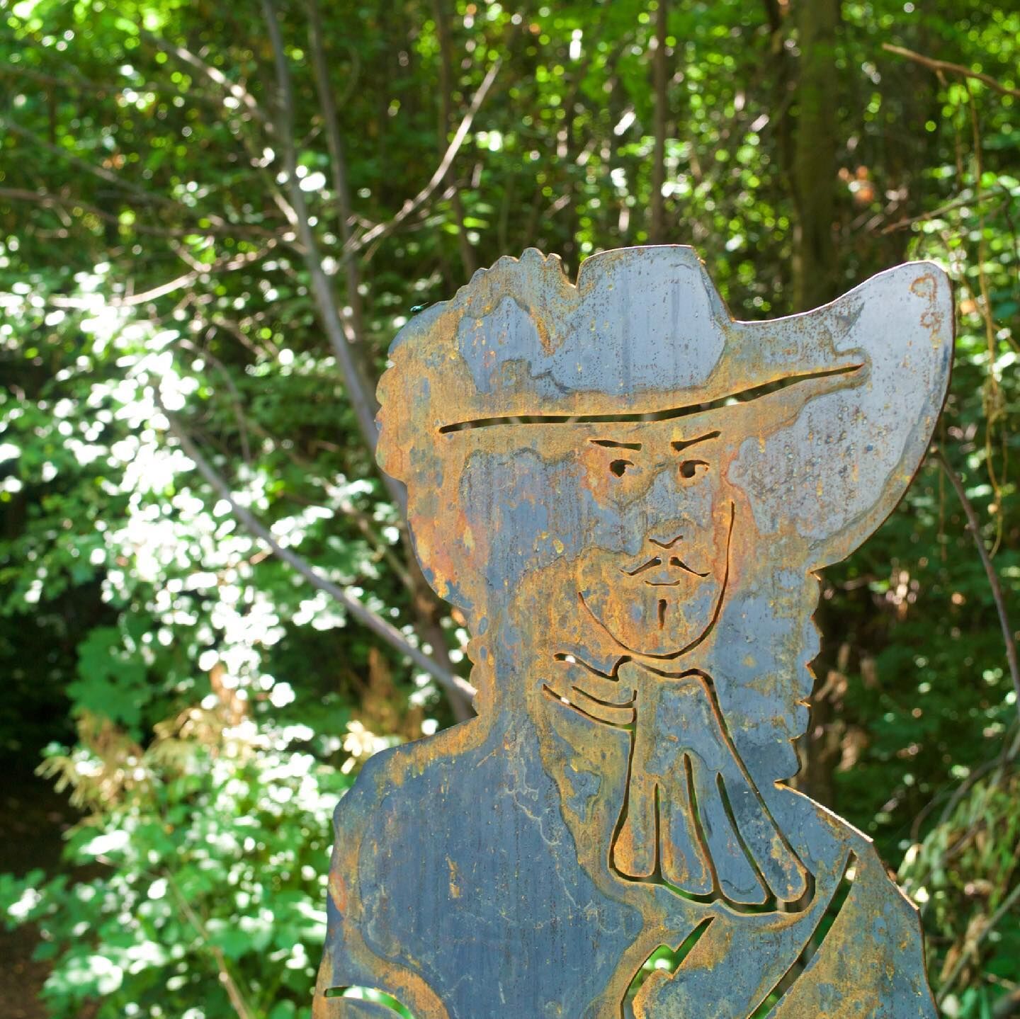
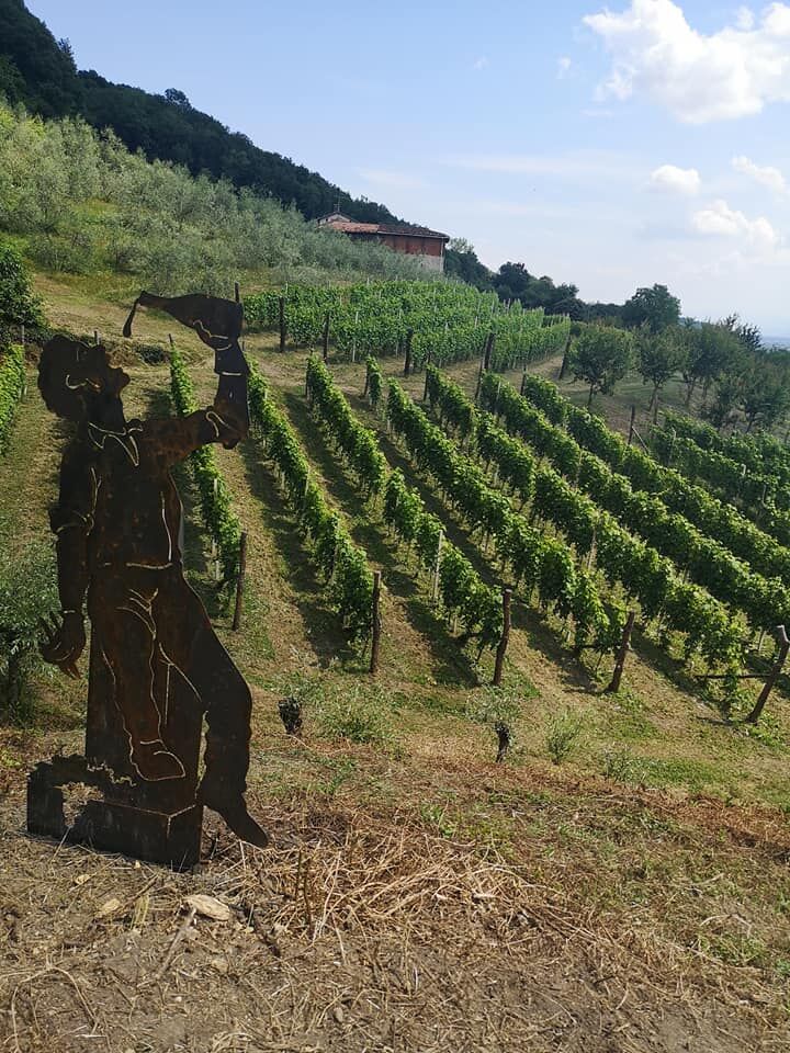
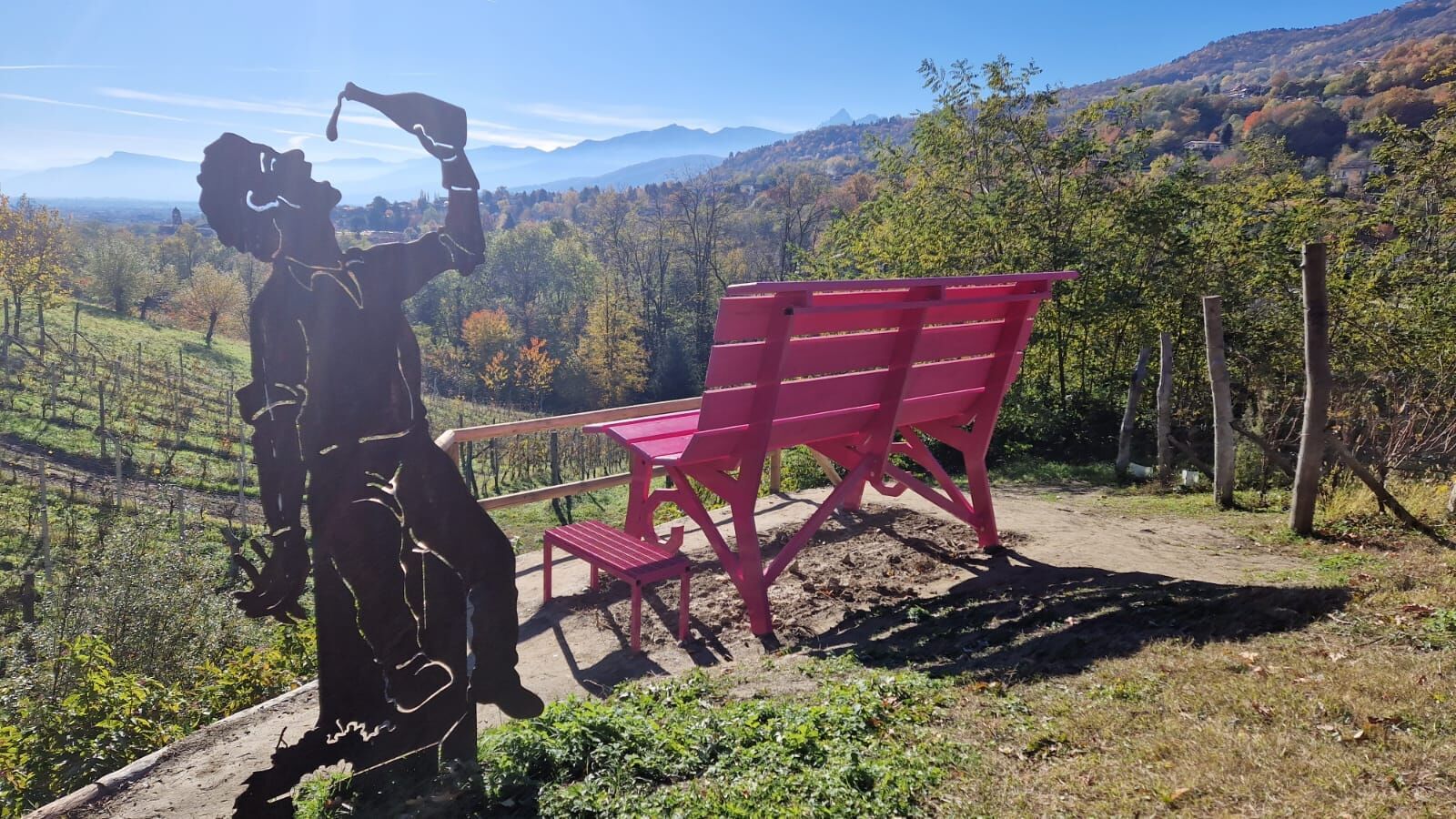
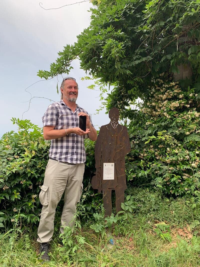
Along the route you will find numerous life-size corten steel silhouettes depicting characters, historical elements, or local curiosities. Each silhouette has a QR code that allows you to listen to an...
Along the route you will find numerous life-size corten steel silhouettes depicting characters, historical elements, or local curiosities. Each silhouette has a QR code that allows you to listen to an audio description of the place and the silhouette, voiced by the Pinerolo actress Marta De Lorenzis.
10 corten steel silhouettes (and 3 negatives): Edmondo De Amicis, Ortensia di Piossasco, Giovanni Prever and Margherita Tron, olive grower, French soldier, medieval lady, winemaker, Luigi Facta, cannon.
Route created by the Association Pinerolo e Valli Experience.


Tak
Wear clothing and footwear suitable for the environment and season and carry water with you.
3 drinking water fountains:
Piazzale San Maurizio Villa Prever Area via Costagrande/Strada San Pietro al Ponte(plus 1 fountain with a detour of about 250 m on Strada Costagrande 171 - Church of San Defendente)
The type of road marked as "asphalt" is in some cases also porphyry, cobblestone, or paved.
The starting point is accessible by car.
Parking spaces are available in the area.
Before undertaking any excursion, it is advisable to check the weather reports or ask for information at the local Tourist Offices.
It is good practice not to undertake an excursion alone; always inform someone of your destination.
Do not litter but carry your rubbish with you, also picking up any left by others.
The times indicated are approximate and can vary depending on weather conditions and personal ability.
4 interesting detours:
Chapel of Santa Lucia alle Vigne (Strada Santa Lucia 4), free entry via the app “Chiese a Porte Aperte”
Church of Colletto (via Raffaello 10)
Chapel of Santa Brigida (Strada ai Losani)
Church of San Defendente (Strada Costagrande 171)
Popularne wycieczki w okolicy
BRICHERASIO The Via della Pietra
światłoKolarstwo długodystansowe 11,5 kmPINEROLO Route to Monte Muretto
średniWędrówka 2,12 kmTORRE PELLICE Naturalistic trail "The Jay"
światłoWędrówka 10,2 kmPRAROSTINO From Piani to Sonagliette and back - SLOWLY TOGETHER
światłoWędrówka 6,60 kmLUSERNA S.G. Upslowtour - Angrogna Valley Ring 11
średniJazda na rowerze 35,0 kmTORRE PELLICE Hike to Bars d'la tajola (and Monte Castlus)
średniWędrówka 4,40 kmTORRE PELLICE Excursion to Colle della Sea
średniWędrówka 7,83 kmPINEROLO Trail "Ecomuseum of the Charcoal Piles"
średniWędrówka 7,46 kmAngrogna Valley Loop
Wędrówka 38,3 kmPRAROSTINO Circuit of the hamlets
średniMountainbike 18,1 km
Wędrówki i tropienie


Nie przegap ofert i inspiracji na następne wakacje
Twój adres e-mail została dodana do listy mailingowej.