


BALDISSERO CANAVESE The Monti Pelati nature reserve


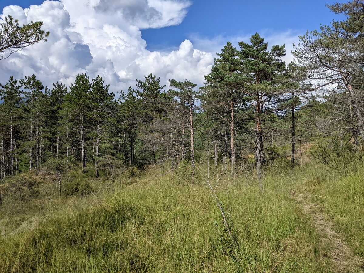
The Monti Pelati nature reserve was established to protect a particular area where the peridotitic rock does not allow good tree growth, thus leaving a vegetation of herbs and lichens, while in the lower...
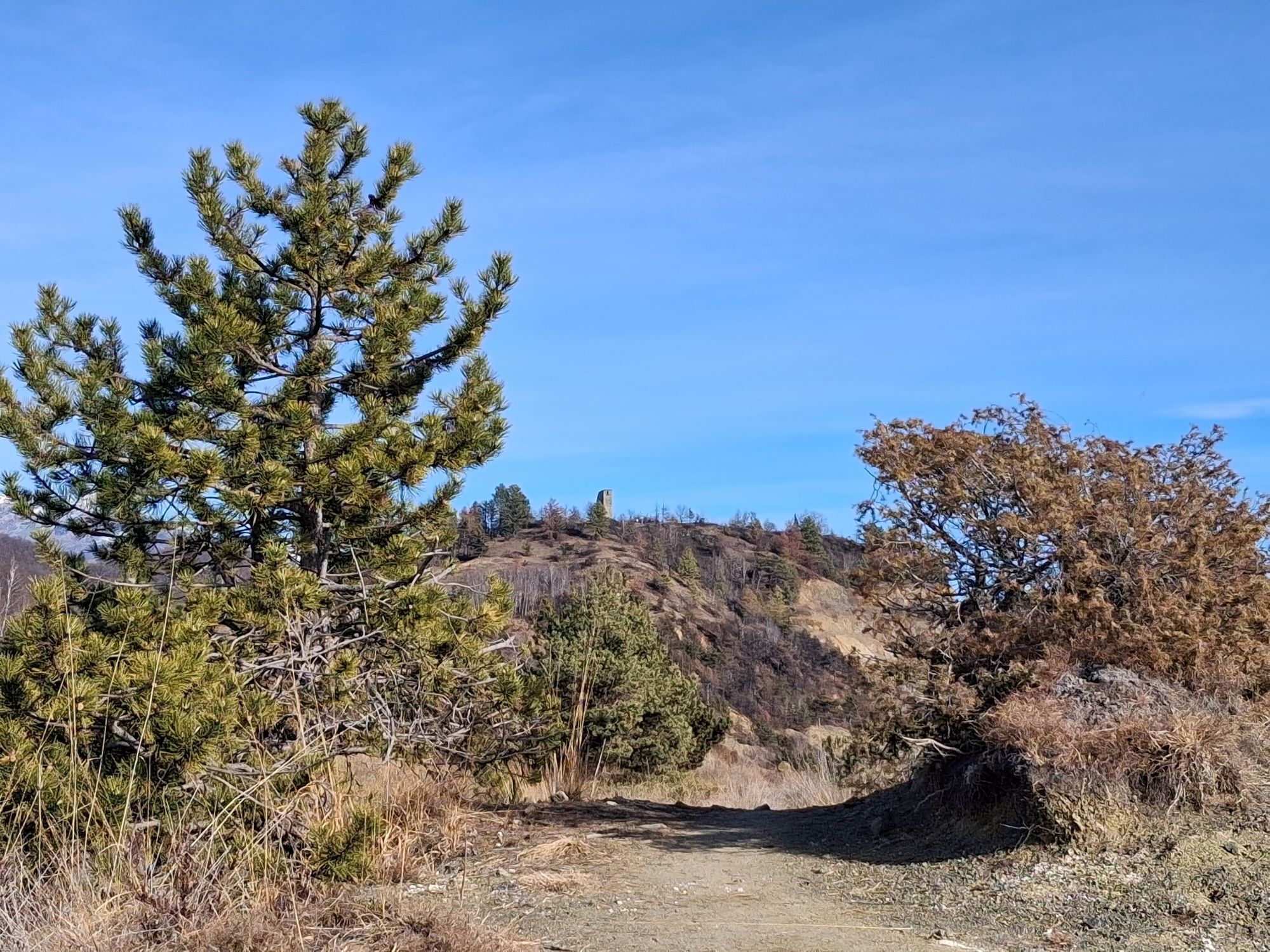
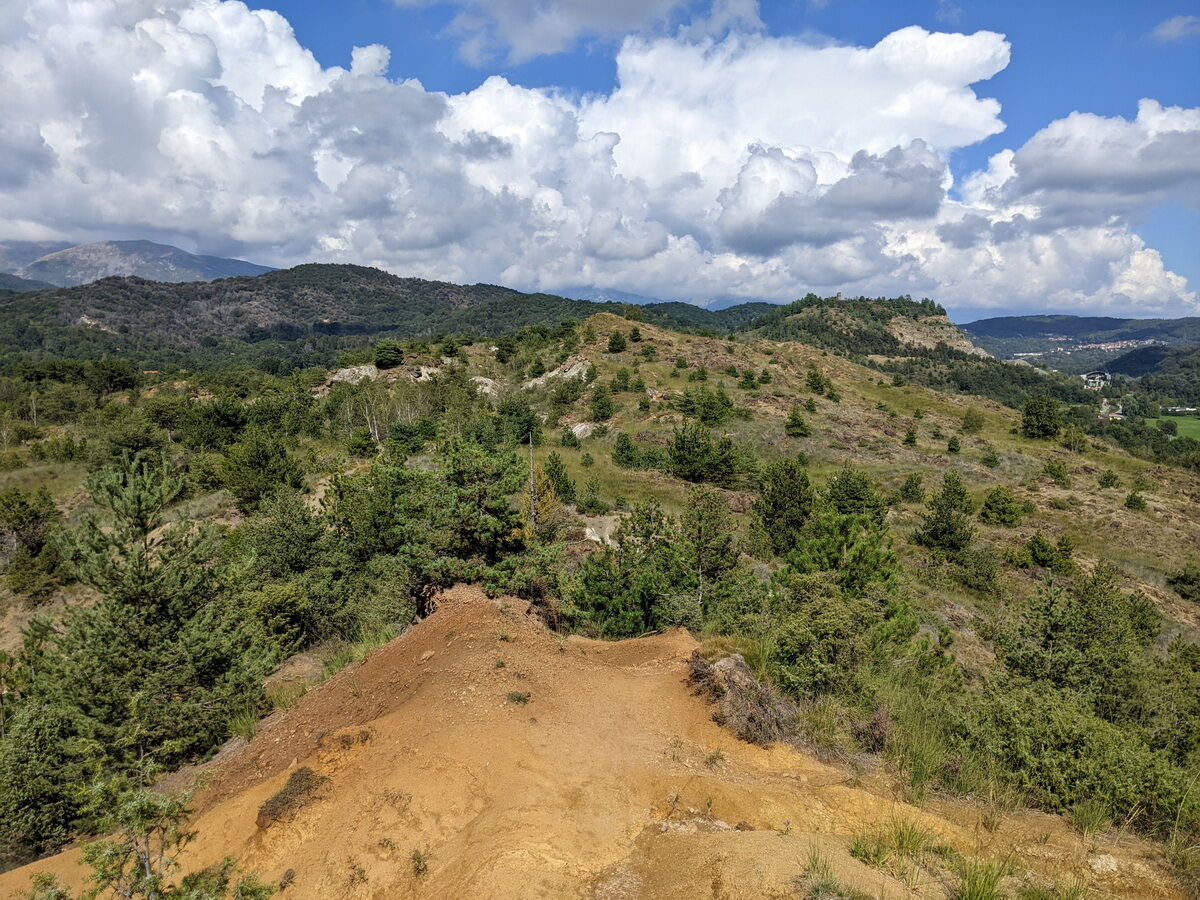
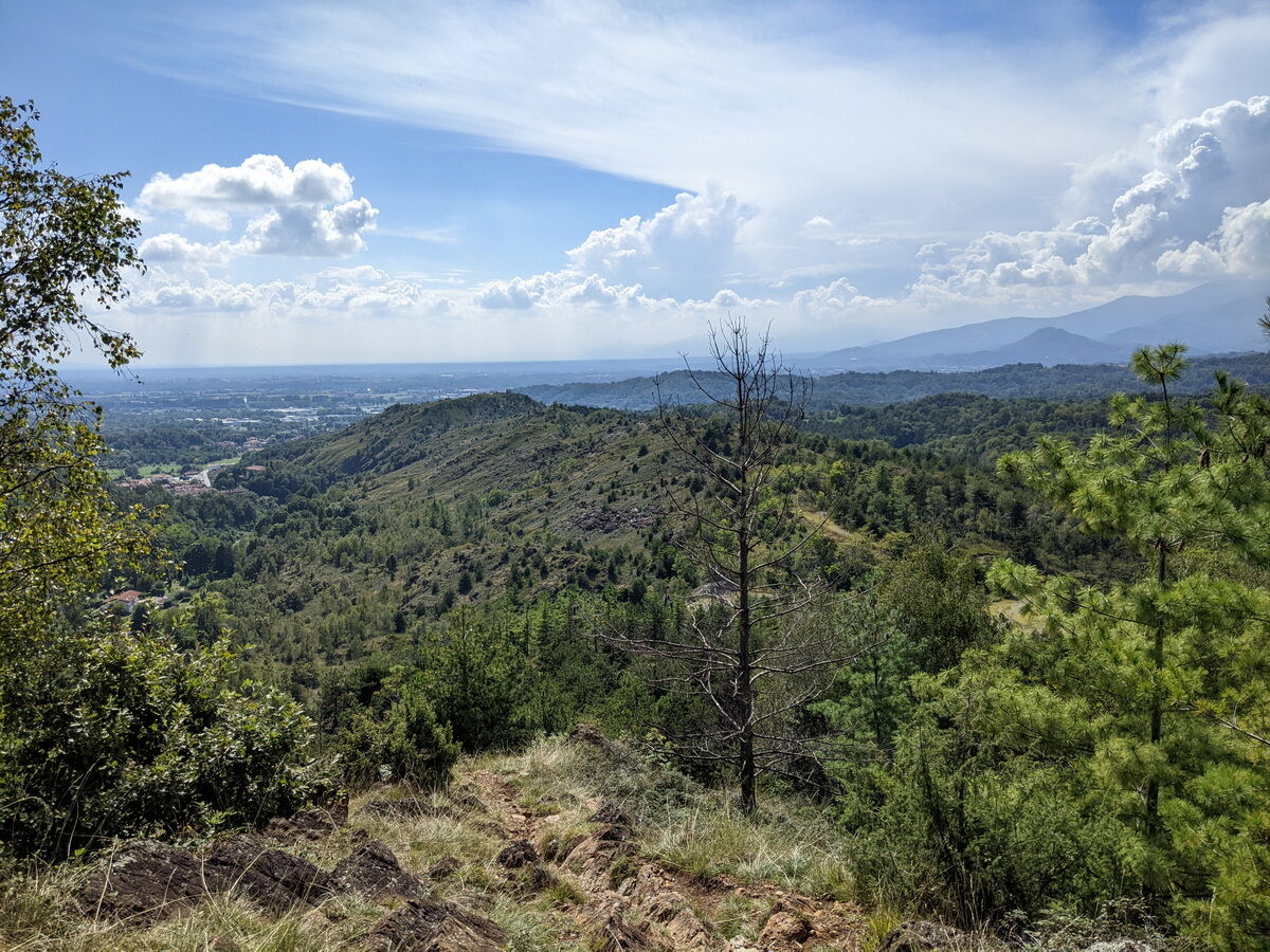
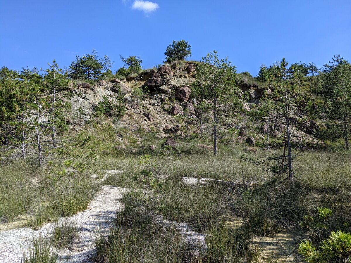
The Monti Pelati nature reserve was established to protect a particular area where the peridotitic rock does not allow good tree growth, thus leaving a vegetation of herbs and lichens, while in the lower areas small birch groves or conifer plantations can be observed. Walking along the ridge of these hills sometimes gives a strange sensation, seeing the widely exposed rocky substrate and the resulting erosive phenomena. The white outcrops of magnesite also catch the eye. The site is important both for nesting and for the passage of some bird species.
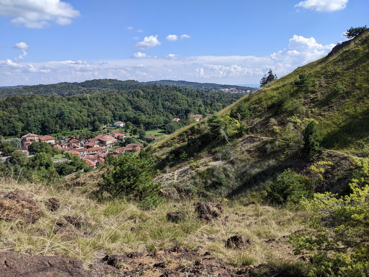
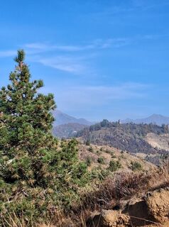
Much of the route is in a panoramic position overlooking the mountains of Valchiusella and the surrounding hills up to the Serra d'Ivrea.
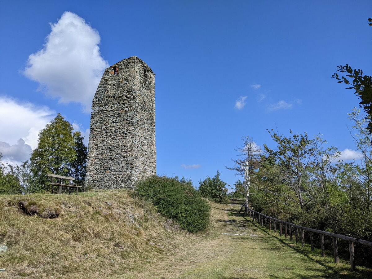
At the highest point is Torre Cives, dating back to the 12th century, probably built for guarding and defending Valchiusella. Around the building, there is a large equipped area with tables.

From the parking lot in front of the town hall, walk downhill along the provincial road until you turn right onto via Rimessa, just before the hamlet of Bettolino. Continue for a few hundred meters until you find a notice board for the protected area and take the path 751 on the right, which slightly ascends. The route stays more or less on the ridge and after passing the bric Carleva area (with its two small peaks) the Torre Cives becomes visible, clearly indicating the direction to follow. Continue with some ups and downs towards the northeast. After a wide clearing, keeping slightly to the right, take the path that with a final little climb leads to Torre Cives.
Near the tower, take a dirt road downhill that ends at the chapel of San Rocco. Here turn left along the paved road. Ignore the first junction that re-enters the park, pass some houses and a small sports field, then take path number 1 on the left. The path bypasses a fenced area, passing the edge of a small stream inside a deciduous forest. It then becomes a sparse pine wood and reaches an area with outcrops of magnesite. You then reach the intersection with the previously traveled path: turn right for a few dozen meters and then turn left (sign indicating Baldissero). Shortly after you see the village which can be reached by quickly descending: the path ends right in front of the starting point.
Tak
Anti-slip sole footwear, wind/rain protection, a warm layer, hat, and sunglasses are recommended.
It is possible to stock up on water near the starting point where there is a water distribution point from SMAT.
From the Ivrea tollbooth, follow the direction Castellamonte; after about 9 Km turn right onto SP 61 heading to Castellamonte. In the hamlet of Bettolino turn right towards the center of Baldissero / Valchiusella. After a few hundred meters you arrive at the parking lot in front of the town hall.
If you come from Castellamonte, turn left upon reaching the hamlet of Bettolino.
Several bus lines managed by GTT (Gruppo Torinese Trasporti) pass through Baldissero.
Go to the GTT website to check schedules and stops.
Large parking lot in front of the town hall
For more information about the nature of the park, consult the dedicated section within the Metropolitan City of Turin website:
Perfect hike in the winter period due to its milder microclimate compared to the rest of the region.

Popularne wycieczki w okolicy
-
5,0
VALCHIUSELLA Loop Fondo - Tissone - Tallorno
średniWędrówka 5,08 km -
4,0
TRAVERSELLA Souls and Transhumance Path
średniWędrówka 10,0 km -
4,0
VALPERGA Sacro Monte di Belmonte Loop
średniWędrówka 10,3 km -
COLLERETTO CASTELNUOVO Pian del Lupo - Quinseina di Santa Elisabetta
ciężkiWędrówka 6,27 km -
RUEGLIO Cima Bossola from the Cima Bossola refuge
średniWędrówka 3,79 km -
VALCHIUSELLA Lakes of Alice Superiore and Meugliano
światłoWędrówka 7,99 km -
SPARONE The ancient mule track of Frachiamo and the Rocca di Sparone
średniWędrówka 6,17 km -
Punta Arbella from Campidaglio
średniWędrówka 6,29 km -
BROSSO Monte Cavallaria
średniWędrówka 8,76 km -
MONTALTO DORA Terre Ballerine - In search of Lake Coniglio
światłoWędrówka 5,35 km
Wędrówki i tropienie


Nie przegap ofert i inspiracji na następne wakacje
Twój adres e-mail została dodana do listy mailingowej.