


Alta Via Canavesana: Stage 2: Alpe Soglia - Salvin Refuge
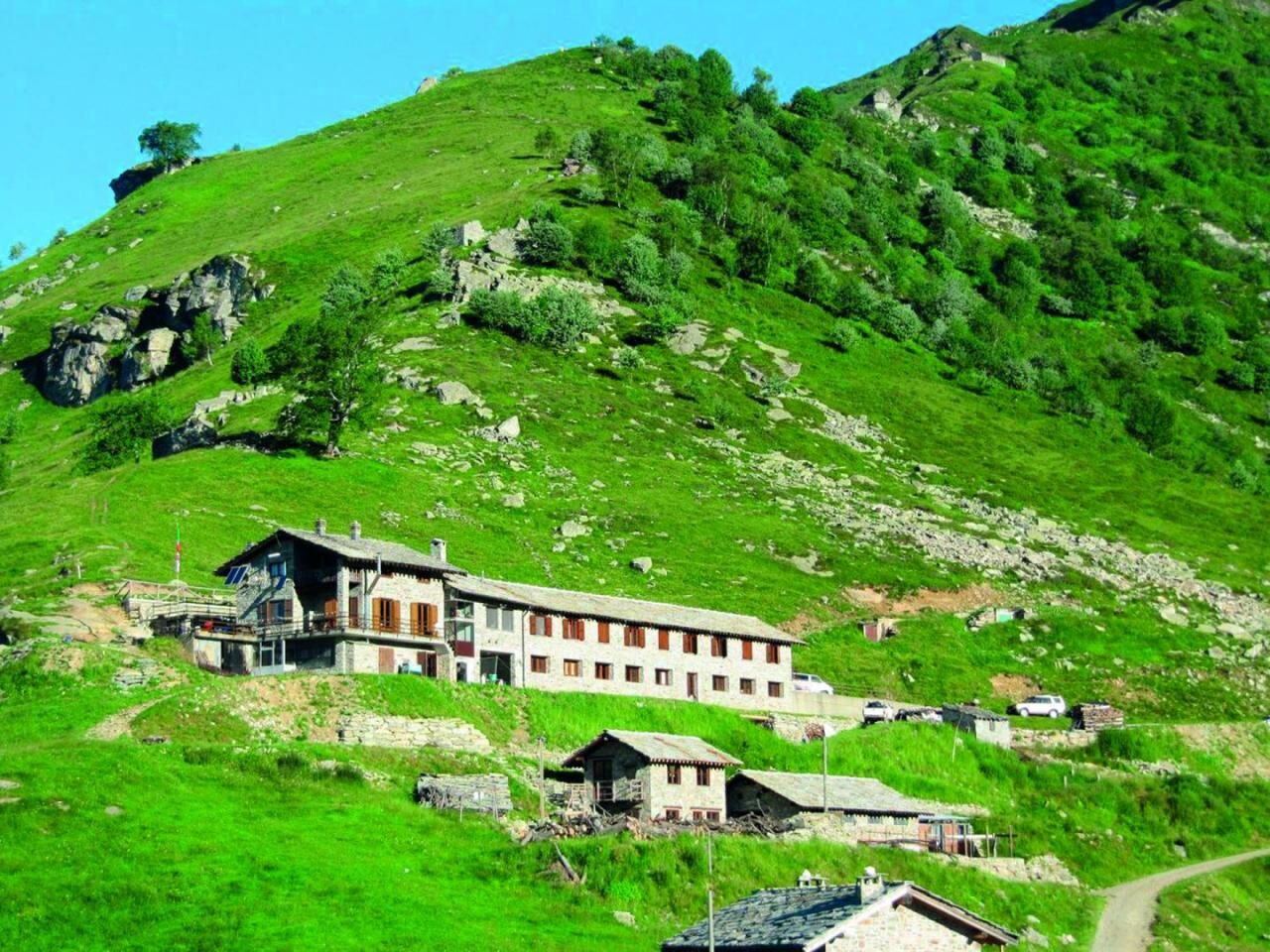
From Rifugio Alpe Soglia, continue along the dirt road backwards to Alpe Soglia at 1720 m; instead of retracing the outward path from here to the crest, turn left along the Tre Vallate track, on a grassy...
From Rifugio Alpe Soglia, continue along the dirt road backwards to Alpe Soglia at 1720 m; instead of retracing the outward path from here to the crest, turn left along the Tre Vallate track, on a grassy dirt road to Alpe Turinetto at 1818 m where the dirt road becomes a path that climbs up to join the Alta Via Canavesana crest path coming from Monte Soglio. You reach a high-tension pylon and crossing the mountainside, you arrive at a depression and the base of the south ridge of Uja, where you will find the ruins of the homonymous alp at 2026 m. Continue slightly downhill (signs for the spring) as far as some quartz rocks, when the path begins to climb halfway up the mountainside, crossing some detrital stretches. You will then reach Bric Volpat at 2038 m and then, almost always along the crest with some ascents and descents, Colle della Croce d'Intror at 1950 m (2.00 hours from Monte Soglio). From Colle della Croce d'Intror, go along the crest to reach Cima dell'Angiolino at 2168 m and Monte Vaccarezza at 2203 m immediately afterwards. Remaining on the crest, you shortly come to Monte Croass at 2155 m and then descend along a steep grassy slope to Alpe Pertus. From the junction with the 408/A road, go down towards the hamlet of Salvini in Monastero di Lanzo, where you can spend the night and eat at the Salvin Refuge/Holiday Farmhouse.


Popularne wycieczki w okolicy
-
CERES Santa Cristina Loop
średniWędrówka 7,84 km -
MONASTEROLO Ca' Bianca and Big Bench
światłoWędrówka 4,13 km -
ALPETTE Monte Soglio and cima Mares from Balmassa
średniWędrówka 10,9 km -
VALLO TORINESE Passo della Croce and the Turu
średniWędrówka 4,29 km -
GPR - Giroparco Gran Paradiso
ciężkiWędrówka 100,4 km -
5,0
ROCCA CANAVESE Madonna della Neve - Bandito Chapel
średniWędrówka 12,4 km -
4,0
VALPERGA Sacro Monte di Belmonte Loop
średniWędrówka 10,3 km -
Grande Traversata delle Alpi - GTA: Central Piedmont Section
średniWędrówka 318,3 km -
CHIALAMBERTO Sanctuary Madonna del Ciavanis and roc d'le Masche from Vonzo
średniWędrówka 6 km -
GROSCAVALLO Gran Lago di Unghiasse and Lago della Fertà
ciężkiWędrówka 14,0 km
Wędrówki i tropienie


Nie przegap ofert i inspiracji na następne wakacje
Twój adres e-mail została dodana do listy mailingowej.